126/128 Manual (new) 6/15/98 9:50 AM Page 1
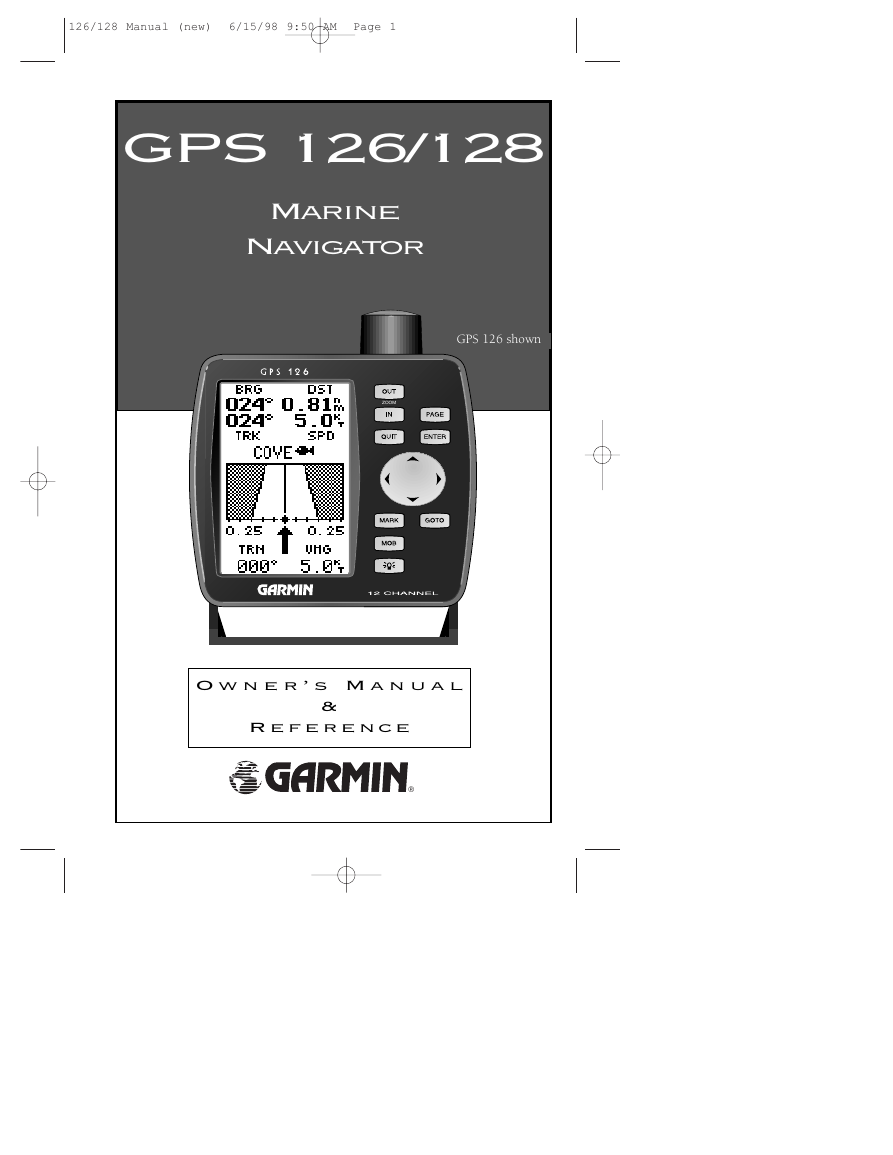
GPS 126/128
Marine
Navigator
GPS 126 shown
ZOOM
O w n e r ’ s M a n u a l
&
R e f e r e n c e
®
�
126/128 Manual (new) 6/15/98 9:50 AM Page 2
Software Version 2.0 or above
© 1997 GARMIN International, Inc
1200 E. 151st Street, Olathe, KS USA 66062
Tel: 913-397-8200 or 800-800-1020
Fax: 913-397-8282
Web Site Address: www.garmin.com
GARMIN (Europe) Ltd.
Unit 5,
The Quadrangle, Abbey Park Industrial Estate,
Romsey, SO51 9AQ, U.K.
Tel: 011-44-1794-519944
Fax: 011-44-1794-519222
GARMIN (Asia) Corp.
4th Fl., No. 1., Lane 45,
Pao-Hsing Road,
Hsin Tein,
Taiwan R.O.C.
Phone: 886.02.917.3773
Fax: 886.02.917.1758
All rights reserved. No part of this manual may be reproduced or transmitted in any
form or by any means, electronic or manual, including photocopying and recording, for
any purpose without the express written permission of GARMIN.
Information in this document is subject to change without notice. GARMIN reserves
the right to change or improve its products and to make changes in the content without
obligation to notify any person or organization of such changes or improvements.
GARMIN, AutoLocate,TracBack, and are all trademarks of GARMIN International
and may not be used without the expressed permission of GARMIN.
January 1998 - Part #190-00151-00 Rev. A - Printed in Taiwan.
i
�
126/128 Manual (new) 6/15/98 9:50 AM Page 3
GPS 126/128
OWNER’S
MANUAL
INTRODUCTION
Packing List
Welcome to the easiest-to-use fixed-mount GPS on the water! The GPS
126 and GPS 128 represent GARMIN’s continuing commitment to provide
mariners with quality navigation information in a versatile, accurate, and
user-friendly design which will be useful for years to come. Due to the simi-
larity between the GPS 126 and GPS 128, we have addressed both units in
one manual. This manual is organized into four sections for your conve-
nience:
Introduction gives a quick overview of the manual and contains the
table of contents and glossary of navigation terms.
Getting Started introduces you to the basic features of the unit with a
quick-start orientation to the GPS 126/128. This section has been designed to
acquaint you with the unit and provide a basic working knowledge necessary
to use the unit in typical conditions.
Reference provides detailed explanations of advanced features and oper-
ations in a topical format. This allows you to concentrate on a specific topic
quickly, without reading through sections of text that you may not need.
The Appendix section contains step by step instructions on how to ini-
tialize the unit for first time use, installation instructions and items with mul-
tiple listings, such as: map datums, time offsets, and the index.
Packing List
Before getting started with your GPS receiver, check to see that your
GARMIN GPS 126/128 package contains the following items. If you are miss-
ing any parts, please contact your dealer immediately.
• Mounting Bracket with knobs
• Owner’s Manual
Standard Package:
• GPS 126/128 Unit
• Power/Data Cable
• Quick Reference Guide
* The GPS 128 also comes with an external antenna with 30’ cable.
See your GARMIN dealer for accessories, including our PC kit.
Thanks for choosing the GARMIN GPS 126/128. We hope it will meet all
of your navigation needs.
ii
�
126/128 Manual (new) 6/15/98 9:50 AM Page 4
INTRODUCTION
Caution
The GPS system is operated by the government of the United States,
which is solely responsible for its accuracy and maintenance. The system is
subject to changes which could affect the accuracy and performance of all
GPS equipment. Although the GPS 126/128 is a precision electronic
NAVigation AID (NAVAID), any NAVAID can be misused or misinterpreted
and, therefore, become unsafe.
Use the GPS 126/128 at your own risk. To reduce the risk of unsafe
operation, carefully review and understand all aspects of this Operator’s
Manual and thoroughly practice operation using the simulator mode prior to
actual use. When in actual use, carefully compare indications from the GPS
126/128 to all available navigation sources including the information from
other NAVAIDs, visual sightings, maps, etc. For safety, always resolve any dis-
crepancies before continuing navigation.
NOTE: This device meets requirements for Part 15 of the FCC limits for
Class B digital devices for home or office use. It has been tested for compli-
ance with all necessary FCC standards. This equipment generates, uses, and
can radiate radio frequency energy and, if not installed and used in accor-
dance with the instructions, may cause harmful interference to radio commu-
nications. However, there is no guarantee that interference will not occur in a
particular installation. If this equipment does cause harmful interference to
other equipment, which can be determined by turning the equipment off and
on, the user is encouraged to try and correct the interference by relocating the
equipment or connecting the equipment to a different circuit than the affected
equipment. Consult an authorized dealer or other qualified service technician
for additional help if these remedies do not correct the problem. Operation is
subject to the following conditions: (1) This device cannot cause harmful
interference, and (2) this device must accept any interference received,
including interference that may cause undesired operation. The GPS 126/128
does not contain any user-serviceable parts. Repairs should only be made by
an authorized service center. Unauthorized repairs or modifications could
void your warranty and your authority to operate this device under Part 15
regulations.
iii
�
126/128 Manual (new) 6/15/98 9:50 AM Page 1
INTRODUCTION
Table of
Contents
SECTION ONE Introduction
Glossary . . . . . . . . . . . . . . . . . . . . . . . . . . . . . . . . . . . . . . . . . . . . . . .1
Navigation Basics . . . . . . . . . . . . . . . . . . . . . . . . . . . . . . . . . . . . . . . .4
SECTION TWO Getting Started
Keypad Usage & Data Entry . . . . . . . . . . . . . . . . . . . . . . . . . . . . . . . .5
Primary Pages . . . . . . . . . . . . . . . . . . . . . . . . . . . . . . . . . . . . . . . . . . .6
Power On & Marking a Position . . . . . . . . . . . . . . . . . . . . . . . . . . . . .8
Position Page and Map Pages . . . . . . . . . . . . . . . . . . . . . . . . . . . . . . . .9
Going to a Waypoint . . . . . . . . . . . . . . . . . . . . . . . . . . . . . . . . . . . . .11
Compass Page & Cancelling A GOTO . . . . . . . . . . . . . . . . . . . . . . . .12
Clearing the Map Display, Adjusting Contrast, & Power Off . . . . . . . .13
SECTION THREE Reference
Satellite Page . . . . . . . . . . . . . . . . . . . . . . . . . . . . . . . . . . . . . . . . . . .14
Backlighting . . . . . . . . . . . . . . . . . . . . . . . . . . . . . . . . . . . . . . . . . . .15
Position Page & User Selectable Fields . . . . . . . . . . . . . . . . . . . . . . . .16
Marking a Position & Position Averaging Function . . . . . . . . . . . .18, 19
Waypoint Pages & Managing Waypoints . . . . . . . . . . . . . . . . . . . . . . .19
TracBack Navigation . . . . . . . . . . . . . . . . . . . . . . . . . . . . . . . . . . . . .26
Creating and Using Routes . . . . . . . . . . . . . . . . . . . . . . . . . . . . . . . . .30
Using the Compass & Highway Pages . . . . . . . . . . . . . . . . . . . . . . . .33
Map Page, Zooming, & Panning . . . . . . . . . . . . . . . . . . . . . . . . . .37, 38
Map Page & Track Log Setup . . . . . . . . . . . . . . . . . . . . . . . . . . . .39, 40
Menu Page & Distance/Sun Calculation . . . . . . . . . . . . . . . . . . . . . . .43
System Setup . . . . . . . . . . . . . . . . . . . . . . . . . . . . . . . . . . . . . . . . . .46
Navigation Setup . . . . . . . . . . . . . . . . . . . . . . . . . . . . . . . . . . . . . . . .47
Interface Setup & DGPS Interface . . . . . . . . . . . . . . . . . . . . . . . . .44, 45
Navigation Simulator . . . . . . . . . . . . . . . . . . . . . . . . . . . . . . . . . . . . .51
Appendix A––Initialization . . . . . . . . . . . . . . . . . . . . . . . . . . . . . . . .52
Appendix B—Installation . . . . . . . . . . . . . . . . . . . . . . . . . . . . . . . . . .54
Appendix C—Specifications & Wiring . . . . . . . . . . . . . . . . . . . . . . . .58
Appendix D—Messages and Time Offsets . . . . . . . . . . . . . . . . . . . . . .60
Appendix E––Map Datums . . . . . . . . . . . . . . . . . . . . . . . . . . . . . . . .62
Appendix F––Index . . . . . . . . . . . . . . . . . . . . . . . . . . . . . . . . . . . . . .64
1
�
126/128 Manual (new) 6/15/98 9:50 AM Page 2
INTRODUCTION
Glossary
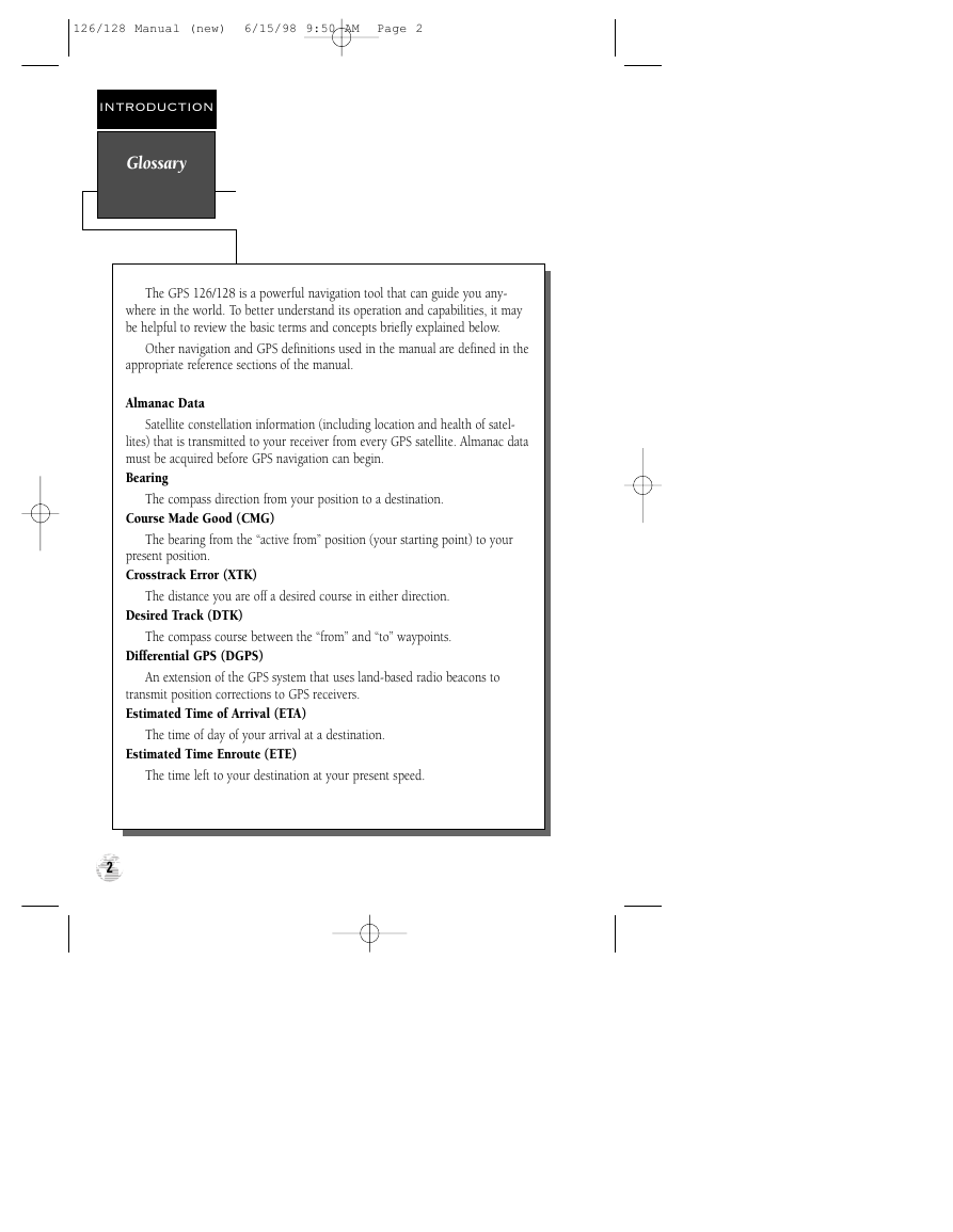
The GPS 126/128 is a powerful navigation tool that can guide you any-
where in the world. To better understand its operation and capabilities, it may
be helpful to review the basic terms and concepts briefly explained below.
Other navigation and GPS definitions used in the manual are defined in the
appropriate reference sections of the manual.
Almanac Data
Satellite constellation information (including location and health of satel-
lites) that is transmitted to your receiver from every GPS satellite. Almanac data
must be acquired before GPS navigation can begin.
Bearing
The compass direction from your position to a destination.
Course Made Good (CMG)
The bearing from the “active from” position (your starting point) to your
present position.
Crosstrack Error (XTK)
The distance you are off a desired course in either direction.
Desired Track (DTK)
The compass course between the “from” and “to” waypoints.
Differential GPS (DGPS)
An extension of the GPS system that uses land-based radio beacons to
transmit position corrections to GPS receivers.
Estimated Time of Arrival (ETA)
The time of day of your arrival at a destination.
Estimated Time Enroute (ETE)
The time left to your destination at your present speed.
2
�
126/128 Manual (new) 6/15/98 9:50 AM Page 3
INTRODUCTION
Glossary
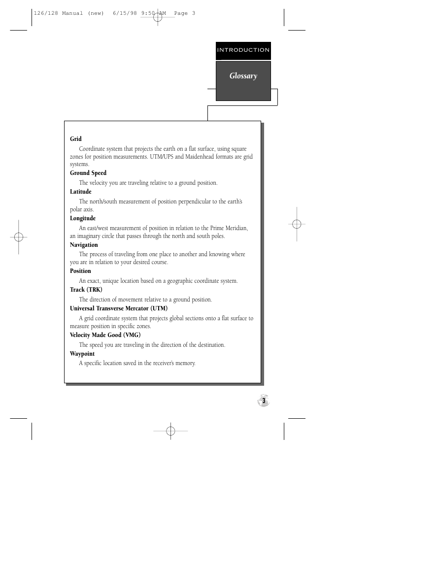
Grid
Coordinate system that projects the earth on a flat surface, using square
zones for position measurements. UTM/UPS and Maidenhead formats are grid
systems.
Ground Speed
The velocity you are traveling relative to a ground position.
Latitude
The north/south measurement of position perpendicular to the earth’s
polar axis.
Longitude
An east/west measurement of position in relation to the Prime Meridian,
an imaginary circle that passes through the north and south poles.
Navigation
The process of traveling from one place to another and knowing where
you are in relation to your desired course.
Position
An exact, unique location based on a geographic coordinate system.
Track (TRK)
The direction of movement relative to a ground position.
Universal Transverse Mercator (UTM)
A grid coordinate system that projects global sections onto a flat surface to
measure position in specific zones.
Velocity Made Good (VMG)
The speed you are traveling in the direction of the destination.
Waypoint
A specific location saved in the receiver’s memory.
3
�
126/128 Manual (new) 6/15/98 9:50 AM Page 4
INTRODUCTION
Navigation
Basics
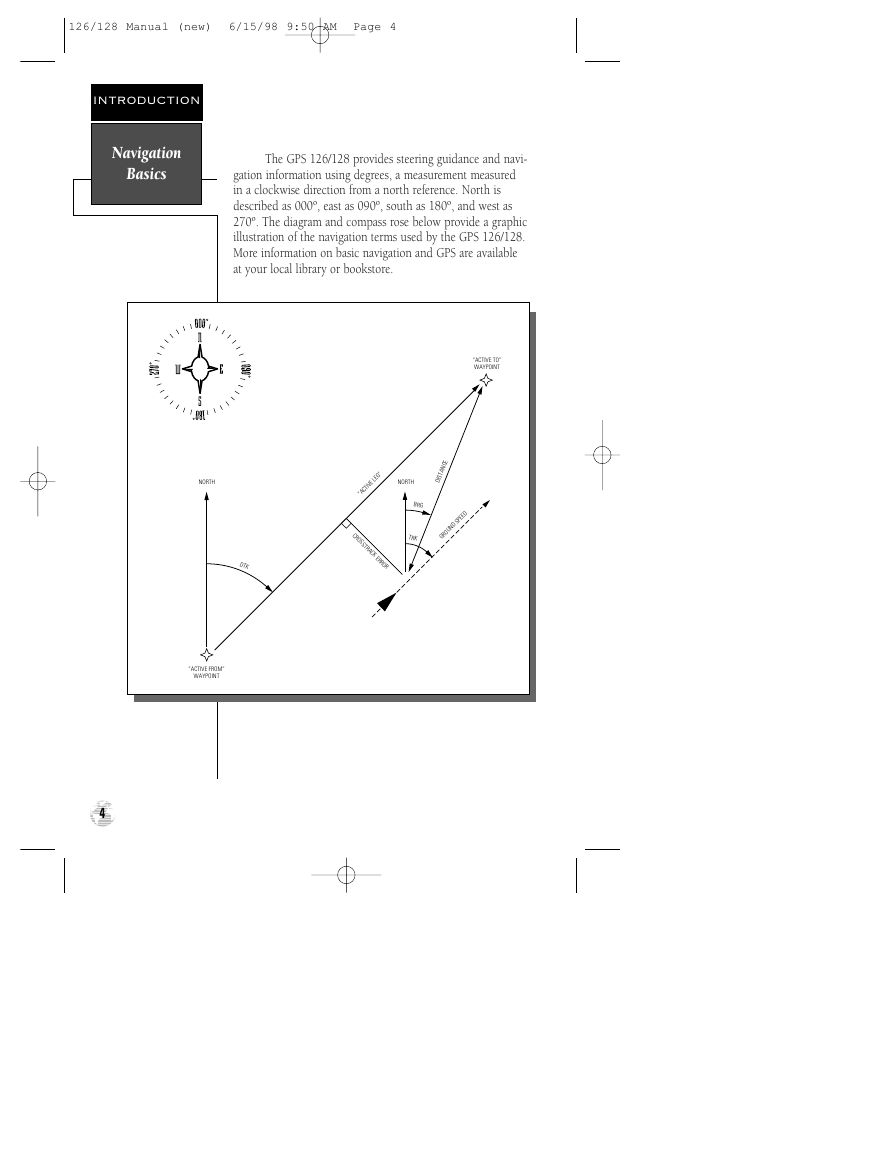
The GPS 126/128 provides steering guidance and navi-
gation information using degrees, a measurement measured
in a clockwise direction from a north reference. North is
described as 000º, east as 090º, south as 180º, and west as
270º. The diagram and compass rose below provide a graphic
illustration of the navigation terms used by the GPS 126/128.
More information on basic navigation and GPS are available
at your local library or bookstore.
“ACTIVE TO”
WAYPOINT
“ACTIVE LEG”
NORTH
CE
N
DISTA
BRG
TRK
GROUND SPEED
C
R
O
S
S
T
R
A
C
K E
R
R
O
R
NORTH
DTK
“ACTIVE FROM”
WAYPOINT
4
�



 2023年江西萍乡中考道德与法治真题及答案.doc
 2012年重庆南川中考生物真题及答案.doc
 2013年江西师范大学地理学综合及文艺理论基础考研真题.doc
 2020年四川甘孜小升初语文真题及答案I卷.doc
 2020年注册岩土工程师专业基础考试真题及答案.doc
 2023-2024学年福建省厦门市九年级上学期数学月考试题及答案.doc
 2021-2022学年辽宁省沈阳市大东区九年级上学期语文期末试题及答案.doc
 2022-2023学年北京东城区初三第一学期物理期末试卷及答案.doc
 2018上半年江西教师资格初中地理学科知识与教学能力真题及答案.doc
 2012年河北国家公务员申论考试真题及答案-省级.doc
 2020-2021学年江苏省扬州市江都区邵樊片九年级上学期数学第一次质量检测试题及答案.doc
 2022下半年黑龙江教师资格证中学综合素质真题及答案.doc