GLOBAL NAVIGATION SATTELITE SYSTEM
GLONASS
MOSCOW
2008
INTERFACE
CONTROL
DOCUMENT
Navigational radiosignal
In bands L1, L2
(Edition 5.1)
�
Edition 5.1 2008 ICD L1, L2 GLONASS
Russian Institute of Space Device Engineering
�
Edition 5.1 2008 ICD L1, L2 GLONASS
Russian Institute of Space Device Engineering
�
Edition 5.1 2008 ICD L1, L2 GLONASS
Russian Institute of Space Device Engineering
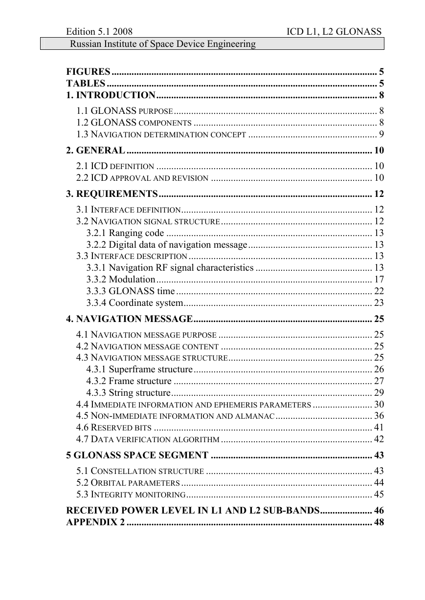
FIGURES........................................................................................................... 5
TABLES ............................................................................................................. 5
1. INTRODUCTION......................................................................................... 8
1.1 GLONASS PURPOSE.................................................................................. 8
1.2 GLONASS COMPONENTS .......................................................................... 8
1.3 NAVIGATION DETERMINATION CONCEPT .................................................... 9
2. GENERAL................................................................................................... 10
2.1 ICD DEFINITION ....................................................................................... 10
2.2 ICD APPROVAL AND REVISION ................................................................. 10
3. REQUIREMENTS...................................................................................... 12
3.1 INTERFACE DEFINITION............................................................................. 12
3.2 NAVIGATION SIGNAL STRUCTURE............................................................. 12
3.2.1 Ranging code ................................................................................... 13
3.2.2 Digital data of navigation message.................................................. 13
3.3 INTERFACE DESCRIPTION.......................................................................... 13
3.3.1 Navigation RF signal characteristics ............................................... 13
3.3.2 Modulation....................................................................................... 17
3.3.3 GLONASS time............................................................................... 22
3.3.4 Coordinate system............................................................................ 23
4. NAVIGATION MESSAGE........................................................................ 25
4.1 NAVIGATION MESSAGE PURPOSE .............................................................. 25
4.2 NAVIGATION MESSAGE CONTENT ............................................................. 25
4.3 NAVIGATION MESSAGE STRUCTURE.......................................................... 25
4.3.1 Superframe structure........................................................................ 26
4.3.2 Frame structure ................................................................................ 27
4.3.3 String structure................................................................................. 29
4.4 IMMEDIATE INFORMATION AND EPHEMERIS PARAMETERS ........................ 30
4.5 NON-IMMEDIATE INFORMATION AND ALMANAC....................................... 36
4.6 RESERVED BITS ........................................................................................ 41
4.7 DATA VERIFICATION ALGORITHM............................................................. 42
5 GLONASS SPACE SEGMENT ................................................................. 43
5.1 CONSTELLATION STRUCTURE ................................................................... 43
5.2 ORBITAL PARAMETERS............................................................................. 44
5.3 INTEGRITY MONITORING........................................................................... 45
RECEIVED POWER LEVEL IN L1 AND L2 SUB-BANDS..................... 46
APPENDIX 2 ................................................................................................... 48
�
Edition 5.1 2008 ICD L1, L2 GLONASS
Russian Institute of Space Device Engineering
RECOMMENDATIONS FOR USERS ON OPERATION OF ECEIVER
DURING UTC LEAP SECOND CORRECTION ................................................. 48
APPENDIX 3 ................................................................................................... 50
FIGURES
Fig. 3.1 Interface NKA/NAP
Fig. 3.2 Structure of the shift register shaping a ranging code
Fig. 3.3 Simplified block diagramme of PSPD ranging creation code and
sync signals for a navigational radiosignal
Fig. 3.4 Simplified block diagramme of data creation series
Fig. 3.5 T Temporal ratio between sync signals of a modulating
navigational signal and PSPD ranging code
Fig. 3.6Data series creation in NKA processor
Fig. 4.1 Superframe structure
Fig. 4.2 Frame structure
Fig. 4.3 String structure
Fig. of Item 1 Relation between the radiosignal amplifying underpower
and elevation angle
page
14
20
21
21
22
22
29
31
32
52
TABLES
Table 3.1 GLONASS carrier frequencies in L1 and L2 sub-bands
Table 3.2 Geodetic constants and parameters of PZ-90.02 common
terrestrial ellipsoid
Table 4.1 Arrangement of GLONASS almanac within superframe
Table 4.2 Accuracy of transmitted of coordinates and velocity for
GLONASS satellite
Table 4.3 Word P1
Table 4.4 Word FT
Table 4.5 Characteristics of words of immediate information (ephemeris
parameters)
Table 4.6 Arrangement of immediate information within frame
Table 4.7 Word KP
Table 4.8 Relationship between "age" of almanac and accuracy of
positioning
Table 4.9 Characteristics of words of non-immediate
(almanac)
information
page
15
25
30
33
34
36
37
39
42
42
43
�
Edition 5.1 2008 ICD L1, L2 GLONASS
Russian Institute of Space Device Engineering
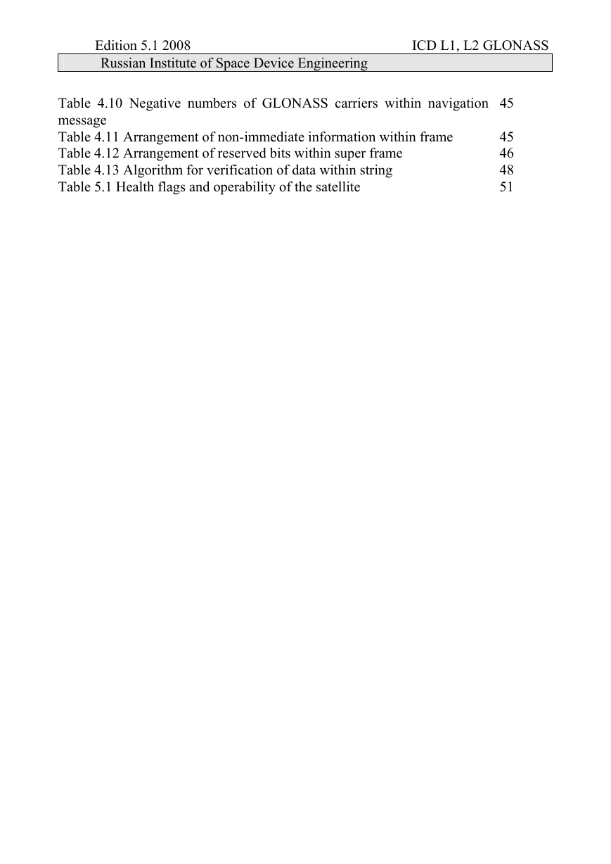
Table 4.10 Negative numbers of GLONASS carriers within navigation
message
Table 4.11 Arrangement of non-immediate information within frame
Table 4.12 Arrangement of reserved bits within super frame
Table 4.13 Algorithm for verification of data within string
Table 5.1 Health flags and operability of the satellite
45
45
46
48
51
�
Edition 5.1 2008 ICD L1, L2 GLONASS
Russian Institute of Space Device Engineering
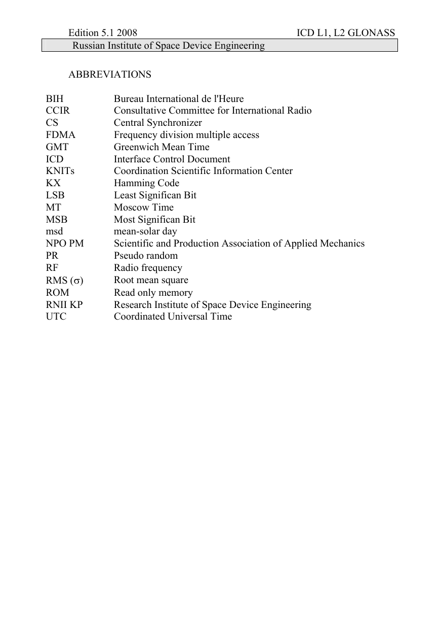
ABBREVIATIONS
BIH
CCIR
CS
FDMA
GMT
ICD
KNITs
KX
LSB
MT
MSB
msd
NPO PM
PR
RF
RMS (σ)
ROM
RNII KP
UTC
Bureau International de l'Heure
Consultative Committee for International Radio
Central Synchronizer
Frequency division multiple access
Greenwich Mean Time
Interface Control Document
Coordination Scientific Information Center
Hamming Code
Least Significan Bit
Moscow Time
Most Significan Bit
mean-solar day
Scientific and Production Association of Applied Mechanics
Pseudo random
Radio frequency
Root mean square
Read only memory
Research Institute of Space Device Engineering
Coordinated Universal Time
�
Edition 5.1 2008 ICD L1, L2 GLONASS
Russian Institute of Space Device Engineering
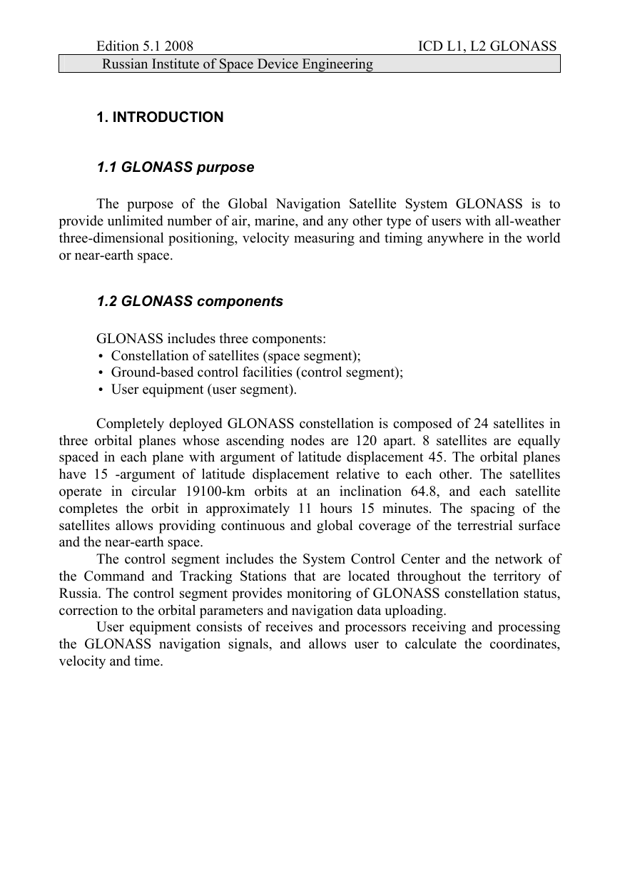
1. INTRODUCTION
1.1 GLONASS purpose
The purpose of the Global Navigation Satellite System GLONASS is to
provide unlimited number of air, marine, and any other type of users with all-weather
three-dimensional positioning, velocity measuring and timing anywhere in the world
or near-earth space.
1.2 GLONASS components
GLONASS includes three components:
• Constellation of satellites (space segment);
• Ground-based control facilities (control segment);
• User equipment (user segment).
Completely deployed GLONASS constellation is composed of 24 satellites in
three orbital planes whose ascending nodes are 120 apart. 8 satellites are equally
spaced in each plane with argument of latitude displacement 45. The orbital planes
have 15 -argument of latitude displacement relative to each other. The satellites
operate in circular 19100-km orbits at an inclination 64.8, and each satellite
completes the orbit in approximately 11 hours 15 minutes. The spacing of the
satellites allows providing continuous and global coverage of the terrestrial surface
and the near-earth space.
The control segment includes the System Control Center and the network of
the Command and Tracking Stations that are located throughout the territory of
Russia. The control segment provides monitoring of GLONASS constellation status,
correction to the orbital parameters and navigation data uploading.
User equipment consists of receives and processors receiving and processing
the GLONASS navigation signals, and allows user to calculate the coordinates,
velocity and time.
�




 2023年江西萍乡中考道德与法治真题及答案.doc
 2012年重庆南川中考生物真题及答案.doc
 2013年江西师范大学地理学综合及文艺理论基础考研真题.doc
 2020年四川甘孜小升初语文真题及答案I卷.doc
 2020年注册岩土工程师专业基础考试真题及答案.doc
 2023-2024学年福建省厦门市九年级上学期数学月考试题及答案.doc
 2021-2022学年辽宁省沈阳市大东区九年级上学期语文期末试题及答案.doc
 2022-2023学年北京东城区初三第一学期物理期末试卷及答案.doc
 2018上半年江西教师资格初中地理学科知识与教学能力真题及答案.doc
 2012年河北国家公务员申论考试真题及答案-省级.doc
 2020-2021学年江苏省扬州市江都区邵樊片九年级上学期数学第一次质量检测试题及答案.doc
 2022下半年黑龙江教师资格证中学综合素质真题及答案.doc