h
s
i
l
g
n
E
s
i
a
ç
n
a
r
F
h
c
s
t
u
e
D
s
d
n
a
l
r
e
d
e
N
o
n
a
i
l
a
t
I
l
o
ñ
a
p
s
E
a
k
s
n
e
v
S
k
s
n
a
D
A
S
U
PC 5400
PC 5500
User manual
Mode d’emploi
Bedienungsanleitung
Gebruiksaanwijzing
Istruzioni d’uso
Instrucciones de manejo
Bruksanvisning
Betjeningsvejledning
www.vdodayton.com
Car Multimedia Systems.
2391609251
VDO Dayton The Car Brand
3112 316 0925.1
09/2002 im
�
PAGE 3
PAGE 45
SEITE 91
PAGINA 135
PAGINA 179
PÁGINA 223
SIDAN 267
SIDE 309
PAGE 351
h
s
i
l
g
n
E
s
i
a
ç
n
a
r
F
h
c
s
t
u
e
D
s
d
n
a
l
r
e
d
e
N
o
n
a
i
l
a
t
I
l
o
ñ
a
p
s
E
a
k
s
n
e
v
S
k
s
n
a
D
A
S
U
�
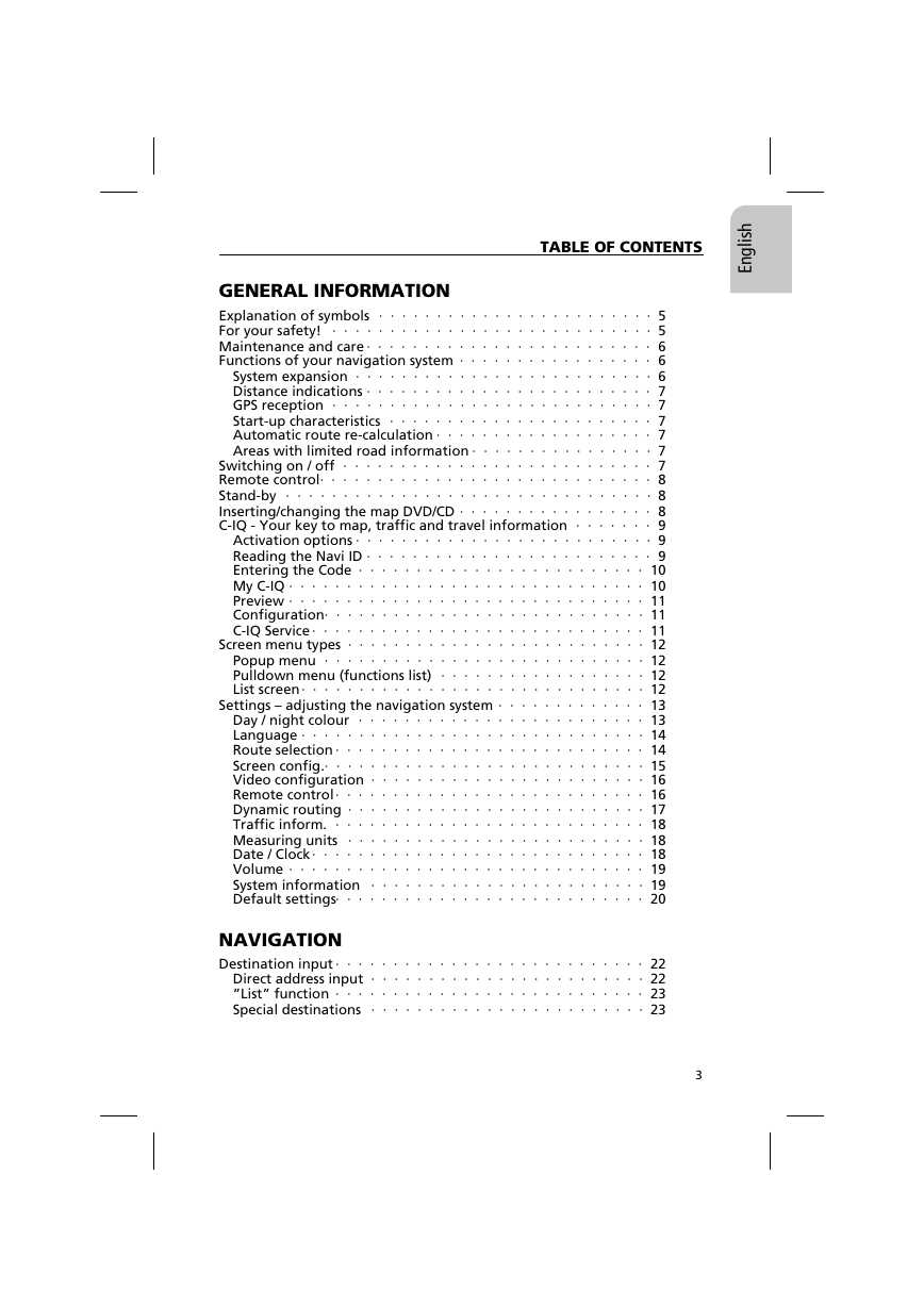
TABLE OF CONTENTS
h
s
i
l
g
n
E
GENERAL INFORMATION
Explanation of symbols · · · · · · · · · · · · · · · · · · · · · · · · 5
For your safety! · · · · · · · · · · · · · · · · · · · · · · · · · · · · 5
Maintenance and care · · · · · · · · · · · · · · · · · · · · · · · · · 6
Functions of your navigation system · · · · · · · · · · · · · · · · · 6
System expansion · · · · · · · · · · · · · · · · · · · · · · · · · · 6
Distance indications · · · · · · · · · · · · · · · · · · · · · · · · · 7
GPS reception · · · · · · · · · · · · · · · · · · · · · · · · · · · · 7
Start-up characteristics · · · · · · · · · · · · · · · · · · · · · · · 7
Automatic route re-calculation · · · · · · · · · · · · · · · · · · · 7
Areas with limited road information · · · · · · · · · · · · · · · · 7
Switching on / off · · · · · · · · · · · · · · · · · · · · · · · · · · · 7
Remote control· · · · · · · · · · · · · · · · · · · · · · · · · · · · · 8
Stand-by · · · · · · · · · · · · · · · · · · · · · · · · · · · · · · · · 8
Inserting/changing the map DVD/CD · · · · · · · · · · · · · · · · · 8
C-IQ - Your key to map, traffic and travel information · · · · · · · 9
Activation options · · · · · · · · · · · · · · · · · · · · · · · · · · 9
Reading the Navi ID · · · · · · · · · · · · · · · · · · · · · · · · · 9
Entering the Code · · · · · · · · · · · · · · · · · · · · · · · · · 10
My C-IQ · · · · · · · · · · · · · · · · · · · · · · · · · · · · · · · 10
Preview · · · · · · · · · · · · · · · · · · · · · · · · · · · · · · · 11
Configuration· · · · · · · · · · · · · · · · · · · · · · · · · · · · 11
C-IQ Service · · · · · · · · · · · · · · · · · · · · · · · · · · · · · 11
Screen menu types · · · · · · · · · · · · · · · · · · · · · · · · · · 12
Popup menu · · · · · · · · · · · · · · · · · · · · · · · · · · · · 12
Pulldown menu (functions list)
· · · · · · · · · · · · · · · · · · 12
List screen· · · · · · · · · · · · · · · · · · · · · · · · · · · · · · 12
Settings – adjusting the navigation system · · · · · · · · · · · · · 13
Day / night colour · · · · · · · · · · · · · · · · · · · · · · · · · 13
Language · · · · · · · · · · · · · · · · · · · · · · · · · · · · · · 14
Route selection · · · · · · · · · · · · · · · · · · · · · · · · · · · 14
Screen config.· · · · · · · · · · · · · · · · · · · · · · · · · · · · 15
Video configuration · · · · · · · · · · · · · · · · · · · · · · · · 16
Remote control· · · · · · · · · · · · · · · · · · · · · · · · · · · 16
Dynamic routing · · · · · · · · · · · · · · · · · · · · · · · · · · 17
Traffic inform.
· · · · · · · · · · · · · · · · · · · · · · · · · · · 18
Measuring units · · · · · · · · · · · · · · · · · · · · · · · · · · 18
Date / Clock· · · · · · · · · · · · · · · · · · · · · · · · · · · · · 18
Volume · · · · · · · · · · · · · · · · · · · · · · · · · · · · · · · 19
System information · · · · · · · · · · · · · · · · · · · · · · · · 19
Default settings· · · · · · · · · · · · · · · · · · · · · · · · · · · 20
NAVIGATION
Destination input · · · · · · · · · · · · · · · · · · · · · · · · · · · 22
Direct address input · · · · · · · · · · · · · · · · · · · · · · · · 22
”List” function · · · · · · · · · · · · · · · · · · · · · · · · · · · 23
Special destinations · · · · · · · · · · · · · · · · · · · · · · · · 23
3
�
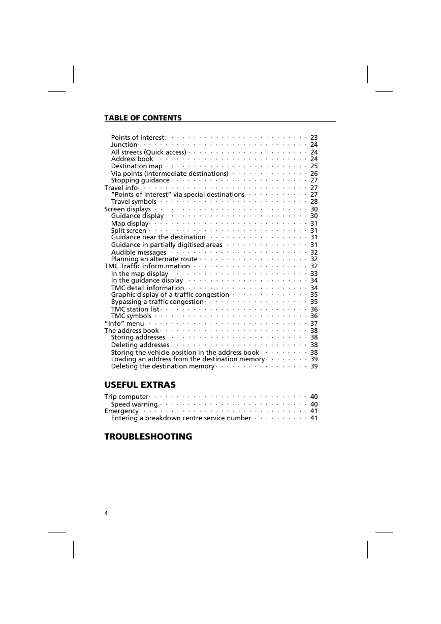
TABLE OF CONTENTS
Points of interest:· · · · · · · · · · · · · · · · · · · · · · · · · · 23
Junction· · · · · · · · · · · · · · · · · · · · · · · · · · · · · · · 24
All streets (Quick access) · · · · · · · · · · · · · · · · · · · · · · 24
Address book · · · · · · · · · · · · · · · · · · · · · · · · · · · 24
Destination map · · · · · · · · · · · · · · · · · · · · · · · · · · 25
Via points (intermediate destinations) · · · · · · · · · · · · · · 26
Stopping guidance · · · · · · · · · · · · · · · · · · · · · · · · · 27
Travel info· · · · · · · · · · · · · · · · · · · · · · · · · · · · · · · 27
”Points of interest” via special destinations · · · · · · · · · · · 27
Travel symbols · · · · · · · · · · · · · · · · · · · · · · · · · · · 28
Screen displays · · · · · · · · · · · · · · · · · · · · · · · · · · · · 30
Guidance display · · · · · · · · · · · · · · · · · · · · · · · · · · 30
Map display· · · · · · · · · · · · · · · · · · · · · · · · · · · · · 31
Split screen · · · · · · · · · · · · · · · · · · · · · · · · · · · · · 31
Guidance near the destination · · · · · · · · · · · · · · · · · · 31
Guidance in partially digitised areas · · · · · · · · · · · · · · · 31
Audible messages · · · · · · · · · · · · · · · · · · · · · · · · · 32
Planning an alternate route · · · · · · · · · · · · · · · · · · · · 32
TMC Traffic inform.rmation · · · · · · · · · · · · · · · · · · · · · 32
In the map display · · · · · · · · · · · · · · · · · · · · · · · · · 33
In the guidance display · · · · · · · · · · · · · · · · · · · · · · 34
TMC detail information · · · · · · · · · · · · · · · · · · · · · · 34
Graphic display of a traffic congestion · · · · · · · · · · · · · · 35
Bypassing a traffic congestion· · · · · · · · · · · · · · · · · · · 35
TMC station list· · · · · · · · · · · · · · · · · · · · · · · · · · · 36
TMC symbols · · · · · · · · · · · · · · · · · · · · · · · · · · · · 36
”Info” menu · · · · · · · · · · · · · · · · · · · · · · · · · · · · · 37
The address book · · · · · · · · · · · · · · · · · · · · · · · · · · · 38
Storing addresses· · · · · · · · · · · · · · · · · · · · · · · · · · 38
Deleting addresses · · · · · · · · · · · · · · · · · · · · · · · · · 38
Storing the vehicle position in the address book· · · · · · · · · 38
Loading an address from the destination memory · · · · · · · · 39
Deleting the destination memory · · · · · · · · · · · · · · · · · 39
USEFUL EXTRAS
Trip computer· · · · · · · · · · · · · · · · · · · · · · · · · · · · · 40
Speed warning · · · · · · · · · · · · · · · · · · · · · · · · · · · 40
Emergency · · · · · · · · · · · · · · · · · · · · · · · · · · · · · · 41
Entering a breakdown centre service number · · · · · · · · · · 41
TROUBLESHOOTING
4
�
GENERAL INFORMATION
h
s
i
l
g
n
E
Explanation of symbols
The following symbols are used in this manual:
! This symbol identifies Safety or Warning Notes. They contain
important information for the safe operation of your equipment.
Failure to observe this information may result in a risk of damage
or injury. Therefore, please observe this information with
particular care.
u Identifies an action to be performed.
t Identifies useful tips and information for the operation of the
system.
• A bullet before the text identifies an enumeration.
“ Text in quotation marks identifies a screen menu option.
For your safety!
! The use of the navigation system by no means relieves the driver of
his/her responsibilities. Always observe the applicable traffic regulations
and the take the current traffic conditions into consideration. You
always have priority over the information provided by the navigation
system if the actual traffic situation and the information from the
navigation system conflict.
! The system does not take the relative safety of the suggested routes
into consideration. Road blocks, building sites, height or weight
restrictions, traffic or weather conditions or other influences which
affect the route safety or travel time are not taken into consideration
for the suggested routes. Use your own discretion in order to decide on
the suitability of the suggested routes. Use the function ”Alternative
Route” to receive better routing suggestions, or simply use your
preferred route and leave the planning of the new route to the
automatic routing recalculation.
! For the sake of traffic safety, perform inputs to the navigation system
only prior to the trip or when the vehicle is stationary.
! In certain areas one-way streets, turn off and entry restrictions (e.g. to
pedestrian zones) have not been surveyed. The navigation system issues
a warning in such areas. Pay particular attention to one-way streets,
turn off and entry restrictions.
! Please make certain that all persons using your multimedia system have
access to this manual, and that they carefully read the instructions and
suggestions for the use of the system prior to using it for the first time.
5
�
GENERAL INFORMATION
! If your screen is installed on a flexible support, adjust it such that you can
see the screen contents quickly and easily, and reflections and dazzle or
glare are avoided. Stop the vehicle at a suitable spot prior to performing
adjustments.
! If your monitor is installed on a fixed support, check that your dealer
has installed it in accordance with the above recommendations. The
screen must not be installed in a position, where it obstructs the view
of any items necessary for the safe operation of the vehicle (e.g. road,
mirrors, instruments, surroundings). In addition, the monitor may not
be installed within deployment range of the airbag.
! Only look at the monitor if it is safe to do so. Stop at a suitable place if
you must look at the screen for a longer period of time.
! Always store the remote control in a safe place.
! The values for the current speed, driving time and the elapsed distance,
displayed in the ”Trip computer” of the system are calculated values.
Accuracy cannot be guaranteed in all cases. For the current speed value,
the vehicle speedometer has priority.
! Do not rely exclusively on the navigation system when you attempt to
locate an emergency service (police, fire service, etc.). It cannot be
guaranteed that all available emergency services in your vicinity are
stored in the database. Act in accordance with your own discretion and
abilities in order to obtain help in such situations.
Maintenance and care
Do not use cleaning fluid, alcohol or other solvents. A damp cloth is best
suited.
Functions of your navigation system
With the VDO Dayton Multimedia System you have purchased a high-
performance instrument which has been designed to assist drivers in daily
traffic. Simply enter the destination prior to starting off, activate ”Desti-
nation routing” and off you go. The navigation system will provide driving
instructions in acoustic and visual form. The system is simple to use, because
of the small number of operating elements and a clear menu structure.
System expansion
In conjunction with a TMC expansion, the system will show the current
traffic situation along your route, and will guide you around traffic
obstructions. Numerous system expansions permit the upgrade to an
information and entertainment system.
6
�
GENERAL INFORMATION
h
s
i
l
g
n
E
Distance indications
On main roads, the distances to exits indicated by the system deviate from
those indicated by road signs. The road signs on main roads refer to the
start of the exit, while the navigation system always indicates the distance
to the end of the slip road. This corresponds to the point where the
driving lanes fork (separate).
GPS reception
Basically, the system is operational even under conditions of poor GPS
reception. Position accuracy can however be reduced.
Start-up characteristics
If the vehicle is parked for longer periods of time, then the satellites
continue their orbit. Thus it may take several minutes before the signals
of enough satellites have been received and analysed after the ignition
has been switched on again. Sufficient reception (three-dimensional
position) is indicated by the green satellite symbol in the display. The
satellite symbol remains red if GPS reception is insufficient.
During the start-up process, it is possible that the navigation system
reports: ”Please proceed to the planned route”. The system assumes that
the vehicle is located off a stored road. If other roads exist in this area,
the navigation system may issue incorrect messages. The system assumes
that the vehicle is located on a different road.
Automatic route re-calculation
If you do not follow the instructions of the system, the system will
automatically plan a new route.
Areas with limited road information
In some areas, not all road information may be available on the map
DVD/CD. Thus, for example, turn-off prohibitions, information on the
direction of travel in a one-way street or prohibited entry into a
pedestrian zone may be missing. The navigation system will display a
warning if you drive into such an area.
t Information concerning the functions of the navigation system can be
found in the internet under www.vdodayton.de.
Switching on / off
The multimedia system is switched on and off with the ignition. If the
system was not switched to stand-by prior to switching off, a title screen
is displayed. This is followed by information on operation of the system.
Confirm this by pressing the OK key. After several seconds, the system is
functional.
All settings made on the system are stored after it is switched off.
7
�
GENERAL INFORMATION
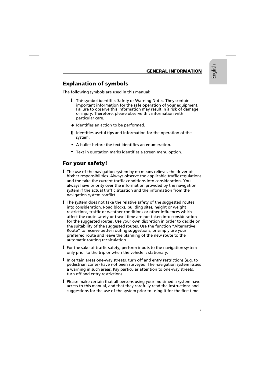
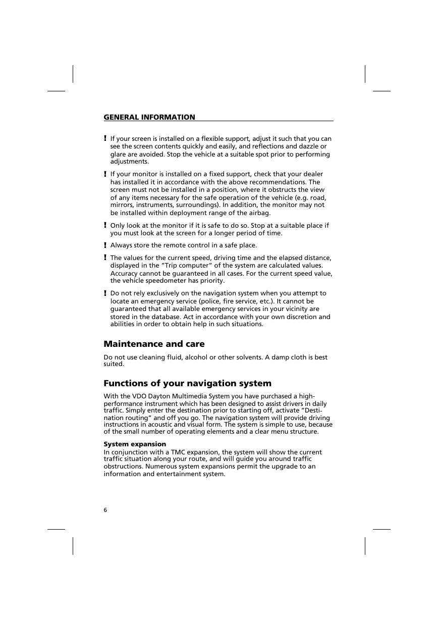
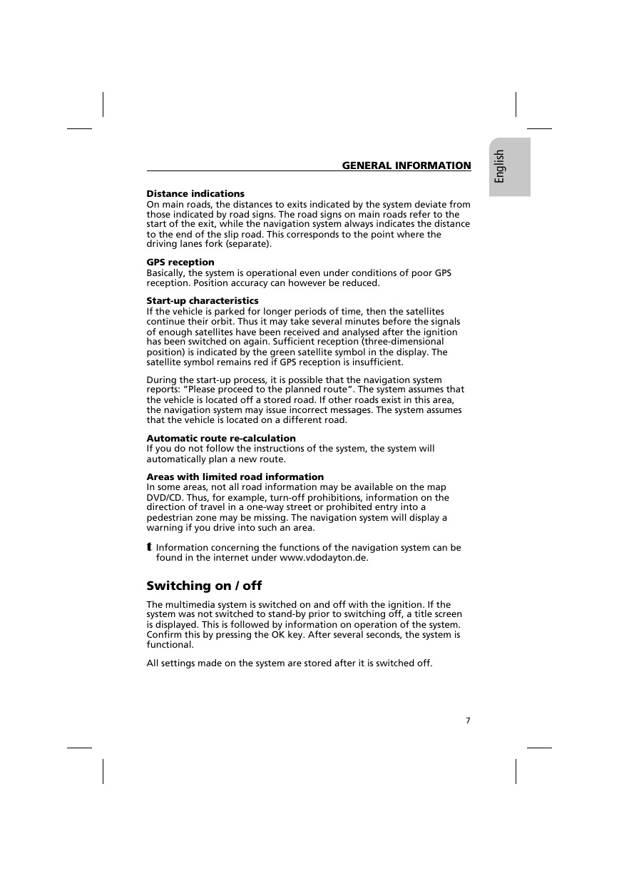
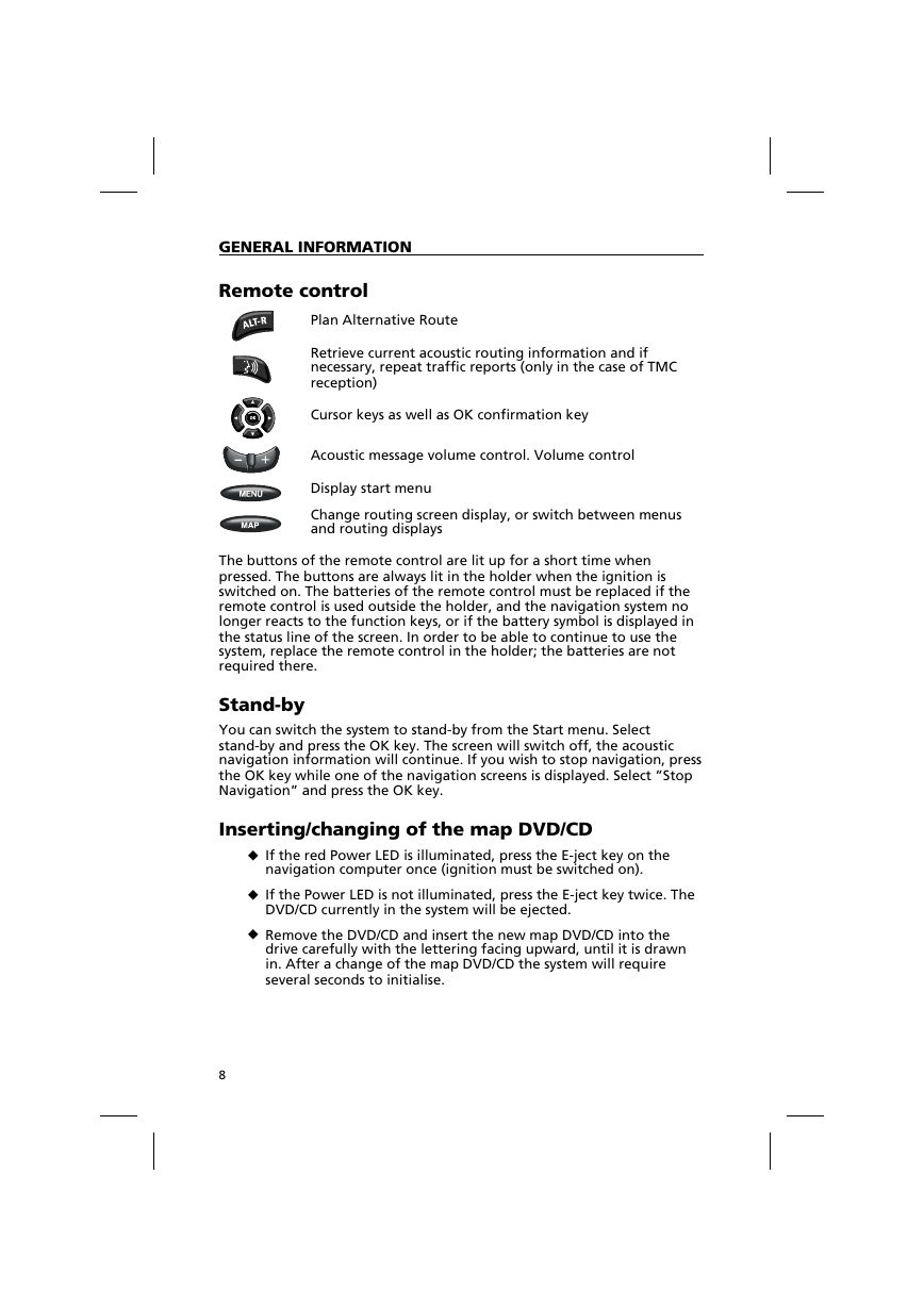
Remote control
Plan Alternative Route
Retrieve current acoustic routing information and if
necessary, repeat traffic reports (only in the case of TMC
reception)
Cursor keys as well as OK confirmation key
Acoustic message volume control. Volume control
Display start menu
Change routing screen display, or switch between menus
and routing displays
The buttons of the remote control are lit up for a short time when
pressed. The buttons are always lit in the holder when the ignition is
switched on. The batteries of the remote control must be replaced if the
remote control is used outside the holder, and the navigation system no
longer reacts to the function keys, or if the battery symbol is displayed in
the status line of the screen. In order to be able to continue to use the
system, replace the remote control in the holder; the batteries are not
required there.
Stand-by
You can switch the system to stand-by from the Start menu. Select
stand-by and press the OK key. The screen will switch off, the acoustic
navigation information will continue. If you wish to stop navigation, press
the OK key while one of the navigation screens is displayed. Select ”Stop
Navigation” and press the OK key.
Inserting/changing of the map DVD/CD
u If the red Power LED is illuminated, press the E-ject key on the
navigation computer once (ignition must be switched on).
u If the Power LED is not illuminated, press the E-ject key twice. The
DVD/CD currently in the system will be ejected.
u Remove the DVD/CD and insert the new map DVD/CD into the
drive carefully with the lettering facing upward, until it is drawn
in. After a change of the map DVD/CD the system will require
several seconds to initialise.
8
�


 2023年江西萍乡中考道德与法治真题及答案.doc
 2012年重庆南川中考生物真题及答案.doc
 2013年江西师范大学地理学综合及文艺理论基础考研真题.doc
 2020年四川甘孜小升初语文真题及答案I卷.doc
 2020年注册岩土工程师专业基础考试真题及答案.doc
 2023-2024学年福建省厦门市九年级上学期数学月考试题及答案.doc
 2021-2022学年辽宁省沈阳市大东区九年级上学期语文期末试题及答案.doc
 2022-2023学年北京东城区初三第一学期物理期末试卷及答案.doc
 2018上半年江西教师资格初中地理学科知识与教学能力真题及答案.doc
 2012年河北国家公务员申论考试真题及答案-省级.doc
 2020-2021学年江苏省扬州市江都区邵樊片九年级上学期数学第一次质量检测试题及答案.doc
 2022下半年黑龙江教师资格证中学综合素质真题及答案.doc