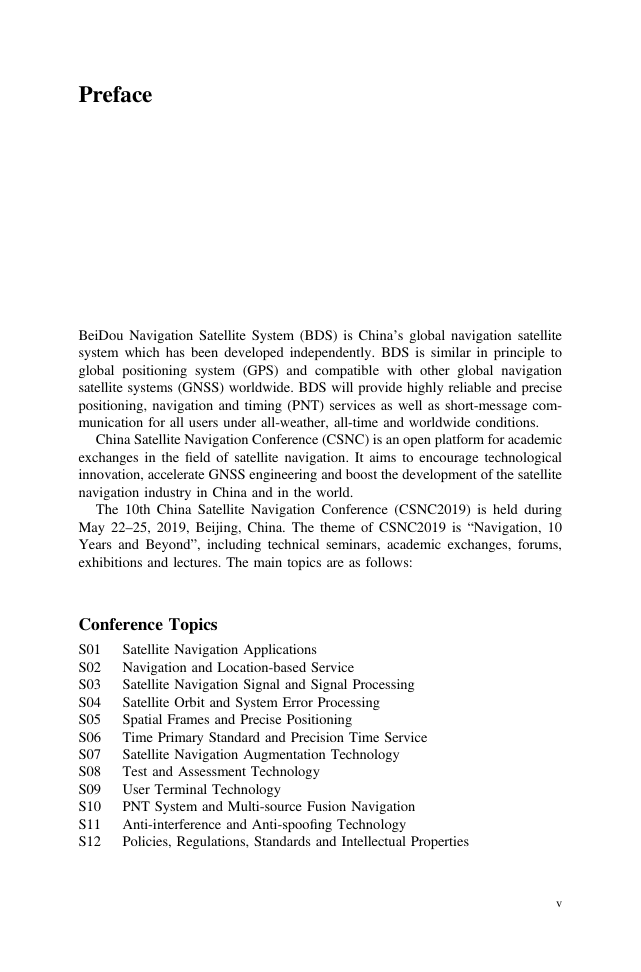
Preface
Conference Topics
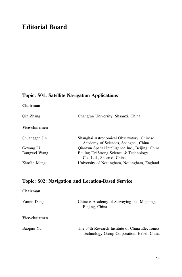
Editorial Board
Topic: S01: Satellite Navigation Applications
Chairman
Vice-chairmen
Topic: S02: Navigation and Location-Based Service
Chairman
Vice-chairmen
Topic: S03: Satellite Navigation Signal and Signal Processing
Chairman
Vice-chairmen
Topic: S04: Satellite Orbit and System Error Processing
Chairman
Vice-chairmen
Topic: S05: Spatial Frames and Precise Positioning
Chairman
Vice-chairmen
Topic: S06: Time Primary Standard and Precision Time Service
Chairman
Vice-chairmen
Topic: S07: Satellite Navigation Augmentation Technology
Chairman
Vice-chairmen
Topic: S08: Test and Assessment Technology
Chairman
Vice-chairmen
Topic: S09: User Terminal Technology
Chairman
Vice-chairmen
Topic: S10: PNT System and Multi-source Fusion Navigation
Chairman
Vice-chairmen
Topic: S11: Anti-interference and Anti-spoofing Technology
Chairman
Vice-chairmen
Topic: S12: Policies, Regulations, Standards and Intellectual Properties
Chairman
Vice-chairmen
Scientific Committee
Chairman
Vice-chairmen
Executive Chairmen
Committee Members
Executive Members
Organizing Committee
Directors
Deputy Directors
Secretary-General
Deputy Secretary-General
Committee Members
Contents
Satellite Orbit and System Error Processing
Calculating the Mean Orbit Elements of Navigation Satellites Using Hilbert-Huang Transformation
Abstract
1 Introduction
2 Mean Orbit Elements Calculation
2.1 Analytical Method
2.2 Harmonic Decomposition
2.3 Hilbert-Huang Transformation
3 Analysis of Algorithms
3.1 Dynamic Perturbation
3.2 Empirical Mode Decomposition
3.3 HHT Perform
4 Calculation Results
4.1 EMD Decomposition
4.2 Frequency Analysis
4.3 Mean Orbit Elements Evolution
5 Conclusions
References
GNSS Orbit Prediction with Enhanced Solar Radiation Pressure Model
Abstract
1 Introduction
2 Performance of Our Daily Adjusted Orbits
3 Evaluation of GNSS Orbit Predictions
4 Summary and Conclusion
Acknowledgments
References
A Method for Improving the Short-Term Prediction Model for ERP Based on Long-Term Observations
Abstract
1 Introduction
2 The Principle of AIC
3 Improved LS Models for ERP Prediction
4 ECLS+MAR Prediction Model
5 Experiments and Analyses
6 Conclusions and Prospects
Acknowledgments
References
An Improved Method for BDS Inter-frequency Clock Bias Estimation
Abstract
1 Introduction
2 IFCB Estimation
2.1 Traditional Approach of IFCB Estimation
2.2 Improved IFCB Estimation Based on Network Solution
3 Experiment Setup
4 IFCB Results and Analysis
4.1 BDS IFCB and Station IFCB
4.2 Effect of IFCB on PPP
5 Conclusions
Acknowledgement
References
A Tightly Combined BDS and GPS Method for RTK Positioning with Triple-Frequency Widelane Combinations
Abstract
1 Introduction
2 Methods
2.1 EWL/WL Ambiguity Resolution Model
2.2 Inter-system Model of BDS and GPS with WL Combination
3 Results of EWL/WL Ambiguity Resolution
4 Stability Analysis of BDS-GPS DISB with WL Combination
5 Experiments of Medium-Baseline RTK Positioning
6 Conclusions
Acknowledgments
References
A Hierarchical Planning Method for the Inter-satellite Links Network of Navigation Satellite Constellations
Abstract
1 Foreword
2 Time Slot Planning Techniques
2.1 Multilayer Link Network Partition Based on Visual Analysis
2.2 Time Slot Planning
2.3 Time Slot Planning Based on Load Balancing
3 Routing Design Scheme
3.1 Evaluation Model
3.2 Routing Planning Technology Based on A* Searching
4 Simulation Verification
4.1 Visual Analysis
4.2 Performance Testing
5 Conclusion
References
Primary Exploration on Approaches to Establish BeiDou Terrestrial Reference Frame
Abstract
1 Introduction
2 Experiments on Establishment of BTRF
2.1 Precise Point Positioning
2.1.1 Experiment Data and Processing Strategy
2.1.2 Results and Analysis
2.2 BDS Net-Solution
2.2.1 Experiment Data and Processing Strategy
2.2.2 Results and Analysis
3 Improvement of BDS Orbit Determination Accuracy with Regional Tracking Network After Coordinates Refinement
3.1 Orbit Determination Strategy with Regional Tracking Network
3.2 Orbit Determination Residual
3.3 Orbit Overlap Comparison
3.4 SLR Evaluation
4 Summary and Conclusions
References
The Accuracy Evaluation of Galileo Broadcast Clocks
Abstract
1 Introduction
2 Brief Introduction to Galileo Broadcast Ephemeris
3 The Accuracy Evaluation Method of Broadcast Clock Offset
3.1 Clock Offset Fitting Model
3.2 Accuracy Evaluation Method
4 Experimental Analysis
4.1 Data Description and Strategy Analysis
4.2 Analysis of Results
5 Conclusion
Acknowledgements
References
BDS Long-Term Almanac Fitting Arc Length Design for Autonomous Navigation
Abstract
1 Introduction
2 BDS Satellite Almanac Parameter Fitting
2.1 Almanac User Algorithm
2.2 Almanac Fitting Algorithm
3 Analysis and Discussion of Almanac Fitting Results
4 Conclusions
Acknowledgements
References
Strategy Analysis of Anchorage Station in Distributed Autonomous Orbit Determination for Beidou MEO Constellation
Abstract
1 Introduction
2 The Function and Application Strategy of Anchorage Station in Autonomous Orbit Determination
2.1 Observability of Astro-Earth Observation on Rising Node Meridian
2.2 Effect of Location and Number of Anchorage Station on Orbit Determination Accuracy
3 Simulation and Verification
3.1 Setting of Simulation Conditions
3.2 Experimental Content
3.3 The Influence of the Existing of Anchorage Station
3.4 The Influence of the Number of Anchorage Station
3.5 The Influence of the Location of Single Anchorage Station
4 Summary and Discussion
References
Spatial Frames and Precise Positioning
The Research on Optimal Tropospheric Combined Model Based on Multi-GNSS PPP
Abstract
1 Introduction
2 Tropospheric Combined Models and Multi-GNSS PPP Model
2.1 Tropospheric Combined Models
2.1.1 Meteorological Data Models
2.1.2 Tropospheric Models
2.2 Multi-GNSS PPP Model
3 Data Sets and Processing Strategy
4 Data Tests and Results Analysis
4.1 The Analysis of the Accuracy of Tropospheric Models
4.2 The Analysis of PPP Result Based on Tropospheric Models
5 Conclusion
Acknowledgements
References
Preliminary Evaluation on the Precision of the BDS-3 Global Ionospheric Model
Abstract
1 Introduction
2 BDS-3 Global Ionospheric Model
3 Insufficient of Klobuchar Model
4 BDGIM Model Precision
5 Positioning Performance of BDGIM
6 Conclusions
References
Research on Multi-GNSS Wide-Lane FCB Estimation Method Based on MGEX
Abstract
1 Introduction
2 FCB Product Estimation Method for Multi-GNSS
2.1 Basic Observation Equation
2.2 Observation Equation of Multi-GNSS
2.3 Multi-GNSS Wide-Lane FCB Estimation Method
3 Experimental Results
4 Conclusion
References
Ambiguity Single Epoch Fixing Method Based on Prior Coordinate Constraints
Abstract
1 Introduction
2 Dual Frequency Observations and Their Linear Combinations
3 Wide Lane Ambiguity Fixed
4 Experiment Analysis
5 Conclusion
References
The Algorithm for Cycle Slip Detection and Repair Based on Pseudo-phase and Ultra-wide Lane Carrier
Abstract
1 Introduction
2 Cycle-Slip Detection
2.1 Pseudo-phase Model
2.2 The Selection of Optimal Combination Coefficient
2.3 Ultra-wide Lane Combination
3 Cycle-Slip Repair
4 Numerical Calculation and Analysis
4.1 Different Size of Cycle-Slip Detection
4.2 Insensitive Cycle-Slip Detection
5 Conclusion
Acknowledgements
References
Assessment of BeiDou-2 Orbit and Clock Quality Based on Analysis of Wide-Lane Ambiguities Derived from PPP Models
Abstract
1 Introduction
2 WL Ambiguities Derived from the GF and GB Models
3 Experiment and Results Analysis
4 Conclusions and Outlooks
References
Satellite Navigation Augmentation Technology
LEO Navigation Augmentation: Satellite Antenna PCV Requirement for Precise Positioning
Abstract
1 Introduction
2 Satellite Antenna Phase Deviation Mathematical Model
3 The PCV Requirement Analysis of Fast PPP Service for LEO Navigation Augmentation Satellite Antenna
4 Simulation Results
5 Conclusions
Acknowledgment
References
Analysis and Modeling on Interference of Solar Radio Burst on GNSS Signal
Abstract
1 Introduction
2 SRB Interference to GNSS Receiver
3 Solar Radio Burst Index - SRBI
3.1 Definition of SRBI
3.2 Identification of SRB Event Based on SRBI
4 Modeling of Signal Fading Under SRB Effects
5 Accuracy of GNSS Signal Fading Model
5.1 Cross-Validation of the Models
5.2 Results of GNSS Signal Fading Models
6 Further Discussion
7 Conclusion
Acknowledgments
References
Research on Receiver Autonomous Integrity Monitoring Technology Based on GNSS Baseband Signal
Abstract
1 Introduction
2 Original Signal-Assisted Integrity Monitoring Algorithm
2.1 Fundamental
3 Detection Threshold Calculation
4 Simulation Test
5 Conclusion
Acknowledgment
References
Rapid PPP Integer Ambiguity Resolution Assisted with RTK Technology Based on VRS
Abstract
1 Introduction
2 Algorithm Principle
2.1 VRS Undifferenced Ambiguity Fixed
2.2 Single-Differenced Ambiguity Determination
2.3 User PPP Solution
3 Experimental Results and Analysis
4 Conclusion
References
Study on the Prediction Method of Single and Dual Frequency Service Area for BDSBAS
Abstract
1 Introduction
2 Overview
3 Modeling of Service Area Prediction
3.1 Reference Station Error Model
3.2 Data Processing Center Error Model
3.2.1 UDRE Model
3.2.2 GIVE Model
3.2.3 User’s Error Model
3.3 Service Area Prediction Method
4 Simulation Analysis
4.1 WAAS Service Area Simulation
4.2 Simulation of BDSBAS Service Area
5 Conclusion
References
Improvement for BeiDou-3 Receiver Autonomous Integrity Monitoring with Missed Detection Probability Equal Allocation
Abstract
1 Introduction
2 A Brief Overview of RAIM
3 Performance of False Alarm Probability
4 Performance of Missed Detection Probability
5 RAIM Risk Allocation
5.1 Experimental Results and Analysis
6 Conclusion
References
Propagation Characteristics of Pseudolite Array Signals Indoors
Abstract
1 Introduction
2 Theoretical Study on Directional Pseudolite
2.1 Uniform Linear Array Radiation Principle
2.2 Main Factors Affecting Array Directivity
2.2.1 Main Lobe Direction
2.2.2 Main Beam Width
2.2.3 Sidelobe Level
2.3 Directional Pseudolite Array Design
3 Pseudolite Array Indoor Positioning Algorithm
3.1 Pseudolite Array Positioning Principle
3.2 Carrier Phase Observation Equation
4 Simulation Verification of Pseudolite Array Propagation Characteristics
4.1 Modeling Indoor Scenes
4.2 Simulation Results
4.2.1 Direction of Propagation
4.2.2 Received Power
5 Conclusions
Acknowledgments
References
Error Prediction Model of Klobuchar Ionospheric Delay Based on TS Fuzzy Neural Network
Abstract
1 Introduction
2 Error Analysis of Klobuchar Ionospheric Model
2.1 Klobuchar Ionospheric Model
2.2 iGMAS Ionospheric Products
2.3 Error Analysis
3 TS Fuzzy Neural Network Prediction Model
3.1 TS Fuzzy Neural Network
3.2 Learning Algorithm of TS Fuzzy Neural Network
4 Error Prediction Experiment Based on TS Fuzzy Neural Network
5 Conclusion
Acknowledgment
References
Research on Fault Detection Algorithm Based on Cumulative Improvement of Parity Vector Sliding Window
Abstract
1 Introduction
2 Fault Detection Scheme Based on Sliding Window Cumulative Improvement
3 System Measurement Equation Construction
4 Research on Cumulative Improvement Algorithm for Parity Vector Sliding Window
4.1 Traditional Parity Vector Algorithm
4.2 Multi-epoch Parity Vector Accumulation Algorithm
4.3 Parity Vector Sliding Window Accumulation Improvement Algorithm
5 Simulation Results and Analysis
6 Conclusion
Acknowledge
References
Research on Regional Instantaneous Availability Evaluation Method of Satellite Navigation System
Abstract
1 Introduction
2 Global Navigation Availability
2.1 Navigation Signal Fault Detection Risk Analysis
2.2 Single Satellite Availability
2.3 Constellation Availability
3 Regional Instantaneous Availability
3.1 Regional Availability
3.2 Service Availability
4 Simulation Results
5 Conclusions
References
The Challenges of LEO Based Navigation Augmentation System – Lessons Learned from Luojia-1A Satellite
Abstract
1 Introduction
2 LEO Navigation Augmentation System of Luojia-1A Satellite
3 Luojia-1A Satellite Augmentation Signal Analysis
3.1 Measurement Noise Assessed with the Geometry-Free Combination
3.2 Measurement Noise Assessed with the Zero-Baseline
4 Characteristic Analysis of Navigation Signals from LEO Satellite
5 Conclusion
Acknowledgments
References
Test and Assessment Technology
Research on Test Method of Complex Electromagnetic Environment Adaptability of GNSS Receivers
Abstract
1 Introduction
2 Technical Characteristics and Application Modes of GNSS Receivers
2.1 Basic Composition and Principle
2.2 Technical Characteristics
2.3 Application Mode
3 Analysis of Complex Electromagnetic Environment of GNSS Receiver
3.1 About Complex Electromagnetic Environment
3.2 The Composition of Complex Electromagnetic Environment
3.3 Complex Electromagnetic Environment Effects on GNSS Receivers
4 Evaluation Method of Complex Electromagnetic Environment Adaptability Test of GNSS Receivers
4.1 General Procedure of Test
4.2 Construction and Evaluation Method of Electromagnetic Environment of GNSS Receivers
4.2.1 Correlation-Based Construction Method of Electromagnetic Environment
4.2.2 Similarity-Based Evaluation Method of Electromagnetic Environment
4.3 Contents of Complex Electromagnetic Environment Adaptability Test
4.3.1 Evaluation Indexes of Electromagnetic Environment Adaptability
4.3.2 Evaluation Method of Electromagnetic Environment Adaptability
5 Summary
References
Impact of the Ionosphere and GPS Surveying Caused by Coronal Mass Ejection on May 23 2017
Abstract
1 Introduction
2 GNSS Global Broadcast Ionosphere Model
2.1 GPS Global Broadcast Ionosphere Model
2.2 Galileo Global Broadcasting Ionosphere Model
2.3 Beidou Global Broadcast Ionosphere Model
3 Global Ionospheric TEC Disturbance Anomaly Analysis
4 Analysis of the Effect of Magnetic Storm on the Correction Effect of Monitoring Station Model and the Single Point Positioning of Pseudorange
4.1 Analysis of the Influence of Magnetic Storm on Model Correction Effect
4.2 Analysis of the Influence of Magnetic Storm on Single Point Positioning Accuracy
5 Conclusion
Acknowledgement
References
Separation and Evaluation Method of GNSS Authorized Service Signals
Abstract
1 Introduction
2 Signal Model and Problem Formulation
2.1 Signal Model
2.2 Problem Formulation
3 The Proposed Methods
3.1 Basic Principle
3.2 Application Cases
4 Simulation Analysis
5 Experimental Results
6 Conclusions
Acknowledgment
References
Analysis of BDS Satellites Code Multipath
Abstract
1 Introduction
2 Theory of Multipath
3 Corrections for Code Multipath Bias of BDS-2 Satellites
4 Analysis of Code Multipath of BDS-3 Satellites
5 Conclusions
References
Accuracy Analysis of GNSS Broadcast Ionospheric Model
Abstract
1 Introduction
2 GNSS Broadcast Ionospheric Model
2.1 GPS Klobuchar Model
2.2 BDS Broadcast Ionospheric Model
2.3 Galileo NeQuick Model
3 Experiment and Evaluation Analysis
3.1 Evaluation Criteria and Methods
3.2 Processing and Analysis
4 Conclusions
Acknowledgments
References
Performance Evaluation of Beidou-3 On-Board Atomic Clock
Abstract
1 Introduction
2 Indicator Calculation Method
3 On-Board Clock Performance Evaluation
3.1 Clock Difference Data Preprocessing
3.2 Frequency Accuracy Assessment
3.3 Frequency Drift Rate Assessment
3.4 Frequency Stability Assessment
3.5 Segment Performance Evaluation
4 Conclusion
References
Quality Analysis of GNSS Data in Polar Region
Abstract
1 Introduction
2 Data Processing and Analysis
2.1 Data
2.2 Number of Visible Satellites
2.3 PDOP
2.4 SNR
2.5 Multipath Delay
2.6 BDS-3 Simulation
3 Conclusions
References
Precision Analysis of BDS-3 Satellite Orbit by Using SLR Data
Abstract
1 Introduction
2 Principle of Accuracy Evaluation of Satellite Orbit
2.1 Assessment Methodology
2.2 Calculation of SLR Observations and Space-Earth Distance
2.3 Corrective Model
3 Example Analysis
3.1 Broadcast Ephemeris
3.2 Precise Ephemeris
4 Summary
Funding Information
References
Accuracy Assessment and Improvement of GNSS Precise Point Positioning Under Ionospheric Scintillation
Abstract
1 Introduction
2 Data and Methodology
2.1 PPP Model
2.2 Ionospheric Scintillation
3 Ionospheric Scintillation
3.1 Space Weather Indices
3.2 PPP Processing Results
3.2.1 GPS-Only PPP
3.2.2 GPS/BDS/GLONASS PPP
4 Conclusions
Acknowledgements
References
Analysis of BDS-3 Satellite System Characteristics Based on “GaoJing-1” Self-designed GNSS Receiver
Abstract
1 Introduction
2 Characteristics of the BDS-3 Open Service Signals
3 “GaoJing-1” Multi-mode Multi-frequency GNSS Receiver
3.1 Overview of “GaoJing-1” Receiver
3.2 Design for BDS-3 Signals
4 Performance Evaluation of BDS-3 System
4.1 Signal Quality Evaluation
4.2 System Visibility Evaluation
4.3 Positioning Performance Evaluation
5 Conclusions
Acknowledgments
References
Performance Evaluation of Galileo Precise Point Positioning
Abstract
1 Introduction
2 Mathematical Model of Precision Point Positioning
2.1 PPP Observation Equation
2.2 Stochastic Model of Observation and Processing Method of Parameters
3 Experiments and Results Analysis
3.1 Experimental Data and Processing Strategies
3.2 Visible Satellites and DOP Value Analysis
3.3 Analysis of Positioning Accuracy
3.4 Convergence Time Analysis
4 Conclusion
Acknowledgments
References
User Terminal Technology
An Improved Geometric Factor-Based Searching and Positioning Algorithm for CGL
Abstract
1 Introduction
2 The Original Searching and Positioning Algorithm for CGL
3 Improved MTs’ Selection Strategy
4 Simulation Results
4.1 Mapping Relationship Between Geometric Factor and Positioning Accuracy
4.2 Performance Comparison of the Improved and the Original Algorithms
5 Conclusion
Acknowledgments
References
Tracking Error Analysis and Performance Evaluation Method for GNSS Non-coherent Vector Tracking Loop
Abstract
1 Introduction
2 Tracking Error Propagation of Non-coherent Vector Tracking Loop
2.1 Navigation Filter Update and Tracking Loop Control Algorithms
2.2 The Propagation of Navigation Error to Code Phase Tracking Error
2.3 The Propagation of Navigation Error to Carrier Frequency Tracing Error
3 Performance Evaluation Method for Non-coherent Vector Tracking Loop
3.1 Design Philosophy of Performance Evaluation Method
3.2 Software Implementation of Performance Evaluation Method
4 Sample Results
4.1 Simulation Setup
4.2 Tracking Error Evaluation
4.3 Navigation Error Evaluation
5 Conclusion
Acknowledgement
References
Design and Performance Analysis of Doppler-Aided Beidou B1C/B2a Joint Tracking Algorithm
Abstract
1 Introduction
2 Beidou B1C and B2a Civil Signal Specifications
2.1 Beidou B1C and B2a Signal
2.2 Theory Analysis of B1C and B2a Tracking Performance
2.2.1 Carrier Phase Tracking Performance
2.2.2 Code Phase Tracking Performance
3 Design of Doppler-Aided Beidou B1C/B2a Joint Tracking Algorithm
3.1 Unambiguous Tracking Method of B1C Signal
3.2 Design of B1C/B2a Joint Tracking Architecture
4 Experiments and Performance Analysis
5 Conclusions
Acknowledgements
References
PNT System and Multi-source Fusion Navigation
The GNSS/Acoustic One-Step Positioning Model with Attitude Parameters
Abstract
1 Introduction
2 Change of Hull Attitude
2.1 Definition of Attitude Angle
2.2 The Effect of Attitude Error on the Instantaneous Coordinate of Transducer
3 The GNSS/Acoustic One-Step Positioning Model with Attitude Parameters
3.1 Traditional Data Processing Methods
3.2 The Function Model of “One-Step Method”
3.3 Introduction of Attitude Parameters
4 Experiments and Results Analysis
5 Conclusion
Acknowledgements
References
Unscented Kalman Filter Based Attitude Estimation with MARG Sensors
Abstract
1 Introduction
2 MARG System Model and Its Linear Kalman Filter Solution
3 Nonlinear Kalman Filtering for Attitude Estimation
4 Disturbance Detection Rules for External Acceleration and Magnetic Field Distortion
5 Experimental Results and Analysis
6 Conclusion
Acknowledgment
References
A Modified TDCP/INS Tightly Coupled Navigation
Abstract
1 Introduction
2 Scheme Design and Mathematical Modeling
2.1 Overall Scheme
2.2 The Modified TDCP Mathematical Modeling
3 Comparative Test
3.1 Result Analysis of Position Errors
3.2 Result Analysis of Velocity Errors
3.3 Result Analysis of Attitude Errors
4 Conclusions
Acknowledgements
References
An Image-Guided Autonomous Navigation System for Multi-rotor UAVs
Abstract
1 Introduction
2 State Estimation
2.1 State Estimator Based on Extended Kalman Filter
2.1.1 Height Compensation by the Attitude of UAVs
2.1.2 Position Estimation
2.1.3 Attitude Estimation
3 UAV Control
3.1 Dynamical Model of UAVs
3.2 Position Control of UAVs
3.2.1 Position-Velocity Controller
3.2.2 Image-Guided Controller
4 Experiments
4.1 Experimental Platform
4.2 State Estimation and Control Performance Evaluation
5 Conclusion
Acknowledgement
References
An Efficient Simulation Platform for Testing and Validating Autonomous Navigation Algorithms for Multi-rotor UAVs Based on Unreal Engine
Abstract
1 Introduction
2 Platform Architecture
2.1 Environment Model
2.1.1 Air Pressure and Density
2.1.2 Magnetic Field
2.1.3 Gravity
2.1.4 Virtual Scenes
2.2 Sensor Model
2.2.1 Gyroscope and Accelerometer
2.2.2 Magnetometer
2.2.3 Barometer
2.2.4 Global Positioning System (GPS)
2.2.5 Camera
3 Experimental Results
3.1 Sensor Model Comparison
3.2 SLAM Algorithm Implementation
3.3 Algorithm Migration
4 Conclusion and Future Work
Acknowledgements
References
Anti-interference and Anti-spoofing Technology
GNSS Anti-jamming Receiving Technology Based on Batch Processing According to CDMA Signals Intensity
Abstract
1 Introduction
2 CDMA Multiple Access Interference in Satellite Navigation System
3 Batch Processing Method for Signals
4 Detection and Elimination of Deception Jamming Signals Based on Intensity
5 Simulations
6 Conclusions
References
Detection on Satellite Navigation Deception Signals Based on Multi Platforms Cooperation
Abstract
1 Introduction
2 Conical Constraint Condition Based on Time Difference Measure
3 Direction Finding Based on Multi Conical Constraint Equations
4 Deception Signals Identification by Cross-Angle Contrast
5 Simulations
6 Conclusions
References
The Navigation Anti-jamming Resource Optimization Algorithm Implemented Based on Wiener Filtering Structure
Abstract
1 Introduction
2 Power Inversion Algorithm
2.1 Algorithm Model
2.2 Implementation Steps
3 Wiener Filtering Algorithm
3.1 Algorithm Model
3.2 Implementation Steps
4 Numerical Simulations
5 Summary
References
Extended Kalman Filter-Based GNSS Signal Tracking Method to Counter Spoofing Attacks
Abstract
1 Introduction
2 GNSS Tracking Loop Based on Kalman Filter
3 Spoofing Signal Model
4 EKF-Based Tracking Loop to Estimate Spoofing Parameters
5 Experiments and Analysis
5.1 Experiment Method and Environment
5.2 Simulation Verification and Analysis
6 Conclusion
References
Fast Interference Detection Aided Notch Filter and Switched Tracking Loop for Mitigating Pulsed CWI in GNSS Receiver
Abstract
1 Introduction
2 Signal Model and Mathematical Analysis
3 Proposed Algorithm
3.1 Architecture of Detector Aided Interference Mitigation Algorithm
3.2 Fast Detection Module
3.3 Structure of Notch Filter
4 Experiments and Tests
4.1 Experiment Environment
4.2 Performance of the Algorithm for Mitigating Pulsed CWIs
5 Conclusions
References
Research on the Random Traversal RAIM Method for Anti-spoofing Applications
Abstract
1 Introduction
2 The Random Traversal RAIM Method
2.1 Introduction to Conventional RAIM
2.2 The Random Traversal RAIM Method
3 The Complexity Analysis of the Random Traversal RAIM Method
4 Simulation and Actual Signal Test Results
4.1 The Simulation Data Description
4.2 The Simulation Result One
4.3 The Simulation Result Two
4.4 The Experimental Design and Result Verification
5 Conclusion
Acknowledgments
References
Time Domain Differential RAIM Method for Spoofing Detection Applications
Abstract
1 Introduction
2 Traditional RAIM
3 RAIM Method Based on Time Difference
4 Simulation and Experiment
4.1 Simulation
4.2 Experiment
5 Conclusion
Acknowledgments
References
Research of Intermediate Spoofing Without Precise Target Information
Abstract
1 Introduction
2 Basic Principles of Intermediate Spoofing
2.1 Principle Introduction
2.2 Analysis of Influencing Factors
3 Simulation Test
3.1 Power Effect
3.2 Code Phase Effect
3.3 Carrier Frequency Effect
4 Verification with Commercial Receiver
5 Analysis and Conclusion
References
The Performance Testing and Evaluation of Anti-spoofing Techniques Using Single or Double Antenna
Abstract
1 Introduction
2 Single-Antenna and Dual-Antenna Anti-spoofing Technology
2.1 Authentic and Counterfeit Signal Model
2.2 Correlation Detection of Signal Amplitudes with Single-Antenna
2.3 Consistency Detection of Signal Arrival Time Differences with Dual-Antenna
3 Spoofing and Anti-spoofing Platform
3.1 Spoofer and Scenarios
3.2 Anti-spoofing Receiver Architecture
4 Experiment Analysis and Evaluation
4.1 Correlation Detection with Stationary and Moving Single-Antenna
4.2 Correlation Detection with Fixed Point Rotating Antenna
4.3 Consistency Detection with Stationary and Moving Dual-Antenna
4.4 Performance of Technologies and Comparison of Advantages and Disadvantages
5 Conclusions
Acknowledgements
References
Policies, Regulations, Standards and Intellectual Properties
Analysis on Intellectual Property Litigations and Countermeasures of Satellite Navigation Enterprises
Abstract
1 Introduction
2 Intellectual Property Litigations in the Daily Operation of Satellite Navigation Enterprises Introduction
2.1 Patent Infringement Litigation
2.2 Copyright Infringement Litigation
2.3 Trademark Reverse Confusion Litigation
2.4 Trade Secret Infringement Litigation
3 Intellectual Property Litigation in Satellite Navigation Enterprises M&A
4 Intellectual Property Litigation in the Process of Satellite Navigation Enterprises IPO
5 Countermeasures for IP Litigation in Satellite Navigation Enterprises
5.1 Strengthening Core Patent R&D and Patent Litigation Strategies
5.2 Pay Attention to Copyright and Trademark Protection
5.3 Intensifying the Protection of Trade Secrets and Improving Corporate Intellectual Property Management
5.4 Prudently Promote IP Due Diligence: Focus on the Effectiveness of Key Patents
5.5 Applying Overseas Intellectual Property in Advance
5.6 Exploring Intellectual Property Insurance System
6 Conclusion
References
The Method and Function of Obtaining Technology and Market Competitive Intelligence of Beidou Industry by Patent Analysis
Abstract
1 Introduction
2 The Significance and Role of Patent Analysis in Enterprise Strategy
3 Patent Data Source and Retrieval Analysis Method
3.1 Patent Retrieval and Analysis Process
3.2 Patent Retrieval Analysis Tools and Data Sources
3.3 Selection of Patent Retrieval Objects
4 Contents and Methods of Technology Patent Analysis in BD Industry
4.1 Analysis on Competitive Environment of BD Industry
4.1.1 Analysis of Technology Development Trend
4.1.2 Patent Technology Life Cycle
4.1.3 Technical Distribution in Countries or Regions
4.1.4 Competitor (or Potential Competitor) Identification
4.2 Competitive Technology Analysis of BD Industry
4.3 Analysis of Competitors in BD Industry
4.3.1 Analysis of Patent Layout of Competitors
4.3.2 Analysis of Patent Layout of Competitors
4.4 Analysis of Enterprise’s Own Technical Competitiveness
4.5 Partner Analysis and Mining
5 Notices for Competition Analysis with Patents
6 Concluding Remarks
References
Patent Layout and Early Warning Advices of Satellite Navigation
Abstract
1 Introduction
2 Patent Layout of Global Satellite Navigation
2.1 Application Trend Analysis of Global Satellite Navigation
2.2 Layout Analysis of Main Applicants of Global Satellite Navigation
3 Patent Layout of Satellite Navigation in China
3.1 Application Trend Analysis of China Satellite Navigation
3.2 Regional Distribution Analysis of China Satellite Navigation
3.3 Application Distribution Analysis of Beidou Industry
4 Discussion on Patent Layout of Qualcomm Inc.
5 Intellectual Property Warning Advice of Beidou Industry
5.1 Continue Patent Layout and Increase the Number of Core Patents
5.2 Give Full Play to the Unique Advantages of Beidou System and Continuously Carry Out Independent Research and Development
5.3 Introduce New Rules of International Competition for Beidou Enterprise
5.4 Track Core Technology, Grasy the Dynamics of Competitors in Real-Time
5.5 Improve the Intellectual Property Practical Ability of Beidou’s Innovative Applicants
6 Conclusion
Reference
Author Index






 2023年江西萍乡中考道德与法治真题及答案.doc
 2012年重庆南川中考生物真题及答案.doc
 2013年江西师范大学地理学综合及文艺理论基础考研真题.doc
 2020年四川甘孜小升初语文真题及答案I卷.doc
 2020年注册岩土工程师专业基础考试真题及答案.doc
 2023-2024学年福建省厦门市九年级上学期数学月考试题及答案.doc
 2021-2022学年辽宁省沈阳市大东区九年级上学期语文期末试题及答案.doc
 2022-2023学年北京东城区初三第一学期物理期末试卷及答案.doc
 2018上半年江西教师资格初中地理学科知识与教学能力真题及答案.doc
 2012年河北国家公务员申论考试真题及答案-省级.doc
 2020-2021学年江苏省扬州市江都区邵樊片九年级上学期数学第一次质量检测试题及答案.doc
 2022下半年黑龙江教师资格证中学综合素质真题及答案.doc