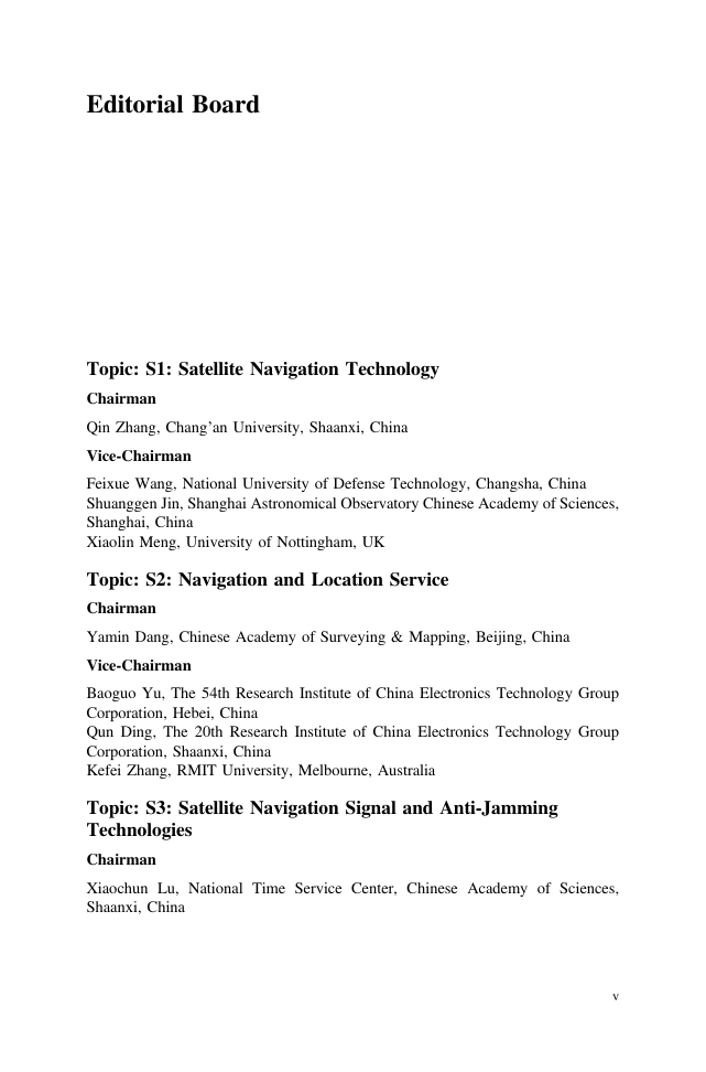
Editorial Board
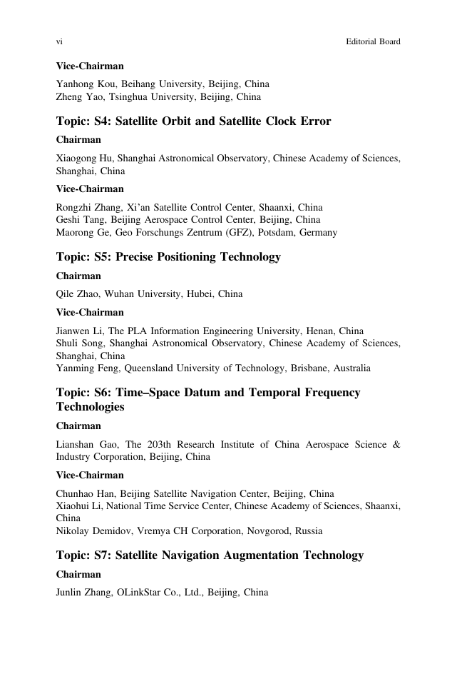
Topic: S1: Satellite Navigation Technology
Topic: S2: Navigation and Location Service
Topic: S3: Satellite Navigation Signal and Anti-Jamming Technologies
Topic: S4: Satellite Orbit and Satellite Clock Error
Topic: S5: Precise Positioning Technology
Topic: S6: Time–Space Datum and Temporal Frequency Technologies
Topic: S7: Satellite Navigation Augmentation Technology
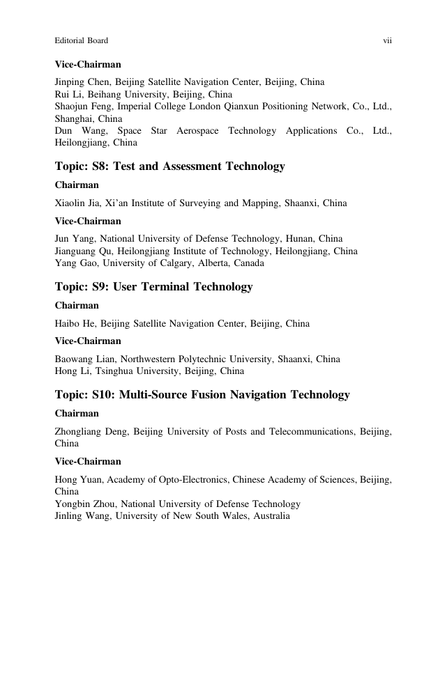
Topic: S8: Test and Assessment Technology
Topic: S9: User Terminal Technology
Topic: S10: Multi-Source Fusion Navigation Technology
Topic: S11: PNT New Concept, New Methods and New Technology
Topic: S12: Policies and Regulations, Standards and Intellectual Properties
Preface
Conference Topics
Scientific Committee
Sec14
Organizing Committee
Sec15
Contents
Satellite Navigation Technology
1 A Troposphere Tomography Method by Combining the Truncation Coefficient and Variance Component Analysis
Abstract
1 Introduction
2 Tomography Theory
3 Establishing the Observation Equation of Signals Penetrating from the Model’s Side Face Using the Truncation Coefficient
4 Experiment Description and Tomography Strategy
4.1 Experiment Description
4.2 Troposphere Tomography Resolving Strategy Based on the VCA
5 Result Analysis
5.1 IWV Comparison
5.2 Water Vapour Profile Comparison
6 Conclusion
Acknowledgements
References
2 The Design and Implementation of a SDS-TWR Based Wireless Location System
Abstract
1 Introduction
2 Chirp Spread Spectrum Technology
3 Analysis of System Positioning Algorithms
3.1 System Positioning Model
3.2 Location Algorithm
4 System Design and Implementation
4.1 System Framework
4.2 System Ranging Design
4.3 System Positioning Design
5 System Test and Error Analysis
5.1 System Ranging Test
5.2 System Positioning Test
6 Conclusion
Acknowledgements
References
3 Research on Smoothing Filtering Algorithm of BDS/GPS Slow Deformation Monitoring Sequence
Abstract
1 Introduction
2 Smoothing Filtering Algorithm for Slow Deformation Monitoring Sequence
2.1 BDS/GPS Combined Slow Deformation Monitoring Sequence
2.2 Robust Moving Average Method
2.3 Sequence Trend Analysis and Adaptive Windowing Filter
3 Example Analysis
4 Conclusions
Acknowledgements
References
4 Research on Space-Based Measurement and Control Scheme of Launch Vehicle Based on BeiDou Navigation Satellite System
Abstract
1 Introduction
2 The Status Quo of Launch Vehicle Space-Based Measurement and Control and BeiDou System Support Ability Analysis
2.1 The Status Quo and Problem of Space-Based Measurement and Control of Launch Vehicle
2.2 Launch Vehicle Space-Based Measurement and Control Mission Needs
2.3 Capability Analysis of BeiDou System for Launch Vehicle Measurement and Control
3 Launch Vehicle Launch Orbit and Invisible Area Boundary Calculation
3.1 Launch Vehicle Launch Orbit
3.2 Invisible Area Boundary Calculation
4 Measurement and Control Communication System of Launch Vehicle Based on BeiDou Satellite Navigation System Constellation
4.1 GEO Constellation Support Launch Vehicle Control Communications Scheme
4.2 IGSO Constellation Support Launch Vehicle Control Communications Scheme
4.3 MEO Constellation Support Launch Vehicle Control Communications Scheme
4.4 GEO, IGSO, MEO Constellations Support the Networking of Space-Based Measurement and Control Tasks
5 Simulation to Verify the Feasibility of Communication Solutions
6 Summary
References
5 Online GPR-KF for GNSS Navigation with Unmodelled Measurement Error
Abstract
1 Introduction
2 Problem Statements
3 Online GPR-KF
3.1 Standard GPR
3.2 Online GPR-KF
4 Experiment Results and Analysis
4.1 Static Experiment
4.2 Kinematic Experiment
5 Concluding Remarks
References
6 The Application of a New Multi-gross Errors Detection Method with the Epoch Variation Constraint in UAV
Abstract
1 Introduction
2 The Mathematical Model of Epoch-Differenced Method
3 The Principle of Gross Error Detection with the Epoch Variation Constraint
3.1 The Principle of Multi-gross Errors Detection
3.2 The Principle of Distinguish the Cycle Slips and Gross Errors
4 Experiment Demonstration
4.1 Experiment 1
4.2 Experiment 2
5 Conclusions
Acknowledgements
References
7 Research on Multi-satellites Fusion Inversion Model of Soil Moisture Based on Sliding Window
Abstract
1 Introduction
2 The Multi-satellites Fusion Inversion Model of Soil Moisture Based on Sliding Window
2.1 The Theory of Satellite Signal Reflection
2.1.1 The Principle of Model Inversion
2.1.2 The Process of Soil Moisture Inversion
3 Experiment Analysis
4 Conclusion
Acknowledgements
References
8 A Study of TEC Storm on 13 October 2016
Abstract
1 Introduction
2 Data Used for the Study
3 Results and Discussions
4 Conclusions
Acknowledgements
References
9 An Alternative Approach for Estimating SNR Metrics in GPS-IR
Abstract
1 Introduction
2 SNR Metrics Estimation
2.1 SNR Interferograms
2.2 LSSA Method
3 Experimental Results
4 Conclusions
Acknowledgements
References
10 Research on Refined 3D Attitude Model of Smart Construction Machinery Based on Multi-sensor Fusion
Abstract
1 Introduction
2 Installation Scheme of Hardware
3 Overview of Algorithm
3.1 Correction of the Pitch
3.2 Roll-and-Pitch Rotation Matrix of the Upper Structure
3.3 Correction of the Yaw
3.4 Maintenance of the Vehicle Coordinate System
3.5 Analysis of Attitude Effect on Single-Axis Inclinometer Output
3.6 Calculation of Working Equipment Key Point Coordinate
3.7 Coordinate Calculation of Arbitrary Point on Working Equipment in Horizontal Coordinate System
4 Program Implementation and Test on Real Vehicle
5 Conclusions
References
11 Feasibility Study of Low Cost Receiver for Deformation Monitoring
Abstract
1 Introduction
2 Performance Evaluation of Low Cost Receiver
2.1 Signal to Noise Ratio
2.2 The Performance of Receiver Clock
2.3 Standard Point Positioning
3 Deformation Monitoring Experiment Simulation
4 Conclusions and Prospect
Acknowledgements
References
12 Algorithm and Performance of Precipitable Water Vapor Retrieval Using Multiple GNSS Precise Point Positioning Technology
Abstract
1 Introduction
2 Multi-GNSS Retrieval Precipitable Water Vapor
3 Experiment and Analysis Results
3.1 Data Sources
3.2 Comparative Analysis of GNSS PPP ZTD
3.3 Precision Validation of GNSS PPP ZTD
3.4 Precision Validation of GNSS PPP PWV
4 Conclusions
Acknowledgements
References
13 Retrieval of PWV Based on GPS and Multi-level Isobaric Surface Data
Abstract
1 Introduction
2 Data and Method
2.1 Data and GPS Sites Distribution
2.2 Layer Interpolation Method
2.3 Parameter Conversion Method
3 Retrieval Pressure and Temperature by NCEP Products
4 Retrieval PWV by NCEP Products
5 Conclusions
References
14 Multipath Mitigation Method in GPS/BDS Deformation Monitoring Based on Observation Domain
Abstract
1 Introduction
2 Mathematical Model
2.1 Obtained Observed Residuals
3 Multipath Modeling
3.1 Multipath Error Analysis
4 Experiment and Analysis
4.1 Experimental Data
4.2 Experimental Program
4.3 Result Analysis
5 Conclusion
Acknowledgements
References
15 Analysis of Sea Surface Multipath and Impact on GNSS Precision Positioning
Abstract
1 Introduction
2 GNSS Multipath Effect
3 Analysis of Coastal GNSS Multipath Effect
4 Analysis of Sea Surface Multipath Effect on GNSS Precision Positioning
4.1 Analysis of GNSS Baseline Solution Accuracy
4.2 Analysis of Multipath Effects Residual
4.3 Comprehensive Analysis of Experimental Results
5 Conclusion
Acknowledgements
References
16 HECTOR for Analysis of GPS Time Series
Abstract
1 Introduction
2 HECTOR Software and Its Basic Theory
2.1 HECTOR Software and Functions
2.2 HECTOR Noise Analysis Method
2.2.1 AIC and BIC Numerical Analysis
2.2.2 Spectral Analysis Method
3 HECTOR for the Analysis of GPS Time Series
3.1 Data Sources
3.2 Extraction of Trend Items and Cycle Items
3.3 Analysis of Optimal Noise Model
3.3.1 Analysis of Numerical Results Based on BIC
3.3.2 Analysis Result Based on Spectrum Analysis Method
4 Conclusion
Acknowledgements
References
17 Inversion of Water Vapor Variation During Typhoon by Quad-Constellation GNSS Tomography
Abstract
1 Introduction
2 The Method of Ground-Based GNSS Tomography
2.1 The GNSS Tomography Model
2.2 The Relationship Between Satellite Elevation and the Satellite Ray Height Intersecting with Tomography Boundary
3 Realization of Quad-Constellation GNSS Tomography at Hong Kong
3.1 The Distribution of Available GNSS Signals
3.2 Inversion of Water Vapor Content Based on Quad-Constellation Tomography
4 Conclusions
Acknowledgements
References
18 GPS-MR for Altai Snow Depth Monitoring
Abstract
1 Introduction
2 GPS-MR Detection of Snow Depth of the Basic Theory
3 Construction of Altay GPS Snow Monitoring Station
3.1 GPS-MR Technology to GPS Tracking Station Construction Site Requirements
3.2 Altay GPS Snow Monitoring Station Layout
4 Altay GPS-MR Snow Detection Experiment Analysis
4.1 Analysis of Altay Snow Depth Accuracy by Ground Based GPS
4.2 Monitoring and Analysis of GPS-MR Snow Depth in Satellite Elevation
5 In Conclusion
Acknowledgements
References
19 Snow Depth Detection Based on L2 SNR of GLONASS Satellites and Multipath Reflectometry
Abstract
1 Introduction
2 GLONASS-MR Model and GLONASS Data Processing
3 Results and Discussion
4 Conclusion
Acknowledgements
References
20 Analysis of Ionospheric Anomalous Disturbance During a Heavy Rainfall
Abstract
1 Introduction
2 Data Selection and Processing
3 Experiment Analysis
4 Discussion on the Triggering Mechanism of Ionosphere Anomalous
5 Conclusion and Outlook
References
21 Water Level Changes Measurement of Reservoir Using Multi-GNSS Reflectometry
Abstract
1 Introduction
2 The Basic Theory of Measuring Water Level Change Based on GNSS SNR
3 Analysis Methods
4 Data Analysis
4.1 Data Source
4.2 Experimental Results
5 Conclusion
Acknowledgements
References
22 The Impact of Atmospheric Mass Loading on Precise Positioning of National GNSS Stations
Abstract
1 Introduction
2 Theoretical Model
3 The Experimental Data and Scheme
4 Analysis the Solution
4.1 Influence to Baseline Solution
4.2 Influence to Stations Coordinate
5 Conclusion
Acknowledgements
References
Navigation and Location Service
23 A Unidirectional Communication Architecture for Extended Location-Based Services
Abstract
1 Introduction
2 Related Work on LBS Architectures and Services
2.1 LBS Components and Services
2.2 LBS Request/Response Communication Paradigm and Application Protocols
3 Extended LBS Application Scenarios and System Requirements
4 Extended LBS Architecture and Services
4.1 Extended LBS Definition and Service
4.2 Extended LBS Architecture Based on the Publish/Subscribe Paradigm
4.3 Publish/Subscribe Application Protocols
5 Performance Evaluation of MQTT Protocols for Extended LBS Services
5.1 Experiment I: CPU Usages in RTCM Data Distribution with MQTT and Ntrip
5.2 Experiment II: Latency and Packet Loss Performance in RTCM Data Exchanges with Ntrip and MQTT
5.3 Experiment III: Latency Performance of D2D Data Exchanges with QoS Modes 1 and 2
6 Conclusions
References
24 Virtual Reference Station (VRS) Coordinate’s Pattern of QianXun Ground-Based Augmentation System
Abstract
1 Introduction
2 QX-GBAS High-Precision GNSS Positioning Service
2.1 Flowchart
2.2 RTCM Message Type
3 Experiment and Analysis
4 Conclusion
Acknowledgements
References
25 A Novel Fingerprinting Method of WiFi Indoor Positioning Based on Weibull Signal Model
Abstract
1 Introduction
2 The Fingerprinting Method Based on RSSI
2.1 Fingerprint Training Phase
2.2 Matching Positioning Phase
3 Bayesian Position Estimation Based on Weibull Signal Model
3.1 Fingerprint Database
3.2 Modelling Fingerprints with the Weibull Signal Model
3.3 Fingerprinting Method with the Weibull Signal Model
4 Experiments and Results
4.1 Experimental Environment and Process
4.2 Experimental Results and Analysis
5 Conclusions
Acknowledgements
References
26 Development and Assessment of GNSS Online Differential Data Processing System Based on HNCORS
Abstract
1 Introduction
2 System Architecture and Data Processing Flow
3 System Data Processing Strategies and Results
4 System Positioning Service Performance Assessment
4.1 CORS Datum Station Data Testing
4.1.1 Hours Solution Results
4.1.2 Daily Solution Results
4.1.3 Multi-station Solution Results
4.2 Measured Data Testing
4.2.1 Data Acquisition
4.2.2 Hours Solution Results
4.2.3 Daily Solution Results
5 Simulation Deformation Monitoring
5.1 Data Collection
5.2 Data Processing and Results Analysis
6 Conclusions
Acknowledgements
References
27 A Robust Turn Detection Algorithm Based on Periodic Signal Identification
Abstract
1 Introduction
2 Related Work
3 System Overview
4 Turn Detection
4.1 Gravitational Unit Vector Estimation Based on Sliding Average
4.2 Turn Judgment
4.3 Fast Turn and Slow Turn
4.4 Periodic Signal Identification Based on FFT
5 Experiment Results and Analysis
5.1 Evaluate Turn Detection Algorithm Performance When Walking
5.2 Evaluate Turn Detection Algorithm Performance on Transports
5.3 Algorithm Complexity Analysis
5.4 Power Consumption
6 Conclusion
Acknowledgements
References
28 The Indoor Localization Algorithm for Combination of Signal Strength and Anti-disturbance
Abstract
1 Introduction
2 RSSI Positioning Principle
2.1 Distance Calculation
2.2 Positioning Principle
3 Trilateration Location Method Based on Robust Estimation
4 Experimental Test and Result Analysis
5 Conclusions
References
29 A Bluetooth Localization Algorithm Based on Map Path Calibration and Time Series Filtering
Abstract
1 Introduction
2 Related Work
3 System Design
3.1 Bluetooth Beacon
3.2 Intelligent Terminals
3.3 Cloud Server
4 Bluetooth Localization Algorithm
4.1 Data Acquisition and Pretreatment
4.2 Initial Positioning Coordinates Calculation
4.3 Post-processing Method Based on the Average Sliding Window
4.4 Time-Series Based Spatial Restraint Post-processing Method
4.5 Location Correction Based on Map Path Information
4.6 Location Map Path Information
5 Experiment and Result Analysis
5.1 Experimental Conditions
5.2 Result Analysis
5.3 Positioning Algorithm Comparison
6 Conclusion
Acknowledgements
References
30 Synthetization of Fingerprint Recognition and Trilateration for Wi-Fi Indoor Localization Through Linear Kalman Filtering
Abstract
1 Introduction
2 Traditional Indoor Localization Algorithms
2.1 Overview of Fingerprint-Recognition Localization Algorithm
2.2 Trilateration Localization Algorithm
3 Adaptive Trilateration/Fingerprint Fusion Algorithm
3.1 Integrated Trilateration/Fingerprint Algorithm
3.2 Adaptive Fusion
4 Linear Kalman Filtering
5 Experiment and Analysis
6 Concluding Remark
Acknowledgements
References
31 Positioning Performance Analysis of Combined BDS/GPS-RTK Based on iGMAS Products
Abstract
1 Introduction
2 Mathematical Model
2.1 GNSS Positioning Observation Equation
2.2 Adaptive EKF Algorithm
3 Positioning Results and Accuracy Analysis of Combined BDS/GPS-RTK
3.1 Static Experiment
3.1.1 Data Collection
3.1.2 Result Analysis
3.2 Dynamic Vehicle Experiment
3.2.1 Data Collection
3.2.2 Result Analysis
3.3 Antenna Movement Experiment
3.3.1 Data Collection
3.3.2 Result Analysis
4 Conclusion
Acknowledgements
References
32 Environment Recognition Based on Temporal Filtering SVM
Abstract
1 Introduction
2 Signal Feature Vector
3 Data Collection
4 Environment Recognition Algorithm
4.1 SVM Classifier
4.2 Prediction Updating Based on Temporal Filtering
5 Performance Test
5.1 Testing Method
5.2 Recognition Result
6 Conclusion
References
33 Pseudorange Double Difference Algorithm Based on Duty-Cycled Carrier Phase Smoothing on Low-Power Smart Devices
Abstract
1 Introduction
2 Error Analysis of Smartphone Measurements
2.1 Performance Limits of Smartphone’s GNSS Module
2.2 Experimental Setup
2.3 Error Analysis of Pseudorange Observations
2.4 Error Analysis of Carrier Phase Observations
3 Carrier Smoothing and Pseudorange DD Algorithm
3.1 Carrier Smoothing with Continuous Loss of Cycles
3.2 Pseudorange DD and Filter Design
4 Experimental Results
4.1 The Results of Carrier Smoothing Methods
4.2 Positioning Methods Comparison and Multipath Effects
5 Conclusion
References
34 Communication Tower Based Experiment and Analysis of Differential Augmentation for Auto-Steering Guidance of Agricultural Machinery
Abstract
1 Introduction
2 Material and Method
2.1 Reference Station Construction
2.2 Evaluation Method
3 Results and Discussion
3.1 Data Quality Evaluation
3.2 CORS Network Adjustment
3.3 Validating of Positioning Accuracy
3.4 Availability Evaluation
4 Conclusions
Acknowledgements
References
35 Low-Cost Receiver Robust-RTD Algorithm Based on the Constraints of Velocity
Abstract
1 Instruction
2 RTD Algorithm
2.1 Velocity Determination Based on Doppler Observations
2.2 RTD Algorithm Based on the Constraints of Velocity
3 Experiment and Analysis
3.1 Static Test on Open Environment
3.2 Dynamics Test on Open Environment
3.3 Dynamics Test on Complex Environment
3.4 Dynamic Car-Borne Test
4 Conclusions and Future Research
Acknowledgements
References
36 The Research on Single Satellite Positioning System of Aircraft Based on Communication Signals of Beijing Inmarsat Ground Earth Station
Abstract
1 Introduction
2 System Structure
3 System Workflow
4 Communication Information Decoding
5 Flight Trajectory Model Construction [3–5]
5.1 Use BTO to Determine the Arc of Aircraft
5.2 Using Iterative Method to Build Aircraft Trajectory Model
5.3 Simulation Calculation
5.4 Track Visualization
6 Probability Screening of Flight Path [6]
6.1 Probability Screening Model
6.2 Calculation Results and Diagrams
7 Flight Trajectory Display
8 Aircraft Positioning Results Output
Acknowledgements
References
37 Assessment of the Contribution of QZSS Combined GPS/BeiDou Positioning in Asia-Pacific Areas
Abstract
1 Introduction
2 QZSS System
3 Data Description
4 Contribution of QZSS
4.1 Contribution of QZSS in DOP Value
4.2 Contribution of QZSS in SPP
4.3 Contribution of QZSS in PPP
4.4 Contribution of QZSS in RTK
5 Conclusions
Acknowledgements
References
38 The Service Improvement of BDS Positioning Based on Advanced Equivalent Satellite Clock Calculation
Abstract
1 Introduction
2 Equivalent Satellite Clock Computation Model
2.1 Equivalent Satellite Clock
2.2 Variation of the ESC
2.3 Smoothing
2.4 Improved Equivalent Satellite Clock Estimation Algorithm
3 User Equivalent Range Error
4 Experiments
4.1 User Ranging Error Statistics
4.1.1 Statistical Results of the UERE, UDRE
4.1.2 RMS of the UDRE
4.1.3 Comparison
4.2 Positioning Results Statistics
4.2.1 Positioning Results of Standard Service and Enhanced Service
4.2.2 Positioning to Enhance the Proportion of Statistical Results
5 Conclusion
Acknowledgements
References
39 Rapid Ambiguity Resolution Algorithm for Multi-constellation Between Reference Stations Based on Ambiguity Tight Constraint
Abstract
1 Instruction
2 Optimal Subset Selection Scheme
3 Ambiguity Tight Constraint Algorithm
3.1 Construct “Pseudo” Observations
3.2 Update the Filter Equations
4 Experiment and Analysis
4.1 The Function of Tight Constraint on Ambiguity Resolution
4.2 The Effect of Newly-Arisen Satellite on Positioning Accuracy
5 Conclusion
Acknowledgements
References
Time-Space Datum and Temporal Frequency Technologies
40 Using IGS RTS Products for Real-Time Subnanosecond Level Time Transfer
Abstract
1 Introduction
2 The IGS RTS Products
2.1 The Organization of the IGS RTS
2.2 Real-Time Satellite Precise Ephemeris and Clocks
2.3 The Accuracy and Availability of the IGS RTS Products
3 GPS PPP Time Transfer Based on the RTS Products
3.1 GPS PPP Time Transfer
3.2 The Time Reference of the RTS Products
3.3 The Experiments
4 Conclusion
Acknowledgements
References
41 Time Transfer Analysis of GPS- and BDS-Precise Point Positioning Based on iGMAS Products
Abstract
1 Introduction
2 CP Time Transfer Model
3 Experimental Data and Processing Strategy
3.1 Dataset
3.2 The Methods of Uncertainty Assessment
4 Results and Analysis
5 Summary
Acknowledgements
References
42 Simulation and Experiment of Multi-section Coil for C Field Used in Passive Hydrogen Maser
Abstract
1 Introduction
2 Calculation and Simulation of Homogeneity of Straight Solenoid
3 Calculation and Simulation of Homogeneity of Multi-section Coil
4 Experiment and Application of Multi-section Coil
5 Conclusion
References
43 Periodicity Systematic Error Analysis of GPS in Nonlinear Variations of Station Coordinates
Abstract
1 Introduction
2 The Adopted Data and Analysis Methods
2.1 The Adopted Data
2.2 Data Analysis Method
3 Analysis of Calculation Results
4 Conclusions
References
44 An Accurate and Efficient Detecting and Correcting Algorithm for Abnormal Clock Data
Abstract
1 Introduction
2 Detecting and Correcting Algorithm for Abnormal Clock Data
2.1 Detecting Algorithm and Application for Abnormal Data
2.1.1 The Median Detection Method
2.1.2 Application of Improved Median Detection Method in Detecting for Abnormal Data
2.2 Correcting Algorithm for Abnormal Data
2.2.1 Linear Interpolation
2.2.2 Phase Compensation Method
2.2.3 Least Squares Method
2.2.4 Least Squares Combination Model
3 Result Analysis of Algorithm Examples
4 Conclusion
References
45 Processing Method of Clock Break in VLBI Data Analysis
Abstract
1 Introduction
2 VLBI System Principle
2.1 VLBI Geometric Principle
2.2 VLBI Data Calculation Principle
3 Clock Break Positioning
3.1 Piecewise Linearization
3.2 Clock Break Positioning and Processing
4 Clock Break in Kalman Filter
5 Discussion and Conclusion
Acknowledgements
References
46 An Improved Abnormity Detection Method for Atomic Clock Frequency Based on Chi-Squared Statistics
Abstract
1 Introduction
2 Chi-Squared Tests for Atomic Clock Frequency Abnormity
3 Pair-Difference Chi-Squared
4 Frequency Abnormity Chi-Squared Test
5 The Results Analysis
6 Conclusions
References
47 Research on Robust Timing Receiver with Joint Verification of Location and Clock Offset
Abstract
1 Introduction
2 Principle of Timing Receiver
3 Principle of Timing Anomaly Monitoring
3.1 Location Monitoring Principle
3.2 Clock Offset Monitoring Principle
3.2.1 Clock Offset Prediction Model
3.2.2 Principle of Abnormal Clock Offset Monitoring Algorithm
4 Simulation and Analysis
4.1 Location Monitoring Simulation Analysis
4.2 Clock Offset Monitoring Simulation Analysis
4.2.1 Phase Outlier
4.2.2 Phase Jump Abnormalities
5 Conclusion
References
48 The Long-Term Performance Analysis and Comparison of BDS on-Board Atomic Clock Based on Precise Clock Products of IGS Analysis Centers
Abstract
1 Introduction
2 Algorithm Principle
2.1 Data Preprocessing Method
2.2 Frequency Accuracy Calculation Method
2.3 Frequency Drift Rate Calculation Method
2.4 Frequency Stability Calculation Method
3 BDS Satellite Clock Performance Analysis
3.1 The 10,000 s Stability Long-Term Changes
3.2 The Daily Drift Rate Long-Term Changes
3.3 Accuracy Long-Term Changes
3.4 Day Stability Long-Term Changes
4 Conclusions
Acknowledgements
References
49 A Method on Laser Power Stabilization in Optical Detection Cesium Atomic Clock
Abstract
1 Introduction
2 Laser Power Stabilization Scheme Based on Liquid Crystal Variable Retarder
3 Results and Discussion
3.1 Results of Light Power Stability
3.2 Temperature Coefficient Measurement Results
3.3 Discussion
4 Conclusion
References
50 Analysis of BDS Satellite Clock in Orbit with ODTS and TWTT Satellite Clock Data
Abstract
1 Introduction
2 Comparison of Satellite Clock Data
2.1 Mutual Agreements of ODTS and TWTT Satellite Clock Data
2.2 Internal Consistency Comparison of OTDS and TWTT Satellite Clock Data
3 Comparison of Periodicity Analysis Results Based on ODTS and TWTT Satellite Clock Data
4 Comparison of Stability Analysis Results Based on ODTS and TWTT Satellite Clock Data
5 Conclusions
Acknowledgements
References
51 Analytical Analysis Method of Whispering Gallery Mode of Sapphire Dielectric Resonators and the Optimization of the Q Value in Liquid Helium Temperature
Abstract
1 Introduction
2 Theoretical Model
3 Analytical Frequency and Optimization of the Q Value
4 Conclusion
References
Satellite Navigation Augmentation Technology
52 Application of Gaussian Overbounding on Ionospheric Error Analysis for China SBAS
Abstract
1 Instruction
2 GIVE Monitor in SBAS
3 Gaussian-Bounding Theorem
4 Gaussian-Bounding Test for Ionospheric Error
5 Comparison of Methods in Bound Estimation
5.1 Threshold of Irregularity Detector
5.2 Static Inflation and Dynamic Inflation
5.3 Undersampled Threat Model
6 Conclusions
Acknowledgements
References
53 Analysis on Characteristics of Delay Errors Under Ionospheric Anomaly in China Area
Abstract
1 Introduction
2 GIVE Monitor
2.1 Grid Model with Kriging Method
2.2 Delay Error Bound Estimation
2.2.1 Ionospheric Irregularity Detector
2.2.2 Inflation of Formal Estimation Error
2.2.3 The Ionospheric Undersampled Threat Model
3 Analysis of Ionospheric Delay Error
3.1 GNSS Data
3.2 Analysis Method
4 Results and Discussion
4.1 Results of Statistics Analysis
4.2 Further Discussion
5 Conclusion
Acknowledgements
References
54 Design of Mega-Constellations of LEO Satellites for Positioning
Abstract
1 Introduction
2 State of the Art
3 Preliminary Work
3.1 Visibility w.r.t. Orbit Height and Elevation Angle
3.2 Visibility w.r.t. Latitude
4 Constellation Design
5 Conclusion and Outlook
References
55 A Required Navigation Performance Based Approach to Monitor the Accuracy and Integrity Performance of UAVs for Delivery Applications
Abstract
1 Introduction
2 The Concept of UAV Delivery System and Its Requirement
3 UAV Navigation Monitoring Requirement for UAV-Borne Deliveries
3.1 UNMR Framework Definition
3.2 Accuracy Calculation for the Size of Route and Dock Design
3.3 The Relationship of UNMR and UANP
4 Simulation
5 Initial Field Test
6 Conclusions
References
56 SBAS Integrity Verification Based on the Extreme Value Theory
Abstract
1 Introduction
2 SBAS Integrity
2.1 The Concept of SBAS Integrity
2.2 SBAS Integrity Estimation
3 EVT and EVT Application in Integrity Verification
4 Measurement and Verification of EGNOS Integrity
4.1 Data Processing
4.2 Measured Data Analysis
5 Summary
Acknowledgements
References
57 Reduced ARAIM Subsets Method Determined by Threshold for Integrity Risk
Abstract
1 Introduction
2 ARAIM Subsets Determination
2.1 Baseline ARAIM Algorithm
2.2 Continuity Risk
3 Reduced Subsets Determined by Threshold for Integrity Risk
4 Worldwide Simulation and Evaluation
5 Conclusions
Acknowledgements
References
58 Comparison and Analysis of the Optimized AGC Setting and the Improved CNMC Method for the Ground Pseudolite Enhanced Beidou System
Abstract
1 Introduction
2 Optimal AGC Setting of Pseudolites
2.1 The Concept and Significance of AGC
2.2 Optimal Setting of AGC
3 Improved CNMC Method for Pseudolites
4 Comparison and Analysis of the Two Methods
5 Conclusion
Acknowledgements
References
59 Research on BDS/GPS Integrated Navigation Satellite Selection Algorithm Based on Particle Swarm Optimization
Abstract
1 Introduction
2 Calculation Method on DOP
3 Particle Swarm Optimization Algorithm
3.1 Basic Principle of PSO Algorithm
3.2 Chaotic Particle Swarm Optimization Algorithm
4 The Steps of PSO Satellites Selection
5 Experiment and Simulation Analysis
6 Conclusions
Acknowledgements
References
60 A Minor Fault Detection Algorithm Based on Sliding-Window Accumulated Parity Vector
Abstract
1 Introduction
2 Improved RAIM Scheme with On-line Sliding Window
3 Improved RAIM Algorithm Based on Accumulated Parity Vector
3.1 Measurement Model for BDS/GPS Joint Positioning
3.2 Fault Detection Based on Parity Vector
3.3 Detection Statistics from Accumulation of Parity Vectors
4 Simulation and Analysis
4.1 Simulation Description
4.2 Simulation Results and Analysis
5 Conclusions
Acknowledgements
References
61 The Construction Method of Ionospheric Delay Model with Combined BDS Phase and Range Observation
Abstract
1 Introduction
2 Mathematical Model
2.1 Ionospheric Delay Estimation Model
2.2 Ionospheric Model Construction Method
3 Experiments and Results Analysis
3.1 Data and Processing Strategies
3.2 DCB Stability Analysis
3.3 Accuracy Analysis of Ionospheric Model
4 Conclusion
Acknowledgements
References
62 Improved RAIM Algorithm Based on Kalman Innovation Monitoring Method
Abstract
1 Introduction
2 Snapshot Algorithm
2.1 Usability Analysis
2.2 Parity Vector Method
2.3 Parity Vector Method Based on Non-coherent Accumulation
3 Kalman Innovation Monitoring Method
3.1 Kalman Filter-Based RAIM Algorithm
3.2 Detection Threshold
4 Improved RAIM Algorithm
5 Experiment and Analysis
6 Conclusion
References
63 LEO Constellation Optimization Model with Non-uniformly Distributed RAAN for Global Navigation Enhancement
Abstract
1 Introduction
2 Constellation Design and Optimization
2.1 Design Indexes and Constraints
2.2 Constellation Configuration Optimization
2.2.1 Walker Constellation Modeling
2.2.2 Satellite Dynamics Modeling
2.2.3 Genetic Algorithm (GA)
2.2.4 Optimize Variables and Range
2.2.5 Optimization Procedure and Result
3 Simulation and Analysis
4 Constellation Deployment
5 Conclusion
References
64 Design of Navigation Message Authentication Assisted by Ground Based Augmentation Systems
Abstract
1 Introduction
2 Model of NMA Protection Against Spoofing Attack
2.1 Model of Spoofing Attacks
2.2 Principle of Navigation Message Authentication
3 NMA Implementation with GBAS Broadcasters
3.1 Structure of NMA Protected GBAS Broadcasting Message
3.2 Generation of NMAS and GMAS Messages
3.3 Verification of NMAS and GMAS Messages
4 Performance Analysis
4.1 Security
4.2 Efficiency
5 Conclusion
Acknowledgements
References
65 Configuration Method of the Dynamic Navigation Network Based on Near Space
Abstract
1 Introduction
2 Optimal Unit Configuration
2.1 Useful Location Calculation
2.2 Single Configuration Location Analysis
2.3 Comparison of Different Unit Configurations
3 Network Extension and Boundary Detection Method
3.1 Navigation Network Model Description
3.2 Boundary Detection Methods
3.2.1 Adaptive Detection Method
3.2.2 Intelligent Detection Algorithm
3.3 Algorithm Simulation Analysis
4 Dynamic Network Design and Optimization
4.1 Working Principle of Super-Pressure Balloon
4.2 Dynamic Network Design
4.3 Dynamic Optimization
5 Conclusions
Acknowledgements
References
66 Research on Ionospheric Grid Correction Strategy Based on Chinese Region
Abstract
1 Introduction
2 Ionospheric Delay Estimation
2.1 Spatial Correlation of Ionospheric Delay
2.2 IDW Algorithm
2.2.1 Fundamental
2.2.2 Grid Ionospheric Vertical Delay Estimation
2.2.3 Grid Ionospheric Vertical Delay Error Estimation
2.3 Kriging Algorithm
2.3.1 Fundamental
2.3.2 Grid Ionospheric Vertical Delay Estimation
2.3.3 Grid Ionospheric Vertical Delay Error Estimation
3 Algorithm Implementation and Results
3.1 Algorithm Estimation Error Analysis
3.2 Algorithm Combination Strategy
3.3 UIVE Envelope Analysis and Verification
4 Conclusion
Acknowledgements
References
67 Satellite Integrity Autonomous Monitoring (SAIM) of BDS and Onboard Performance Evaluation
Abstract
1 Introduction
2 Monitoring Scheme for Autonomous Integrity of BDS Satellite
2.1 Selection of Monitoring Measurement
2.2 Monitoring Process and Alarm Type
3 Navigation Signal Monitoring Technology
3.1 Signal Power Monitoring
3.2 Signal Delay Monitoring
3.3 Abnormal Monitoring of Signal Correlation Peak Distortion
3.4 Code/Carrier Phase Inconsistency Monitoring
4 Satellite Clock Monitoring Technology
5 Performance Evaluation Results in Orbit Operation
6 Conclusion
Acknowledgements
References




 2023年江西萍乡中考道德与法治真题及答案.doc
 2012年重庆南川中考生物真题及答案.doc
 2013年江西师范大学地理学综合及文艺理论基础考研真题.doc
 2020年四川甘孜小升初语文真题及答案I卷.doc
 2020年注册岩土工程师专业基础考试真题及答案.doc
 2023-2024学年福建省厦门市九年级上学期数学月考试题及答案.doc
 2021-2022学年辽宁省沈阳市大东区九年级上学期语文期末试题及答案.doc
 2022-2023学年北京东城区初三第一学期物理期末试卷及答案.doc
 2018上半年江西教师资格初中地理学科知识与教学能力真题及答案.doc
 2012年河北国家公务员申论考试真题及答案-省级.doc
 2020-2021学年江苏省扬州市江都区邵樊片九年级上学期数学第一次质量检测试题及答案.doc
 2022下半年黑龙江教师资格证中学综合素质真题及答案.doc