Fundamentals
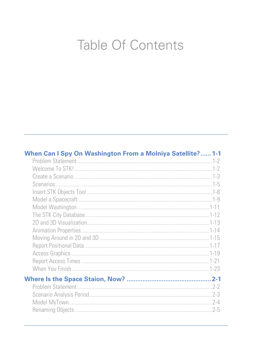
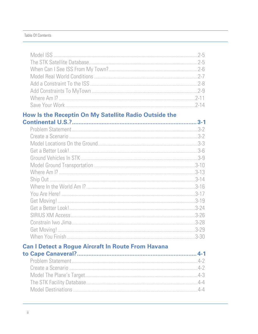
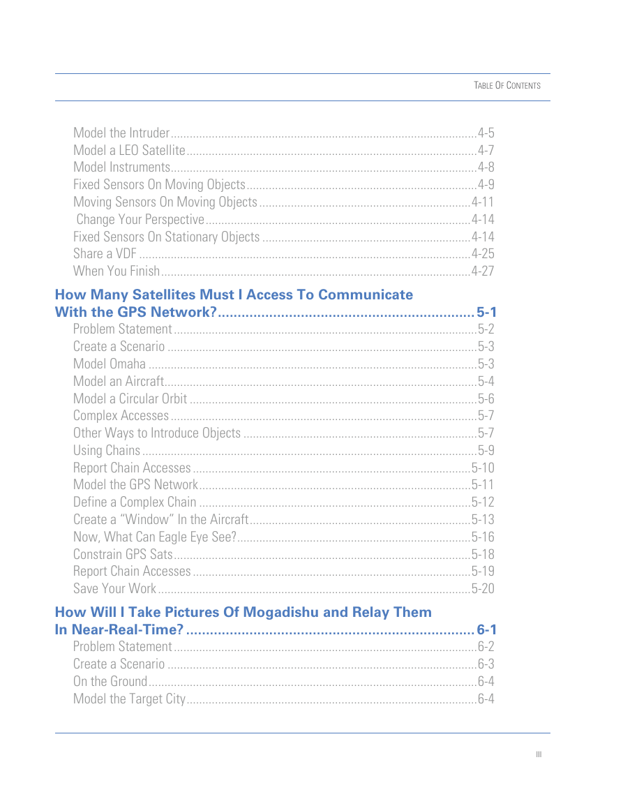
Table Of Contents
When Can I Spy On Washington From a Molniya Satellite? EXERCISE 1
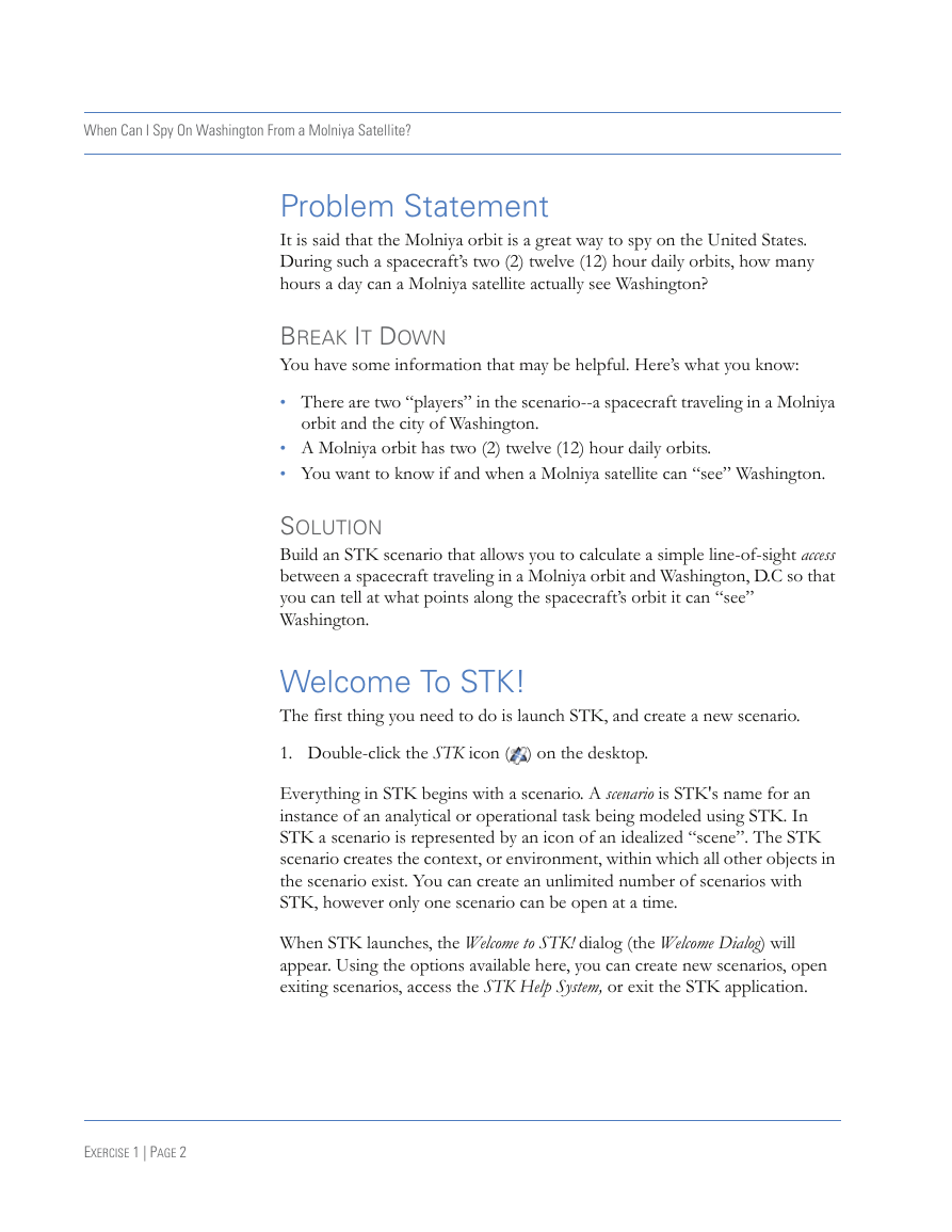
Problem Statement
Break It Down
Solution
Welcome To STK!
Create a Scenario
Analysis Period
Get Off on the Right Foot--Stay Organized
Scenarios
The Properties Browser
Accessing Object Properties
Scenario Basic Properties
Insert STK Objects Tool
Model a Spacecraft
The Orbit Wizard
Model Washington
Insert the Facility
The STK City Database
2D and 3D Visualization
Animation Properties
Animation Cycle
Animation Toolbar
Moving Around in 2D and 3D
Magnify an Area on the Map
Zoom To SpySat
Mouse Around in 3D
Restore the View
Report Positional Data
Access Graphics
Report Access Times
Report Data Tools
Start and Stop Times and Step
Report Units
When You Finish
Where Is the Space Staion, Now? EXERCISE 2
Problem Statement
Break it Down
Solution
Scenario Analysis Period
Model MyTown
Renaming Objects
Model ISS
The STK Satellite Database
Satellite Properties
When Can I See ISS From My Town?
Model Real World Conditions
Add a Constraint To the ISS
Sun Constraints
When Can I See ISS?
Change to Local Time
Add Constraints To MyTown
Sun Constraints From the Ground
Basic Constraints
When Can I See ISS?
Where Am I?
Accessing Window Properties
Display Constraints
Get Moving!
Set Your 3D Graphics Window To ISS
Save Your Work
How Is the Receptin On My Satellite Radio Outside the Continental U.S.? EXERCISE 3
Problem Statement
Break it Down
Solution
Create a Scenario
Model Locations On the Ground
California Cities
Nagasaki
Model a Region-of-Interest
Get a Better Look!
Zoom To It!
2D Graphics Window Details
2D Zoom
Change the Facility Marker Style
Ground Vehicles In STK
Model Ground Transportation
Define a Route
Refine Your Route
Where Am I?
The Center Of the Universe
Ship Out
Vehicle Time Periods
Chart a Course
Where In the World Am I?
You Are Here!
The Message Viewer
Measure Distance on the Map
Get Moving!
Where’s My Ride?
Rhythm & Blues
SIRIUS Satellites
Get a Better Look!
SIRIUS XM Access
Constrain Iwo Jima
Refresh
Get Moving!
When You Finish
Can I Detect a Rogue Aircraft In Route From Havana to Cape Canaveral? EXERCISE 4
Problem Statement
Break it Down
Solution
Create a Scenario
Model The Plane’s Target
The STK Facility Database
Query the Facility Database
Model Destinations
Add Cities
Model the Intruder
Get a Better Look
Define a Route
Model a LEO Satellite
Zoom To Icarus
Model Instruments
Fixed Sensors On Moving Objects
Get a Better Look
Get Moving!
Moving Sensors On Moving Objects
Targeted Sensor Definition
Sensor Pointing
Get a Better Look
What Can Targeted See?
Change Your Perspective
Fixed Sensors On Stationary Objects
Radar Dome Definition
Constrain Radar Dome
Projection Display
Get a Better Look
What Can Radar Dome See?
When Can Radar Dome See It?
Access Data
Sensor Pointing
Constrain Radar Sweep
Projection Display
Get a Better Look
What Can Radar Sweep See?
When Can Radar Sweep See It?
Log Your First Alert
Share a VDF
Pack It Up
View Rogue Aircraft
When You Finish
How Many Satellites Must I Access To Communicate With the GPS Network? EXERCISE 5
Problem Statement
Break it Down
Solution
Create a Scenario
Model Omaha
Model an Aircraft
Get a Better Look
Object Models
Model a Circular Orbit
Complex Accesses
Other Ways to Introduce Objects
The Object Catalog
Using Chains
Insert a Chain
Define a Simple Chain
Report Chain Accesses
When You Finish
Model the GPS Network
Define a Complex Chain
Change Your Perspective
What Can Eagle Eye See?
Create a “Window” In the Aircraft
Get a Better Look
Flip that Sensor
Now, What Can Eagle Eye See?
Sensor Display
Get Moving!
Constrain GPS Sats
Now, What Can Eagle Eye See?
Report Chain Accesses
Individual Strand Access
Save Your Work
Problem Statement
Break it Down
Solution
Create a Scenario
On the Ground
Model the Target City
Model Ground Sites
Group Your Ground Sites
Model Spacecraft
Model the Landsat Satellites
Model the TDRS Network
Change Your Perspective
Attach Cameras
Sensor Definition
Change Your Perspective
Reuse Objects
Group the Cameras
Define a Chain of Events
Constrain Access to Mogadishu
When Can I see It?
Visual Analysis
When You Finish
Who Can See What When?
On Your Own
Save Your Work
How Will I Take Pictures Of Mogadishu and Relay Them In Near-Real-Time? EXERCISE 6
Design
Table of Contents
Will the Local Terrain Impact My Ground Based Radar? EXERCISE 1
Problem Statement
Break It Down
Solution
Open an Existing Scenario
Scenario Setup
Terrain Data
Manage Terrain, Imagery and Globes
Views
Zoom To It!
Scenario Properties
Analytical Terrain
Description
Cache
Model a Ground Based Radar
Constrain Radar Site
Change Your Perspective
3D Object Model
Get a Better Look
Model the Range of Your Radar
Radar Dome Definition
Constrain the Range of the Radar
Change Your Perspective
Build an AzEl Mask
Display the AzEl Mask
Change Your Perspective
Constrain Radar Dome
Change Your Perspective
How Efficient Is My Radar Dome?
Save Your Work
Will My Radar Detect a Cruise Missile Attack? EXERCISE 2
Problem Statement
Break It Down
Solution
Open an Existing Scenario
Change the Description
Model an Air Missile?
Define Cruise Missile’s Route
Will the Terrain Affect My Flight Path?
Export Missile Route Data
Export Data File Tool
Insert a Missile
Import the Missile Route
Remove Unnecessary Objects
Change Your Perspective
Use a More Realistic Object Model
Change Your Perspective
Visualize Terrain References
Visualize a Cruise Missile Strike
When Can I See It?
How Close Will It Be?
Extend Your Radar Coverage
Copy Radar Site
Radar East
Radar West
Change Your Perspective
Remove the Domes
Change Your Perspective
Group the Radar Sites for Analysis
Constrain the Constellation
Constellation Access
Are Three Radars an Improvement?
Number of Accesses
Individual Strand Access
One Final Piece
Save Your Work
How Can I Recreate the Venus Transit of 2004? EXERCISE 3
Problem Statement
Break It Down
Solution
Create a Scenario
Close the 2D Graphics Window
Model Stupava
Model Planets
Set the Sun as the Central Body
Center the View Around the Sun
Visualize Orbits
Maximum Visible Distance
Hide the Moon
Hide Subplanet Labels
Get Moving!
Model Venus In Transit
Store That View!
Vector Geometry Tool
When Will the Planes Align?
Graph the Angle
Model the Telescope View
A View from Stupava to the Sun
Custom Windows
Viewer Position & Direction
View From/To
Untethered
Set the View
Adjust The Visible Distance
Enable Sun Textures
Display Venus
Get Moving!
Store That View!
Unidentified Object in Transit
Deck Access
Find Out What the Object Was
Import ISS
ISS Properties
View the ISS Transit the Sun
View ISS Transit Venus
Store That View!
Additional Analysis
Save Your Work
Can I Communicate With My Firefighting Crews In the Field? EXERCISE 4
Problem Statement
Break It Down
Solution
Create a Scenario
Some Highs and Lows
Zoom In On the Map
To What Extent?
Identify the Analysis Area
Working with Shapefiles
Clean Up
Get a Better Look
Preview the Imagery
Create Terrain Inlays
Image Converter for My Terrain?
Image Inlay
Terrain Inlay
Apply Imagery To the Map
Add Imagery to the Globe
Zoom To It!
Raise the 3D Boundaries
Change Your Perspective
Fight Fire With Firetrucks
Change Your Perspective
3D Model Properties
Get a Better Look
Refine Your Route
3D Object Editor
Edit Fieldcrew’s Route
Save Fieldcrew
Model Satellites
Know Your Limitations
Back At HQ
Customize Castle Rock
Set Constraints
Import the Relay Nodes
The Insert Menu
Change Your Perspective
Group the Nodes
Chain Analysis
When Can I See It?
Change Your Perspective
Who Is the Weakest Link?
Change Your Perspective
Individual Strand Access
Save Your Work
Will Incorporating Aerial Water Drops Improve My Firefighting Model? EXERCISE 5
Problem Statement
Break It Down
Solution
Reacquaint Yourself With REMSAT
Change the Description
Globe Surface Reference & Mission Modeler
Model Peterson Air Force Base
Position Properties
My Airport Model
Change Your Perspective
Orient Yourself
Model Offsets
Aircraft Mission Modeler
Enter Hercules
Design Hercules’ Mission
Performance Models
Aircraft Selection
Apply a More Accurate Model
3D Models
Model Holder
Design a Flight Path
2D Route Display
Phase One
Procedures
Take Off
Timing Is Everything
Where Is Hercules?
Animation Cycle
There’s Hercules!
Give Hercules Some Direction
Second Stop Before the Fire
At the Water Drop
Last Stop Before Landing
Cleared For Landing
Get a Better Look
Take A Test Drive
When Will Hercules Be Where?
What If I Were A C-5 Aircraft?
Save Your Work
When Will My GPS Satellites Enter an Eclipse Season? EXERCISE 6
Problem Statement
Break It Down
Solution
Open an Existing Scenario
Display the Earth Sun Vector
Create an Orbital Plane
Define A Normal Vector
Define the Reference Vector
Define the Reference Point
Display the Orbital Plane in 3D
Display Plane A
Display the Line of Nodes Vector
Display Plane A
Change Your Perspective
Change Your Perspective
Use VGT to Create a Beta Angle
Select a Reference Vector
Select a Reference Plane
Display the Beta Angle in 3D
Enable the Display
Change Your Perspective
Visualize All Six Orbital Planes
Access To a Plane
Constrain the Beta Angle
Model Earth
Group the GPS Satellites
Disabling Line of Sight
Get Earth In the Loop
Graph Individual Strand Access
Report Individual Strand Access
Custom Reports & Graphs
Create a New Custom Graph
Define Content
Label the Graph
Edit The Graph’s Properties
Modify The Graph
Save Your Work
Use What You Know
Can I See the ISS On My Vacation?
Why Can’t I See It?
Analyze
Table Of Contents
Where On Earth Will Three Different Satellites Provide Simultaneous Coverage? EXERCISE 1
Problem Statement
Break it Down
Solution
Open an Existing Scenario
What Is Coverage?
Coverage Definition
Defining a Coverage Grid
Grid Resolution
Coverage Graphics
Get a Better Look
Manage Your Resources
How Will I Constrain My Coverage?
Create the Constraints Template
Apply Constraints
Associate the Constraints
Identify Your Assets
Compute Coverage!
Define the Quality of Coverage
Measure Simple Coverage
Static Coverage Graphics
Clean Up!
Dynamic Coverage Graphics
Clean Up
N Asset Coverage
Definition
Get a Better Look
Satisfaction
Get a Better Look
Graph Coverage By Latitude
Coverage By Latitude Data Provider
Coverage Over Time
Get a Better Look
Contour Graphics
Static Contours
Get a Better Look
Dynamic Contours
Get a Better Look
Clean Up
Measure Coverage Time
Get a Better Look
Report Coverage Time
Coverage Time Contours
Change the Legend Layout
Get a Better Look
Report Coverage Time By Grid Point
Save Your Work
How Will I Determine the Accuracy of My In-Flight Navigation Solution? EXERCISE 2
Problem Statement
Break it Down
Solution
Create a Scenario
Narrow Your Focus
Clean Up
Define the Analysis Area
Get a Better Look
Remove the Area Target Label
Model Ground Locations
Change Your Perspective
Model an Aircraft
Define Test Flight’s Route
Get a Better Look
Model the GPS Network
Get a Better Look
How Will I Measure DOP?
Coverage Definition
Get a Better Look
Define the Altitude of the Grid Points
Assign Assets
Don’t Calculate Access ‘Til I Say
Compute Coverage!
Dilution of Precision
Method
Type
Compute
Time Step
Define the Quality of Coverage
Keep It Clean
Grid Stats Over Time
Dynamic Contours
Get a Better Look
Clean Up
Single Object Coverage
Assign Assets To a Single Object
Define a Single Object Figure Of Merit
Report PDOP
Graph PDOP
Single Object Contour Graphics
Get a Better Look
Change Your Perspective
De-Assign Assets
Recompute PDOP for Test Flight
Exclude BIIRM
Recompute PDOP for the Continental US
Recompute Coverage
Report Grid Stats Over Time
Adjust the Display of Contours
Get a Better Look
Change Your Perspective
When You Finish
How Can I Analyze the Quality of My Link Budgets?
Problem Statement
Break it Down
Solution
Reacquaint Yourself With REMSAT
Change the Description
STK/Communications
Model Anik
Anik Transmitter
Define the Transmitter
Antenna Gain
Displaying Contours
Clean Up
Gain Contour Graphics
3D Contours Display
Mark Castle Rock
Check It Out!
Receivers As Children of Children
Model the Pointing Mechanism
Sensor Display
Define Castle Rock’s Receiver
What Can I See?
Detailed Link Budget
Scenario Environment Properties
Rain Models
Atmospheric Absorption Models
Rain Loss Effects on Comm Links
Dynamic Link Budgets
Receive From Node
Transmitter On Node
Computing A Dynamic Link Budget
Working With Comm Constraints
When You Finish
How Will I Survey Yachts In All of the World’s Seas?
Problem Statement
Break it Down
Solution
Create a Scenario
Walker Constellations
Create a Seed Satellite
Get a Better Look
Attach The Payload
Customize The Payload
Create a Walker Constellation
Walker Satellite Relationships
Create a Constellation
World Water Coverage
Assign Assets
Manage Your Resources
Compute Coverages
Measure The Quality of Coverage
How’d I Do?
Parametric Study Analysis
STK/Analyzer
Analysis Tools
Clean Up
What Have I Done!?
Reload the Yacht Watcher Satellite
Launch Analyzer
The Parametric Study Tool
Define Your Design Variables
New Walker
New Constellation
Define Your Responses
Just The Data, Please
Run It!
Review Your Results
Data Explorer Toolbar
Table Data
Save Your Work
How Can I Monitor and Communicate With a Decaying Satellite?
Problem Statement
Break it Down
Solution
Open an Existing Scenario
What’s In My Scenario?
Nimitz
MEO Sensor
Graphics
Create a Walker Constellation
Create the Seed Satellite
Create a Walker Constellation
Remove the Seed
Attitude Coverage
Attitude Sphere
Change Your Perspective
Point Definition Properties
Assign Assets
Manage Your Resources
Coverage Graphics
Attitude Figure Of Merit
FOM Graphics
FOM Contours
Compute Coverage
Change Your Perspective
Decaying Satellite
High-Precision Orbit Propagator
Force Models
Central Body Gravity Model
Solar Radiation Pressure
Drag
Third Body Gravity
Errant Satellite Display
Lifetime Tool
Satellite Characteristics
Atmospheric Density
Solar Data
Advanced Options
Limit Method & Orbit Count
Orbits Per Calculation
Gaussian Quadratures
Decay Altitude
Modeling Attitude in STK
Errant View
Display Vectors
Change Your Perspective
Attach a Sensor
Sensor Pointing
AER Report
Satellite Attitude
Default Attitude
Display Vectors
Get Moving!
Maximizing Data Transmission
Get Moving!
Maximizing Power Generation
Get Moving!
When You Finish
How Can I Assess the Threat of My Satellite Colliding With Space Debris? EXERCISE 6
Problem Statement
Break it Down
Solution
SOCRATES, CSSI, and STK/CAT
Preparing Internet Explorer
Open SOCRATES
Conjunction Summary
STK and SOCRATES
Build Scenario
3D Conjunction Display
Threshold Start
Get Moving!
Change Your Perspective
Closest Approach
AdvCAT in STK
Reporting Close Approaches
When You Finish
Analyzing Multiple Conjunctions
Repropagate Objects
Advanced CAT Time Period
Using Pre-Filters
Display Ellipsoids
Compute!
Report Close Approaches
When You Finish
The Big Picture
Get Moving!
When You Finish
Use What You Know
XM or SIRIUS?
Let’s Go Off Road!
Collision Avoidance
Optimize
Table Of Contents
Which Two Communications Nodes Will Provide the Most Extensive Coverage? EXERCISE 1
Problem Statement
Break it Down
Solution
Reacquaint Yourself With REMSAT
Change the Description
Remove Accesses
Save the Scenario
Identify the Analysis Area
The Area Target Wizard
Define the Boundary
Where Am I?
Raise the 3D Boundaries
Node Coverage
Exercise Area Coverage
Grid Resolution
Constrain Coverage In the Exercise Area
Setting Object Properties with the Mouse
Graphics
Introduce the Exercise Area To His Limitations
Grid Point Altitude
Assign Assets
Manage Your Resources
Measure The Quality of Coverage
What Do I Want to See?
Set Up the Analyzer Experiment
Design Variables
Input Variables
Output Variables
Table of Runs
Saving an Analysis Configuration
Run Analyzer!
Main Effects Plot
Further Analysis
Save Your Work
Can I Image Locations On the Ground From a Predator? EXERCISE 2
Problem Statement
Break it Down
Solution
Open an Existing Scenario
Analysis Times
Change the Description
Globe Surface Reference & Mission Modeler
Save
Outline an Area of Interest
Raise the Boundary
Change Your Perspective
What Is Connect?
Message Formats
Command Name
What Kind of Command Is That?
Paths To Objects in a Scenario
Wildcards (*) in Object Paths
Command Data
Command Syntax Elements
Use Connect To Model the Hot Spots
Clone the New Connect Command
Clone the Position Connect Command
The Button Tool
Move The New Commands to the Button Tool
Move The SetPosition Commands
Create a Button
Did I Do It?
Adjust the Model Scale
Clone the VO ScaleLog Command
Get the Hot Spots Above Ground
Clone the SetHeightAboveGround Command
Automate Properties Definition
Move the Commands
Create Another Button
Did I Do It?
Declutter Labels
Get a Better Look
Add an Az/El Mask
Clone the SetConstraints Command
Create Another Button
Did I Do It?
Save Your Work
Save the BTIP
Import the Predator
Change Your Perspective
The Predator’s Flight Path
Constrain the Predator
What Can the Predator See?
Get A Better Look
Clean Up
On Your Own
Save Your Work
How Can I Optimize My Data Collection Schedule? EXERCISE 3
Problem Statement
Break it Down
Solution
STK/Scheduler
Launch Scheduler
STK Properties
Schedule Properties
Start/Stop Times
Predator Scenario
Have Scheduler Ingest STK Objects
Resources
General Resources
Availability Resources
Accommodations
Creating A New Resource in Scheduler
Capacity Resources
Status Resources
Targeting Versus Scheduling
Tasks
General
Scheduling
Duration
Resources
Timeslot Definition
Resource Usage
Deleting a Task
Using Resource Groups in a Task
Duration
Resources
Build a Logic String
Resource Usage
Generate a Schedule
Main View
How the Schedule is Computed
Changing Priorities
Maximizing Duration
Additional Scheduler Capabilities
Export Your Schedule
Save Your Work
At What True Anomaly Should I Perform a Burn If I Want To Minimize Fuel Usage?
Problem Statement
Break it Down
Solution
Open an Existing Scenario
What’s In My Scenario?
What Is Astrogator?
Mission Control Sequence
Initial State
Fuel Mass
Target Sequence
Variables
Propagate
Maneuver
The Astrogator Component Browser
Propagator
Propagate
Target Maneuver Variables
Optimize for Fuel
MCS Controls
Run!
Summary
Switch Profiles
Carpet Plot
Input Variables
Results
Examining the Results
Adjust the Graph Display
Manipulate the Graph
Save Your Work
How Can I Model My Mission Battlespace & Analyze Access To Tactical Broadcasts? EXERCISE 5
Problem Statement
Break It Down
Solution
Open an Existing Scenario
GIS Analyst Extension
Load GIS Data
ArcGIS Legend
Get a Better Look!
Visual Terrain
Analytical Terrain
Get a Better Look
GIS Data As STK Objects
Model Boundaries
Area of Operation
Check It Out
Custom Workflows
Model Additional Boundaries
Area Displays
Raise the Boundary
Change Your Perspective
Model Enemy Forces
The Geckos
Get a Better Look
The Kill Zones
Get a Better Look
Model Task Force Omega
Ground Locations
Get a Better Look
Airborne & Seaborne Operations
Get a Better Look
Forward Line of Troops
Change Your Perspective
Access To Tactical Report Broadcasts
When you finish
RivetJoint to Rescue
Model the GPS Network
Constrain the Constellation
Model the Chain of Events
Report Chain Access
Who Else Can See Rescue?
Change Your Perspective
When You Finish
How Can I Simulate & Analyze a Tactical Rescue Operation In Real-time? EXERCISE 6
Problem Statement
Break It Down
Solution
Open an Existing Scenario
Reacquaint Yourself With Battlespace
The Battlefield
The Good Guys
The Bad Guys
Real Time Tracking Tool (RT3)
DSim
Prepare For the Simulation
Get Moving!
Delete Objects
Change Your Perspective
RT3 Display Manager
Select a Provider
DSim Configuration File Editor
Create a Query
General Display Options
Models & Markers
Query Ships
Display Options
Models & Markers
DIS Log
Load the Simulation Log
Start the Simulation
Entities & Objects
Get Info Tool
Stop the Simulation
Promoting Entities
Display Settings
Restart the Simulation
3D Display
Change Your Perspective
3D Models
Change Your Perspective
Who Else Can See Rescue?
When You Finish
Use What You Know
Battlespace Coverage
Design a Rescue Route
Output
Table Of Contents
How Do I Optimize Scenarios For Movie Making? EXERCISE 1
Problem Statement
Break it Down
Solution
Making Technical Animations
Movie Making Checklist
Gather Info About Your Movie
Purpose
Audience
Medium
Storyboard
Reacquaint Yourself With REMSAT
Prepare the Canvas
Clean Up Your Scenario
Remove Area Targets
Import Objects From a Saved Scenario
Adjust the Display of Vehicles
Turn Off Facility Labels
Remove Contour Graphics
Remove Accesses
Application Level Customization
Setting Application Preferences
OpenGL Options
Change the Units
Change the Description
Prepare the 3D Graphics Window
Lighting
Annotations
Window Size
Anti Anti-Aliasing
Pixel Options
Field of View
Export the REMSAT Globe
AGI Globeserver
Load a Predefined Globe
Load Terrain and Imagery
Reapply the REMSAT Globe
Desktop Management
Working With STK Windows
Pinned and Unpinned Windows
Try it!
Dock Markers
Try it!
Tabbed Groups
Try it!
No Automatic Docking
Using STK Toolbars
Customize Quickly
Automatic Resizing
Try It!
Window Toolbars
Hiding and Displaying Toolbars
On Your Own
Save Your Work
Can I Make 3D Model More Realistic Realistic by Adding Movable Parts? EXERCISE 2
Problem Statement
Break it Down
Solution
Reacquaint Yourself With REMSAT
Object Models
Model (*.mdl) Files
Using Existing Models
Converting Models
What Models Are You Currently Using?
Castle Rock Model
Orient Yourself
Arrange Your Workspace
Model Articulation Properties
Work With Articulations
Model the Movable Antenna Dish
Attach Point
Articulations and Pointable Elements
Load the New Model
Arrange Your Workspace
Rotate the Dish
Model Offsets
Point the Dish
Adjust the Field of View
Vertex Offset
Display Times
Hercules Model
Set the Animation Time
Change Your Perspective
Load a Custom Model
Model Makeover
Model Articulation Files
Articulation File Format
Automate Hercules
Open the Articulation File in a Text Editor
Articulation to Open Hatch
Articulation To Close Hatch
Spin the Props
Water Drop
Save Your Work
Reload Articulations
Check It Out!
Save Your Work
How Do I Create Animations Using STK and Other Custom Tools? EXERCISE 3
Problem Statement
Break it Down
Solution
Reacquaint Yourself With REMSAT
Camera Control Tool
Camera Paths
Tips
Video Output
Follow Hercules
Hercules Camera Path
Set the Animation Time
Change the Animation Period
Perform a Walkthrough
Create a Camera Path
Add More Keyframes
Review the Recording
Make Some Adjustments if Necessary
Check It Out!
Clean Up
Create an Animation
Soft Video Tape Recorder
Record!
The Final Cut
Take a Look
When You Finish
Movie Timeline Plugin
Extend the STK User Interface
UI Plugin Installation
Managing Plugins From the STK GUI
Enable the Movie Timeline Tool
Enable Movie Timeline Controls
Recording Control
Preview Controls
Play All Frames
Emulate Playback
Import and Export
Unit Controls
Open the Movie Timeline Tool
Window
Movie Time & Length
Take a Test Drive
Properties
Filename & Format
Window
Resolution
Camera
Time & Length
Size & Quality
Record
Save and Load
Converting & Compressing Video
Author a Visual Data Format File
AGI Viewer
Get Moving
Save Your Work
Saving & Displaying Data: Snaps, Graphs & Dynamic Displays EXERCISE 4
Problem Statement
Break it Down
Solution
Survey Your Scenario
Turn Off the Compass
Snap Properties
Capture
Anti-Aliasing
Resolution
Experiment With Snap Properties
Set the View
Store the View
Normal Resolution
Anti-Aliasing
Compare
High Resolution
Raise the DPI
Raise the DPI Again
Compare
Display Dynamic Data
What Do You Want to Display?
Change Your Perspective
Customized Data
Display My Data
Take a Look
Adjust the Display
Take Another Look
Quick Reports
Recalling Saved Quick Reports
Reformatting Report Data
Flight Data Graph
Save the Fight Profile
Save Your Work
Can I Provide My Colleagues That Do Not Use STK With A Usable Verion of My Scenarios? EXERCISE 5
Problem Statement
Break it Down
Solution
Create Your Presentation
Windows Security
Title Your PowerPoint
Add Static Images & Data
Add a Movie
Add a Visual Data Format File!
PowerPoint Controls Toolbox
Manual Load
Automatic Load
Present!
Save Your Work


 2023年江西萍乡中考道德与法治真题及答案.doc
 2012年重庆南川中考生物真题及答案.doc
 2013年江西师范大学地理学综合及文艺理论基础考研真题.doc
 2020年四川甘孜小升初语文真题及答案I卷.doc
 2020年注册岩土工程师专业基础考试真题及答案.doc
 2023-2024学年福建省厦门市九年级上学期数学月考试题及答案.doc
 2021-2022学年辽宁省沈阳市大东区九年级上学期语文期末试题及答案.doc
 2022-2023学年北京东城区初三第一学期物理期末试卷及答案.doc
 2018上半年江西教师资格初中地理学科知识与教学能力真题及答案.doc
 2012年河北国家公务员申论考试真题及答案-省级.doc
 2020-2021学年江苏省扬州市江都区邵樊片九年级上学期数学第一次质量检测试题及答案.doc
 2022下半年黑龙江教师资格证中学综合素质真题及答案.doc