Remote Sensing of Urban and Suburban Areas
Acknowledgments
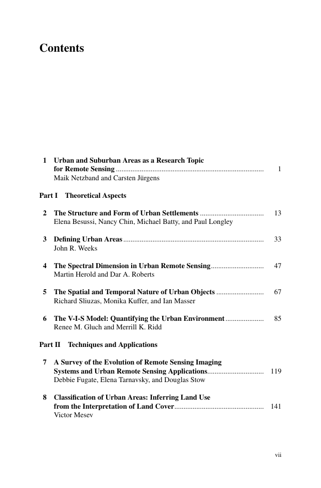
Contents
Contributors
Part I Theoretical Aspects
Chapter 2: The Structure and Form of Urban Settlements
2.1 Urban Structure and Urban Growth: An Overview of Theories and Methodologies
2.2 Physical Manifestations of Urban Growth: Suburbanization and Sprawl
2.2.1 Defining Sprawl Through Form
2.2.2 Defining Sprawl Through Land Use
2.3 The SCATTER Project
2.3.1 Qualitative Analysis of Urban Sprawl in Europe
2.3.2 Statistical Indicators to Identify and Quantify Urban Sprawl
2.4 Conclusions
References
Chapter 3: Defining Urban Areas
3.1 What Is Urban?
3.2 Urban–Rural Is Not Really a Dichotomy
3.3 Remotely-Sensed Data as Proxies for the Built Environment
3.3.1 What Spatial Unit of Analysis Should Be Used?
3.3.2 What Variables Should Be Used to Define Urbanness?
3.3.3 How Will the Variables Be Measured?
3.4 Using the Urban Index as a Predictor Variable
References
Chapter 4: The Spectral Dimension in Urban Remote Sensing
4.1 Introduction
4.2 Spectral Characteristics of Urban Surfaces
4.3 Urban Materials Versus Land Cover Types
4.4 Spectral Separability of Urban Land Cover Types
4.5 Most Suitable Wavelengths in Mapping Urban Land Cover
4.6 Effects of Spectral Resolution on Urban Land Cover Mapping
4.7 Effects of Spatial Resolution and Three-Dimensional Information
References
Chapter 5: The Spatial and Temporal Nature of Urban Objects
5.1 Introduction
5.2 Planning and Management of Urban Development
5.2.1 A Model of Urban Development and Planning
5.3 Basic Objects, Attributes, and Planning Level
5.4 Area-Based and Object-Based Approaches to Urban Data Extraction
5.5 Data Sources for Urban Applications
5.5.1 Selection of an Appropriate Resolution
5.6 The Life Cycle of Planning Processes and Urban Objects
5.7 Implications for Urban Applications of Remote Sensing
References
Chapter 6: The V-I-S Model: Quantifying the Urban Environment
6.1 Introduction
6.2 The V-I-S Model
6.2.1 Relationship to Urban Spatial Models
6.2.2 Time and Change
6.2.3 The Role of Remote Sensing in Urban Systems
6.3 The Influence of Resolution on V-I-S Analysis
6.4 Morphological Application of the V-I-S Model
6.4.1 SPOT-X Data: Spatial Variation in Urban Communities
6.4.2 IRS-1C Data: Anatomy of a Metropolis
6.4.3 Thematic Mapper Data: Multivariate Calibration and Color Display
6.4.4 Thematic Mapper Data: Radial Transects for Environmental Patterns
6.4.5 AVIRIS Data: Neural Network Analysis
6.5 Environmental Process Application of the V-I-S Model
6.5.1 ATLAS Data: Thermal Emittance per Land Cover Class
6.5.2 Thematic Mapper/SPOT-P Data: Storm Runoff Prediction
6.6 Temporal Application of the V-I-S Model
6.6.1 SPOT-X Data: Pre- and Post-earthquake Analysis
6.6.2 MSS/TM/ETM+ Data: Urban Growth, Expert System Analysis
References
Part II Techniques and Applications
Chapter 7: A Survey of the Evolution of Remote Sensing Imaging Systems and Urban Remote Sensing Applications
7.1 Introduction
7.2 Evolution of Remote Sensing Systems
7.2.1 Spatial Resolution
7.2.2 Radiometric Resolution
7.2.3 Spectral Resolution
7.2.4 Temporal Resolution
7.3 Evolution of Urban Remote Sensing and a Gallery of Applications
7.3.1 Early Urban Remote Sensing (1950–1970)
7.3.2 Recent Urban Remote Sensing (1971 to Present)
7.3.2.1 Land Cover and Land Use, Urban Structure, and Change Analyses
7.3.2.2 Urban Population Studies
7.3.2.3 Social Science Applications
References
Chapter 8: Classification of Urban Areas: Inferring Land Use from the Interpretation of Land Cover
8.1 Introduction
8.2 Urban Image Classification
8.2.1 Urban Land Use from Land Cover
8.2.2 Spectral Classifications
8.2.3 Spatial Classifications
8.3 Modified Maximum Likelihood Classification
8.4 Nearest Neighbor Spatial Pattern Recognition
8.5 Concluding Thoughts Regarding Classifications
References
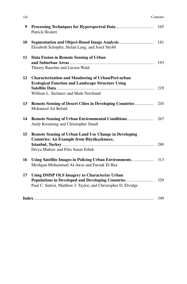
Chapter 9: Processing Techniques for Hyperspectral Data
9.1 Introduction: Hyperspectral Data and Urban Remote Sensing
9.2 Pre-processing
9.2.1 Radiometric Correction
9.2.2 Geometric Correction
9.3 Spectral Libraries
9.4 Analysis Techniques
9.4.1 Data Optimization
9.4.2 Classification and Material Detection
9.4.3 Analysis Focusing on Mixed Pixels
9.5 Future Developments
References
Chapter 10: Segmentation and Object-Based Image Analysis
10.1 Introduction
10.2 Image Segmentation
10.2.1 Limitations of Pixel-Based Classification Techniques
10.2.2 Reasons for Object-Based Classification
10.2.3 Principles and Realization
10.3 Object-Based Classification
10.3.1 Object Features
10.3.2 Classification
10.3.3 Post Processing
10.3.4 Accuracy Assessment
10.4 Case Studies
10.4.1 Detecting Urban Features from IKONOS Data Using Methods of Object Oriented Image Analysis (Hofmann 2001)
10.4.2 Analysis of Urban Structure and Development. Applying Procedures for Automatic Mapping of Large-Area Data (De Kok
References
Chapter 11: Data Fusion in Remote Sensing of Urban and Suburban Areas
11.1 Introduction
11.2 Advanced Mathematical Tools for Data Fusion
11.2.1 Wavelet Transform (WT)
11.2.2 Multi-resolution Analysis (MRA)
11.3 Encrustation of Higher Spatial Resolution Quickbird Image in Low Resolution Image
11.3.1 Benefits of Encrustation
11.3.2 Methods
11.3.3 Illustration Example
11.4 The ARSIS Concept for Fusion of Images in Urban Areas
11.4.1 Introduction
11.4.2 Synthetic Merging Methods
11.4.3 Illustration Example
11.5 Fusion of Images, Databases and Punctual Measurements for Air Quality
11.5.1 Introduction
11.5.2 Methods
11.5.3 Illustrated Example
References
Chapter 12: Characterization and Monitoring of Urban/Peri-urban Ecological Function and Landscape Structure Using Satellite Dat
12.1 Introduction
12.1.1 Why Study Cities?
12.1.2 Remote Sensing and Urban Analysis
12.2 Analytical Methods and Techniques
12.2.1 Study Area
12.2.2 ASTER and MODIS Image Processing
12.2.3 Land Cover Classification of ASTER Data
12.2.4 Landscape Metric Calculation and Grid Construction
12.3 Results and Discussion
References
Chapter 13: Remote Sensing of Desert Cities in Developing Countries
13.1 Urban Areas in Desert Environment
13.1.1 Status and Extent of Desertification
13.1.2 Urban Areas in Africa
13.1.3 Urban Areas in West Asia
13.2 GIS and RS in Desert Cities
13.2.1 A General Framework for Mapping Desertification Hazards
13.2.2 Fusion of Optical and Radar Imagery
13.2.3 Surface Temperature Estimation
13.2.4 Green Belt Implementation
13.2.5 GIS Implementation at Municipalities
13.2.6 Other Urban Application Examples
13.3 Urban Areas Monitoring and Modeling
13.3.1 Land Use Change Detection
13.3.2 Land Use Change Analysis and Modeling
13.4 Case Studies
13.4.1 Adopted Methodology
13.4.2 The Case Study of Morocco
13.4.3 The Case Study of Saudi Arabia
References
Chapter 14: Remote Sensing of Urban Environmental Conditions
14.1 Introduction
14.2 Urban Physical Environment
14.2.1 Importance of Urban Vegetation
14.2.2 Urban Microclimates
14.2.3 Public Health Issues
14.3 Urban Vegetation Mapping
14.3.1 Normalized Difference Vegetation Index
14.3.2 Spectral Mixture Analysis
14.4 Urban Thermal Mapping
14.4.1 Principles of Thermal Radiation
14.4.2 Retrieval of Thermal Data from Satellite Imagery
14.4.3 Urban Heat Island
14.4.4 Relations Between Satellite Thermal Measurements and In Situ Air Temperatures Observations
14.5 Comparison of Environmental Conditions in New York City and Kuwait City
References
Chapter 15: Remote Sensing of Urban Land Use Change in Developing Countries: An Example from Büyükçekmece, Istanbul, Turkey
15.1 Introduction
15.2 Rural–Urban Land Use Changes
15.3 Urbanization in Developing Countries
15.4 Example: Analysis of Urban Growth in Istanbul, Turkey, Using Multitemporal Satellite Data
15.4.1 Study Area
15.4.2 Data and Methods
15.5 Results and Discussion
15.6 Conclusions
References
Chapter 16: Using Satellite Images in Policing Urban Environments
16.1 Introduction
16.2 Spatial Analysis of Crime
16.2.1 Data Versus Information in Community Policing
16.2.2 Crime Mapping
16.3 Application Examples
16.4 Dubai Police Practice1
16.4.1 Image Processing of IKONOS Data of Dubai
16.4.2 Crime Hotspot Analysis
16.4.3 Automated Vehicle Location (AVL)
References
Chapter 17: Using DMSP OLS Imagery to Characterize Urban Populations in Developed and Developing Countries
17.1 Introduction
17.2 Overview of the Nighttime Satellite Image Data Products
17.3 Summary of Several Applications of the Nighttime Imagery
17.4 Case Studies
17.4.1 Case Study#1 (Developed Country): Mapping Exurbia in the Conterminous United States
17.4.2 Case Study #2 (Developing Country): Exploring the Use of Nighttime Imagery in Guatemala
References
Index





 2023年江西萍乡中考道德与法治真题及答案.doc
 2012年重庆南川中考生物真题及答案.doc
 2013年江西师范大学地理学综合及文艺理论基础考研真题.doc
 2020年四川甘孜小升初语文真题及答案I卷.doc
 2020年注册岩土工程师专业基础考试真题及答案.doc
 2023-2024学年福建省厦门市九年级上学期数学月考试题及答案.doc
 2021-2022学年辽宁省沈阳市大东区九年级上学期语文期末试题及答案.doc
 2022-2023学年北京东城区初三第一学期物理期末试卷及答案.doc
 2018上半年江西教师资格初中地理学科知识与教学能力真题及答案.doc
 2012年河北国家公务员申论考试真题及答案-省级.doc
 2020-2021学年江苏省扬州市江都区邵樊片九年级上学期数学第一次质量检测试题及答案.doc
 2022下半年黑龙江教师资格证中学综合素质真题及答案.doc