logo资料库

GARMIN GPS导航设备-GPSMAP 640说明书.pdf

第1页 / 共92页
第2页 / 共92页
第3页 / 共92页
第4页 / 共92页
第5页 / 共92页
第6页 / 共92页
第7页 / 共92页
第8页 / 共92页
资料共92页,剩余部分请下载后查看
Introduction
Product Registration
Contact Garmin®
Manual Conventions
Caring for Your GPSMAP 620/640
Getting Started
Identifying the GPSMAP 620/640 Features
Identifying the GPSMAP 620/640 Mounting Bracket Features
Using the Mounting Bracket
Powering the GPSMAP 620/640 On and Off
Removing and Inserting the Battery Pack
Inserting and Removing a Secure Digital (SD) Card
Marine Mode: Getting Started
Step 1: Mount Your GPSMAP 620/640
Step 2: Configure Your GPSMAP 620/640
Step 3: Acquire Satellites
Step 4: Use Your GPSMAP 620/640
Navigating Directly to a Destination
Saving Your Current Location
Navigating Directly to a Saved Location
Stopping Navigation
Adjusting the Volume
Adjusting the Backlight
Marine Mode: Using Charts
Using the Navigation Chart
Interacting With Objects on the Navigation Chart
Accessing Additional Object or Chart Information
Using Mariner’s Eye
Using BlueChart g2 Vision
Using Mariner’s Eye 3D
Using Fish Eye 3D
Using Fishing Charts
Enabling High-Resolution Satellite Imagery
Marine Mode: Navigating
Step 1: Choose a Destination
Step 2: Set and Follow the Course
Marine Mode: Where To?
Searching For Marine Services
Searching for Waypoints
Searching for Saved Routes
Searching for Saved Tracks
Searching by Name
Marine Mode: Using Waypoints and Tracks
Using Man Overboard (MOB) Waypoints
Marking a Waypoint at Your Current Location
Creating a Waypoint From the Navigation Chart
Editing Waypoint Details
Using Tracks
Marine Mode: Using the Dashboard
Using the Compass Screen
Using the Numbers Screen
Using the Trip Screen
Marine Mode: Viewing Almanac Data
Viewing Tide Station Information
Viewing Current Information
Viewing Celestial Information
Marine Mode: Managing User Data
Transferring Data (Waypoints, Routes, Tracks) to or From an SD Card
Backing up Data to a PC
Copying or Merging MapSource® Data to the GPSMAP 620/640
Marine Mode: Managing Information From Other Vessels
Viewing AIS Information
Viewing DSC Information
Marine Mode: Advanced Configuration
Configuring System Settings
Changing Units of Measure
Configuring Communications Settings
Configuring Alarm Settings
Configuring My Boat
Configuring Other Vessels
Configuring XM Radio
Configuring Navigation Chart Options
Configuring Mariner’s Eye Options and Mariner’s Eye 3D Options
Fish Eye 3D Settings
Fishing Chart Settings
Configuring the Active Track Options
Configuring the Numbers Screen
Marine Mode: Using XM WX Weather and Audio
Using XM WX Weather
Setting the XM WX Weather Options
Viewing Precipitation Information
Viewing Forecast Information
Viewing Sea Conditions
Viewing Fishing Information
Viewing Visibility Information
Viewing Buoy Reports
Using XM Audio
Automotive Mode: Getting Started
Step 1: Mount Your GPSMAP 620/640
Step 2: Configure Your GPSMAP 620/640
Step 3: Acquire Satellites
Step 4: Use Your GPSMAP 620/640
Finding Your Destination
Adding a Stop
Taking a Detour
Stopping the Route
Automotive Mode: Where To?
Finding an Address
Setting a Home Location
Go! Page Options
Finding a Place by Spelling the Name
Searching Near Another Location
Finding Recently Found Places
Favorites
Finding a Place Using the Map
Using Custom Routes
Entering Coordinates
Navigating Off Road
Automotive Mode: Using the Map
Next Turn
Turn List
Trip Computer
Automotive Mode: Managing Files
Loading Files
Deleting Files
Automotive Mode: Using the Tools
Settings
Where Am I?
Picture Viewer
My Data
Automotive Mode: Advanced Configuration
Changing the System Settings
Changing the Navigation Settings
Adjusting the Display Settings
Adjusting the Volume
Adjusting the Backlight
Updating the Time Settings
Setting the Languages
Changing the Map Settings
Changing Security Settings
Restoring All Settings
Automotive Mode: Using XM
Listening to XM Radio
Using XM Traffic Information
Traffic in Your Area
Severity Color Code
Traffic on Your Route
Viewing the Traffic Map
Viewing Traffic Delays
Adding an XM Subscription
Appendix
Calibrating the Screen
Resetting Your GPSMAP 620/640
Updating the Software
Clearing User Data
Battery Information
Charging Your GPSMAP 620/640
Changing the Fuse on the Automotive Mount
Additional Maps
About GPS Satellite Signals
Extras and Optional Accessories
Specifications
Declaration of Conformity
Software License Agreement
Troubleshooting
Messages and Alarms (Marine Mode)
Index
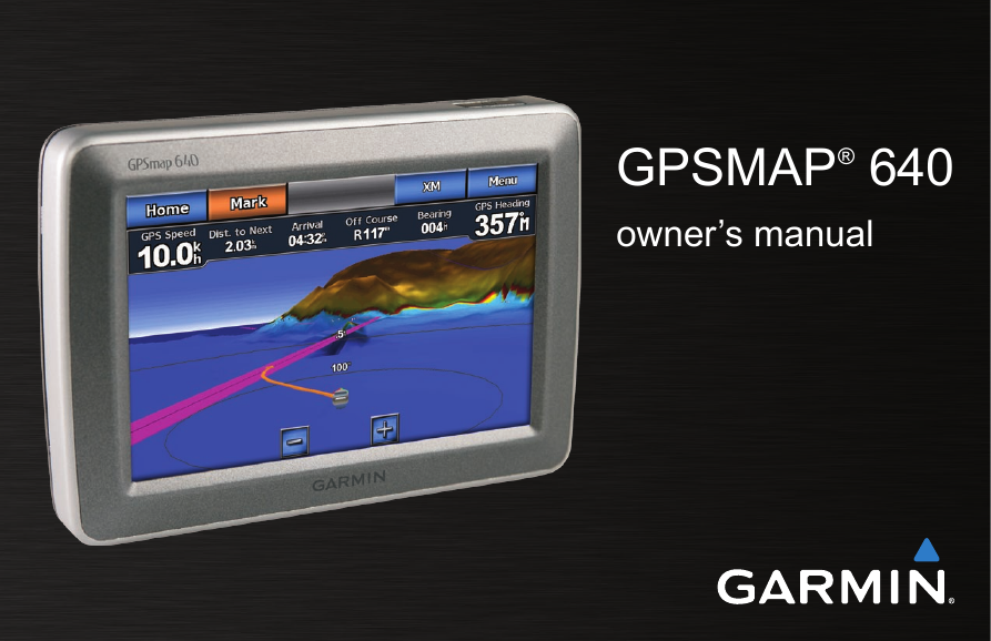
GPSMAP® 640 owner’s manual
© 2008 Garmin Ltd. or its subsidiaries Garmin International, Inc. 1200 East 151st Street, Olathe, Kansas 66062, USA Tel. (913) 397.8200 or (800) 800.1020 Fax (913) 397.8282 Garmin (Europe) Ltd. Liberty House Hounsdown Business Park, Southampton, Hampshire, SO40 9RB UK Tel. +44 (0) 870.8501241 (outside the UK) 0808 2380000 (within the UK) Fax +44 (0) 870.8501251 Garmin Corporation No. 68, Jangshu 2nd Road, Shijr, Taipei County, Taiwan Tel. 886/2.2642.9199 Fax 886/2.2642.9099 All rights reserved. Except as expressly provided herein, no part of this manual may be reproduced, copied, transmitted, disseminated, downloaded or stored in any storage medium, for any purpose without the express prior written consent of Garmin. Garmin hereby grants permission to download a single copy of this manual onto a hard drive or other electronic storage medium to be viewed and to print one copy of this manual or of any revision hereto, provided that such electronic or printed copy of this manual must contain the complete text of this copyright notice and provided further that any unauthorized commercial distribution of this manual or any revision hereto is strictly prohibited. Information in this document is subject to change without notice. Garmin reserves the right to change or improve its products and to make changes in the content without obligation to notify any person or organization of such changes or improvements. Visit the Garmin Web site (www.garmin.com) for current updates and supplemental information concerning the use and operation of this and other Garmin products. Garmin®, the Garmin logo, GPSMAP®, BlueChart®, g2 Vision®, and MapSource® are trademarks of Garmin Ltd. or its subsidiaries, registered in the USA and other countries. These trademarks may not be used without the express permission of Garmin. Windows® and Windows NT® are registered trademarks of Microsoft Corporation in the United States and/or other countries. Mac® is a registered trademark of Apple Computer, Inc. XM® and XM WX Satellite Weather® are registered trademarks of XM Satellite Radio Inc. November, 2008 Part Number 190-01046-00 Rev. A Printed in Taiwan
Introduction The GPSMAP® 640 is both a marine and an automotive GPS- enabled navigation device. Two mounts are provided with the GPSMAP 640 device, one for your boat and one for your car. When you place the device in the mount installed on your boat, it powers on in marine mode. When you place the device in the automotive mount, it powers on in automotive mode. This manual is divided in two sections; the first section describes how to use the GPSMAP 640 in marine mode, and the second section describes how to use the device in automotive mode. The sections are labeled with tabs along the edge of the page to help identify the usage mode. See the Important Safety and Product Information guide in the product box for product warnings and other important information. Product Registration Help us better support you by completing our online registration today. Go to http://my.garmin.com. Keep the original sales receipt, or a photocopy, in a safe place. Introduction Contact Garmin® Contact Garmin Product Support if you have any questions while using your GPSMAP 640. In the USA, go to www.garmin .com/support, or contact Garmin USA by phone at (913) 397.8200 or (800) 800.1020. In the UK, contact Garmin (Europe) Ltd. by phone at 0808 2380000. In Europe, go to www.garmin.com/support and click Contact Support for in-country support information, or contact Garmin (Europe) Ltd. by phone at +44 (0) 870.8501241. Manual Conventions In this manual, when you are instructed to touch something, use your finger to touch that item on the screen. Small arrows (>) used in the text indicate that you should touch a series of items in order. For example, if you see, “Touch Charts > Navigation Chart”, you should touch the Charts button on the screen, and then touch Navigation Chart. GPSMAP 640 Owner’s Manual  
Introduction Caring for Your GPSMAP 640 Your GPSMAP 640 contains sensitive electronic components that can be permanently damaged if exposed to excessive shock or vibration. To minimize the risk of damage to your GPSMAP 640, avoid dropping your unit and operating it in high-shock and high- vibration environments. Cleaning the Unit The GPSMAP 640 is constructed of high-quality materials and does not require user maintenance other than cleaning. Clean the outer casing of the unit (not the touchscreen) using a cloth dampened with a mild detergent solution, and then wipe it dry. Avoid chemical cleaners and solvents that can damage plastic components. Cleaning the Touch Screen Clean the touchscreen with a soft, clean, lint-free cloth. Use water, isopropyl alcohol, or eyeglass cleaner, if needed. Apply the liquid to the cloth, and then gently wipe the touchscreen. Protecting Your GPSMAP 640 • Do not store the GPSMAP 640 where prolonged exposure to extreme temperatures can occur, because it can cause permanent damage. Although a PDA stylus can be used to operate the touchscreen, never attempt this while operating a vehicle. Never use a hard or sharp object to operate the touchscreen because damage might result. • Water Immersion The unit is waterproof to IEC Standard 60529 IPX7. It can withstand immersion in 1 meter of water for 30 minutes. Prolonged submersion can cause damage to the unit. After submersion, be certain to wipe and air dry the unit before reuse. Avoiding Theft • To avoid theft, remove the unit and mount from sight when not in use. Do not keep your unit in the glove compartment. Register your product at http://my.garmin.com. • •   GPSMAP 640 Owner’s Manual
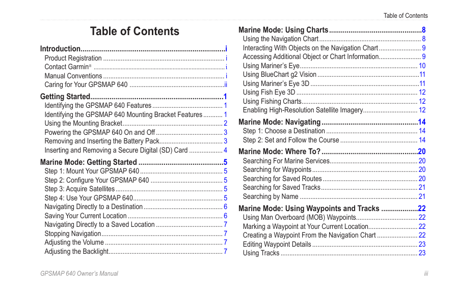
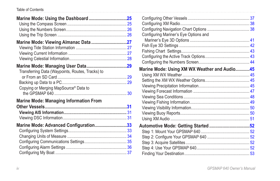
Table of Contents Introduction ...........................................................................i Product Registration ..................................................................... i Contact Garmin® ...................................................................................i Manual Conventions ..................................................................... i Caring for Your GPSMAP 640 ......................................................ii Getting Started .....................................................................1 Identifying the GPSMAP 640 Features ........................................ 1 Identifying the GPSMAP 640 Mounting Bracket Features ........... 1 Using the Mounting Bracket ......................................................... 2 Powering the GPSMAP 640 On and Off ...................................... 3 Removing and Inserting the Battery Pack .................................... 3 Inserting and Removing a Secure Digital (SD) Card ................... 4 Marine Mode: Getting Started ............................................5 Step 1: Mount Your GPSMAP 640 ............................................... 5 Step 2: Configure Your GPSMAP 640 ......................................... 5 Step 3: Acquire Satellites ............................................................. 5 Step 4: Use Your GPSMAP 640 ................................................... 5 Navigating Directly to a Destination ............................................. 6 Saving Your Current Location ...................................................... 6 Navigating Directly to a Saved Location ...................................... 7 Stopping Navigation ..................................................................... 7 Adjusting the Volume ................................................................... 7 Adjusting the Backlight ................................................................. 7 Table of Contents Marine Mode: Using Charts ................................................8 Using the Navigation Chart .......................................................... 8 Interacting With Objects on the Navigation Chart ........................ 9 Accessing Additional Object or Chart Information ........................ 9 Using Mariner’s Eye ................................................................... 10 Using BlueChart g2 Vision ..........................................................11 Using Mariner’s Eye 3D ..............................................................11 Using Fish Eye 3D ..................................................................... 12 Using Fishing Charts .................................................................. 12 Enabling High-Resolution Satellite Imagery ............................... 12 Marine Mode: Navigating ..................................................14 Step 1: Choose a Destination .................................................... 14 Step 2: Set and Follow the Course ............................................ 14 Marine Mode: Where To? ..................................................20 Searching For Marine Services .................................................. 20 Searching for Waypoints ............................................................ 20 Searching for Saved Routes ...................................................... 20 Searching for Saved Tracks ....................................................... 21 Searching by Name ................................................................... 21 Marine Mode: Using Waypoints and Tracks ...................22 Using Man Overboard (MOB) Waypoints................................... 22 Marking a Waypoint at Your Current Location............................ 22 Creating a Waypoint From the Navigation Chart ....................... 22 Editing Waypoint Details ............................................................ 23 Using Tracks .............................................................................. 23 GPSMAP 640 Owner’s Manual  
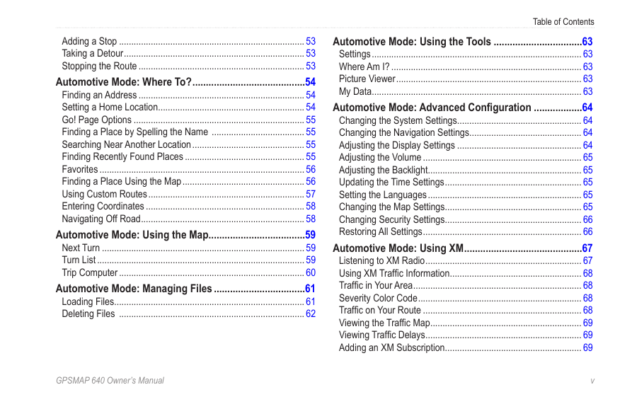
Table of Contents Marine Mode: Using the Dashboard ................................25 Using the Compass Screen ....................................................... 25 Using the Numbers Screen ........................................................ 26 Using the Trip Screen ................................................................ 26 Marine Mode: Viewing Almanac Data ..............................27 Viewing Tide Station Information ............................................... 27 Viewing Current Information ...................................................... 27 Viewing Celestial Information ..................................................... 28 Marine Mode: Managing User Data ..................................29 Transferring Data (Waypoints, Routes, Tracks) to or From an SD Card ................................................................ 29 Backing up Data to a PC ............................................................ 29 Copying or Merging MapSource® Data to the GPSMAP 640 ................................................................... 30 Marine Mode: Managing Information From Other Vessels .....................................................................31 Viewing AIS Information .......................................................... 31 Viewing DSC Information ........................................................... 31 Marine Mode: Advanced Configuration ...........................33 Configuring System Settings ...................................................... 33 Changing Units of Measure ....................................................... 34 Configuring Communications Settings ....................................... 35 Configuring Alarm Settings ........................................................ 36 Configuring My Boat .................................................................. 37 Configuring Other Vessels ......................................................... 37 Configuring XM Radio ................................................................ 38 Configuring Navigation Chart Options ....................................... 38 Configuring Mariner’s Eye Options and Mariner’s Eye 3D Options ....................................................... 41 Fish Eye 3D Settings ................................................................. 42 Fishing Chart Settings ............................................................... 43 Configuring the Active Track Options ......................................... 43 Configuring the Numbers Screen ............................................... 44 Marine Mode: Using XM WX Weather and Audio ............45 Using XM WX Weather .............................................................. 45 Setting the XM WX Weather Options ......................................... 45 Viewing Precipitation Information ............................................... 45 Viewing Forecast Information .................................................... 47 Viewing Sea Conditions ............................................................. 48 Viewing Fishing Information ....................................................... 49 Viewing Visibility Information...................................................... 50 Viewing Buoy Reports ................................................................ 50 Using XM Audio ......................................................................... 51 Automotive Mode: Getting Started ..................................52 Step 1: Mount Your GPSMAP 640 ............................................. 52 Step 2: Configure Your GPSMAP 640 ....................................... 52 Step 3: Acquire Satellites ........................................................... 52 Step 4: Use Your GPSMAP 640 ................................................. 52 Finding Your Destination ............................................................ 53 v  GPSMAP 640 Owner’s Manual
Adding a Stop ............................................................................ 53 Taking a Detour .......................................................................... 53 Stopping the Route .................................................................... 53 Automotive Mode: Where To? ..........................................54 Finding an Address .................................................................... 54 Setting a Home Location ............................................................ 54 Go! Page Options ...................................................................... 55 Finding a Place by Spelling the Name ...................................... 55 Searching Near Another Location .............................................. 55 Finding Recently Found Places ................................................. 55 Favorites .................................................................................... 56 Finding a Place Using the Map .................................................. 56 Using Custom Routes ................................................................ 57 Entering Coordinates ................................................................. 58 Navigating Off Road ................................................................... 58 Automotive Mode: Using the Map ....................................59 Next Turn ................................................................................... 59 Turn List ..................................................................................... 59 Trip Computer ............................................................................ 60 Automotive Mode: Managing Files ..................................61 Loading Files .............................................................................. 61 Deleting Files ............................................................................ 62 Table of Contents Automotive Mode: Using the Tools .................................63 Settings ...................................................................................... 63 Where Am I? .............................................................................. 63 Picture Viewer ............................................................................ 63 My Data ...................................................................................... 63 Automotive Mode: Advanced Configuration ..................64 Changing the System Settings ................................................... 64 Changing the Navigation Settings .............................................. 64 Adjusting the Display Settings ................................................... 64 Adjusting the Volume ................................................................. 65 Adjusting the Backlight ............................................................... 65 Updating the Time Settings ........................................................ 65 Setting the Languages ............................................................... 65 Changing the Map Settings ........................................................ 65 Changing Security Settings ........................................................ 66 Restoring All Settings ................................................................. 66 Automotive Mode: Using XM ............................................67 Listening to XM Radio ................................................................ 67 Using XM Traffic Information ...................................................... 68 Traffic in Your Area ..................................................................... 68 Severity Color Code ................................................................... 68 Traffic on Your Route ................................................................. 68 Viewing the Traffic Map .............................................................. 69 Viewing Traffic Delays ................................................................ 69 Adding an XM Subscription ........................................................ 69 GPSMAP 640 Owner’s Manual  v
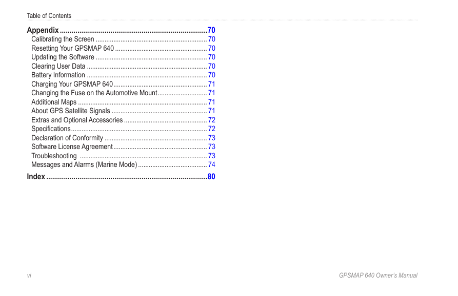
Table of Contents Appendix ............................................................................70 Calibrating the Screen ............................................................... 70 Resetting Your GPSMAP 640 .................................................... 70 Updating the Software ............................................................... 70 Clearing User Data .................................................................... 70 Battery Information .................................................................... 70 Charging Your GPSMAP 640 ..................................................... 71 Changing the Fuse on the Automotive Mount ............................ 71 Additional Maps ......................................................................... 71 About GPS Satellite Signals ...................................................... 71 Extras and Optional Accessories ............................................... 72 Specifications ............................................................................. 72 Declaration of Conformity .......................................................... 73 Software License Agreement ..................................................... 73 Troubleshooting ........................................................................ 73 Messages and Alarms (Marine Mode) ....................................... 74 Index ...................................................................................80 v  GPSMAP 640 Owner’s Manual
分享到:
收藏