GPSMAP 76S
chartplotting receiver
owner’s
manual
and
reference
guide
�
© 2006 Garmin Ltd. or its subsidiaries
Garmin International, Inc.
1200 East 151st Street,
Olathe, Kansas 66062, U.S.A.
Tel. 913/397.8200 or 800/800.1020
Fax 913/397.8282
Garmin (Europe) Ltd.
Unit 5, The Quadrangle, Abbey Park Industrial Estate, Romsey, SO51 9DL, U.K.
Tel. 44/0870.8501241
Fax 44/0870.8501251
Garmin Corporation
No. 68, Jangshu 2nd Road, Shijr, Taipei County, Taiwan
Tel. 886/2.2642.9199
Fax 886/2.2642.9099
All rights reserved. Except as expressly provided herein, no part of this manual may be reproduced, copied, transmitted, disseminated,
downloaded or stored in any storage medium, for any purpose without the express prior written consent of Garmin. Garmin hereby grants
permission to download a single copy of this manual onto a hard drive or other electronic storage medium to be viewed and to print one
copy of this manual or of any revision hereto, provided that such electronic or printed copy of this manual must contain the complete text
of this copyright notice and provided further that any unauthorized commercial distribution of this manual or any revision hereto is strictly
prohibited.
Information in this document is subject to change without notice. Garmin reserves the right to change or improve its products and to make
changes in the content without obligation to notify any person or organization of such changes or improvements. Visit the Garmin Web site
(www.garmin.com) for current updates and supplemental information concerning the use and operation of this and other Garmin products.
Garmin®, TracBack® GPSMAP® and MapSource® are registered trademarks Garmin Ltd. or its subsidiaries and may not be
used without the express permission of Garmin.
April 2006
Part Number 190-00249-00 Rev. E
Printed in Taiwan
�
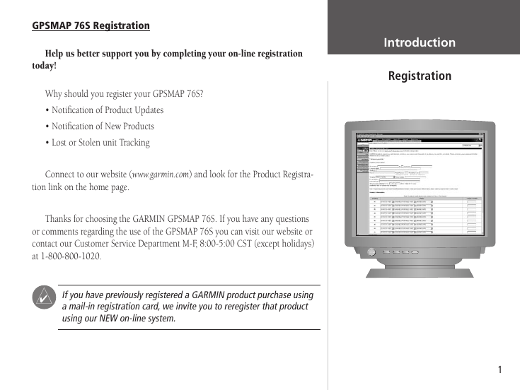
GPSMAP 76S Registration
Help us better support you by completing your on-line registration
today!
Why should you register your GPSMAP 76S?
• Notification of Product Updates
• Notification of New Products
• Lost or Stolen unit Tracking
Connect to our website (www.garmin.com) and look for the Product Registra-
tion link on the home page.
Thanks for choosing the GARMIN GPSMAP 76S. If you have any questions
or comments regarding the use of the GPSMAP 76S you can visit our website or
contact our Customer Service Department M-F, 8:00-5:00 CST (except holidays)
at 1-800-800-1020.
POWER
F
If you have previously registered a GARMIN product purchase using
a mail-in registration card, we invite you to reregister that product
using our NEW on-line system.
Registration
Introduction
Registration
1
�
Introduction
Warnings and Cautions
2
WARNING: If you choose to use the GPSMAP 76S in a vehicle, it is the sole
responsibility of the owner/operator of the GPSMAP 76S to secure the GPS unit
so that it will not cause damage or personal injury in the event of an accident. Do
not mount the GPSMAP 76S over airbag panels or in a place where the driver or
passengers are likely to have an impact with it in an accident or collision.
WARNING: If you choose to use the GPSMAP 76S in a vehicle, it is the
sole responsibility of the operator of the vehicle to operate the vehicle in a safe
manner, maintain full surveillance of all driving conditions at all times, and
never become distracted by the GPSMAP 76S to the exclusion of safe operating
practices. It is unsafe to operate the GPSMAP 76S while you are driving. Failure
by the operator of a vehicle equipped with an GPSMAP 76S to pay full attention
to operating the vehicle and road conditions while the vehicle is in motion could
result in an accident or collision with property damage and personal injury.
CAUTION: IT IS THE USER’S RESPONSIBILITY TO USE THIS PRODUCT
PRUDENTLY. THIS PRODUCT IS INTENDED TO BE USED ONLY AS A TRAVEL
AID AND MUST NOT BE USED FOR ANY PURPOSE REQUIRING PRECISE
MEASUREMENT OF DIRECTION, DISTANCE, LOCATION, OR TOPOGRAPHY.
CAUTION: The Global Positioning System (GPS) is operated by the gov-
ernment of the United States, which is solely responsible for its accuracy and
maintenance. The system is subject to changes which could affect the accuracy
and performance of all GPS equipment. Although the GPSMAP 76S is a precision
electronic NAVigation AID (NAVAID), any NAVAID can be misused or misinter-
preted and, therefore, become unsafe.
�
NOTE: This device complies with Part 15 of the FCC interference limits for
Class B digital devices FOR HOME OR OFFICE USE (“home or office” interfer-
ence requirements are more stringent than “outdoor” requirements). Operation of
this device is subject to the following conditions: (1) This device may not cause
harmful interference, and (2) this device must accept any interference received,
including interference that may cause undesired operation.
Introduction
FCC Compliance Statement
The GPSMAP 76S does not contain any user-serviceable parts. Repairs should
only be made by an authorized GARMIN service center. Unauthorized repairs or
modifications could result in permanent damage to the equipment, and void your
warranty and your authority to operate this device under Part 15 regulations.
3
�
Software License Agreement
Introduction
Software License Agreement
BY USING THE GPSMAP 76S, YOU AGREE TO BE BOUND
BY THE TERMS AND CONDITIONS OF THE FOLLOWING
SOFTWARE LICENSE AGREEMENT. PLEASE READ THIS
AGREEMENT CAREFULLY.
GARMIN grants you a limited license to use the software embedded
in this device (the “Software”) in binary executable form in the
normal operation of the product. Title, ownership rights and
intellectual property rights in and to the Software remain in
GARMIN.
You acknowledge that the Software is the property of GARMIN
and is protected under the United States of America copyright laws
and international copyright treaties. You further acknowledge that
the structure, organization and code of the Software are valuable
trade secrets of GARMIN and that the Software in source code
form remains a valuable trade secret of GARMIN. You agree not to
decompile, disassemble, modify, reverse assemble, reverse engineer
or reduce to human readable form the Software or any part thereof
or create any derivative works based on the Software. You agree not
to export or re-export the Software to any country in violation of the
export control laws of the United States of America.
4
�
MapSource Info ................................ 47
Setup Menu- General Tab ............47-48
Setup Menu-Altimeter Tab ................ 49
Setup Menu-Compass Tab ................ 50
Setup Menu-Time Tab .................50-51
Setup Menu-Units Tab ...................... 51
Setup Menu-Location Tab ............52-53
Setup Menu-Alarms Tab ................... 53
Setup Menu-Interface Tab ................ 54
Appendices .................................55-71
Appendix A: Specifications ...............55
Appendix B: Wiring & Interfacing ....56
Appendix C: Time Offsets ................57
Appendix D: Map Datums ...........58-59
Appendix E: Navigation Terms ....60-61
Appendix F: Messages .................62-63
Appendix G: Loran TD ................64-65
Appendix H: Accessories ..................66
Appendix I: Index ......................67-70
Appendix J: Warranty .....................71
Introduction ....................................1-6
Registration ........................................ 1
Warnings and Cautions ...................... 2
FCC Compliance Statement ............... 3
Features .............................................. 4
Table of Contents ...............................5
Unit Features ...................................... 6
Section Two: Reference ................7-54
Initializing the GPS Receiver ............7-8
GPS Information Page ...................8-11
Map Page .....................................12-13
Map Page Setup Options .............13-19
Pointer Page ...............................21-22
Highway Page ..............................22-23
Active Route/Goto Page .................... 24
Plot Page .....................................24-26
Main Menu ....................................... 26
Trip Computer ............................27-28
Tracks ..........................................28-30
Waypoints ...................................30-34
Points of Interest ......................... 35
Cities .......................................... 36
Exits ......................................36-37
Addresses ................................... 37
Intersections ............................... 38
Routes ...................................38-42
Proximity .................................... 43
Celestial ......................................44-46
Introduction
Table of Contents
5
�
Introduction
Features
ZOOM
NOTE: You should always be prepared and capable of
navigating without the GPSMAP 76S. It is designed to
compliment other forms of basic navigation, not entirely
replace them.
6
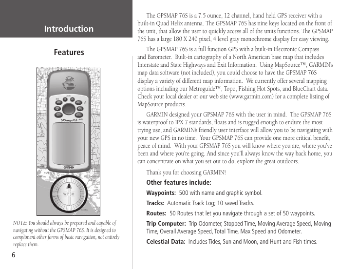
The GPSMAP 76S is a 7.5 ounce, 12 channel, hand held GPS receiver with a
built-in Quad Helix antenna. The GPSMAP 76S has nine keys located on the front of
the unit, that allow the user to quickly access all of the units functions. The GPSMAP
76S has a large 180 X 240 pixel, 4 level gray monochrome display for easy viewing.
The GPSMAP 76S is a full function GPS with a built-in Electronic Compass
and Barometer. Built-in cartography of a North American base map that includes
Interstate and State Highways and Exit Information. Using MapSource™, GARMIN’s
map data software (not included), you could choose to have the GPSMAP 76S
display a variety of different map information. We currently offer several mapping
options including our Metroguide™, Topo, Fishing Hot Spots, and BlueChart data.
Check your local dealer or our web site (www.garmin.com) for a complete listing of
MapSource products.
GARMIN designed your GPSMAP 76S with the user in mind. The GPSMAP 76S
is waterproof to IPX 7 standards, floats and is rugged enough to endure the most
trying use, and GARMIN’s friendly user interface will allow you to be navigating with
your new GPS in no time. Your GPSMAP 76S can provide one more critical benefit,
peace of mind. With your GPSMAP 76S you will know where you are, where you’ve
been and where you’re going. And since you’ll always know the way back home, you
can concentrate on what you set out to do, explore the great outdoors.
Thank you for choosing GARMIN!
Other features include:
Waypoints: 500 with name and graphic symbol.
Tracks: Automatic Track Log; 10 saved Tracks.
Routes: 50 Routes that let you navigate through a set of 50 waypoints.
Trip Computer: Trip Odometer, Stopped Time, Moving Average Speed, Moving
Time, Overall Average Speed, Total Time, Max Speed and Odometer.
Celestial Data: Includes Tides, Sun and Moon, and Hunt and Fish times.
�




 2023年江西萍乡中考道德与法治真题及答案.doc
 2012年重庆南川中考生物真题及答案.doc
 2013年江西师范大学地理学综合及文艺理论基础考研真题.doc
 2020年四川甘孜小升初语文真题及答案I卷.doc
 2020年注册岩土工程师专业基础考试真题及答案.doc
 2023-2024学年福建省厦门市九年级上学期数学月考试题及答案.doc
 2021-2022学年辽宁省沈阳市大东区九年级上学期语文期末试题及答案.doc
 2022-2023学年北京东城区初三第一学期物理期末试卷及答案.doc
 2018上半年江西教师资格初中地理学科知识与教学能力真题及答案.doc
 2012年河北国家公务员申论考试真题及答案-省级.doc
 2020-2021学年江苏省扬州市江都区邵樊片九年级上学期数学第一次质量检测试题及答案.doc
 2022下半年黑龙江教师资格证中学综合素质真题及答案.doc