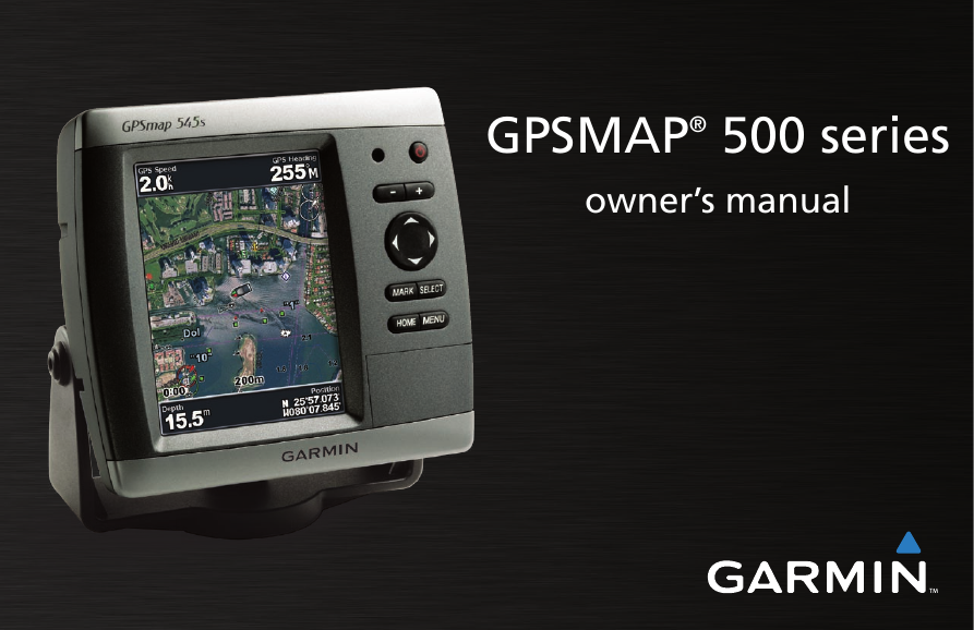
GPSMAP® 500 series
owner’s manual
�
© 2007 Garmin Ltd. or its subsidiaries
Garmin International, Inc.
1200 East 151st Street,
Olathe, Kansas 66062, USA
Tel. (913) 397.8200 or (800) 800.1020
Fax (913) 397.8282
Garmin (Europe) Ltd.
Liberty House
Hounsdown Business Park,
Southampton, Hampshire, SO40 9RB UK
Tel. +44 (0) 870.8501241 (outside the UK)
Fax +44 (0) 870.8501251
0808 2380000 (within the UK)
Garmin Corporation
No. 68, Jangshu 2nd Road,
Shijr, Taipei County, Taiwan
Tel. 886/2.2642.9199
Fax 886/2.2642.9099
All rights reserved. Except as expressly provided herein, no part of this manual may be reproduced, copied, transmitted, disseminated, downloaded or stored in any
storage medium, for any purpose without the express prior written consent of Garmin. Garmin hereby grants permission to download a single copy of this manual
onto a hard drive or other electronic storage medium to be viewed and to print one copy of this manual or of any revision hereto, provided that such electronic
or printed copy of this manual must contain the complete text of this copyright notice and provided further that any unauthorized commercial distribution of this
manual or any revision hereto is strictly prohibited.
Information in this document is subject to change without notice. Garmin reserves the right to change or improve its products and to make changes in
the content without obligation to notify any person or organization of such changes or improvements. Visit the Garmin Web site (www.garmin.com)
for current updates and supplemental information concerning the use and operation of this and other Garmin products.
Garmin® is a trademark of Garmin Ltd. or its subsidiaries, registered in the USA and other countries. GPSMAP®, AutoLocate®, BlueChart®, BlueChart® g2 Vision™,
TracBack®, BlueChart®, MapSource®, and Ultrascroll™ are trademarks of Garmin Ltd. or its subsidiaries. These trademarks may not be used without the express
permission of Garmin. XM WX Weather and XM Radio are trademarks of XM Satellite Radio, Inc.
August 2007
Part Number 190-00758-00 Rev. C
Printed in Taiwan
�
IntroductIon
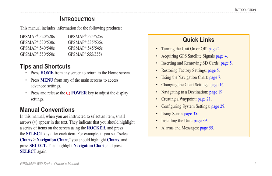
This manual includes information for the following products:
GPSMAP® 520/520s
GPSMAP® 530/530s
GPSMAP® 540/540s
GPSMAP® 550/550s
GPSMAP® 525/525s
GPSMAP® 535/535s
GPSMAP® 545/545s
GPSMAP® 555/555s
Tips and Shortcuts
• Press HOME from any screen to return to the Home screen.
• Press MENU from any of the main screens to access
advanced settings.
• Press and release the
settings.
POWER key to adjust the display
Manual Conventions
In this manual, when you are instructed to select an item, small
arrows (>) appear in the text. They indicate that you should highlight
a series of items on the screen using the ROCKER, and press
the SELECT key after each item. For example, if you see “select
Charts > Navigation Chart,” you should highlight Charts, and
press SELECT. Then highlight Navigation Chart, and press
SELECT again.
IntroductIon
Quick Links
Inserting and Removing SD Cards: page 5.
• Turning the Unit On or Off: page 2.
• Acquiring GPS Satellite Signals page 4.
•
• Restoring Factory Settings: page 5.
• Using the Navigation Chart: page 7.
• Changing the Chart Settings: page 16.
• Navigating to a Destination: page 19.
• Creating a Waypoint: page 21.
• Configuring System Settings: page 29.
• Using Sonar: page 35.
•
• Alarms and Messages: page 55.
Installing the Unit: page 39.
GPSMAP® 500 Series Owner’s Manual
i
�
IntroductIon
table of contents
Introduction ...........................................................................i
Tips and Shortcuts ................................................................... i
Manual Conventions ................................................................ i
Quick Links ............................................................................... i
Warnings ................................................................................. iv
Important Information ............................................................ iv
Getting Started .....................................................................1
Unit Overview .......................................................................... 1
Turning the Unit On or Off ...................................................... 2
Adjusting the Backlight .......................................................... 2
Using the Keypad .................................................................... 3
Acquiring GPS Satellite Signals ............................................ 4
Using Simulator Mode ............................................................ 4
Viewing System Information .................................................. 5
Restoring Factory Settings .................................................... 5
Inserting and Removing SD Cards ........................................ 5
Understanding the Home Screen ........................................... 6
Using Charts ........................................................................7
Using the Navigation Chart .................................................... 7
Using the Split Navigation Chart ......................................... 11
Using BlueChart g2 Vision ................................................... 11
Using Mariner’s Eye 3D ........................................................ 12
Using Fish Eye 3D ................................................................. 13
Using Fishing Charts ............................................................ 13
Enabling High Resolution Satellite Imagery ....................... 14
Viewing Aerial Photos ........................................................... 15
Viewing Current Station Information ................................... 16
Detailed Road and POI Data ................................................. 16
Using Automatic Guidance ................................................... 16
Changing the Chart Settings ................................................ 16
Using the Chart/Sonar Screen ............................................. 18
Where To ............................................................................19
Navigating to a Destination .................................................. 19
Creating and Using Waypoints ............................................ 21
Creating and Using Routes .................................................. 23
Viewing Information ..........................................................25
Viewing Numbers .................................................................. 25
Viewing Tide Station Information ......................................... 26
Viewing Current Information ................................................ 26
Viewing Celestial Information .............................................. 27
Viewing User Data ................................................................. 27
Viewing Other Boats ............................................................. 28
ii
GPSMAP® 500 Series Owner’s Manual
�
IntroductIon
Appendix ............................................................................53
Specifications ........................................................................ 53
Product Registration ............................................................. 54
Caring for the Unit ................................................................. 54
Alarms and Messages ........................................................... 55
Weather Data Warranty ......................................................... 59
XM Satellite Radio Service Agreement ................................ 60
Software License Agreement ............................................... 60
Limited Warranty ................................................................... 61
FCC Compliance .................................................................... 62
Industry Canada Compliance ............................................... 62
Declaration of Conformity (DoC) ......................................... 62
Optional Accessories ............................................................ 62
Index ...................................................................................63
Configuring the Unit ..........................................................29
Configuring System Settings ............................................... 29
Changing Units of Measure .................................................. 29
Configuring Communications Settings ............................... 30
Setting Alarms ....................................................................... 31
Configuring My Boat ............................................................. 32
Configuring Other Boats ...................................................... 34
Configuring XM Audio ........................................................... 34
Using Sonar .......................................................................35
Understanding the Full Screen ............................................ 35
Understanding the Flasher ................................................... 35
Understanding the Split Freq Screen .................................. 36
Understanding The Split Zoom Screen ............................... 36
Understanding the Temp Log Screen .................................. 37
Setting Up Sonar ................................................................... 37
Advanced Sonar Settings ..................................................... 38
Installing The Unit .............................................................39
Step 1: Select a Location ...................................................... 39
Step 2: Mount the Unit .......................................................... 40
Step 3: Install the Transducer .............................................. 42
Step 4: Install the Wiring Harness ....................................... 48
Step 5: Test the Installation .................................................. 51
GPSMAP® 500 Series Owner’s Manual
iii
�
IntroductIon
Warnings
Failure to avoid the following potentially hazardous situations could
result in an accident or collision resulting in death or serious injury.
• When navigating, carefully compare information displayed on
the unit to all available navigation sources, including information
from visual sightings, and maps. For safety, always resolve any
discrepancies or questions before continuing navigation.
• Use the electronic chart in the unit only to facilitate, not to replace,
the use of authorized government charts. Official government charts
and notices to mariners contain all information needed to navigate
safely.
• Use this unit only as a navigational aid. Do not attempt to use the
unit for any purpose requiring precise measurement of direction,
distance, location, or topography.
WARNING: This product, its packaging, and its components contain chemicals known to the State of California to cause cancer, birth defects, or reproductive
harm. This Notice is provided in accordance with California’s Proposition 65. See www.garmin.com/prop65 for more information.
Hg - LAMPS INSIDE THIS PRODUCT CONTAIN MERCURy AND MUST bE RECyCLED OR DISPOSED OF ACCORDING TO LOCAL,
STATE, OR FEDERAL LAWS.
For more information go to:
www.garmin.com/aboutGarmin/environment/disposal.jsp.
Important Information
MAP DATA INFORMATION: One of the goals of Garmin is to provide customers with the most complete and accurate cartography that is available to us at a
reasonable cost. We use a combination of governmental and private data sources, which we identify in product literature and copyright messages displayed to the
consumer. Virtually all data sources contain some inaccurate or incomplete data. In some countries, complete and accurate map information is either not available
or is prohibitively expensive.
The California Electronic Waste Recycling Act of 2003 requires the recycling of certain electronics. For more information on the applicability to this product, see
www.erecycle.org.
iv
GPSMAP® 500 Series Owner’s Manual
�
GettInG started
GettInG Started
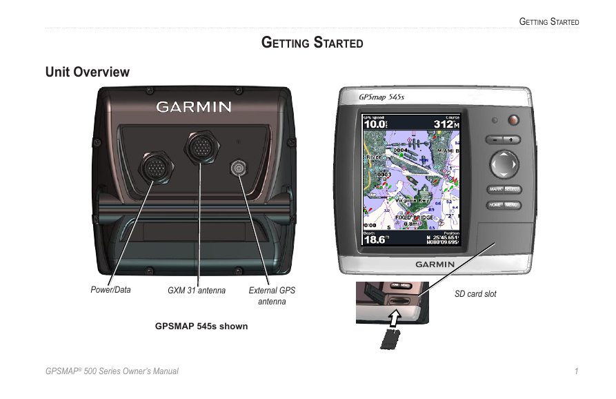
Unit Overview
Power/Data
GXM 3� antenna
External GPS
antenna
GPSMAP 545s shown
SD card slot
GPSMAP® 500 Series Owner’s Manual
�
�
GettInG Started
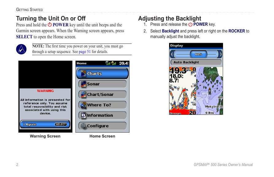
Turning the Unit On or Off
POWER key until the unit beeps and the
Press and hold the
Garmin screen appears. When the Warning screen appears, press
SELECT to open the Home screen.
NOTE: The first time you power on your unit, you must go
through a setup sequence. See page 51 for details.
Adjusting the Backlight
manually adjust the backlight.
1. Press and release the
2. Select Backlight and press left or right on the ROCKER to
POWER key.
Warning Screen
Home Screen
�
GPSMAP® 500 Series Owner’s Manual
�



 2023年江西萍乡中考道德与法治真题及答案.doc
 2012年重庆南川中考生物真题及答案.doc
 2013年江西师范大学地理学综合及文艺理论基础考研真题.doc
 2020年四川甘孜小升初语文真题及答案I卷.doc
 2020年注册岩土工程师专业基础考试真题及答案.doc
 2023-2024学年福建省厦门市九年级上学期数学月考试题及答案.doc
 2021-2022学年辽宁省沈阳市大东区九年级上学期语文期末试题及答案.doc
 2022-2023学年北京东城区初三第一学期物理期末试卷及答案.doc
 2018上半年江西教师资格初中地理学科知识与教学能力真题及答案.doc
 2012年河北国家公务员申论考试真题及答案-省级.doc
 2020-2021学年江苏省扬州市江都区邵樊片九年级上学期数学第一次质量检测试题及答案.doc
 2022下半年黑龙江教师资格证中学综合素质真题及答案.doc