logo资料库

麦哲伦 GPS导航设备-MobileMapper Office说明书.pdf

第1页 / 共150页
第2页 / 共150页
第3页 / 共150页
第4页 / 共150页
第5页 / 共150页
第6页 / 共150页
第7页 / 共150页
第8页 / 共150页
资料共150页,剩余部分请下载后查看
1. Introduction
2. Installing MobileMapper Office
3. Launching MobileMapper Office
4. MobileMapper Office Main Window
5. Map Display Area
Controlling the Content of the Map Display Area
Making Measurements on the Map Display Area
Step-by-Step Procedure
Units Used by the Measurement Tool
What the Tool Actually Measures
GPS Position Display Filter
6. Working on Job Files
Creating a New Job
Importing GIS Data Into a Job File
Step-by-Step Procedure
About Imported Formats
What if GIS Data Import Fails
Importing Files with Compatible Feature Libraries
Connecting the Handheld to the PC
Using the USB Port (ProMark3 Only)
Using the Serial Port
Uploading a Job to the Handheld
Uploading an Entire Job
Uploading Part of a Job (Job Region)
Saving/Cutting a Job Region
Downloading a Completed Job from the Handheld
Downloading a job file
Deleting a file from the handheld
Viewing/Analyzing the Content of a Job
Using the Point Feature’s “Updated” Field
Opening Several Jobs at a Time
Individual Points in Line or Area Features
Deleting Features
Deleting Feature Types
Exporting Jobs in GIS Formats
7. Using the Feature Library Editor
Introduction
Creating a New, Standalone Feature Library File
Inserting New Feature Types to the Feature Library
Defining Feature Attributes
Defining Menu-Style Attribute Values
Defining Numeric-Style Attribute Values
Defining Text-Style Attribute Values
Choosing the Attribute Used as a Label
Renaming a Feature Type or an Attribute
Defining the Representation of Feature Type
Deleting Feature Types, Attributes or Attribute Values
Saving a Feature Library
Attaching a Feature Library to a Job
Importing a Feature Library from a Job or GIS File
Uploading a Standalone Feature Library File to the Receiver
8. Grid Mapping Utility
Introduction
Grid Features vs. Grid Points
Setting up a Grid Feature in a Feature Library file
Editing the Grid Properties
Uploading the Grid Feature to the Receiver
9. Using the Waypoint/Route Editor
Introduction
Placing Waypoints
Creating Waypoints from the Waypoint Table
Saving Waypoints
Finding a Waypoint on the Map
Editing/Deleting Waypoints
Building a Route
Saving Routes
Uploading Waypoints/Routes to the Receiver
Downloading Waypoints/Routes
10. Background Maps
Introduction
Creating a Vector Background Map
First Steps
Adding Layers to a Vector Map Project
Changing the Order of Layers
Removing Layers
Changing the Visual Aspect of Layers
Building the Vector Background Map
Creating a Raster Background Map
First Steps
Adding/Removing Raster Data To/From a Raster Map Project
Georeferencing Images
Building the Raster Background Map
Defining the Background Displayed in MobileMapper Office
Which Scale to Use to Display a Vector Background Map?
Setting a Map Region
Uploading Whole or Part of the Background
11. Coordinate System
Introduction to Coordinate Systems and Datums
Defining Coordinate Systems in MobileMapper Office
Selecting a Coordinate System for the Open Job
Creating a Projected System
Defining the Datum
Defining the Projection
Defining the System
Creating a Geographic System
Creating a Geocentric System
Managing Coordinate Systems
12. Print Function
13. Save Map function
14. Post-Processing
Field Receiver (Handheld)
Basics of Post-Processed Differential Correction
Field Implementation
System Requirements
Timing Requirement
Where to Install the Reference
Accuracy Vs. Distance Between Reference and Rover
Downloading GPS Measurements Files to MobileMapper Office
Post-Processing Phase
Description of the Differential Correction Window
Working with Several Reference Files
GPS Position Display Filter
Downloading RINEX Data via the Internet
Introduction
Adding a New Provider
15. Appendices
Importing Waypoints into MobileMapper Office
Importing a text file (*.txt)
Importing an Excel file (*.xls)
Naming Conventions for Rover and Reference Files (Post-Processing Option)
Defining a User Map Datum
Da and Df of Frequently Used Datums
Shortcut Keys
Example of Adding a New Provider of Reference Station Data
Mission Planning Utility
Glossary
Index
MobileMapper™Office User Manual
EXCEPT AS SET FORTH IN THIS LIMITED WARRANTY, ALL OTHER EXPRESSED OR IMPLIED WARRANTIES, INCLUDING THOSE OF FITNESS FOR ANY PARTICULAR PURPOSE, MERCHANTABILITY OR NON- INFRINGEMENT, ARE HEREBY DISCLAIMED AND IF APPLICABLE, IMPLIED WARRANTIES UNDER ARTICLE 35 OF THE UNITED NATIONS CONVENTION ON CONTRACTS FOR THE INTERNATIONAL SALE OF GOODS. Some national, state, or local laws do not allow limitations on implied warranty or how long an implied warranty lasts, so the above limitation may not apply to you. The following are excluded from the warranty coverage: (1) periodic maintenance and repair or replacement of parts due to normal wear and tear; (2) batteries and finishes; (3) installations or defects resulting from installation; (4) any damage caused by (i) shipping, misuse, abuse, negligence, tampering, or improper use; (ii) disasters such as fire, flood, wind, and lightning; (iii) unauthorized attachments or modification; (5) service performed or attempted by anyone other than an authorized Magellan Navigations Service Center; (6) any product, components or parts not manufactured by Magellan Navigation; (7) that the receiver will be free from any claim for infringement of any patent, trademark, copyright or other proprietary right, including trade secrets; and (8) any damage due to accident, resulting from inaccurate satellite transmissions. Inaccurate transmissions can occur due to changes in the position, health or geometry of a satellite or modifications to the receiver that may be required due to any change in the GPS. (Note: Magellan Navigation GPS receivers use GPS or GPS+GLONASS to obtain position, velocity and time information. GPS is operated by the U.S. Government and GLONASS is the Global Navigation Satellite System of the Russian Federation, which are solely responsible for the accuracy and maintenance of their systems. Certain conditions can cause inaccuracies which could require modifications to the receiver. Examples of such conditions include but are not limited to changes in the GPS or GLONASS transmission.) Opening, dismantling or repairing of this product by anyone other than an authorized Magellan Navigation Service Center will void this warranty. MAGELLAN NAVIGATION SHALL NOT BE LIABLE TO PURCHASER OR ANY OTHER PERSON FOR ANY INCIDENTAL OR CONSEQUENTIAL DAMAGES WHATSOEVER, INCLUDING BUT NOT LIMITED TO LOST PROFITS, DAMAGES RESULTING FROM DELAY OR LOSS OF USE, LOSS OF OR DAMAGES ARISING OUT OF BREACH OF THIS WARRANTY OR ANY IMPLIED WARRANTY EVEN THOUGH CAUSED BY NEGLIGENCE OR OTHER FAULT OF MAGELLAN NAVIGATION OR NEGLIGENT USAGE OF THE PRODUCT. IN NO EVENT WILL MAGELLAN NAVIGATION BE RESPONSIBLE FOR SUCH DAMAGES, EVEN IF MAGELLAN NAVIGATION HAS BEEN ADVISED OF THE POSSIBILITY OF SUCH DAMAGES. Copyright Notice ©2005-2006 Magellan Navigation, Inc. All rights reserved. Trademarks All product and brand names mentioned in this publication are trademarks of their respective holders. MAGELLAN NAVIGATION PROFESSIONAL PRODUCTS - LIMITED WARRANTY (North, Central and South America) Magellan Navigation warrants their GPS receivers and hardware accessories to be free of defects in material and workmanship and will conform to our published specifications for the product for a period of one year from the date of original purchase. THIS WARRANTY APPLIES ONLY TO THE ORIGINAL PURCHASER OF THIS PRODUCT. In the event of a defect, Magellan Navigation will, at its option, repair or replace the hardware product with no charge to the purchaser for parts or labor. The repaired or replaced product will be warranted for 90 days from the date of return shipment, or for the balance of the original warranty, whichever is longer. Magellan Navigation warrants that software products or software included in hardware products will be free from defects in the media for a period of 30 days from the date of shipment and will substantially conform to the then-current user documentation provided with the software (including updates thereto). Magellan Navigation's sole obligation shall be the correction or replacement of the media or the software so that it will substantially conform to the then- current user documentation. Magellan Navigation does not warrant the software will meet purchaser's requirements or that its operation will be uninterrupted, error-free or virus-free. Purchaser assumes the entire risk of using the software. PURCHASER'S EXCLUSIVE REMEDY UNDER THIS WRITTEN WARRANTY OR ANY IMPLIED WARRANTY SHALL BE LIMITED TO THE REPAIR OR REPLACEMENT, AT MAGELLAN NAVIGATION'S OPTION, OF ANY DEFECTIVE PART OF THE RECEIVER OR ACCESSORIES WHICH ARE COVERED BY THIS WARRANTY. REPAIRS UNDER THIS WARRANTY SHALL ONLY BE MADE AT AN AUTHORIZED MAGELLAN NAVIGATION SERVICE CENTER. ANY REPAIRS BY A SERVICE CENTER NOT AUTHORIZED BY MAGELLAN NAVIGATION WILL VOID THIS WARRANTY. To obtain warranty service the purchaser must obtain a Return Materials Authorization (RMA) number prior to shipping by calling 800-229-2400, option 1 (U.S.) or 408-615-3981 (International), or by submitting a repair request on-line at http://professional.magellangps.com/ en/support/rma.asp. The purchaser must return the product postpaid with a copy of the original sales receipt to the address provided by Magellan Navigation with the RMA number. Purchaser's return address and the RMA number must be clearly printed on the outside of the package. Magellan Navigation reserves the right to refuse to provide service free-of-charge if the sales receipt is not provided or if the information contained in it is incomplete or illegible or if the serial number is altered or removed. Magellan Navigation will not be responsible for any losses or damage to the product incurred while the product is in transit or is being shipped for repair. Insurance is recommended. Magellan Navigation suggests using a trackable shipping method such as UPS or FedEx when returning a product for service. II
This written warranty is the complete, final and exclusive agreement between Magellan Navigation and the purchaser with respect to the quality of performance of the goods and any and all warranties and representations. This warranty sets forth all of Magellan Navigation's responsibilities regarding this product. This limited warranty is governed by the laws of the State of California, without reference to its conflict of law provisions or the U.N. Convention on Contracts for the International Sale of Goods, and shall benefit Magellan Navigation, its successors and assigns. This warranty gives the purchaser specific rights. The purchaser may have other rights which vary from locality to locality (including Directive 1999/44/EC in the EC Member States) and certain limitations contained in this warranty, including the exclusion or limitation of incidental or consequential damages may not apply. For further information concerning this limited warranty, please call or write: Magellan Navigation, Inc., 960 Overland Court, San Dimas, CA 91773, Phone: +1 909-394-5000, Fax: +1 909-394-7050 or Magellan Navigation SA - ZAC La Fleuriaye - BP 433 - 44474 Carquefou Cedex - France Phone: +33 (0)2 28 09 38 00, Fax: +33 (0)2 28 09 39 39 MAGELLAN NAVIGATION PROFESSIONAL PRODUCTS LIMITED WARRANTY (Europe, Middle East, Africa) All Magellan Navigation global positioning system (GPS) receivers are navigation aids, and are not intended to replace other methods of navigation. Purchaser is advised to perform careful position charting and use good judgment. READ THE USER GUIDE CAREFULLY BEFORE USING THE PRODUCT. 1. MAGELLAN NAVIGATION WARRANTY Magellan Navigation warrants their GPS receivers and hardware accessories to be free of defects in material and workmanship and will conform to our published specifications for the product for a period of one year from the date of original purchase or such longer period as required by law. THIS WARRANTY APPLIES ONLY TO THE ORIGINAL PURCHASER OF THIS PRODUCT. In the event of a defect, Magellan Navigation will, at its option, repair or replace the hardware product with no charge to the purchaser for parts or labor. The repaired or replaced product will be warranted for 90 days from the date of return shipment, or for the balance of the original warranty, whichever is longer. Magellan Navigation warrants that software products or software included in hardware products will be free from defects in the media for a period of 30 days from the date of shipment and will substantially conform to the then-current user documentation provided with the software (including updates thereto). Magellan Navigation's sole obligation shall be the correction or replacement of the media or the software so that it will substantially conform to the then- current user documentation. Magellan Navigation does not warrant the software will meet purchaser's requirements or that its operation will be uninterrupted, error-free or virus-free. Purchaser assumes the entire risk of using the software. 2. PURCHASER'S REMEDY PURCHASER'S EXCLUSIVE REMEDY UNDER THIS WRITTEN WARRANTY OR ANY IMPLIED WARRANTY SHALL BE LIMITED TO THE REPAIR OR REPLACEMENT, AT MAGELLAN NAVIGATION'S OPTION, OF ANY DEFECTIVE PART OF THE RECEIVER OR ACCESSORIES WHICH ARE COVERED BY THIS WARRANTY. REPAIRS UNDER THIS WARRANTY SHALL ONLY BE MADE AT AN AUTHORIZED MAGELLAN NAVIGATION SERVICE CENTER. ANY REPAIRS BY A SERVICE CENTER NOT AUTHORIZED BY MAGELLAN NAVIGATION WILL VOID THIS WARRANTY. 3. PURCHASER'S DUTIES To obtain service, contact and return the product with a copy of the original sales receipt to the dealer from whom you purchased the product. Magellan Navigation reserves the right to refuse to provide service free-of-charge if the sales receipt is not provided or if the information contained in it is incomplete or illegible or if the serial number is altered or removed. Magellan Navigation will not be responsible for any losses or damage to the product incurred while the product is in transit or is being shipped for repair. Insurance is recommended. Magellan Navigation suggests using a trackable shipping method such as UPS or FedEx when returning a product for service. 4. LIMITATION OF IMPLIED WARRANTIES EXCEPT AS SET FORTH IN ITEM 1 ABOVE, ALL OTHER EXPRESSED OR IMPLIED WARRANTIES, INCLUDING THOSE OF FITNESS FOR ANY PARTICULAR PURPOSE OR MERCHANTABILITY, ARE HEREBY DISCLAIMED AND IF APPLICABLE, IMPLIED WARRANTIES UNDER ARTICLE 35 OF THE UNITED NATIONS CONVENTION ON CONTRACTS FOR THE INTERNATIONAL SALE OF GOODS. Some national, state, or local laws do not allow limitations on implied warranty or how long an implied warranty lasts, so the above limitation may not apply to you. 5. EXCLUSIONS The following are excluded from the warranty coverage: (1) periodic maintenance and repair or replacement of parts due to normal wear and tear; (2) batteries; (3) finishes; (4) installations or defects resulting from installation; (5) any damage caused by (i) shipping, misuse, abuse, negligence, tampering, or improper use; (ii) disasters such as fire, flood, wind, and lightning; (iii) unauthorized attachments or modification; (6) service performed or attempted by anyone other than an authorized Magellan Navigations Service Center; (7) any product, components or parts not manufactured by Magellan Navigation, (8) that the receiver will be free from any claim for infringement of any patent, trademark, copyright or other proprietary right, including trade secrets (9) any damage due to accident, resulting from inaccurate satellite transmissions. Inaccurate transmissions can occur due to changes in the position, health or geometry of a satellite or modifications to the receiver that may be required due to any change in the GPS. (Note: Magellan Navigation GPS receivers use GPS or GPS+GLONASS to obtain position, velocity and time information. GPS is operated by the U.S. Government and GLONASS is the Global Navigation Satellite System of the Russian Federation, which are solely responsible for the accuracy III
IV
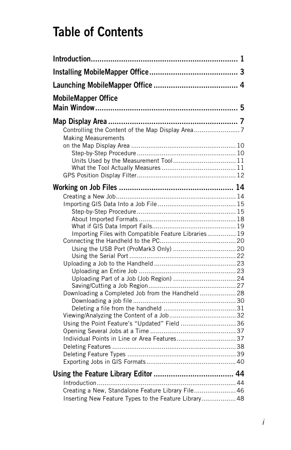
Table of Contents Introduction.................................................................... 1 Installing MobileMapper Office......................................... 3 Launching MobileMapper Office ....................................... 4 MobileMapper Office Main Window.................................................................. 5 Map Display Area ............................................................ 7 Controlling the Content of the Map Display Area........................ 7 Making Measurements on the Map Display Area ....................................................... 10 Step-by-Step Procedure .................................................... 10 Units Used by the Measurement Tool................................. 11 What the Tool Actually Measures ....................................... 11 GPS Position Display Filter.................................................... 12 Working on Job Files ..................................................... 14 Creating a New Job............................................................... 14 Importing GIS Data Into a Job File ......................................... 15 Step-by-Step Procedure .................................................... 15 About Imported Formats ................................................... 18 What if GIS Data Import Fails............................................ 19 Importing Files with Compatible Feature Libraries ............... 19 Connecting the Handheld to the PC........................................ 20 Using the USB Port (ProMark3 Only) ................................. 20 Using the Serial Port ........................................................ 22 Uploading a Job to the Handheld ........................................... 23 Uploading an Entire Job ................................................... 23 Uploading Part of a Job (Job Region) ................................. 24 Saving/Cutting a Job Region.............................................. 27 Downloading a Completed Job from the Handheld ................... 28 Downloading a job file ...................................................... 30 Deleting a file from the handheld ...................................... 31 Viewing/Analyzing the Content of a Job................................... 32 Using the Point Feature’s “Updated” Field ............................. 36 Opening Several Jobs at a Time ............................................. 37 Individual Points in Line or Area Features............................... 37 Deleting Features ................................................................. 38 Deleting Feature Types ......................................................... 39 Exporting Jobs in GIS Formats ............................................... 40 Using the Feature Library Editor ..................................... 44 Introduction......................................................................... 44 Creating a New, Standalone Feature Library File...................... 46 Inserting New Feature Types to the Feature Library.................. 48 i
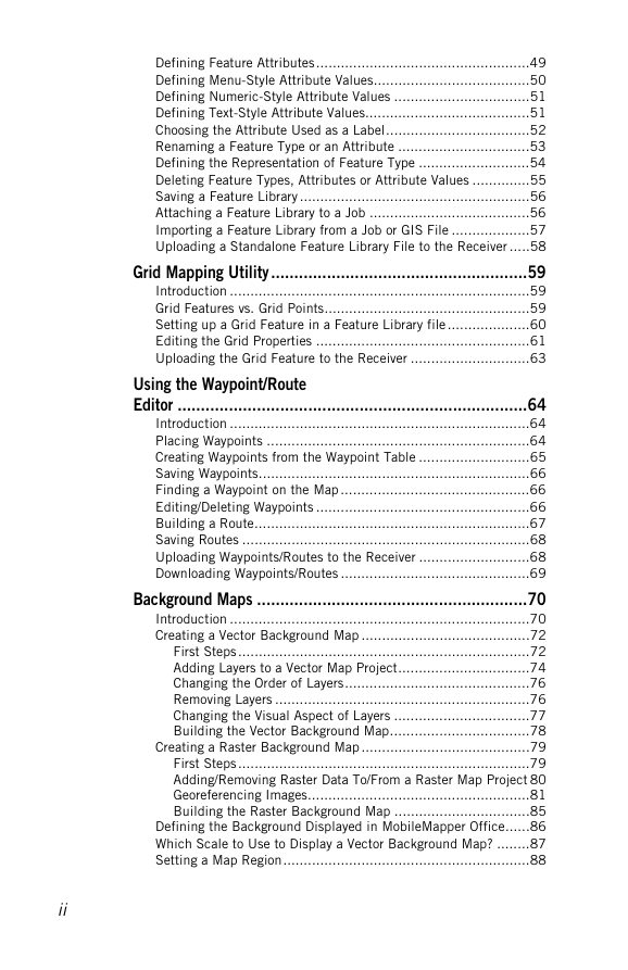
Defining Feature Attributes....................................................49 Defining Menu-Style Attribute Values......................................50 Defining Numeric-Style Attribute Values .................................51 Defining Text-Style Attribute Values........................................51 Choosing the Attribute Used as a Label...................................52 Renaming a Feature Type or an Attribute ................................53 Defining the Representation of Feature Type ...........................54 Deleting Feature Types, Attributes or Attribute Values ..............55 Saving a Feature Library ........................................................56 Attaching a Feature Library to a Job .......................................56 Importing a Feature Library from a Job or GIS File ...................57 Uploading a Standalone Feature Library File to the Receiver .....58 Grid Mapping Utility.......................................................59 Introduction .........................................................................59 Grid Features vs. Grid Points..................................................59 Setting up a Grid Feature in a Feature Library file....................60 Editing the Grid Properties ....................................................61 Uploading the Grid Feature to the Receiver .............................63 Using the Waypoint/Route Editor ...........................................................................64 Introduction .........................................................................64 Placing Waypoints ................................................................64 Creating Waypoints from the Waypoint Table ...........................65 Saving Waypoints..................................................................66 Finding a Waypoint on the Map ..............................................66 Editing/Deleting Waypoints ....................................................66 Building a Route...................................................................67 Saving Routes ......................................................................68 Uploading Waypoints/Routes to the Receiver ...........................68 Downloading Waypoints/Routes ..............................................69 Background Maps ..........................................................70 Introduction .........................................................................70 Creating a Vector Background Map .........................................72 First Steps.......................................................................72 Adding Layers to a Vector Map Project................................74 Changing the Order of Layers.............................................76 Removing Layers ..............................................................76 Changing the Visual Aspect of Layers .................................77 Building the Vector Background Map..................................78 Creating a Raster Background Map .........................................79 First Steps.......................................................................79 Adding/Removing Raster Data To/From a Raster Map Project 80 Georeferencing Images......................................................81 Building the Raster Background Map .................................85 Defining the Background Displayed in MobileMapper Office......86 Which Scale to Use to Display a Vector Background Map? ........87 Setting a Map Region............................................................88 ii
Uploading Whole or Part of the Background ............................ 89 Coordinate System ........................................................ 91 Introduction to Coordinate Systems and Datums...................... 91 Defining Coordinate Systems in MobileMapper Office .............. 92 Selecting a Coordinate System for the Open Job...................... 93 Creating a Projected System .................................................. 95 Defining the Datum.......................................................... 95 Defining the Projection..................................................... 97 Defining the System ......................................................... 98 Creating a Geographic System ............................................... 99 Creating a Geocentric System ................................................ 99 Managing Coordinate Systems ............................................... 99 Print Function............................................................. 101 Save Map function ...................................................... 102 Post-Processing .......................................................... 103 Field Receiver (Handheld)................................................... 103 Basics of Post-Processed Differential Correction .................... 103 Field Implementation.......................................................... 105 System Requirements..................................................... 105 Timing Requirement....................................................... 106 Where to Install the Reference ........................................ 107 Accuracy Vs. Distance Between Reference and Rover ........ 108 Downloading GPS Measurements Files to MobileMapper Office109 Post-Processing Phase ........................................................ 111 Description of the Differential Correction Window .................. 115 Working with Several Reference Files ................................... 119 GPS Position Display Filter.................................................. 119 Downloading RINEX Data via the Internet ............................. 119 Introduction .................................................................. 119 Adding a New Provider ................................................... 123 Appendices ................................................................ 126 Importing Waypoints into MobileMapper Office ..................... 126 Importing a text file (*.txt) ..............................................126 Importing an Excel file (*.xls).......................................... 127 Naming Conventions for Rover and Reference Files (Post-Processing Option)........................ 127 Defining a User Map Datum ................................................ 129 ∆a and ∆f of Frequently Used Datums .................................. 130 Shortcut Keys .................................................................... 131 Example of Adding a New Provider of Reference Station Data . 132 Mission Planning Utility ...................................................... 135 Glossary ..................................................................... 136 Index ......................................................................... 139 iii
iv
分享到:
收藏