Owner’s Manual
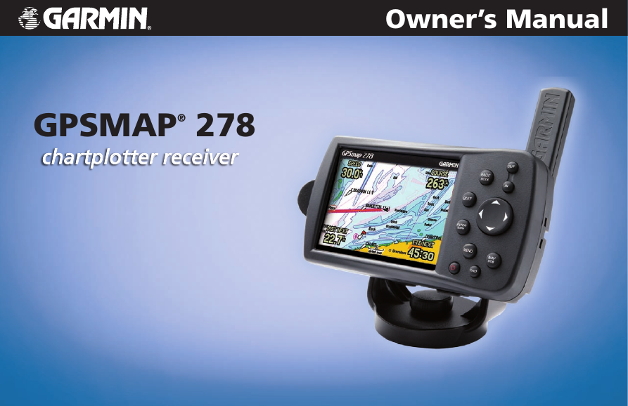
GPSMAP® 278
chartplotter receiver
�
© 2009 Garmin Ltd. or its subsidiaries
Garmin International, Inc.
1200 East 151st Street,
Olathe, Kansas 66062, USA
Tel. (913) 397.8200 or (800) 800.1020
Fax (913) 397.8282
Garmin (Europe) Ltd.
Liberty House
Hounsdown Business Park,
Southampton, Hampshire, SO40 9RB UK
Tel. +44 (0) 870.8501241 (outside the UK)
0808 2380000 (within the UK)
Fax +44 (0) 870.8501251
Garmin Corporation
No. 68, Jangshu 2nd Road,
Shijr, Taipei County, Taiwan
Tel. 886/2.2642.9199
Fax 886/2.2642.9099
All rights reserved. Except as expressly provided herein, no part of this manual may be reproduced, copied, transmitted, disseminated, downloaded, or stored in any storage
medium, for any purpose without the express prior written consent of Garmin. Garmin hereby grants permission to download a single copy of this manual onto a hard drive
or other electronic storage medium to be viewed and to print one copy of this manual or of any revision hereto, provided that such electronic or printed copy of this manual
must contain the complete text of this copyright notice and provided further that any unauthorized commercial distribution of this manual or any revision hereto is strictly
prohibited.
Information in this document is subject to change without notice. Garmin reserves the right to change or improve its products and to make changes in the content without
obligation to notify any person or organization of such changes or improvements. Visit the Garmin Web site (www.garmin.com) for current updates and supplemental
information concerning the use and operation of this and other Garmin products.
Garmin®, the Garmin logo, GPSMAP®, AutoLocate®, TracBack®, BlueChart®, City Navigator®, MapSource®, and See-Thru® are trademarks of Garmin Ltd. or its
subsidiaries, registered in the USA and other countries. These trademarks may not be used without the express permission of Garmin.
January 2009
Part Number 190-00691-00 Rev. B
Printed in Taiwan
�
IntroductIon
Thank you for choosing the Garmin® GPSMAP® 278, which uses
the proven performance of Garmin GPS and full-featured mapping
to create an unsurpassed portable marine navigation chartplotter
and automobile navigation device. Take a moment to compare
the contents of this package with the packing list on the outside
of the box; if any pieces are missing, contact your Garmin dealer
immediately.
About This Manual
To get the most out of your new navigation system, read this manual
and learn the operating procedures for your unit. This manual is
organized into the following sections:
The Introduction contains the Table of Contents, Care Information,
Warnings and Cautions.
The Getting Started section provides an overview of the unit, how
to turn the unit on, and how to simulate navigation.
The Marine Mode section provides you with information about
navigating with the GPSMAP 278 in Marine Mode.
The Marine Mode Pages section reviews the main pages in Marine
Mode.
IntroductIon > About thIs MAnuAl
The Automotive Mode section provides you with information about
navigating with the GPSMAP 278 in Automotive Mode.
The Automotive Mode Pages section reviews, in detail, the main
pages and features in Automotive Mode, such as the Trip Data Page
and creating waypoints.
The Main Menu section describes features found on the Main
Menu, and information on how to change settings.
The Using Sonar section provides instructions on using a Garmin
GSD 20 or GSD 21 sounder with your GPSMAP 278.
The Appendix contains specifications, optional accessories,
maintenance information, and other product information.
An Index is provided at the end of the manual for reference.
Manual Conventions
This manual uses the term Warning to indicate a
potentially hazardous situation, which, if not avoided,
could result in death or serious injury.
This manual uses the term Caution to indicate a potentially
hazardous situation, which, if not avoided, may result
in minor injury or property damage. It may also be used
without the symbol to alert you to avoid unsafe practices.
GPSMAP 278 Owner’s Manual
�
�
IntroductIon > tAble of contents
table of contents
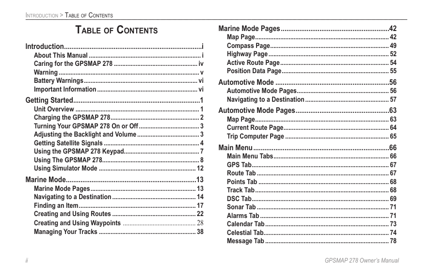
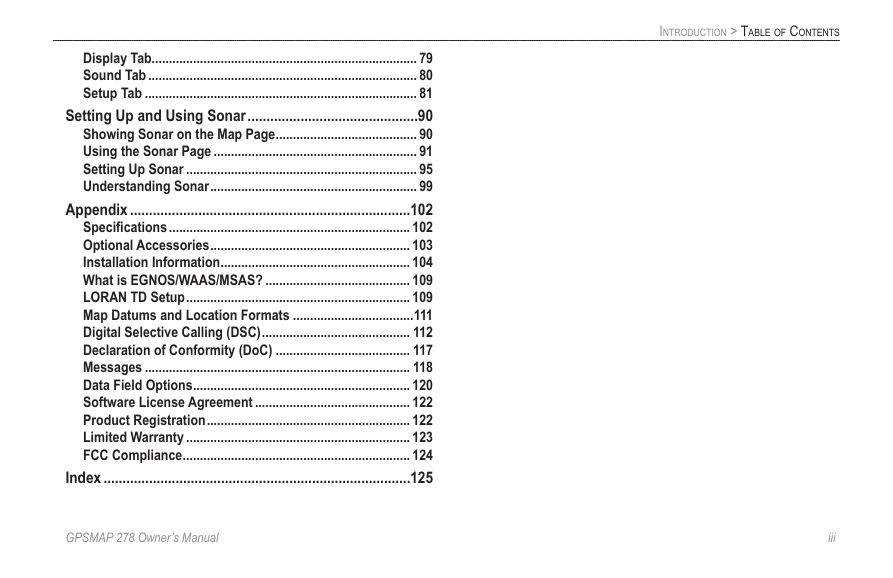
Introduction ...........................................................................i
About This Manual ................................................................... i
Caring for the GPSMAP 278 .................................................. iv
Warning .................................................................................... v
Battery Warnings .................................................................... vi
Important Information ............................................................ vi
Getting Started .....................................................................1
Unit Overview .......................................................................... 1
Charging the GPSMAP 278 ..................................................... 2
Turning Your GPSMAP 278 On or Off .................................... 3
Adjusting the Backlight and Volume ..................................... 3
Getting Satellite Signals ......................................................... 4
Using the GPSMAP 278 Keypad............................................. 7
Using The GPSMAP 278.......................................................... 8
Using Simulator Mode .......................................................... 12
Marine Mode .......................................................................13
Marine Mode Pages ............................................................... 13
Navigating to a Destination .................................................. 14
Finding an Item ...................................................................... 17
Creating and Using Routes .................................................. 22
Creating and Using Waypoints ............................................ 28
Managing Your Tracks .......................................................... 38
Marine Mode Pages ...........................................................42
Map Page ................................................................................ 42
Compass Page ....................................................................... 49
Highway Page ........................................................................ 52
Active Route Page ................................................................. 54
Position Data Page ................................................................ 55
Automotive Mode ..............................................................56
Automotive Mode Pages ....................................................... 56
Navigating to a Destination .................................................. 57
Automotive Mode Pages ...................................................63
Map Page ................................................................................ 63
Current Route Page ............................................................... 64
Trip Computer Page .............................................................. 65
Main Menu ..........................................................................66
Main Menu Tabs ..................................................................... 66
GPS Tab .................................................................................. 67
Route Tab ............................................................................... 67
Points Tab .............................................................................. 68
Track Tab ................................................................................ 68
DSC Tab .................................................................................. 69
Sonar Tab ............................................................................... 71
Alarms Tab ............................................................................. 71
Calendar Tab .......................................................................... 73
Celestial Tab........................................................................... 74
Message Tab .......................................................................... 78
��
GPSMAP 278 Owner’s Manual
�
IntroductIon > tAble of contents
Display Tab............................................................................. 79
Sound Tab .............................................................................. 80
Setup Tab ............................................................................... 81
Setting Up and Using Sonar .............................................90
Showing Sonar on the Map Page ......................................... 90
Using the Sonar Page ........................................................... 91
Setting Up Sonar ................................................................... 95
Understanding Sonar ............................................................ 99
Appendix ..........................................................................102
Specifications ...................................................................... 102
Optional Accessories .......................................................... 103
Installation Information ....................................................... 104
What is EGNOS/WAAS/MSAS? .......................................... 109
LORAN TD Setup ................................................................. 109
Map Datums and Location Formats ...................................111
Digital Selective Calling (DSC) ........................................... 112
Declaration of Conformity (DoC) ....................................... 117
Messages ............................................................................. 118
Data Field Options ............................................................... 120
Software License Agreement ............................................. 122
Product Registration ........................................................... 122
Limited Warranty ................................................................. 123
FCC Compliance .................................................................. 124
Index .................................................................................125
GPSMAP 278 Owner’s Manual
���
�
IntroductIon > cArIng for the gPsMAP 278
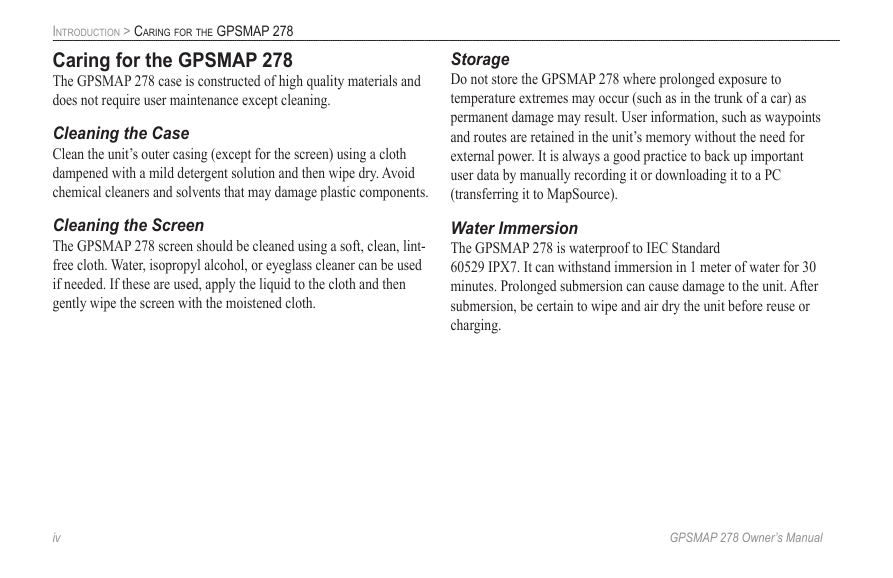
Caring for the GPSMAP 278
The GPSMAP 278 case is constructed of high quality materials and
does not require user maintenance except cleaning.
Cleaning the Case
Clean the unit’s outer casing (except for the screen) using a cloth
dampened with a mild detergent solution and then wipe dry. Avoid
chemical cleaners and solvents that may damage plastic components.
Cleaning the Screen
The GPSMAP 278 screen should be cleaned using a soft, clean, lint-
free cloth. Water, isopropyl alcohol, or eyeglass cleaner can be used
if needed. If these are used, apply the liquid to the cloth and then
gently wipe the screen with the moistened cloth.
Storage
Do not store the GPSMAP 278 where prolonged exposure to
temperature extremes may occur (such as in the trunk of a car) as
permanent damage may result. User information, such as waypoints
and routes are retained in the unit’s memory without the need for
external power. It is always a good practice to back up important
user data by manually recording it or downloading it to a PC
(transferring it to MapSource).
Water Immersion
The GPSMAP 278 is waterproof to IEC Standard
60529 IPX7. It can withstand immersion in 1 meter of water for 30
minutes. Prolonged submersion can cause damage to the unit. After
submersion, be certain to wipe and air dry the unit before reuse or
charging.
�v
GPSMAP 278 Owner’s Manual
�
IntroductIon > WArnIng
Warning
Failure to avoid the following potentially hazardous situations could
result in an accident or collision resulting in death or serious injury.
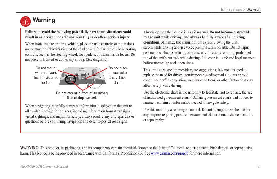
When installing the unit in a vehicle, place the unit securely so that it does
not obstruct the driver’s view of the road or interfere with vehicle operating
controls, such as the steering wheel, foot pedals, or transmission levers. Do
not place in front of or above any airbag. (See diagram.)
Do not mount
where driver’s
field of vision is
blocked.
Do not place
unsecured on
the vehicle
dash.
Do not mount in front of an airbag
field of deployment.
When navigating, carefully compare information displayed on the unit to
all available navigation sources, including information from street signs,
visual sightings, and maps. For safety, always resolve any discrepancies or
questions before continuing navigation and defer to posted road signs.
Always operate the vehicle in a safe manner. Do not become distracted
by the unit while driving, and always be fully aware of all driving
conditions. Minimize the amount of time spent viewing the unit’s
screen while driving and use voice prompts when possible. Do not input
destinations, change settings, or access any functions requiring prolonged
use of the unit’s controls while driving. Pull over in a safe and legal manner
before attempting such operations.
This unit is designed to provide route suggestions. It is not designed to
replace the need for driver attentiveness regarding road closures or road
conditions, traffic congestion, weather conditions, or other factors that may
affect safety while driving.
Use the electronic chart in the unit only to facilitate, not to replace, the use
of authorized government charts. Official government charts and notices to
mariners contain all information needed to navigate safely.
Use this unit only as a navigational aid. Do not attempt to use the unit for
any purpose requiring precise measurement of direction, distance, location,
or topography.
WARNING: This product, its packaging, and its components contain chemicals known to the State of California to cause cancer, birth defects, or reproductive
harm. This Notice is being provided in accordance with California’s Proposition 65. See www.garmin.com/prop65 for more information.
GPSMAP 278 Owner’s Manual
v
�
IntroductIon > WArnIng
Battery Warnings
If these guidelines are not followed, the internal lithium-ion battery may
experience a shortened life span or may present a risk of damage to the GPS
unit, fire, chemical burn, electrolyte leak, and/or injury.
• Do not leave the unit exposed to a heat source or in a high temperature
location, such as in the sun in an unattended vehicle. To prevent
damage, remove the unit from the vehicle or store it out of direct
sunlight, such as in the glove box.
• Do not puncture or incinerate.
• When storing the unit for an extended time, store within the following
temperature range: 32° to 77°F (0° to 25°C).
• Do not operate the unit outside of the following temperature range: -4°
to 131°F (-20° to 55°C).
• Contact your local waste disposal department to properly recycle/
dispose of the unit/battery.
Additional User-Replaceable Battery Warnings:
• Do not use a sharp object to remove the battery.
• Keep the battery away from children.
• Do not disassemble, puncture, or damage the battery.
•
If using an external battery charger, only use the Garmin accessory
approved for your product.
• Only replace the battery with the correct replacement battery. Using
another battery presents a risk of fire or explosion. To purchase a
replacement battery, see your Garmin dealer or the Garmin Web site.
Important Information
MAP DATA INFORMATION: One of the goals of Garmin is to provide
customers with the most complete and accurate cartography that is available
to us at a reasonable cost. We use a combination of governmental and private
data sources, which we identify in product literature and copyright messages
displayed to the consumer. Virtually all data sources contain some inaccurate or
incomplete data. In some countries, complete and accurate map information is
either not available or is prohibitively expensive.
NOTICE REGARDING WINDSHIELD MOUNTING; SPECIAL
NOTICE TO DRIVERS IN CALIFORNIA AND MINNESOTA: State
law prohibits drivers in California and Minnesota from using suction mounts
on their windshields while operating motor vehicles. Check your state and
local laws and ordinances for similar restrictions. Other Garmin dashboard
or friction mounting options should be used. Garmin does not take any
responsibility for any fines, penalties, or damages that may be incurred as a
result of disregarding this notice or as a result of any other state or local law
or ordinance relating to use of the unit. (See California Vehicle Code Section
26708(a); Minnesota Statutes 2005, Section 169.71.)
The California Electronic Waste Recycling Act of 2003 requires the
recycling of certain electronics. For more information on the applicability to
this product, see www.erecycle.org.
v�
GPSMAP 278 Owner’s Manual
�


 2023年江西萍乡中考道德与法治真题及答案.doc
 2012年重庆南川中考生物真题及答案.doc
 2013年江西师范大学地理学综合及文艺理论基础考研真题.doc
 2020年四川甘孜小升初语文真题及答案I卷.doc
 2020年注册岩土工程师专业基础考试真题及答案.doc
 2023-2024学年福建省厦门市九年级上学期数学月考试题及答案.doc
 2021-2022学年辽宁省沈阳市大东区九年级上学期语文期末试题及答案.doc
 2022-2023学年北京东城区初三第一学期物理期末试卷及答案.doc
 2018上半年江西教师资格初中地理学科知识与教学能力真题及答案.doc
 2012年河北国家公务员申论考试真题及答案-省级.doc
 2020-2021学年江苏省扬州市江都区邵樊片九年级上学期数学第一次质量检测试题及答案.doc
 2022下半年黑龙江教师资格证中学综合素质真题及答案.doc