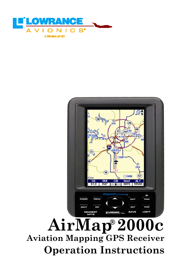
AirMap 2000c
Aviation Mapping GPS Receiver
Operation Instructions
�
Copyright © 2004 Lowrance Electronics, Inc.
All rights reserved.
No part of this manual may be copied, reproduced, republished, trans-
mitted, distributed, downloaded or stored in any storage medium, for
any purpose, without prior written consent of Lowrance Electronics.
Any unauthorized commercial distribution of this manual is
strictly prohibited.
AirMap, Lowrance Avionics and Lowrance are all registered trade-
marks of Lowrance Electronics, Inc. MapCreate is a trademark of LEI.
Jeppesen is a registered trademark of Jeppesen Sanderson, Inc.
Navionics is a registered trademark of Navionics, Inc.
DURACELL is a registered trademark of Duracell, Inc.
RAYOVAC is a registered trademark of Rayovac Corporation.
Points of Interest Data in this unit are by infoUSA,
copyright 2001-2004, All Rights Reserved. infoUSA is a
trademark of infoUSA, Inc.
eXitSource Database, copyright 2001-2003 Zenrin Co.
Ltd. Exit Authority and eXitSource are trademarks of
Zenrin Co. Ltd.
All features and specifications subject to change without notice. All
screens in this manual are simulated.
For free owner's manuals and the most current information on
this product, it's operation and accessories, visit our web site:
www.lowrance.com
Lowrance Electronics Inc.
12000 E. Skelly Dr.
Tulsa, OK USA 74128-2486
Printed in USA.
�
Table of Contents
Sec. 1: Read Me First! ............................................................... 1
Capabilities and Specifications .................................................... 3
How AirMap
Works .................................................................... 5
Introduction to GPS and WAAS................................................... 7
How to Use this Manual: Typographical Conventions................ 9
Sec. 2: Installation & Accessories ........................................ 11
Power ........................................................................................... 11
Emergency Backup Batteries..................................................... 11
Cigarette Lighter Power Adapter .............................................. 13
MMC or SD Memory Card Installation ..................................... 13
External Active Antenna ............................................................ 14
R-A-M
Bracket Mounting System ............................................ 16
Protective Bag ............................................................................. 17
Protective Cover.......................................................................... 18
Sec. 3: Aviation Operation..................................................... 19
Keypad......................................................................................... 19
Power/Lights (Turn Unit On and Off) ....................................... 20
Main Menu .................................................................................. 20
Pages ........................................................................................... 22
Satellite Status Page .............................................................. 23
Navigation Page ...................................................................... 25
Compass Rose with HSI and OBS Hold............................. 26
Map Page ................................................................................. 31
Aviation GPS Quick Reference ............................................ 39
Find your Current Position ........................................................ 40
Moving around the Map: Zoom & Cursor Arrow Keys.............. 40
Selecting any Map Item with the Cursor .................................. 41
Searching..................................................................................... 42
Find Nearest Airport (Shortcut) ................................................ 44
Navigating to Nearest Airport with the AirMap....................... 44
Setting a Waypoint ..................................................................... 45
Navigate Back to a Waypoint..................................................... 45
Navigate to Cursor Position on Map.......................................... 46
Navigate to a Point of Interest................................................... 47
Go "Direct to" (Using the Direct to Button)............................... 47
Airspace Status ........................................................................... 48
Airport Information .................................................................... 48
Runways .................................................................................. 49
Runway Approach Guidance Feature .................................... 50
Services.................................................................................... 51
Transfer Custom Maps and GPS Data Files ............................. 52
Switch to Land Mode .................................................................. 54
i
�
Switch Back to Aviation Mode from Land Mode ................... 54
Aviation Calculators ................................................................... 54
E6B Altitude/Airspeed Calculator.......................................... 54
E6B Wind Speed/Direction Calculator................................... 55
Vertical Navigation Calculator .............................................. 56
Sec. 4: Land Operation ........................................................... 57
Keypad......................................................................................... 57
Power/Lights (Turn Unit On and Off) ....................................... 58
Main Menu .................................................................................. 58
Pages ........................................................................................... 58
Satellite Status Page .............................................................. 59
Navigation Page ...................................................................... 59
Map Page ................................................................................. 60
Moving around the Map: Zoom & Cursor Arrow Keys.............. 61
Find Distance from Current Position to Another Location ...... 61
Find Distance from Point to Point ......................................... 62
Find your Current Position ........................................................ 62
Icons............................................................................................. 63
Create Icon on Map................................................................. 63
Create Icon at Current Position ............................................. 63
Delete an Icon ......................................................................... 64
Load GPS Data Files from an MMC .......................................... 64
Navigate ...................................................................................... 65
Navigate Back to Man Overboard Waypoint......................... 65
Cancel Navigation................................................................... 65
Navigate a Route..................................................................... 65
Navigate to Cursor Position on Map ...................................... 65
Navigate to an Icon ................................................................. 66
Navigate to Point of Interest (POI) ........................................ 66
Navigate to a Waypoint .......................................................... 66
Navigate a Trail ...................................................................... 66
Backtrack a Trail .................................................................... 68
Routes.......................................................................................... 68
Create and Save a Route ........................................................ 68
Delete a Route ......................................................................... 71
Save GPS Data Files to an MMC ............................................... 71
Searching..................................................................................... 72
Switch to Aviation Mode............................................................. 74
Switch Back to Land Mode from Aviation Mode ................... 74
Trails ........................................................................................... 74
Create and Save a Trail.......................................................... 74
Delete a Trail .......................................................................... 75
Edit a Trail Name ................................................................... 75
ii
�
Transferring GPS Data .............................................................. 75
Transferring and Loading Custom Maps .................................. 75
Utilities........................................................................................ 75
Alarm Clock............................................................................. 76
Sun/Moon Rise & Set Calculator............................................ 76
Trip Calculator........................................................................ 76
Trip Down Timer..................................................................... 76
Trip Up Timer ......................................................................... 76
Waypoints.................................................................................... 76
Create a Waypoint .................................................................. 76
Create a Man Overboard Waypoint ....................................... 77
Selecting a Waypoint .............................................................. 78
Delete a Waypoint................................................................... 78
Edit a Waypoint (Name, Symbol, Position or Altitude) ........ 78
Sec. 5: System & GPS Setup Options................................... 79
Alarms ......................................................................................... 79
Aviation Alarms .......................................................................... 80
Auto Satellite Search .................................................................. 81
Battery Indicator ........................................................................ 82
Check MMC Files and Storage Space ........................................ 82
Com Port Configuration ............................................................. 82
Coordinate System Selection...................................................... 83
Map Fix.................................................................................... 85
Customize Page Displays ........................................................... 86
GPS Simulator ............................................................................ 87
Map Auto Zoom ........................................................................... 88
Map Data..................................................................................... 88
Show Map Data....................................................................... 89
Pop-Up Map Info ..................................................................... 89
Map Boundaries ...................................................................... 89
Fill Water with White............................................................. 89
Map Overlays (Range Rings; Lat/Long Grid) ........................ 89
Map Datum Selection ................................................................. 90
Map Detail Category Selection................................................... 90
Map Orientation ......................................................................... 91
Navionics
Charts....................................................................... 92
Port Information ..................................................................... 93
Tidal Current Information ..................................................... 94
Tide Information ..................................................................... 96
Pop-Up Help ................................................................................ 97
Reset Options .............................................................................. 98
Screen Contrast and Brightness ................................................ 98
Set Language ............................................................................ 100
iii
�
Set Local Time .......................................................................... 101
Software Version Information.................................................. 102
Sounds and Alarm Sound Styles.............................................. 102
Track Smoothing....................................................................... 103
Trail Options ............................................................................. 104
Update Active Trail Option .................................................. 104
Update Trail Criteria (Auto, Time, Distance) ..................... 104
Trail Update Rate (Time, Distance)..................................... 105
New Trail............................................................................... 105
Units of Measure....................................................................... 106
Sec. 6: Searching.................................................................... 109
Aviation Mode Searches ...................................................... 109
Find an Airspace (Using Cursor) ............................................. 109
Find Airports (Aviation Mode only) ......................................... 110
Find VORs (Aviation Mode only).............................................. 111
Find NDBs (Aviation Mode only) ............................................. 113
Find Intersections (Aviation Mode only).................................. 115
Land Mode Searches............................................................. 116
Find Addresses.......................................................................... 116
Find any Item Selected by Map Cursor ................................... 118
Find Interstate Highway Exits ................................................ 119
Find Map Places........................................................................ 120
Find Streets or (Street) Intersections ...................................... 122
Find Waypoints ......................................................................... 124
Sec. 7: Supplemental Material ............................................ 127
Index......................................................................................... 133
A CAREFUL NAVIGATOR NEVER RELIES ON ONLY ONE METHOD
TO OBTAIN POSITION INFORMATION.
WARNING!
CAUTION
When showing navigation data to a position (waypoint), a GPS unit will show
the shortest, most direct path to the waypoint. It provides navigation data to the
waypoint regardless of obstructions. Therefore, the prudent navigator will not
only take advantage of all available navigation tools when traveling to a way-
point, but will also visually check to make sure a clear, safe path to the waypoint
is always available.
WARNING!
When a GPS unit is used in a vehicle, the vehicle operator is solely re-
sponsible for operating the vehicle in a safe manner. Vehicle operators
must maintain full surveillance of all pertinent driving, boating or fly-
ing conditions at all times. An accident or collision resulting in damage
to property, personal injury or death could occur if the operator of a
GPS-equipped vehicle fails to pay full attention to travel conditions and
vehicle operation while the vehicle is in motion.
iv
�
Section 1: Read Me First!
How this manual can get you flying, fast!
Welcome to the exciting world of GPS! We know you're anxious to take
off and begin navigating, but we have a favor to ask. Before you head for
the plane, please give us a moment or two to show you how to skip
around our manual for the information you need. (Tips start on page 2.)
We want to help you get the best performance from this versatile little
GPS unit — in the air, on the ground and on the sea!
Before we go any further, we want to thank you for buying an AirMap
2000C. Whether you're a first time GPS user or a professional naviga-
tor, you'll find that the AirMap 2000C includes a complete set of power-
ful aeronautical mapping and navigation features, yet is easy to use.
How easy? Well, if you've already figured out how to load the
card and batteries yourself, and you just can't wait any longer,
turn to the Quick Reference on page 39 and head outside with
your AirMap! You can be practicing touch-and-goes at a nearby
airport in only 12 steps.
Not in that big of a hurry? Good, because we really recommend you
practice a bit before taking your AirMap aloft. The AirMap 2000C is a
powerful GPS+WAAS receiver, but its slim silhouette is crammed with
lots of extra features and value. You don't need to learn them all right
away, but a little practice on the ground will help you become familiar
with AirMap's capabilities — and make you a safer pilot. Flying, of
course, is why you bought an AirMap, but it's like having three differ-
ent GPS receivers in one. Here are the other two reasons why.
Need business or pleasure travel directions or phone numbers after
landing? You don't need another GPS — when you leave the cockpit,
just move your AirMap into your car and take advantage of the fully-
functional Land Navigation Mode. With your own custom-built Map-
Create 6 map, your AirMap can use a massive searchable Point of
Interest database of businesses and attractions to lead you to your final
destination. (Land Mode Operation is described in Section 4; Searching
is covered in Section 6.)
And AirMap performance doesn't stop at the water's edge. If your des-
tination is a boating or fishing adventure, your AirMap will help you
safely navigate the Great Lakes and coastal U.S. waters with our
70,000-item database of marine navigation aids, wrecks and obstruc-
tions. (This also requires a MapCreate map; functions are discussed in
Section 4. The MapCreate manual has an Easy Mode Quick Reference
of its own; it'll help you make a map in just 6 steps.)
1
�
Whether your AirMap 2000 is the only GPS in the cockpit or backing up
an in-panel display, you're using the most versatile and most affordable
color-screen GPS receiver in the aviation market today.
Our goal for this book is to get you in the air (or out on the road) fast,
with a minimum of fuss. Like you, we'd rather spend more time flying,
and less time reading the manual!
So, we designed our book so that you don't have to read the whole thing
from front to back for the information you want. At the start (or end) of
each segment, we'll tell you what content is coming up next. If it's a
concept you're already familiar with, we'll show you how and where to
skip ahead for the next important topic.
You may be the button-pushing type who just likes to play with the
GPS first, before peeking inside the manual. That’s fine, because Air-
Map menus have a pop-up Help feature that will answer many of your
questions. If this is your learning style, turn to the installation instruc-
tions in Section 2, then step outdoors with your unit. When you come to
a menu command you want to learn more about, jut turn to the Table of
Contents or the Index and look it up.
The manual is organized into six sections. If you’re new to GPS, prefer
a tutorial approach to learning or just want to explore more of the awe-
some features in your AirMap, we suggest you skim some of these sec-
tions more closely.
This first section is an introduction to AirMap, GPS and WAAS. It tells
you the basics you need to know before you can make AirMap look
around and tell you where you are.
Section 2, Installation, will help you get the power and MultiMedia
Card (MMC) correctly installed in your AirMap. (The card contains the
Jeppesen
Americas and Lowrance Obstructions aeronautical data-
bases.) We'll also tell you how to install the RAM
mounting bracket on
a yoke and the remote active antenna in an aircraft window or on top of
the instrument panel.
Section 3 is really the heart of our book, Aviation Mode Operation. It
will introduce you to the basic airborne GPS functions. This section in-
cludes the one-page Aviation Mode Quick Reference we mentioned ear-
lier. The rest of Section 3 contains short, easy-to-scan lessons that fol-
low one another in chronological order. They're all you'll need to know
to get in the air quickly.
Aviation Mode instructions are only 38 pages long, and these lessons
will meet the navigation needs of many pilots. But, after you've learned
the basics (or if you already have some GPS experience), you may want
2
�


 2023年江西萍乡中考道德与法治真题及答案.doc
 2012年重庆南川中考生物真题及答案.doc
 2013年江西师范大学地理学综合及文艺理论基础考研真题.doc
 2020年四川甘孜小升初语文真题及答案I卷.doc
 2020年注册岩土工程师专业基础考试真题及答案.doc
 2023-2024学年福建省厦门市九年级上学期数学月考试题及答案.doc
 2021-2022学年辽宁省沈阳市大东区九年级上学期语文期末试题及答案.doc
 2022-2023学年北京东城区初三第一学期物理期末试卷及答案.doc
 2018上半年江西教师资格初中地理学科知识与教学能力真题及答案.doc
 2012年河北国家公务员申论考试真题及答案-省级.doc
 2020-2021学年江苏省扬州市江都区邵樊片九年级上学期数学第一次质量检测试题及答案.doc
 2022下半年黑龙江教师资格证中学综合素质真题及答案.doc