Warnings and safety information
General information
Operating iGO (Controls)
Hardware buttons
Power on/off
Zoom in and out
Screen buttons and controls
Direct selectors
List selectors
Sliders
Switches
Switches in the Quick menu
Virtual keyboards
ABC-type keyboards
QWERTY-type keyboards
The numeric keyboard
Discovering the program through the screens
Main menu
About screen
The map
2D and 3D map views
Zoom levels
Daylight and night colour schemes
Streets and roads
Other objects
Current position and Lock-on-Road
Selected map point, also known as the Cursor
Marked map points (Pin)
Visible POIs (Points of Interest)
Road safety cameras
Elements of the Active Route
The start point, via points and the destination
Animated turn guidance
The active leg of the route
Inactive legs of the route
Roads in the route excluded by your preferences
GPS Data screen
GPS data displayed
GPS connection indicator
GPS data quality indicator
Time synchronization
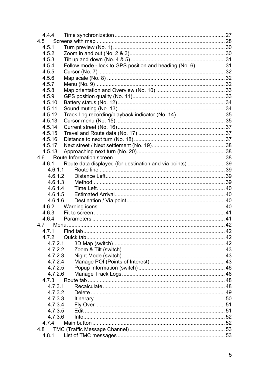
Screens with map
Turn preview (No. 1)
Zoom in and out (No. 2 & 3)
Tilt up and down (No. 4 & 5)
Follow mode - lock to GPS position and heading (No. 6)
Cursor (No. 7)
Map scale (No. 8)
Menu (No. 9)
Map orientation and Overview (No. 10)
GPS position quality (No. 11)
Battery status (No. 12)
Sound muting (No. 13)
Track Log recording/playback indicator (No. 14)
Cursor menu (No. 15)
Current street (No. 16)
Travel and Route data (No. 17)
Distance to next turn (No. 18)
Next street / Next settlement (No. 19)
Approaching next turn (No. 20)
Route Information screen
Route data displayed (for destination and via points)
Route line
Distance Left
Method
Time Left
Estimated Arrival
Destination / Via point
Warning icons
Fit to screen
Parameters
Menu
Find tab
Quick tab
3D Map (switch)
Zoom & Tilt (switch)
Night Mode (switch)
Manage POI (Points of Interest)
Popup Information (switch)
Manage Track Logs
Route tab
Recalculate
Delete
Itinerary
Fly Over
Edit
Info
Main button
TMC (Traffic Message Channel)
List of TMC messages
TMC control centre
Selected FM radio station
Exclude selected station
Show excluded stations
Sort events by distance / type
Use traffic information
Recalculate to avoid traffic
Road safety cameras
Camera types
Fixed cameras
Mobile cameras
Built-in cameras
Section control cameras
Red light cameras
Controlled traffic direction
Speed limit checked
Add a new camera or edit an existing one
Change the settings of the camera warning
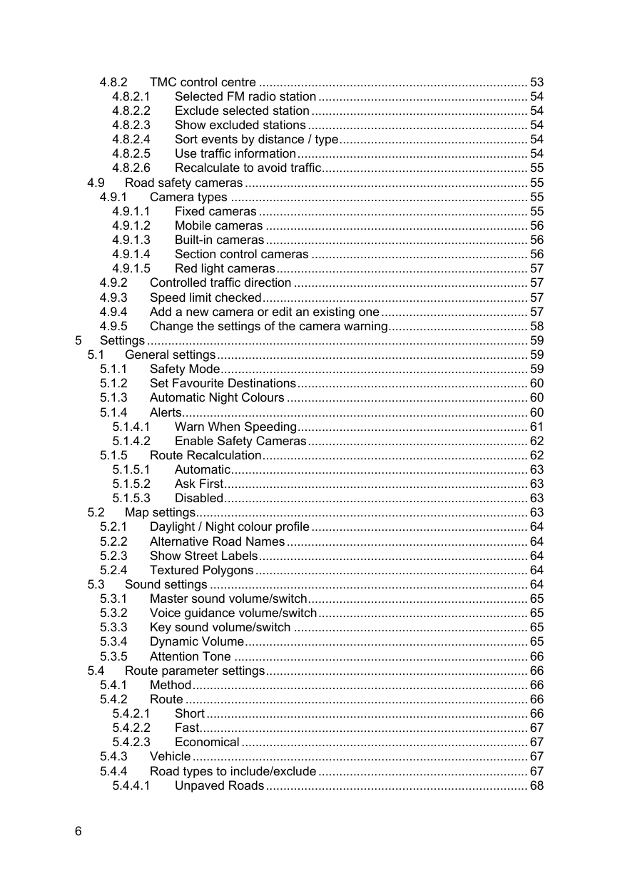
Settings
General settings
Safety Mode
Set Favourite Destinations
Automatic Night Colours
Alerts
Warn When Speeding
Enable Safety Cameras
Route Recalculation
Automatic
Ask First
Disabled
Map settings
Daylight / Night colour profile
Alternative Road Names
Show Street Labels
Textured Polygons
Sound settings
Master sound volume/switch
Voice guidance volume/switch
Key sound volume/switch
Dynamic Volume
Attention Tone
Route parameter settings
Method
Route
Short
Fast
Economical
Vehicle
Road types to include/exclude
Unpaved Roads
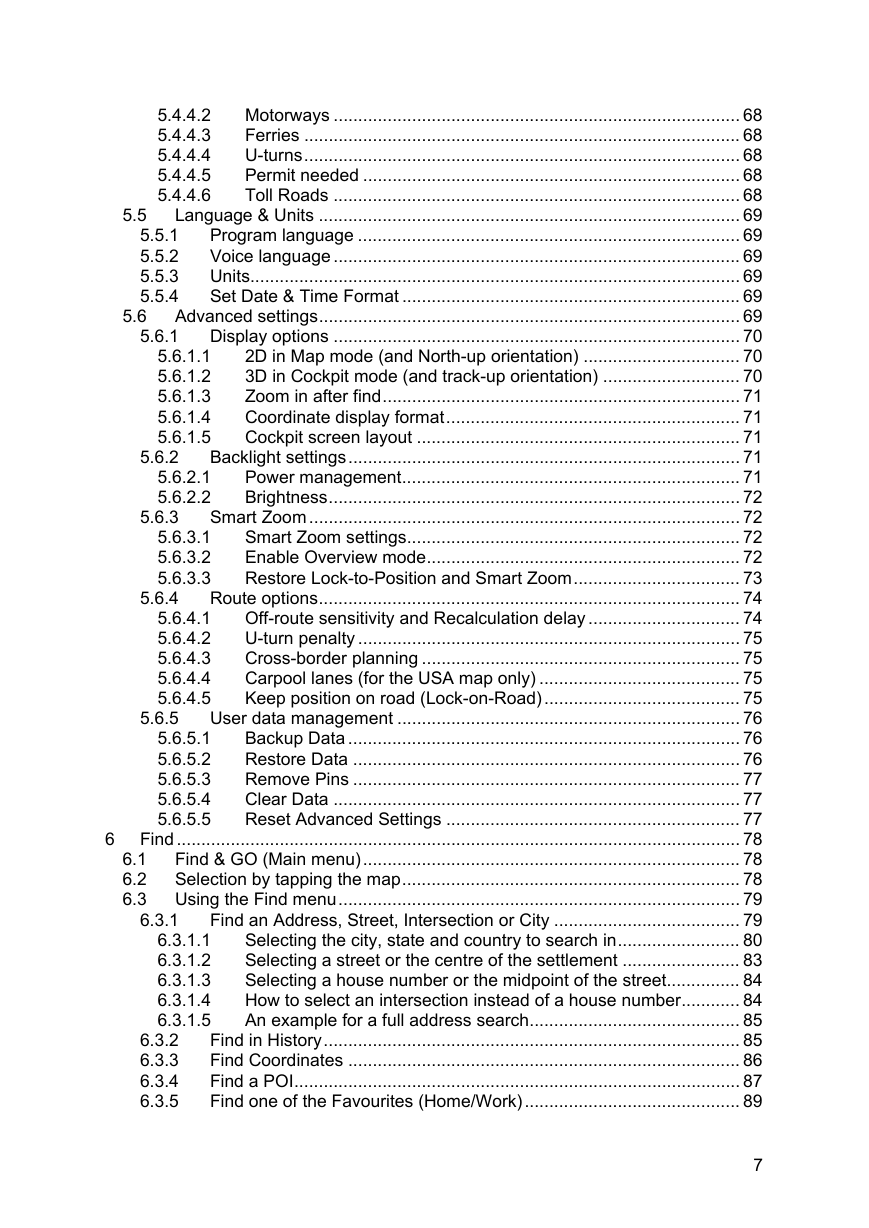
Motorways
Ferries
U-turns
Permit needed
Toll Roads
Language & Units
Program language
Voice language
Units
Set Date & Time Format
Advanced settings
Display options
2D in Map mode (and North-up orientation)
3D in Cockpit mode (and track-up orientation)
Zoom in after find
Coordinate display format
Cockpit screen layout
Backlight settings
Power management
Brightness
Smart Zoom
Smart Zoom settings
Enable Overview mode
Restore Lock-to-Position and Smart Zoom
Route options
Off-route sensitivity and Recalculation delay
U-turn penalty
Cross-border planning
Carpool lanes (for the USA map only)
Keep position on road (Lock-on-Road)
User data management
Backup Data
Restore Data
Remove Pins
Clear Data
Reset Advanced Settings
Find
Find & GO (Main menu)
Selection by tapping the map
Using the Find menu
Find an Address, Street, Intersection or City
Selecting the city, state and country to search in
Selecting a street or the centre of the settlement
Selecting a house number or the midpoint of the street
How to select an intersection instead of a house number
An example for a full address search
Find in History
Find Coordinates
Find a POI
Find one of the Favourites (Home/Work)
Troubleshooting guide
Glossary
End User License Agreement


 2023年江西萍乡中考道德与法治真题及答案.doc
 2012年重庆南川中考生物真题及答案.doc
 2013年江西师范大学地理学综合及文艺理论基础考研真题.doc
 2020年四川甘孜小升初语文真题及答案I卷.doc
 2020年注册岩土工程师专业基础考试真题及答案.doc
 2023-2024学年福建省厦门市九年级上学期数学月考试题及答案.doc
 2021-2022学年辽宁省沈阳市大东区九年级上学期语文期末试题及答案.doc
 2022-2023学年北京东城区初三第一学期物理期末试卷及答案.doc
 2018上半年江西教师资格初中地理学科知识与教学能力真题及答案.doc
 2012年河北国家公务员申论考试真题及答案-省级.doc
 2020-2021学年江苏省扬州市江都区邵樊片九年级上学期数学第一次质量检测试题及答案.doc
 2022下半年黑龙江教师资格证中学综合素质真题及答案.doc