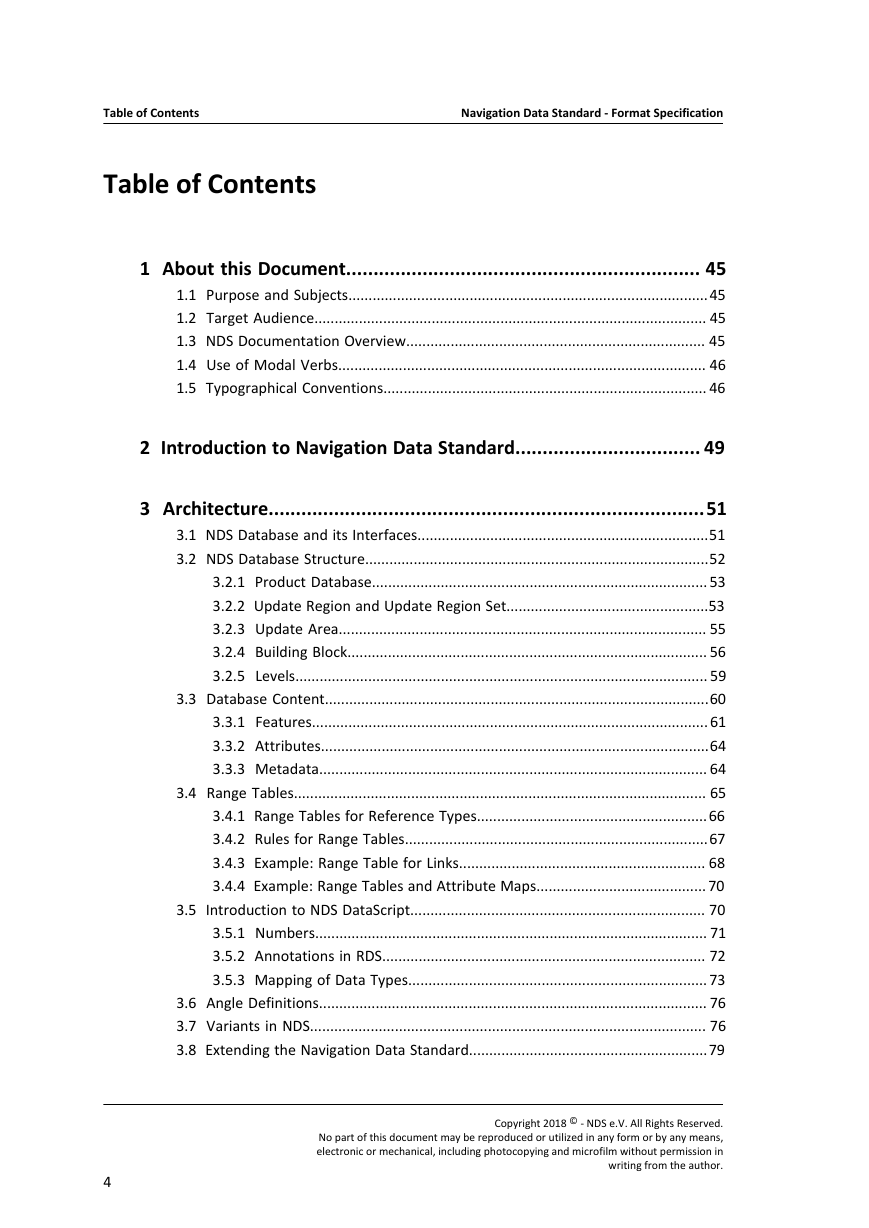
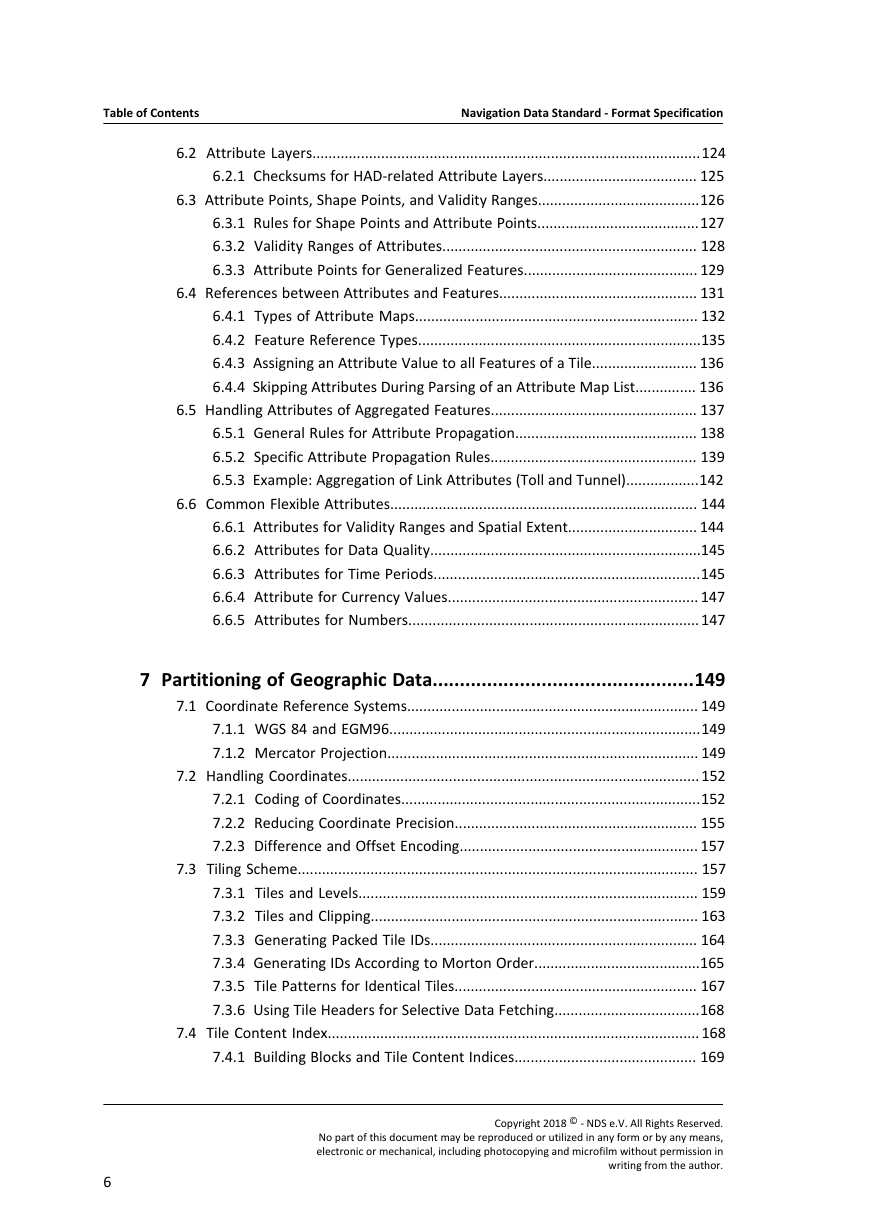
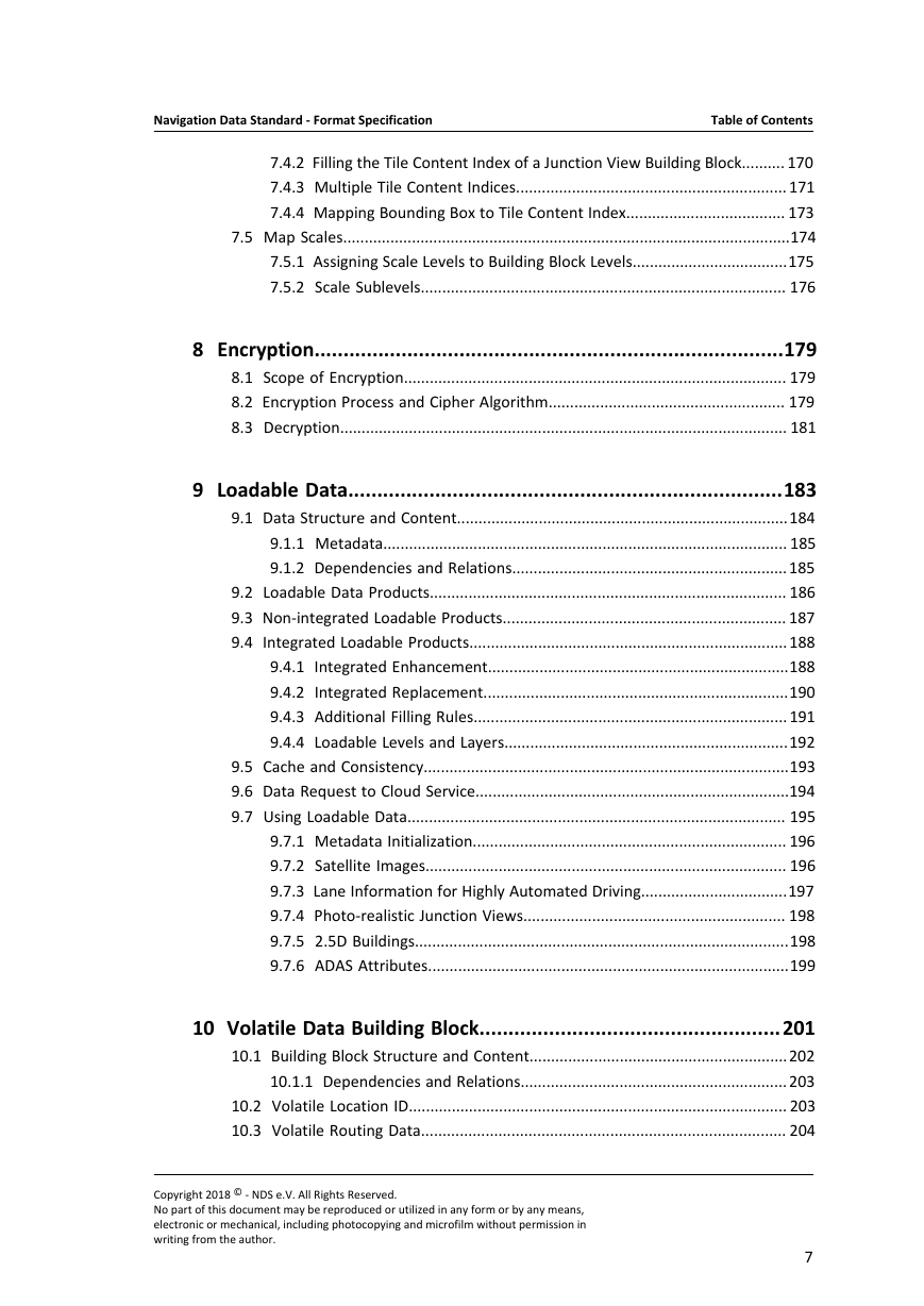
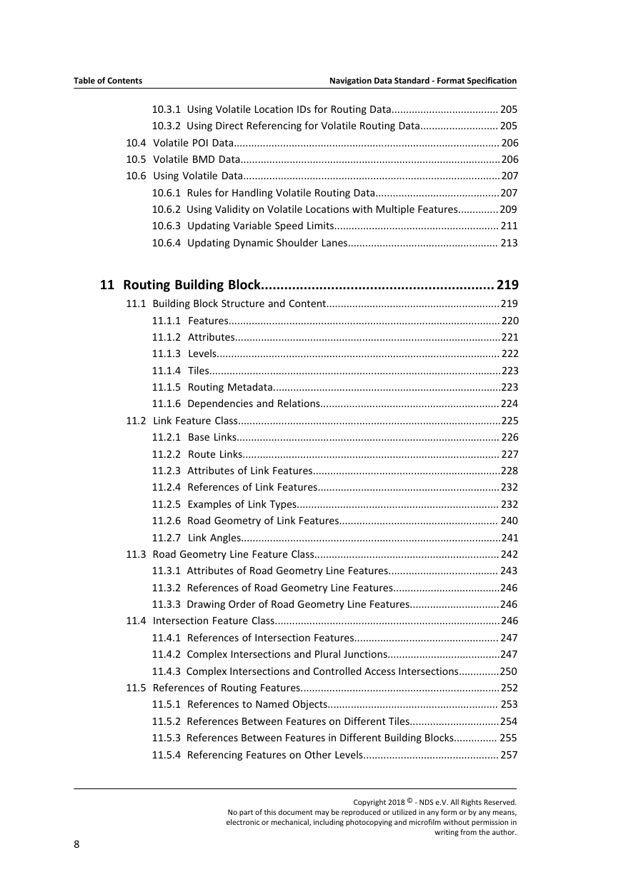
Table of Contents
List of Figures
List of Tables
1 About this Document
1.1 Purpose and Subjects
1.2 Target Audience
1.3 NDS Documentation Overview
1.4 Use of Modal Verbs
1.5 Typographical Conventions
2 Introduction to Navigation Data Standard
3 Architecture
3.1 NDS Database and its Interfaces
3.2 NDS Database Structure
3.2.1 Product Database
3.2.2 Update Region and Update Region Set
3.2.3 Update Area
3.2.4 Building Block
3.2.5 Levels
3.3 Database Content
3.3.1 Features
3.3.2 Attributes
3.3.3 Metadata
3.4 Range Tables
3.4.1 Range Tables for Reference Types
3.4.2 Rules for Range Tables
3.4.3 Example: Range Table for Links
3.4.4 Example: Range Tables and Attribute Maps
3.5 Introduction to NDS DataScript
3.5.1 Numbers
3.5.2 Annotations in RDS
3.5.3 Mapping of Data Types
3.6 Angle Definitions
3.7 Variants in NDS
3.8 Extending the Navigation Data Standard
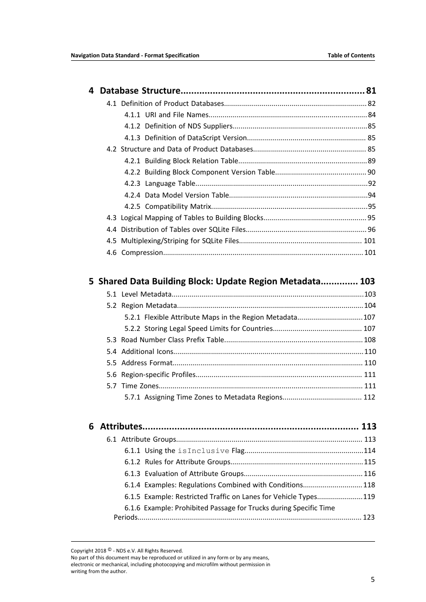
4 Database Structure
4.1 Definition of Product Databases
4.1.1 URI and File Names
4.1.2 Definition of NDS Suppliers
4.1.3 Definition of DataScript Version
4.2 Structure and Data of Product Databases
4.2.1 Building Block Relation Table
4.2.2 Building Block Component Version Table
4.2.3 Language Table
4.2.4 Data Model Version Table
4.2.5 Compatibility Matrix
4.3 Logical Mapping of Tables to Building Blocks
4.4 Distribution of Tables over SQLite Files
4.5 Multiplexing/Striping for SQLite Files
4.6 Compression
5 Shared Data Building Block: Update Region Metadata
5.1 Level Metadata
5.2 Region Metadata
5.2.1 Flexible Attribute Maps in the Region Metadata
5.2.2 Storing Legal Speed Limits for Countries
5.3 Road Number Class Prefix Table
5.4 Additional Icons
5.5 Address Format
5.6 Region-specific Profiles
5.7 Time Zones
5.7.1 Assigning Time Zones to Metadata Regions
6 Attributes
6.1 Attribute Groups
6.1.1 Using the isInclusive Flag
6.1.2 Rules for Attribute Groups
6.1.3 Evaluation of Attribute Groups
6.1.4 Examples: Regulations Combined with Conditions
6.1.5 Example: Restricted Traffic on Lanes for Vehicle Types
6.1.6 Example: Prohibited Passage for Trucks during Specific Time Periods
6.2 Attribute Layers
6.2.1 Checksums for HAD-related Attribute Layers
6.3 Attribute Points, Shape Points, and Validity Ranges
6.3.1 Rules for Shape Points and Attribute Points
6.3.2 Validity Ranges of Attributes
6.3.3 Attribute Points for Generalized Features
6.4 References between Attributes and Features
6.4.1 Types of Attribute Maps
6.4.2 Feature Reference Types
6.4.3 Assigning an Attribute Value to all Features of a Tile
6.4.4 Skipping Attributes During Parsing of an Attribute Map List
6.5 Handling Attributes of Aggregated Features
6.5.1 General Rules for Attribute Propagation
6.5.2 Specific Attribute Propagation Rules
6.5.3 Example: Aggregation of Link Attributes (Toll and Tunnel)
6.6 Common Flexible Attributes
6.6.1 Attributes for Validity Ranges and Spatial Extent
6.6.2 Attributes for Data Quality
6.6.3 Attributes for Time Periods
6.6.4 Attribute for Currency Values
6.6.5 Attributes for Numbers
7 Partitioning of Geographic Data
7.1 Coordinate Reference Systems
7.1.1 WGS 84 and EGM96
7.1.2 Mercator Projection
7.2 Handling Coordinates
7.2.1 Coding of Coordinates
7.2.2 Reducing Coordinate Precision
7.2.3 Difference and Offset Encoding
7.3 Tiling Scheme
7.3.1 Tiles and Levels
7.3.2 Tiles and Clipping
7.3.3 Generating Packed Tile IDs
7.3.4 Generating IDs According to Morton Order
7.3.5 Tile Patterns for Identical Tiles
7.3.6 Using Tile Headers for Selective Data Fetching
7.4 Tile Content Index
7.4.1 Building Blocks and Tile Content Indices
7.4.2 Filling the Tile Content Index of a Junction View Building Block
7.4.3 Multiple Tile Content Indices
7.4.4 Mapping Bounding Box to Tile Content Index
7.5 Map Scales
7.5.1 Assigning Scale Levels to Building Block Levels
7.5.2 Scale Sublevels
8 Encryption
8.1 Scope of Encryption
8.2 Encryption Process and Cipher Algorithm
8.3 Decryption
9 Loadable Data
9.1 Data Structure and Content
9.1.1 Metadata
9.1.2 Dependencies and Relations
9.2 Loadable Data Products
9.3 Non-integrated Loadable Products
9.4 Integrated Loadable Products
9.4.1 Integrated Enhancement
9.4.2 Integrated Replacement
9.4.3 Additional Filling Rules
9.4.4 Loadable Levels and Layers
9.5 Cache and Consistency
9.6 Data Request to Cloud Service
9.7 Using Loadable Data
9.7.1 Metadata Initialization
9.7.2 Satellite Images
9.7.3 Lane Information for Highly Automated Driving
9.7.4 Photo-realistic Junction Views
9.7.5 2.5D Buildings
9.7.6 ADAS Attributes
10 Volatile Data Building Block
10.1 Building Block Structure and Content
10.1.1 Dependencies and Relations
10.2 Volatile Location ID
10.3 Volatile Routing Data
10.3.1 Using Volatile Location IDs for Routing Data
10.3.2 Using Direct Referencing for Volatile Routing Data
10.4 Volatile POI Data
10.5 Volatile BMD Data
10.6 Using Volatile Data
10.6.1 Rules for Handling Volatile Routing Data
10.6.2 Using Validity on Volatile Locations with Multiple Features
10.6.3 Updating Variable Speed Limits
10.6.4 Updating Dynamic Shoulder Lanes
11 Routing Building Block
11.1 Building Block Structure and Content
11.1.1 Features
11.1.2 Attributes
11.1.3 Levels
11.1.4 Tiles
11.1.5 Routing Metadata
11.1.6 Dependencies and Relations
11.2 Link Feature Class
11.2.1 Base Links
11.2.2 Route Links
11.2.3 Attributes of Link Features
11.2.4 References of Link Features
11.2.5 Examples of Link Types
11.2.6 Road Geometry of Link Features
11.2.7 Link Angles
11.3 Road Geometry Line Feature Class
11.3.1 Attributes of Road Geometry Line Features
11.3.2 References of Road Geometry Line Features
11.3.3 Drawing Order of Road Geometry Line Features
11.4 Intersection Feature Class
11.4.1 References of Intersection Features
11.4.2 Complex Intersections and Plural Junctions
11.4.3 Complex Intersections and Controlled Access Intersections
11.5 References of Routing Features
11.5.1 References to Named Objects
11.5.2 References Between Features on Different Tiles
11.5.3 References Between Features in Different Building Blocks
11.5.4 Referencing Features on Other Levels
11.6 Compiling Routing Data
11.6.1 Adjusting Direction of Links
11.6.2 Reducing Bivalent Intersections
11.6.3 Splitting Links
11.6.4 Sorting Links at Intersections
11.6.5 Assigning Intersections to Tiles
11.6.6 Adjusting Coordinates
11.6.7 Generalizing Features for Upper Levels
11.7 Handling Links and Transitions at Update Region Borders
11.7.1 Duplicate Features at Update Region Borders
11.7.2 Modeling Transitions across Intersections at Update Region Borders
11.7.3 Modeling Path-dependent Transitions at Update Region Borders
11.8 Modeling Average Speed
11.9 Speed Profiles
11.9.1 Flexible Attributes for Speed Profiles
11.9.2 Example of a Speed Profile
11.9.3 Example of a Holiday Speed Profile
11.9.4 Generalizing Speed Profiles
11.10 Modeling Travel Direction and Prohibited Passage
11.11 Modeling Transitions and Turns
11.11.1 Using Transition Masks
11.11.2 Using SpecialTransitionCode
11.11.3 Using Turn Penalties for Transitions
11.11.4 Modeling Turn Restrictions
11.11.5 Modeling Right Turns on Red
11.11.6 Modeling Permitted U-Turns
11.11.7 Modeling Roundabouts with Middle Traversal
11.12 Modeling Signposts
11.12.1 Information in the SIGNPOST Attribute
11.12.2 Example: Signpost with Unambiguous Information
11.12.3 Example: Signpost with Ambiguous Information
11.12.4 Signpost Templates
11.12.5 Example: Using Signpost Templates
11.12.6 Example: Using Complex Signpost Templates
11.13 Further Use Cases with Flexible Attributes
11.13.1 Modeling Links with Different Grades
11.13.2 Using Side-dependent Name Attributes
11.13.3 Assigning Data Quality Attributes
11.13.4 Handling Urban Indicator, Priority Road Class, and Traffic Direction
11.13.5 Warning Sign Attributes
11.13.6 Modeling License Plate Restrictions
11.13.7 Modeling Parking Facilities
11.13.8 Use of Bypasses, Side Streets, or Shortcuts as Routing Options
11.13.9 Modeling Multi-Digitized Roads
11.13.10 Modeling Enforcement Cameras
11.13.11 Retrieving the Administrative Hierarchy of Routing Features for Reverse Geocoding
11.13.12 Detecting the Country from the Current Car Position
11.13.13 Modeling Roads as Start or End Point
11.13.14 Modeling Traffic Zones
11.13.15 Modeling Stationary Objects along the Road
12 Routing: Advanced Driver Assistance (ADAS)
12.1 Data Structures for ADAS
12.2 Basic ADAS Information
12.2.1 Curvature Profile
12.2.2 Modeling Curvature Profiles Across Intersections
12.2.3 Modeling Curvature and Speed Profiles along a Path
12.2.4 Slope Profile
12.3 Extended ADAS Information: Enhanced Geometry
12.3.1 Data Structures for Clothoid Data
12.3.2 Relation between Clothoids and Shape Points
12.3.3 Offset between Clothoids and Shape Points
12.3.4 Relative Curvature Deviation of Clothoids
12.3.5 Handling Tiles and Clipping for Clothoids
12.4 Extended ADAS Information: Elevation Profiles
12.4.1 Modeling Grade Lines
12.4.2 Chainage on the Extension of a Road Center Line
12.4.3 Clipping Grade Lines
12.5 Extended ADAS Information: Intersection Features
13 Routing: Modeling Toll
13.1 Modeling Toll Roads
13.1.1 Defining Detailed Toll Information for Roads and/or Lanes
13.1.2 Defining Toll Information for Lane Guidance
13.1.3 Modeling Fixed-fee Toll Systems
13.1.4 Modeling Distance-based Toll Systems
13.1.5 Modeling Vignette-based Toll Systems
13.2 Modeling Toll Fee
13.2.1 Modeling Toll Fee for Standalone Toll Gates
13.2.2 Modeling Distance-based Toll Fee
13.2.3 Modeling Path-dependent Toll Fee
13.2.4 Modeling Toll Fee for Complex Toll Paths
13.2.5 Modeling Toll Fee Across Update Regions
14 Routing: Eco Routing
14.1 Overview of Data Structures and Calculation
14.1.1 Data Structures for Eco Routing
14.1.2 Eco Routing Metadata
14.1.3 Eco Route Calculation
14.2 Consumption Speed Curve (CSC)
14.2.1 Data Structures for CSC
14.2.2 Independence of CSC Effects from Other Influences
14.2.3 CSC on Different Routing Levels
14.2.4 Calculating cspeed with Speed Profiles and/or Real-time Flow Data
14.3 Speed Variation
14.3.1 Data Structures for Speed Variation Factor
14.3.2 Kinetic Energy Modeling
14.3.3 Using cvar as a Common Representation for ctransition and ccurve
14.3.4 Speed Variation Factors for Transitions
14.3.5 Speed Variation Factors for Curves
14.3.6 NDS Database Storage Aspects for ctransition and ccurve
14.3.7 NDS Database Compilation Aspects for ccurve
14.4 Slope
14.4.1 Data Structures for Slope
14.4.2 Consumption Influence of Slope
14.4.3 Slope Applications: Eco Routing vs. Range Estimation
14.4.4 Excess Slope Attribute
14.4.5 Average Slope Attribute for Range Estimation
14.4.6 NDS Database Representation for cslope
14.4.7 Compiler Aspects for cslope
14.5 Calculation Examples of Eco Routing
14.5.1 Speed-based Consumption Estimation
14.5.2 Transition-based Consumption Estimation – Speed Variation by Average Speed Changes
14.5.3 Transition-based Consumption Estimation – Speed Variation by Intersections
14.5.4 Estimation of Consumption due to Speed Variation by Curves
14.5.5 Estimation of Consumption due to Excess Slope
14.5.6 Estimation of Consumption due to Average Slope
15 Routing: Modeling Lanes
15.1 Numbers and Numbering of Lanes
15.1.1 Example: Numbering Normal Lanes
15.1.2 Example: Numbering Exit Lanes
15.2 Lane Markings
15.3 Lane Dividers
15.4 Modeling the Connectivity of Lanes
15.4.1 Connectivity of Lanes Across Features: Default Case without Lane Connectivity Attribute
15.4.2 Connectivity of Lanes Across Features: with Lane Connectivity Attribute
15.4.3 Connectivity of Lanes Across Complex Intersections
15.4.4 Connectivity of Lanes Along a Feature
15.5 Using 3D Lane Guidance
15.5.1 3D Lane Guidance Along a Feature
15.5.2 3D Lane Guidance Across Features
15.6 Lane Separators
15.7 Lane Separator Markings
15.8 Passing Lanes
15.9 Center Turning Lanes
15.10 High-Occupancy Vehicle Lanes
15.11 Lanes Reserved for Special Vehicles
15.12 Modeling Express Roads and Express Lanes
16 Lane Building Block
16.1 Types of Maps for Automated Driving
16.2 Building Block Structure and Content
16.2.1 Attributes
16.2.2 Dependencies and Relations
16.3 Numbers and Numbering of Lanes
16.4 Assigning Flexible Attributes to Lanes
16.4.1 Flexible Attributes for Lane Types
16.4.2 Defining the Attribution Status of Lanes
16.5 Lane Groups
16.5.1 Lane Connectivity
16.6 Relations between Lanes
16.6.1 Modeling Lane Relations in Split Scenarios
16.6.2 Modeling Lane Relations in Merge Scenarios
16.6.3 Modeling Lane Relations for Shoulder Lanes
16.7 Relations between Lane Groups
16.8 Lane Geometry
16.8.1 Center Line
16.8.2 Lane Boundary
16.8.3 Shared Lane Boundaries
16.8.4 Clipping Lanes and Lane Groups at Tile Borders
16.9 Modeling Lanes along a Road
16.9.1 Assigning Lane Groups to Features
16.9.2 Assigning Lane Groups to Features with High Precision
16.9.3 Modeling Connectivity of Lanes
16.10 Modeling Lanes at Intersections
16.10.1 Assigning Lane Groups to Intersecting Links
16.10.2 Defining Relations of Lane Groups at Intersections
16.10.3 Modeling Connectivity of Lanes Across Intersections
16.10.4 Modeling Connectivity of Lanes Across Complex Intersections
16.11 Modeling Lane Boundaries
16.11.1 Modeling Lane Boundaries along a Road
16.11.2 Modeling Lane Boundaries at Intersections
16.11.3 Modeling Lane Boundaries for Gores
16.11.4 Modeling Lane Boundaries for Walking Areas
16.12 Modeling Road Areas
16.13 Modeling Lanes for Public Transport
16.13.1 Modeling Tramways
16.13.2 Modeling Public Transport Stops
16.14 Modeling Lane Prohibitions
16.14.1 Lanes with Time-Dependent Prohibitions
16.14.2 Modeling Dynamic Shoulder Lanes
16.14.3 High-Occupancy Vehicle Lanes
16.14.4 Lanes Reserved for Special Vehicles
16.15 Further Use Cases with Flexible Attributes
16.15.1 Passing Lanes
16.15.2 Modeling Traffic Lights
16.15.3 Modeling Stop Lines and Waiting Lines
16.15.4 Modeling Express Roads and Express Lanes
16.15.5 Modeling Speed Limits for a Single Lane
16.15.6 Modeling Medians between Lanes
17 Name Building Block
17.1 Building Block Structure and Content
17.1.1 Features
17.1.2 Attributes
17.1.3 Levels
17.1.4 Name Metadata
17.1.5 Dependencies and Relations
17.2 Named Object Feature Class
17.2.1 Named Object Class Attribute
17.2.2 Destination Attributes
17.2.3 Mapping Named Object Classes to Different Address Systems
17.3 Named Object Strings
17.3.1 Type of Use Attribute
17.3.2 Name Format Attribute
17.3.3 Control Character Attribute
17.3.4 Relation Attribute
17.3.5 Language Code Attribute
17.3.6 String Type Attribute
17.3.7 Multilingual Support
17.4 Named Object Relations
17.4.1 Access-at-road Relation
17.4.2 Capital Relation
17.4.3 Contained-in Relation
17.4.4 Road-to-house Relation
17.4.5 Signpost-to-destination Relation
17.4.6 Same-feature Relation
17.4.7 Refinement Relation
17.5 References of Named Objects
17.5.1 Region Named Object Reference
17.5.2 Named Object References Across Update Regions
17.6 Contained-in Relations for Address Retrieval
17.6.1 Contained-in Relations for Neighborhoods
17.6.2 Contained-in Relations for Multiple Addresses
17.6.3 Contained-in Relations for Municipalities
17.7 Use Cases for Handling Name Data
17.7.1 Modeling Named Objects with Geographical Extent
17.7.2 Using the Geographical Extent for Location Input
17.7.3 Modeling Administrative Levels with Identical Names
17.7.4 Handling Official Language Attributes
17.7.5 Handling Features with Multiple Official Names
17.7.6 Handling Exonyms
17.7.7 Modeling the Address Point of a House Number
17.7.8 Modeling House Number Ranges
17.7.9 Handling Multiple Address Systems
17.7.10 Handling Features with Multiple Official Names
17.7.11 Displaying Country Flags for Country Named Objects
18 Basic Map Display Building Block
18.1 Building Block Structure and Content
18.1.1 Basic Map Display Features
18.1.2 Levels
18.1.3 BMD Metadata
18.1.4 Dependencies and Relations
18.2 Point Features
18.2.1 Properties of Point Features
18.2.2 Validity of Point Feature Geometry
18.3 Line Features
18.3.1 Properties of Line Features
18.3.2 Validity of Line Feature Geometry
18.3.3 Map Matching on Upper Levels
18.3.4 Line Feature Classes for Special Purposes
18.4 Area Features
18.4.1 Properties of Area Features
18.4.2 Polygon Types
18.4.3 Definitions of Polygon Types
18.4.4 Area Feature Classes for Special Purposes
18.5 Identifiers of BMD Features
18.6 Relation between Source Features and Compiled Features
18.7 References to Named Objects
18.8 Generalization Methods
18.9 Icons for BMD Features
18.10 Drawing Styles
18.11 Drawing Order
18.11.1 Attributes for Deviating Drawing Order
18.11.2 Handling the DRAWING_ORDER Attribute
18.12 Using Z Levels for Map Rendering
18.12.1 Advantages of Z Levels
18.12.2 Data Structures for Z Level Information
18.12.3 Using End Caps for 2D Map Rendering
18.12.4 Using a Single Link for Z Level Change
18.12.5 Using Shape Points for Map Rendering with Z Levels
18.12.6 Defining Overlap Sections
18.13 2.5D Rendering of Features
18.13.1 2.5D Rendering of Links, Lines, Points, and Areas
18.13.2 Detached from Terrain Attribute
18.13.3 2.5D City Models
18.13.4 2.5D Texture Patterns
18.14 3D Objects Representing Building Footprints
18.15 Labeling Hints
18.15.1 Labeling Features with Curved Text
18.15.2 Labeling Features with Horizontal or Vertical Text
18.16 Labeling Groups
18.17 Use Cases for BMD Data
18.17.1 Modeling Geopolitical Borders
18.17.2 Modeling Elevation
19 POI Building Block
19.1 Types of POI Building Blocks
19.2 Building Block Structure and Content
19.2.1 Features
19.2.2 Attributes
19.2.3 Tiles
19.2.4 POI Metadata
19.2.5 References and Dependencies
19.3 POI Feature Class
19.3.1 Primary POI Attributes
19.3.2 Secondary POI Attributes
19.3.3 Predefined Secondary POI Attributes
19.4 POI Categories
19.4.1 Attributes of POI Categories
19.4.2 POI Category ID
19.4.3 Directed Acyclic Graph of POI Categories
19.4.4 POI Standard Categories
19.4.5 Collections of POI Categories
19.4.6 Finding POI Categories to Display on a Given Zoom Level
19.5 Compiling Data for POIs
19.5.1 Filling Metadata of Integrated POI Building Blocks
19.5.2 Filling Metadata of Non-integrated POI Building Blocks
19.5.3 Versioning POIs
19.6 Relations between POIs
19.6.1 Part-of Relation
19.6.2 Access Relation
19.6.3 Logical-access Relation
19.6.4 Guidance-point Relation
19.6.5 Connected-to Relation
19.7 Relations between POIs and POI Regions
19.7.1 Explicit Relation between POIs and Geographic Areas
19.7.2 POI Region
19.7.3 Relation between POI Regions and Named Objects
19.7.4 Country and State Code References
19.7.5 Modeling Vanity POIs with Virtual Regions
19.7.6 Using POI Region ID in Searches
19.8 POI Icons
19.8.1 Scale Ranges for POIs
19.9 POI Virtual Tiles
19.10 Use Cases for POI Data
19.10.1 Modeling Brand POIs
19.10.2 Accessing POIs for Location Input and Map Display
19.10.3 Modeling Access Points for POIs along a Route
19.10.4 Setting the Relevance for POIs along a Route
19.10.5 Activating POIs along a Route
19.10.6 Modeling POIs for Pedestrian Access
19.10.7 Modeling Smart Interchanges
19.10.8 Using Bitmasks for Filtering Secondary POI Attributes
19.10.9 Using Bitmasks for Displaying Secondary Attributes as Additional Icons
19.10.10 Highlighting POIs Within a Building
19.11 Using POIs for Parking Facilities
19.11.1 Modeling Structured Parking Facilities
19.11.2 Modeling Unstructured Parking Facilities
19.11.3 Modeling Access Points in Parking Facility Maps
19.11.4 Modeling Sections of Parking Facilities
20 Traffic Information Building Block
20.1 Building Block Structure and Content
20.2 Traffic Message Channel (TMC)
20.2.1 TMC Event Information
20.2.2 TMC Location Information
20.2.3 Determining TMC Locations for a Traffic Event
20.2.4 Hierarchical Structure of TMC Locations
20.2.5 Linking TMC Information to NDS Features
20.3 Transport Protocol Experts Group (TPEG)
20.3.1 TPEG Event Information
20.3.2 TPEG Location Information
20.3.3 TPEG Data Design
20.4 Other Precoded Traffic Protocols
20.4.1 Precoded Traffic Locations
20.4.2 Precoded Traffic Events
20.4.3 Linking Precoded Traffic to NDS Features
20.5 NDS Data Structures for Traffic Information
20.5.1 Lookup Tables for TMC Event Information
20.5.2 Lookup Tables for TPEG Event Information
20.5.3 Lookup Tables for TMC Location Information
20.5.4 Local TMC Attribute Maps
20.5.5 Local Attribute Maps for Precoded Traffic
20.6 Processing Traffic Location Information
20.6.1 Looking up TMC Location Information
20.6.2 TMC Attribute Maps
20.6.3 Calculating Distances between TMC Point Locations
20.6.4 Splitting TMC Location Tables
20.6.5 Gateways and Split TMC Location Tables
20.6.6 Partial TMC Locations
20.7 Using Traffic Overview Maps
20.7.1 Traffic Mapping and Highlighting
20.7.2 Activating Traffic Overview Maps
21 Location Input in NDS
21.1 Selection Criteria
21.1.1 Combining Named Object Feature Classes into a Selection Criterion
21.1.2 Mixed-case Characters in Names
21.1.3 Character and Token Replacements in Names
21.2 Selection Paths
21.3 Global Entry for Location Input
21.4 House Number Search
21.5 Combining SLI and FTS Location Input
22 SQLite Location Input Building Block
22.1 Building Block Structure and Content
22.1.1 Location Input Data
22.1.2 Metadata
22.2 Location Input Data in the SLI Tables
22.2.1 Mapping SLI IDs to IDs of Source Features
22.2.2 Multiple Location Input Strings for One Source Feature
22.2.3 Location Input Strings and Display Strings
22.3 Selection Paths in SLI
22.3.1 Defining a Selection Path in SLI
22.3.2 Using Multiple Selection Criteria on the Same Hierarchy Level
22.3.3 Example of a Parallel Search in Multiple SLI Tables
22.4 Use Cases for Location Input
22.4.1 SLI Search and Intersections
22.4.2 Base Names in SLI
22.4.3 Clusters in SLI
22.4.4 Searching House Numbers with SLI
22.4.5 Searching for POIs by their Phone Number
22.4.6 Using Filtered POI Search
22.4.7 Using Direct-Access Location Input
22.5 Using Contained-in Relations for Address Retrieval with SLI
22.5.1 Example: One Real-world Road in Three City Districts
22.5.2 Example: Two Real-world Roads in Three City Districts
22.5.3 Example: One Real-world Road with Multiple Addresses
22.5.4 Example: Contained-in Relations for Municipalities
22.6 User Input Methods
22.7 Customizing the Result List
22.8 Searching Across Update Regions in SLI
22.9 Creating NVC Functionality for SLI
22.10 Sorting SLI Strings Using Collations
22.11 Handling Asian Characters in SLI
23 Full-text Search Building Block
23.1 Building Block Structure and Content
23.1.1 Full-text Search Documents
23.1.2 Metadata
23.1.3 Dependencies and Relations
23.2 Full-text Search Documents for Named Object Features
23.2.1 Columns of an FTS Document for a Named Object
23.2.2 Mapping Selection Criteria to Columns
23.2.3 Mapping Selection Criteria to Named Object Classes
23.2.4 Full-text Search and Unnamed Intersections
23.3 Full-text Search Documents for POI Features
23.3.1 Columns of an FTS Document for a POI
23.3.2 Mapping Selection Criteria and Attributes to Columns
23.3.3 POI Attributes in FTS tables
23.4 Multiple Languages in FTS
23.4.1 Querying FTS Tables with Language-specific Prefixes
23.4.2 Multilingual Names with Multiple Tokens in FTS
23.4.3 Asian Characters in FTS
23.5 Exceptions and Substitutions
23.5.1 Exception Terms
23.5.2 Substitution Terms
23.5.3 Querying FTS Databases with Exceptions and Substitutions
23.6 Fuzzy Search and Edit Cost
23.6.1 Filling and Searching the Fuzzy Search Table
23.6.2 Edit Costs for Fuzzy Search
23.7 Creating NVC Functionality for FTS Tokens
23.8 Enabling Spatial Search in FTS
23.9 Use Cases of the Full-text Search Building Block
23.9.1 Searching House Numbers with FTS
23.9.2 Searching for Administrative Hierarchy in FTS
23.9.3 Searching Across Update Regions with FTS
23.9.4 Using Contained-in Relations for Address Retrieval with FTS
23.10 Priority Index for FTS Search Results
23.11 Optimization of FTS Content Tables
23.11.1 Optimizing FTS Content Tables for Administrative Hierarchies
23.11.2 Updating Optimized FTS Content Tables
24 Automatic Speech Recognition Building Block
24.1 Building Block Structure and Content
24.1.1 Dependencies and Relations
24.2 Acoustic Model Metadata
24.3 ASR Index
24.3.1 ASR Index for Names
24.3.2 ASR Index for POIs
24.4 Selection Paths in ASR
24.4.1 Defining a Selection Path in ASR
24.4.2 Mapping Selection Criteria to Selection Keys
24.5 Use Cases for Automatic Speech Recognition
24.5.1 Searching Full Addresses with One-Shot Location Input
24.5.2 Searching POI Attribute Values with ASR
25 Natural Guidance Building Block
25.1 Building Block Structure and Content
25.2 Natural Guidance Feature Class
25.3 Associating Routing Features to Natural Guidance Features
25.4 Generating Instructions with Natural Guidance
26 Speech Building Block
26.1 Building Block Structure and Content
26.2 Grammatical Structures for Phonetic Transcriptions
26.2.1 Articles and Prepositions
26.2.2 Grammatical Cases
26.2.3 Selecting Phonetic Transcriptions and Prepositions for Acoustic Driving Recommendation
26.3 Preference Order of Phonetic Transcriptions
26.4 Optimization Structures for Phonetic Transcriptions
27 Digital Terrain Model Building Block
27.1 Height Maps
27.1.1 Data Structures for Height Maps
27.1.2 Partitioning of Height Information into Tiles and Levels
27.1.3 Content of a Single DTM Tile
27.1.4 Traversal of Height Points
27.1.5 Delta Encoding of Height Points
27.2 Batched Dynamic Adaptive Meshes (BDAM)
27.2.1 Building Block Structure and Content
27.2.2 BDAM Metadata
27.2.3 Level of Detail
27.2.4 BDAM Levels
27.2.5 Rules for Mixing BDAM Levels
27.2.6 TINs in BDAM Patches
27.2.7 Regular Grids in BDAM
27.2.8 Assigning BDAM Patches to NDS Tiles
27.2.9 Rendering BDAM Patches
27.2.10 Connecting BDAM Patches to an Enhanced City Model or Junction View
28 Orthoimages Building Block
28.1 Building Block Structure and Content
28.1.1 Orthoimage Tiles
28.1.2 Orthoimage Metadata
28.2 Handling Orthoimage Tiles
28.2.1 Map Projection Method for Orthoimages
28.2.2 Handling Image Texels at Tile Borders
28.2.3 Handling Orthoimage Tiles at Update Region Borders
28.3 Controlling the Level of Detail
28.4 Defining Resolution for Orthoimages
29 3D Objects Building Block
29.1 Building Block Structure and Content
29.1.1 Features
29.1.2 3D Metadata
29.1.3 References and Dependencies
29.2 Spatial Index Structure
29.2.1 Partitioning of Spatial Trees
29.2.2 Object Hierarchy Level
29.3 Bounding Box
29.3.1 Bounding Boxes Sharing a Center Point
29.4 3D Object Features
29.4.1 Properties of 3D Object Features
29.4.2 Identifying 3D Objects
29.5 References of 3D Objects
29.5.1 References from POI Features to 3D Objects
29.5.2 References to Geometry Information
29.6 Compiling 3D Data
29.6.1 Avoiding T-Junctions
29.6.2 Size Recommendations
29.7 Geometry Information for 3D Objects
29.7.1 Elevation Information for 3D Objects
29.7.2 Level of Detail for 3D Objects
29.7.3 Body Geometry Type
29.7.4 Accuracy of Body Geometry – Recommendations
29.7.5 Template Body Geometry
29.7.6 Render Groups
29.8 Material and Textures
29.9 Landmark Icons
29.10 Height over Ground
29.11 Non-Uniform Rational B-Splines and Curves
29.11.1 Data Structures for NURBS
29.11.2 Data Structures for NURBS Curves
29.12 Using the 3D Objects Data Structures
30 Localization Landmark Building Block
30.1 Building Block Structure and Content
30.2 Localization Landmarks
30.3 Types of Localization Landmarks
30.3.1 Sign Landmarks
30.3.2 Pole Landmarks
30.3.3 Wall Landmarks
30.3.4 Traffic Light Landmarks
30.3.5 Marking Landmarks
30.4 Use Cases for Localization Landmarks
30.4.1 Modeling Landmarks for Traffic Lights
30.4.2 Modeling Landmarks for Warning Signs and Signposts
31 Obstacles Building Block
31.1 Building Block Structure and Content
31.2 Obstacles
31.2.1 Linking Obstacles to Routing Features
31.3 Generating Obstacles from a 3D Representation
32 Junction View Building Block
32.1 Building Block Structure and Content
32.1.1 Tables in the Junction View Building Block
32.1.2 References to Routing Building Block
32.2 Junction View Images
32.2.1 Attributes of Junction View Images
32.2.2 Image Formats for 2D Junction Views
32.3 Generic Junction Views
32.4 Junction View Image Collections
32.5 Junction View Image Sets
32.6 3D Junction Views
32.6.1 NURBS for 3D Junction Views
32.7 Drawing Junction Views
32.7.1 Drawing Junction View Images for Different Conditions
32.7.2 Highlighting a Maneuver in the Junction View
33 Map Confidence Building Block
33.1 Building Block Structure and Content
33.1.1 Map Confidence Metadata
33.1.2 Dependencies and Relations
33.2 Attribute Categories
33.3 Confidence Levels
33.4 Attribute Category and Confidence Level Mapping
34 Icons
34.1 Data Structure and Content
34.1.1 Tables for Storing Icons
34.1.2 Icon Groups
34.1.3 Icon Information
34.2 Icon Sets
34.2.1 Icon Templates
34.3 Icon Collections
34.4 Icon Sprites
34.5 3D Icons
34.6 Use Cases for Icons
34.6.1 Default Icons and Application-specific Icons
34.6.2 Overlapping Icons in Map Display
34.6.3 Additional Icons for Bannered Routes
34.6.4 Alternative Road Icons without Numbers
35 Glossary
35.1 3D city model
35.2 Address retrieval
35.3 Advanced Map Display
35.4 Aggregated link
35.5 Application
35.6 Area
35.7 Baseline map
35.8 Base link
35.9 Basic Map Display building block
35.10 Binding
35.11 Building block
35.12 Character code chart
35.13 Cipher key
35.14 Clothoid
35.15 Compiler
35.16 Complex intersection
35.17 Contours
35.18 Controlled access road
35.19 Curvature
35.20 Database
35.21 Data carrier
35.22 Destination location
35.23 Detailed city model
35.24 Direct access location input
35.25 EGM96
35.26 Enhanced city model
35.27 Exonym
35.28 Expression
35.29 External POI
35.30 Feature
35.31 Feature class
35.32 Filter attribute
35.33 GDF
35.34 Geocoding
35.35 IME
35.36 Input data
35.37 Integrated POI building block
35.38 Intersection
35.39 Landmark
35.40 Level
35.41 Level of detail (LOD)
35.42 Line
35.43 Link
35.44 Location
35.45 Location reference
35.46 Map matching
35.47 Map scale
35.48 Metadata
35.49 Metadata region
35.50 Motorway
35.51 Name building block
35.52 Name feature
35.53 Name rotation
35.54 Name string
35.55 Named object feature
35.56 Navigation Data Standard (NDS)
35.57 Navigation system
35.58 NDS database
35.59 NDS e.V.
35.60 NVC tree
35.61 Non-integrated POI building block
35.62 Phonetic transcription
35.63 POI
35.64 POI building block
35.65 POI category
35.66 Point
35.67 Polygon
35.68 Product database
35.69 Profile
35.70 Proximity search
35.71 Road geometry line
35.72 Route calculation
35.73 Route guidance
35.74 Route link
35.75 Routing building block
35.76 Selection graph
35.77 South-west rule
35.78 Texel
35.79 Tile
35.80 Tile element
35.81 Tiling scheme
35.82 Transition
35.83 Transliteration
35.84 Triangular irregular network (TIN)
35.85 Triangulation
35.86 Unicode
35.87 Update area
35.88 Update region
35.89 UTF-8
35.90 WGS 84 coordinate system
36 NDS Versions and Associated Data Model Versions
37 Warning Signs



 2023年江西萍乡中考道德与法治真题及答案.doc
 2012年重庆南川中考生物真题及答案.doc
 2013年江西师范大学地理学综合及文艺理论基础考研真题.doc
 2020年四川甘孜小升初语文真题及答案I卷.doc
 2020年注册岩土工程师专业基础考试真题及答案.doc
 2023-2024学年福建省厦门市九年级上学期数学月考试题及答案.doc
 2021-2022学年辽宁省沈阳市大东区九年级上学期语文期末试题及答案.doc
 2022-2023学年北京东城区初三第一学期物理期末试卷及答案.doc
 2018上半年江西教师资格初中地理学科知识与教学能力真题及答案.doc
 2012年河北国家公务员申论考试真题及答案-省级.doc
 2020-2021学年江苏省扬州市江都区邵樊片九年级上学期数学第一次质量检测试题及答案.doc
 2022下半年黑龙江教师资格证中学综合素质真题及答案.doc