�
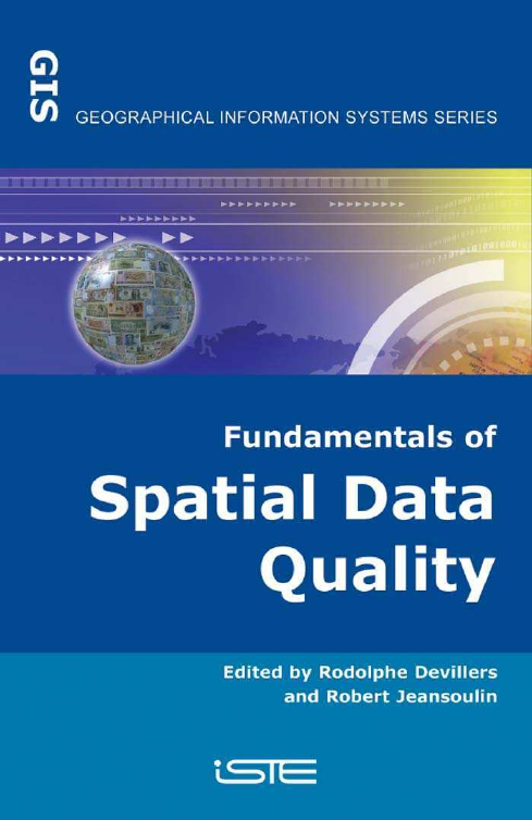
Fundamentals of Spatial Data Quality
This page intentionally left blank
�
Fundamentals of
Spatial Data Quality
Edited by
Rodolphe Devillers
Robert Jeansoulin
�
Part of this book adapted from “Qualité de l’information géographique” published in France
by Hermès Science/Lavoisier in 2005
Published in Great Britain and the United States in 2006 by ISTE Ltd
Apart from any fair dealing for the purposes of research or private study, or criticism or
review, as permitted under the Copyright, Designs and Patents Act 1988, this publication may
only be reproduced, stored or transmitted, in any form or by any means, with the prior
permission in writing of the publishers, or in the case of reprographic reproduction in
accordance with the terms and licenses issued by the CLA. Enquiries concerning reproduction
outside these terms should be sent to the publishers at the undermentioned address:
ISTE Ltd
6 Fitzroy Square
London W1T 5DX
UK
ISTE USA
4308 Patrice Road
Newport Beach, CA 92663
USA
Library of Congress Cataloging-in-Publication Data
www.iste.co.uk
© LAVOISIER, 2005
© ISTE Ltd, 2006
The rights of Rodolphe Devillers and Robert Jeansoulin to be identified as the authors of this
work has been asserted by them in accordance with the Copyright, Designs and Patents Act
1988.
Fundamentals of spatial data quality / edited by Rodolphe Devillers, Robert Jeansoulin.
p. cm.
"Part of this book adapted from "Qualité de l'information géographique"
published in France by Hermes Science/Lavoisier in 2005."
Includes bibliographical references and index.
ISBN-13: 978-1-905209-56-9
ISBN-10: 1-905209-56-8
1. Geographic information systems--Data processing--Quality control. I. Devillers,
Rodolphe. II. Jeansoulin, Robert.
G70.212.F85 2006
526.0285--dc22
British Library Cataloguing-in-Publication Data
A CIP record for this book is available from the British Library
ISBN 10: 1-905209-56-8
ISBN 13: 978-1-905209-56-9
Printed and bound in Great Britain by Antony Rowe Ltd, Chippenham, Wiltshire.
2006009298
�
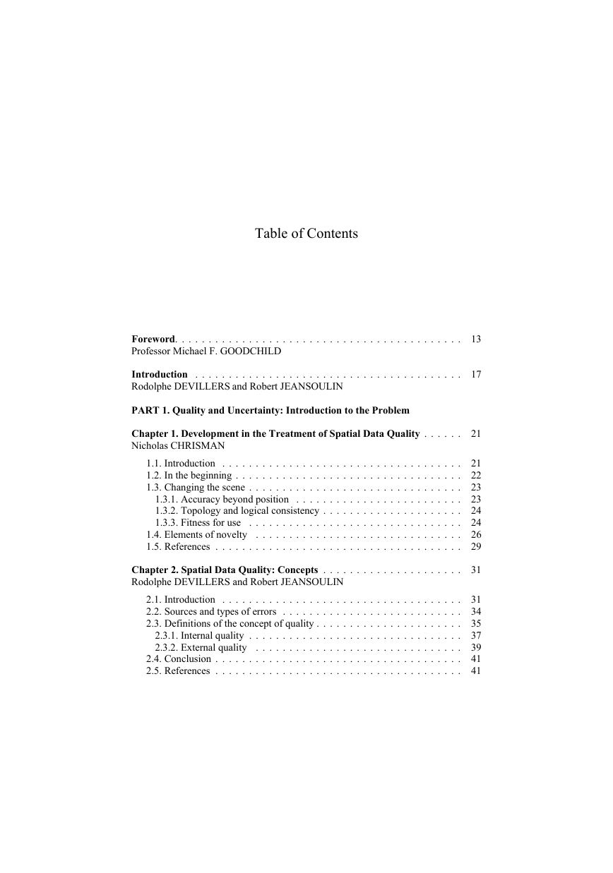
Table of Contents
Foreword. . . . . . . . . . . . . . . . . . . . . . . . . . . . . . . . . . . . . . . . . . .
Professor Michael F. GOODCHILD
Introduction . . . . . . . . . . . . . . . . . . . . . . . . . . . . . . . . . . . . . . . .
Rodolphe DEVILLERS and Robert JEANSOULIN
PART 1. Quality and Uncertainty: Introduction to the Problem
Chapter 1. Development in the Treatment of Spatial Data Quality . . . . . .
Nicholas CHRISMAN
1.1. Introduction . . . . . . . . . . . . . . . . . . . . . . . . . . . . . . . . . . . .
1.2. In the beginning . . . . . . . . . . . . . . . . . . . . . . . . . . . . . . . . . .
1.3. Changing the scene . . . . . . . . . . . . . . . . . . . . . . . . . . . . . . . .
1.3.1. Accuracy beyond position . . . . . . . . . . . . . . . . . . . . . . . . .
1.3.2. Topology and logical consistency . . . . . . . . . . . . . . . . . . . . .
. . . . . . . . . . . . . . . . . . . . . . . . . . . . . . . .
1.3.3. Fitness for use
1.4. Elements of novelty
. . . . . . . . . . . . . . . . . . . . . . . . . . . . . . .
1.5. References . . . . . . . . . . . . . . . . . . . . . . . . . . . . . . . . . . . . .
Chapter 2. Spatial Data Quality: Concepts . . . . . . . . . . . . . . . . . . . . .
Rodolphe DEVILLERS and Robert JEANSOULIN
2.1. Introduction . . . . . . . . . . . . . . . . . . . . . . . . . . . . . . . . . . . .
2.2. Sources and types of errors . . . . . . . . . . . . . . . . . . . . . . . . . . .
2.3. Definitions of the concept of quality . . . . . . . . . . . . . . . . . . . . . .
2.3.1. Internal quality . . . . . . . . . . . . . . . . . . . . . . . . . . . . . . . .
2.3.2. External quality
. . . . . . . . . . . . . . . . . . . . . . . . . . . . . . .
2.4. Conclusion . . . . . . . . . . . . . . . . . . . . . . . . . . . . . . . . . . . . .
2.5. References . . . . . . . . . . . . . . . . . . . . . . . . . . . . . . . . . . . . .
13
17
21
21
22
23
23
24
24
26
29
31
31
34
35
37
39
41
41
�
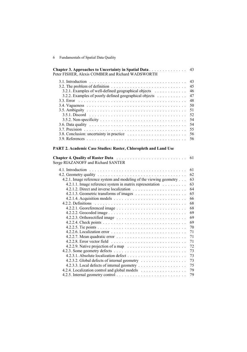
6 Fundamentals of Spatial Data Quality
Chapter 3. Approaches to Uncertainty in Spatial Data . . . . . . . . . . . . . .
Peter FISHER, Alexis COMBER and Richard WADSWORTH
3.1. Introduction . . . . . . . . . . . . . . . . . . . . . . . . . . . . . . . . . . . .
3.2. The problem of definition . . . . . . . . . . . . . . . . . . . . . . . . . . . .
3.2.1. Examples of well-defined geographical objects
. . . . . . . . . . . .
3.2.2. Examples of poorly defined geographical objects . . . . . . . . . . .
3.3. Error
. . . . . . . . . . . . . . . . . . . . . . . . . . . . . . . . . . . . . . . .
3.4. Vagueness . . . . . . . . . . . . . . . . . . . . . . . . . . . . . . . . . . . . .
3.5. Ambiguity . . . . . . . . . . . . . . . . . . . . . . . . . . . . . . . . . . . . .
3.5.1. Discord
. . . . . . . . . . . . . . . . . . . . . . . . . . . . . . . . . . . .
3.5.2. Non-specificity . . . . . . . . . . . . . . . . . . . . . . . . . . . . . . . .
3.6. Data quality . . . . . . . . . . . . . . . . . . . . . . . . . . . . . . . . . . . .
3.7. Precision . . . . . . . . . . . . . . . . . . . . . . . . . . . . . . . . . . . . . .
3.8. Conclusion: uncertainty in practice . . . . . . . . . . . . . . . . . . . . . .
3.9. References . . . . . . . . . . . . . . . . . . . . . . . . . . . . . . . . . . . . .
PART 2. Academic Case Studies: Raster, Chloropleth and Land Use
Chapter 4. Quality of Raster Data
Serge RIAZANOFF and Richard SANTER
. . . . . . . . . . . . . . . . . . . . . . . . . .
4.2.2. Definitions
4.1. Introduction . . . . . . . . . . . . . . . . . . . . . . . . . . . . . . . . . . . .
4.2. Geometry quality . . . . . . . . . . . . . . . . . . . . . . . . . . . . . . . . .
4.2.1. Image reference system and modeling of the viewing geometry . . .
4.2.1.1. Image reference system in matrix representation
. . . . . . . . .
4.2.1.2. Direct and inverse localization . . . . . . . . . . . . . . . . . . . .
4.2.1.3. Geometric transforms of images . . . . . . . . . . . . . . . . . . .
4.2.1.4. Acquisition models . . . . . . . . . . . . . . . . . . . . . . . . . . .
. . . . . . . . . . . . . . . . . . . . . . . . . . . . . . . . . .
4.2.2.1. Georeferenced image . . . . . . . . . . . . . . . . . . . . . . . . . .
4.2.2.2. Geocoded image . . . . . . . . . . . . . . . . . . . . . . . . . . . . .
4.2.2.3. Orthorectified image . . . . . . . . . . . . . . . . . . . . . . . . . .
4.2.2.4. Check points . . . . . . . . . . . . . . . . . . . . . . . . . . . . . . .
4.2.2.5. Tie points . . . . . . . . . . . . . . . . . . . . . . . . . . . . . . . . .
4.2.2.6. Localization error . . . . . . . . . . . . . . . . . . . . . . . . . . . .
4.2.2.7. Mean quadratic error . . . . . . . . . . . . . . . . . . . . . . . . . .
4.2.2.8. Error vector field . . . . . . . . . . . . . . . . . . . . . . . . . . . .
. . . . . . . . . . . . . . . . . . . . . .
4.2.2.9. Native projection of a map
4.2.3. Some geometry defects . . . . . . . . . . . . . . . . . . . . . . . . . . .
4.2.3.1. Absolute localization defect . . . . . . . . . . . . . . . . . . . . . .
4.2.3.2. Global defects of internal geometry . . . . . . . . . . . . . . . . .
4.2.3.3. Local defects of internal geometry . . . . . . . . . . . . . . . . . .
4.2.4. Localization control and global models
. . . . . . . . . . . . . . . . .
4.2.5. Internal geometry control . . . . . . . . . . . . . . . . . . . . . . . . . .
43
43
45
46
47
48
50
51
52
54
54
55
56
56
61
61
62
63
63
64
65
66
68
68
69
69
69
70
71
71
71
72
73
73
73
75
79
79
�
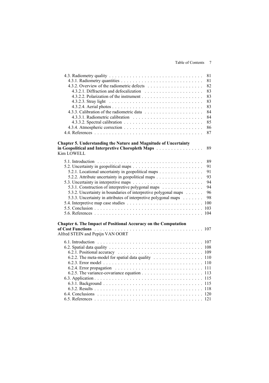
Table of Contents 7
4.3. Radiometry quality . . . . . . . . . . . . . . . . . . . . . . . . . . . . . . . .
4.3.1. Radiometry quantities . . . . . . . . . . . . . . . . . . . . . . . . . . . .
4.3.2. Overview of the radiometric defects . . . . . . . . . . . . . . . . . . .
4.3.2.1. Diffraction and defocalization
. . . . . . . . . . . . . . . . . . . .
4.3.2.2. Polarization of the instrument . . . . . . . . . . . . . . . . . . . . .
4.3.2.3. Stray light
. . . . . . . . . . . . . . . . . . . . . . . . . . . . . . . .
4.3.2.4. Aerial photos . . . . . . . . . . . . . . . . . . . . . . . . . . . . . . .
4.3.3. Calibration of the radiometric data . . . . . . . . . . . . . . . . . . . .
4.3.3.1. Radiometric calibration
. . . . . . . . . . . . . . . . . . . . . . . .
4.3.3.2. Spectral calibration . . . . . . . . . . . . . . . . . . . . . . . . . . .
4.3.4. Atmospheric correction . . . . . . . . . . . . . . . . . . . . . . . . . . .
4.4. References . . . . . . . . . . . . . . . . . . . . . . . . . . . . . . . . . . . . .
81
81
82
83
83
83
83
84
84
85
86
87
Chapter 5. Understanding the Nature and Magnitude of Uncertainty
in Geopolitical and Interpretive Choropleth Maps . . . . . . . . . . . . . . . . 89
Kim LOWELL
5.1. Introduction . . . . . . . . . . . . . . . . . . . . . . . . . . . . . . . . . . . .
5.2. Uncertainty in geopolitical maps . . . . . . . . . . . . . . . . . . . . . . . .
5.2.1. Locational uncertainty in geopolitical maps . . . . . . . . . . . . . . .
5.2.2. Attribute uncertainty in geopolitical maps . . . . . . . . . . . . . . . .
5.3. Uncertainty in interpretive maps . . . . . . . . . . . . . . . . . . . . . . . .
5.3.1. Construction of interpretive polygonal maps . . . . . . . . . . . . . .
5.3.2. Uncertainty in boundaries of interpretive polygonal maps . . . . . .
5.3.3. Uncertainty in attributes of interpretive polygonal maps . . . . . . .
89
91
91
93
94
94
96
98
5.4. Interpretive map case studies . . . . . . . . . . . . . . . . . . . . . . . . . . 100
5.5. Conclusion . . . . . . . . . . . . . . . . . . . . . . . . . . . . . . . . . . . . . 103
5.6. References . . . . . . . . . . . . . . . . . . . . . . . . . . . . . . . . . . . . . 104
Chapter 6. The Impact of Positional Accuracy on the Computation
of Cost Functions . . . . . . . . . . . . . . . . . . . . . . . . . . . . . . . . . . . . . 107
Alfred STEIN and Pepijn VAN OORT
6.1. Introduction . . . . . . . . . . . . . . . . . . . . . . . . . . . . . . . . . . . . 107
6.2. Spatial data quality . . . . . . . . . . . . . . . . . . . . . . . . . . . . . . . . 108
6.2.1. Positional accuracy
. . . . . . . . . . . . . . . . . . . . . . . . . . . . . 109
6.2.2. The meta-model for spatial data quality . . . . . . . . . . . . . . . . . 110
6.2.3. Error model . . . . . . . . . . . . . . . . . . . . . . . . . . . . . . . . . . 110
6.2.4. Error propagation
. . . . . . . . . . . . . . . . . . . . . . . . . . . . . . 111
6.2.5. The variance-covariance equation . . . . . . . . . . . . . . . . . . . . . 113
6.3. Application . . . . . . . . . . . . . . . . . . . . . . . . . . . . . . . . . . . . . 115
6.3.1. Background . . . . . . . . . . . . . . . . . . . . . . . . . . . . . . . . . . 115
6.3.2. Results . . . . . . . . . . . . . . . . . . . . . . . . . . . . . . . . . . . . . 118
6.4. Conclusions . . . . . . . . . . . . . . . . . . . . . . . . . . . . . . . . . . . . 120
6.5. References . . . . . . . . . . . . . . . . . . . . . . . . . . . . . . . . . . . . . 121
�




 2023年江西萍乡中考道德与法治真题及答案.doc
 2012年重庆南川中考生物真题及答案.doc
 2013年江西师范大学地理学综合及文艺理论基础考研真题.doc
 2020年四川甘孜小升初语文真题及答案I卷.doc
 2020年注册岩土工程师专业基础考试真题及答案.doc
 2023-2024学年福建省厦门市九年级上学期数学月考试题及答案.doc
 2021-2022学年辽宁省沈阳市大东区九年级上学期语文期末试题及答案.doc
 2022-2023学年北京东城区初三第一学期物理期末试卷及答案.doc
 2018上半年江西教师资格初中地理学科知识与教学能力真题及答案.doc
 2012年河北国家公务员申论考试真题及答案-省级.doc
 2020-2021学年江苏省扬州市江都区邵樊片九年级上学期数学第一次质量检测试题及答案.doc
 2022下半年黑龙江教师资格证中学综合素质真题及答案.doc