Geographical Information Systems and Science
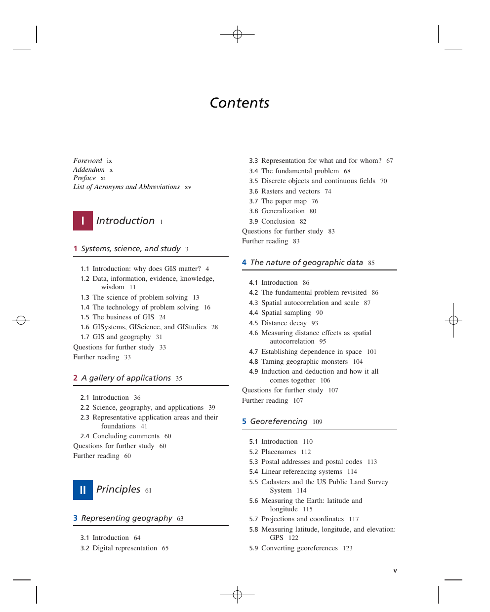
Contents
Foreword
Addendum
Preface
List of Acronyms and Abbreviations
I Introduction
1 Systems, science, and study
1.1 Introduction: why does GIS matter?
1.2 Data, information, evidence, knowledge, wisdom
1.3 The science of problem solving
1.4 The technology of problem solving
1.5 The business of GIS
1.6 GISystems, GIScience, and GIStudies
1.7 GIS and geography
Questions for further study
Further reading
2 A gallery of applications
2.1 Introduction
2.2 Science, geography, and applications
2.3 Representative application areas and their foundations
2.4 Concluding comments
Questions for further study
Further reading
II Principles
3 Representing geography
3.1 Introduction
3.2 Digital representation
3.3 Representation for what and for whom?
3.4 The fundamental problem
3.5 Discrete objects and continuous fields
3.6 Rasters and vectors
3.7 The paper map
3.8 Generalization
3.9 Conclusion
Questions for further study
Further reading
4 The nature of geographic data
4.1 Introduction
4.2 The fundamental problem revisited
4.3 Spatial autocorrelation and scale
4.4 Spatial sampling
4.5 Distance decay
4.6 Measuring distance effects as spatial autocorrelation
4.7 Establishing dependence in space
4.8 Taming geographic monsters
4.9 Induction and deduction and how it all comes together
Questions for further study
Further reading
5 Georeferencing
5.1 Introduction
5.2 Placenames
5.3 Postal addresses and postal codes
5.4 Linear referencing systems
5.5 Cadasters and the US Public Land Survey System
5.6 Measuring the Earth: latitude and longitude
5.7 Projections and coordinates
5.8 Measuring latitude, longitude, and elevation: GPS
5.9 Converting georeferences
5.10 Summary
Questions for further study
Further reading
6 Uncertainty
6.1 Introduction
6.2 U1: Uncertainty in the conception of geographic phenomena
6.3 U2: Further uncertainty in the measurement and representation of geographic phenomena
6.4 U3: Further uncertainty in the analysis of geographic phenomena
6.5 Consolidation
Questions for further study
Further reading
III Techniques
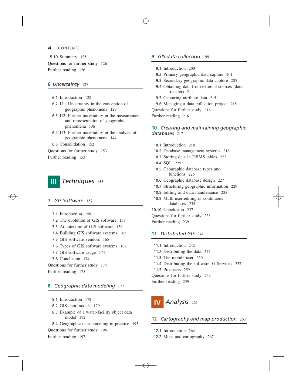
7 GIS Software
7.1 Introduction
7.2 The evolution of GIS software
7.3 Architecture of GIS software
7.4 Building GIS software systems
7.5 GIS software vendors
7.6 Types of GIS software systems
7.7 GIS software usage
7.8 Conclusion
Questions for further study
Further reading
8 Geographic data modeling
8.1 Introduction
8.2 GIS data models
8.3 Example of a water-facility object data model
8.4 Geographic data modeling in practice
Questions for further study
Further reading
9 GIS data collection
9.1 Introduction
9.2 Primary geographic data capture
9.3 Secondary geographic data capture
9.4 Obtaining data from external sources (data transfer)
9.5 Capturing attribute data
9.6 Managing a data collection project
Questions for further study
Further reading
10 Creating and maintaining geographic databases
10.1 Introduction
10.2 Database management systems
10.3 Storing data in DBMS tables
10.4 SQL
10.5 Geographic database types and functions
10.6 Geographic database design
10.7 Structuring geographic information
10.8 Editing and data maintenance
10.9 Multi-user editing of continuous databases
10.10 Conclusion
Questions for further study
Further reading
11 Distributed GIS
11.1 Introduction
11.2 Distributing the data
11.3 The mobile user
11.4 Distributing the software: GIServices
11.5 Prospects
Questions for further study
Further reading
IV Analysis
12 Cartography and map production
12.1 Introduction
12.2 Maps and cartography
12.3 Principles of map design
12.4 Map series
12.5 Applications
12.6 Conclusions
Questions for further study
Further reading
13 Geovisualization
13.1 Introduction: uses, users, messages, and media
13.2 Geovisualization and spatial query
13.3 Geovisualization and transformation
13.4 Immersive interaction and PPGIS
13.5 Consolidation
Questions for further study
Further reading
14 Query, measurement, and transformation
14.1 Introduction: what is spatial analysis?
14.2 Queries
14.3 Measurements
14.4 Transformations
14.5 Conclusion
Questions for further study
Further reading
15 Descriptive summary, design, and inference
15.1 More spatial analysis
15.2 Descriptive summaries
15.3 Optimization
15.4 Hypothesis testing
15.5 Conclusion
Questions for further study
Further reading
16 Spatial modeling with GIS
16.1 Introduction
16.2 Types of model
16.3 Technology for modeling
16.4 Multicriteria methods
16.5 Accuracy and validity: testing the model
16.6 Conclusion
Questions for further study
Further reading
V Management and Policy
17 Managing GIS
17.1 The big picture
17.2 The process of developing a sustainable GIS
17.3 Sustaining a GIS – the people and their competences
17.4 Conclusions
Questions for further study
Further reading
18 GIS and management, the Knowledge Economy, and information
18.1 Are we all in ‘managed businesses’ now?
18.2 Management is central to the successful use of GIS
18.3 The Knowledge Economy, knowledge management, and GIS
18.4 Information, the currency of the Knowledge Economy
18.5 GIS as a business and as a business stimulant
18.6 Discussion
Questions for further study
Further reading
19 Exploiting GIS assets and navigating constraints
19.1 GIS and the law
19.2 GIS people and their skills
19.3 Availability of ‘core’ geographic information
19.4 Navigating the constraints
19.5 Conclusions
Questions for further study
Further reading
20 GIS partnerships
20.1 Introduction
20.2 Collaborations at the local level
20.3 Working together at the national level
20.4 Multi-national collaborations
20.5 Nationalism, globalization, politics, and GIS
20.6 Extreme events can change everything
20.7 Conclusions
Questions for further study
Further reading
21 Epilog
21.1 Introduction
21.2 A consolidation of some recurring themes
21.3 Ten ‘grand challenges’ for GIS
21.4 Conclusions
Questions for further study
Further reading
Index


 2023年江西萍乡中考道德与法治真题及答案.doc
 2012年重庆南川中考生物真题及答案.doc
 2013年江西师范大学地理学综合及文艺理论基础考研真题.doc
 2020年四川甘孜小升初语文真题及答案I卷.doc
 2020年注册岩土工程师专业基础考试真题及答案.doc
 2023-2024学年福建省厦门市九年级上学期数学月考试题及答案.doc
 2021-2022学年辽宁省沈阳市大东区九年级上学期语文期末试题及答案.doc
 2022-2023学年北京东城区初三第一学期物理期末试卷及答案.doc
 2018上半年江西教师资格初中地理学科知识与教学能力真题及答案.doc
 2012年河北国家公务员申论考试真题及答案-省级.doc
 2020-2021学年江苏省扬州市江都区邵樊片九年级上学期数学第一次质量检测试题及答案.doc
 2022下半年黑龙江教师资格证中学综合素质真题及答案.doc