Editors: Heather Tallis, Taylor Ricketts, Anne Guerry, Spencer Wood, and Richard Sharp.
Contributing Authors: Erik Nelson, Driss Ennaanay, Stacie Wolny, Nasser Olwero, Kari Vigerstol, Derric Penning-
ton, Guillermo Mendoza, Juliann Aukema, John Foster, Jessica Forrest, Dick Cameron, Katie Arkema, Eric Lonsdorf,
Christina Kennedy, Gregory Verutes, Chong-Ki Kim, Gregory Guannel, Michael Papenfus, Jodie Toft, Matthew Mar-
sik, and Joey Bernhardt.
Citation: Tallis, H.T., Ricketts, T., Guerry, A.D., Wood, S.A., Sharp, R., Nelson, E., Ennaanay, D., Wolny, S.,
Olwero, N., Vigerstol, K., Pennington, D., Mendoza, G., Aukema, J., Foster, J., Forrest, J., Cameron, D., Arkema, K.,
Lonsdorf, E., Kennedy, C., Verutes, G., Kim, C.K., Guannel, G., Papenfus, M., Toft, J., Marsik, M., and Bernhardt, J.
2011. InVEST 2.2.0 User’s Guide. The Natural Capital Project, Stanford.
i
�
CONTENTS
I Front-matter
1 The Need for a New Tool
.
Introduction .
1.1
.
1.2 Who should use InVEST? .
.
1.3
.
1.4 A work in progress .
1.5
.
.
Introduction to InVEST .
.
.
This guide
.
.
.
.
.
.
.
.
.
.
.
.
.
.
.
.
.
.
.
.
.
.
.
. . . . . . . . . . . . . . . . . . . . . . . . . . . . . . . . . . . .
.
. . . . . . . . . . . . . . . . . . . . . . . . . . . . . . . . . . . .
.
.
. . . . . . . . . . . . . . . . . . . . . . . . . . . . . . . . . . . .
. . . . . . . . . . . . . . . . . . . . . . . . . . . . . . . . . . . . .
.
. . . . . . . . . . . . . . . . . . . . . . . . . . . . . . . . . . . .
2 Getting Started
.
. . . . . . . . . . . . . . . . . . . . . . . .
. . . . . . . . . . . . . . . . . . . . . . . .
. . . . . . . . . . . . . . . . . . . . . . . . . . . . . . . . . . . . .
2.1 Getting started with InVEST .
.
Installing the InVEST tool and data on your computer
2.2
2.3 Downloading and installing Python library extensions
.
2.4 Adding the InVEST toolbox to ArcMap . . . . . . . . . . . . . . . . . . . . . . . . . . . . . . . . .
.
. . . . . . . . . . . . . . . . . . . . . . . . . . . . . . . . . . . . .
2.5 Using sample data .
.
2.6
. . . . . . . . . . . . . . . . . . . . . . . . . . . . . . . . . . . . .
.
. . . . . . . . . . . . . . . . . . . . . . . . . . . . . . . . . . . .
.
2.7
.
. . . . . . . . . . . . . . . . . . . . . . . . . . . . . . . . . . . .
.
2.8
. . . . . . . . . . . . . . . . . . . . . . . . . . . . . . . . . . . .
.
.
2.9 Model run checklist
.
2.10 Reporting errors
.
.
. . . . . . . . . . . . . . . . . . . . . . . . . . . . . . . . . . . .
2.11 Working with the DEM .
. . . . . . . . . . . . . . . . . . . . . . . . . . . . . . . . . . . . .
. . . . . . . . . . . . . . . . . . . . . . . . . . . . . . . . . . . . .
.
2.12 Resources .
.
Formatting your data .
Running the models
.
Support information .
.
.
.
.
.
.
.
.
.
.
.
.
.
.
.
.
.
.
.
.
.
.
.
.
.
.
.
.
.
.
.
.
.
.
.
.
.
.
.
.
II Marine Models
3 Wave Energy Model
Summary .
.
Introduction .
.
The model
.
.
.
.
.
.
.
.
.
.
3.1
3.2
3.3
.
3.4 Data needs .
3.5
3.6
3.7
3.8 Appendix A .
3.9
.
. . . . . . . . . . . . . . . . . . . . . . . . . . . . . . . . . . . .
.
.
. . . . . . . . . . . . . . . . . . . . . . . . . . . . . . . . . . . .
.
.
.
. . . . . . . . . . . . . . . . . . . . . . . . . . . . . . . . . . . .
.
. . . . . . . . . . . . . . . . . . . . . . . . . . . . . . . . . . . . .
.
.
. . . . . . . . . . . . . . . . . . . . . . . . . . . . . . . . . . . .
Running the model .
. . . . . . . . . . . . . . . . . . . . . . . . . . . . . . . . . . . . .
Interpreting results .
Case example illustrating results . . . . . . . . . . . . . . . . . . . . . . . . . . . . . . . . . . . . .
. . . . . . . . . . . . . . . . . . . . . . . . . . . . . . . . . . . .
. . . . . . . . . . . . . . . . . . . . . . . . . . . . . . . . . . . .
References .
.
.
.
.
.
.
.
.
.
.
.
.
.
.
.
.
.
.
.
.
.
.
.
.
.
.
.
.
.
.
.
.
.
.
.
.
.
.
.
.
.
.
.
.
.
.
.
.
.
.
.
.
.
.
.
.
4 Coastal Vulnerability Model
.
.
Summary .
.
Introduction .
4.1
4.2
.
.
.
.
.
.
.
.
.
.
.
.
.
.
.
.
.
.
.
. . . . . . . . . . . . . . . . . . . . . . . . . . . . . . . . . . . .
. . . . . . . . . . . . . . . . . . . . . . . . . . . . . . . . . . . .
1
2
2
2
3
5
5
7
7
7
7
8
9
9
10
11
13
13
13
16
17
18
18
18
19
23
26
31
33
35
36
37
37
37
ii
�
.
.
.
.
.
.
.
.
.
.
.
.
4.3
4.4
4.5 Data needs .
4.6
4.7
4.8 Appendix A .
.
4.9 Appendix B .
4.10 References .
.
.
The model
Limitations and Simplifications
.
.
.
.
.
.
.
Running the model .
Interpreting results .
.
.
.
.
.
.
.
.
.
.
.
.
.
.
.
.
.
.
.
.
.
.
.
.
.
.
.
.
.
.
.
.
.
.
.
.
.
.
.
.
.
.
.
.
.
.
.
.
.
.
5 Coastal Protection Model
.
.
.
.
.
.
5.1
5.2
5.3
5.4
5.5 Data Needs .
5.6
5.7
.
5.8
5.9 Appendix A .
.
Summary .
.
.
Introduction .
The model
.
.
Limitations and Simplifications
.
.
.
.
.
.
Running the model .
Interpreting results .
References .
.
.
.
.
.
.
.
.
.
.
.
.
.
.
.
.
.
.
.
.
.
.
.
.
.
.
.
.
.
.
.
.
.
.
.
.
.
.
.
6 Marine Fish Aquaculture
.
.
.
.
.
.
6.1
6.2
6.3
6.4
6.5 Data needs .
6.6
6.7
6.8
.
.
Summary .
.
Introduction .
The Model
.
.
Limitations and simplifications
.
.
.
.
.
Running the model .
Interpreting results .
References .
.
.
.
.
.
.
.
.
.
.
.
.
.
.
.
.
.
.
.
.
.
.
.
.
.
.
.
.
.
.
.
.
.
.
.
.
.
.
.
.
.
.
.
.
.
.
.
.
.
.
.
.
. . . . . . . . . . . . . . . . . . . . . . . . . . . . . . . . . . . . .
. . . . . . . . . . . . . . . . . . . . . . . . . . . . . . . . . . . . .
. . . . . . . . . . . . . . . . . . . . . . . . . . . . . . . . . . . . .
. . . . . . . . . . . . . . . . . . . . . . . . . . . . . . . . . . . . .
. . . . . . . . . . . . . . . . . . . . . . . . . . . . . . . . . . . . .
. . . . . . . . . . . . . . . . . . . . . . . . . . . . . . . . . . . . .
. . . . . . . . . . . . . . . . . . . . . . . . . . . . . . . . . . . . .
. . . . . . . . . . . . . . . . . . . . . . . . . . . . . . . . . . . . .
38
44
44
48
58
60
61
66
68
68
. . . . . . . . . . . . . . . . . . . . . . . . . . . . . . . . . . . .
.
68
. . . . . . . . . . . . . . . . . . . . . . . . . . . . . . . . . . . .
.
69
.
. . . . . . . . . . . . . . . . . . . . . . . . . . . . . . . . . . . .
80
. . . . . . . . . . . . . . . . . . . . . . . . . . . . . . . . . . . . .
81
. . . . . . . . . . . . . . . . . . . . . . . . . . . . . . . . . . . . .
.
95
. . . . . . . . . . . . . . . . . . . . . . . . . . . . . . . . . . . .
. . . . . . . . . . . . . . . . . . . . . . . . . . . . . . . . . . . . . 105
.
. . . . . . . . . . . . . . . . . . . . . . . . . . . . . . . . . . . . 107
. . . . . . . . . . . . . . . . . . . . . . . . . . . . . . . . . . . . 108
.
112
. . . . . . . . . . . . . . . . . . . . . . . . . . . . . . . . . . . . 112
.
. . . . . . . . . . . . . . . . . . . . . . . . . . . . . . . . . . . . 112
.
.
. . . . . . . . . . . . . . . . . . . . . . . . . . . . . . . . . . . . 113
. . . . . . . . . . . . . . . . . . . . . . . . . . . . . . . . . . . . . 115
. . . . . . . . . . . . . . . . . . . . . . . . . . . . . . . . . . . . . 115
.
. . . . . . . . . . . . . . . . . . . . . . . . . . . . . . . . . . . . 118
. . . . . . . . . . . . . . . . . . . . . . . . . . . . . . . . . . . . . 122
.
. . . . . . . . . . . . . . . . . . . . . . . . . . . . . . . . . . . . 124
.
.
.
.
.
.
.
.
.
.
.
.
.
.
.
.
.
.
.
.
.
.
.
.
.
.
7 Aesthetic Quality
.
Summary .
.
.
Introduction .
The model
.
.
Limitations and simplifications
.
.
.
125
. . . . . . . . . . . . . . . . . . . . . . . . . . . . . . . . . . . . 125
.
. . . . . . . . . . . . . . . . . . . . . . . . . . . . . . . . . . . . 125
.
.
. . . . . . . . . . . . . . . . . . . . . . . . . . . . . . . . . . . . 126
. . . . . . . . . . . . . . . . . . . . . . . . . . . . . . . . . . . . . 127
. . . . . . . . . . . . . . . . . . . . . . . . . . . . . . . . . . . . . 127
.
.
. . . . . . . . . . . . . . . . . . . . . . . . . . . . . . . . . . . . 128
Running the model .
Interpreting results .
. . . . . . . . . . . . . . . . . . . . . . . . . . . . . . . . . . . . . 133
Case example illustrating results . . . . . . . . . . . . . . . . . . . . . . . . . . . . . . . . . . . . . 134
. . . . . . . . . . . . . . . . . . . . . . . . . . . . . . . . . . . . 137
References .
7.1
7.2
7.3
7.4
7.5 Data needs .
7.6
7.7
7.8
7.9
.
.
.
.
.
.
.
.
.
.
.
.
.
.
.
.
.
.
.
.
.
.
.
.
.
.
.
.
.
8 Overlap Analysis Model: Fisheries and Recreation (Tier 0)
.
.
.
.
.
.
.
.
.
.
.
.
.
.
.
.
.
.
.
.
.
.
.
.
.
.
.
Summary .
.
.
Introduction .
The model
.
.
Limitations and simplifications
.
.
.
.
Running the model .
Interpreting results .
Case examples illustrating results .
8.1
8.2
8.3
8.4
8.5 Data needs .
8.6
8.7
8.8
8.9 Appendix A .
8.10 References .
.
.
.
.
.
.
.
.
.
.
.
.
.
.
.
.
.
.
.
.
.
.
.
.
.
.
.
.
.
.
.
.
.
.
.
.
.
139
. . . . . . . . . . . . . . . . . . . . . . . . . . . . . . . . . . . . 139
.
. . . . . . . . . . . . . . . . . . . . . . . . . . . . . . . . . . . . 139
.
.
. . . . . . . . . . . . . . . . . . . . . . . . . . . . . . . . . . . . 140
. . . . . . . . . . . . . . . . . . . . . . . . . . . . . . . . . . . . . 142
. . . . . . . . . . . . . . . . . . . . . . . . . . . . . . . . . . . . . 142
.
. . . . . . . . . . . . . . . . . . . . . . . . . . . . . . . . . . . . 145
. . . . . . . . . . . . . . . . . . . . . . . . . . . . . . . . . . . . . 151
. . . . . . . . . . . . . . . . . . . . . . . . . . . . . . . . . . . 152
. . . . . . . . . . . . . . . . . . . . . . . . . . . . . . . . . . . . 156
. . . . . . . . . . . . . . . . . . . . . . . . . . . . . . . . . . . . 159
.
.
9 Habitat Risk Assessment
.
Summary .
9.1
.
.
.
.
.
.
.
.
.
.
.
160
. . . . . . . . . . . . . . . . . . . . . . . . . . . . . . . . . . . . 160
iii
�
.
.
.
.
.
.
Introduction .
.
The model
.
9.2
9.3
.
9.4 Data needs .
9.5
9.6
9.7
.
.
.
Running the model .
Interpreting results .
.
References .
.
.
.
.
.
.
.
.
.
.
.
.
.
.
.
.
.
.
.
.
.
.
.
.
.
.
.
.
.
.
.
.
.
.
.
.
.
.
.
. . . . . . . . . . . . . . . . . . . . . . . . . . . . . . . . . . . . . 160
. . . . . . . . . . . . . . . . . . . . . . . . . . . . . . . . . . . . . 162
. . . . . . . . . . . . . . . . . . . . . . . . . . . . . . . . . . . . . 169
. . . . . . . . . . . . . . . . . . . . . . . . . . . . . . . . . . . . . 174
. . . . . . . . . . . . . . . . . . . . . . . . . . . . . . . . . . . . . 180
. . . . . . . . . . . . . . . . . . . . . . . . . . . . . . . . . . . . . 184
III Terrestrial and Freshwater Models
185
10 Biodiversity: Habitat Quality & Rarity
.
10.1 Summary .
.
.
10.2 Introduction .
.
10.3 The Model
.
.
10.4 Running the Model .
10.5 References .
.
.
.
.
.
.
.
.
.
.
.
.
.
.
.
.
.
.
.
.
.
.
.
.
.
.
.
.
.
.
.
.
.
.
.
.
.
11 Carbon Storage and Sequestration
.
.
.
.
.
.
.
.
11.1 Summary .
.
.
.
11.2 Introduction .
.
11.3 The Model
.
.
11.4 Running the Model .
.
11.5 Appendix: data sources
.
11.6 References .
.
.
.
.
.
.
.
.
.
.
.
.
.
.
.
.
.
.
.
.
.
.
.
.
.
.
.
.
.
.
.
.
.
.
.
.
.
.
.
186
. . . . . . . . . . . . . . . . . . . . . . . . . . . . . . . . . . . . . 186
. . . . . . . . . . . . . . . . . . . . . . . . . . . . . . . . . . . . . 186
. . . . . . . . . . . . . . . . . . . . . . . . . . . . . . . . . . . . . 187
. . . . . . . . . . . . . . . . . . . . . . . . . . . . . . . . . . . . . 196
. . . . . . . . . . . . . . . . . . . . . . . . . . . . . . . . . . . . . 200
201
. . . . . . . . . . . . . . . . . . . . . . . . . . . . . . . . . . . . . 201
. . . . . . . . . . . . . . . . . . . . . . . . . . . . . . . . . . . . . 201
. . . . . . . . . . . . . . . . . . . . . . . . . . . . . . . . . . . . . 203
. . . . . . . . . . . . . . . . . . . . . . . . . . . . . . . . . . . . . 212
. . . . . . . . . . . . . . . . . . . . . . . . . . . . . . . . . . . . . 216
. . . . . . . . . . . . . . . . . . . . . . . . . . . . . . . . . . . . . 221
.
12 Reservoir Hydropower Production
.
.
.
.
226
. . . . . . . . . . . . . . . . . . . . . . . . . . . . . . . . . . . . . 226
.
12.1 Summary .
.
. . . . . . . . . . . . . . . . . . . . . . . . . . . . . . . . . . . . . 227
.
12.2 Introduction .
. . . . . . . . . . . . . . . . . . . . . . . . . . . . . . . . . . . . . 227
12.3 The Model
.
.
12.4 Appendix A: Data Sources .
. . . . . . . . . . . . . . . . . . . . . . . . . . . . . . . . . . . . . 239
12.5 Appendix B: Calibration of Water Yield Model . . . . . . . . . . . . . . . . . . . . . . . . . . . . . 244
. . . . . . . . . . . . . . . . . . . . . . . . . . . . . . . . . . . . . 245
12.6 References .
.
.
.
.
.
.
.
.
.
.
.
.
.
.
.
.
.
.
.
.
.
.
.
.
.
.
.
.
.
.
.
.
.
13 Water Purification: Nutrient Retention
.
.
.
.
.
.
.
.
.
.
13.1 Summary .
.
.
13.2 Introduction .
.
13.3 The Model
.
.
13.4 Running the Model .
.
13.5 Appendix: Data Sources .
13.6 References .
.
.
.
.
.
.
.
.
.
.
.
.
.
.
.
.
.
.
.
.
.
.
.
.
.
.
.
.
.
.
.
.
.
.
246
. . . . . . . . . . . . . . . . . . . . . . . . . . . . . . . . . . . . . 246
. . . . . . . . . . . . . . . . . . . . . . . . . . . . . . . . . . . . . 246
. . . . . . . . . . . . . . . . . . . . . . . . . . . . . . . . . . . . . 247
. . . . . . . . . . . . . . . . . . . . . . . . . . . . . . . . . . . . . 253
. . . . . . . . . . . . . . . . . . . . . . . . . . . . . . . . . . . . . 256
. . . . . . . . . . . . . . . . . . . . . . . . . . . . . . . . . . . . . 260
14 Sediment Retention Model: Avoided dredging and water quality regulation
.
.
14.1 Summary .
.
.
14.2 Introduction .
14.3 The Model
.
.
14.4 Appendix: data sources
14.5 References .
.
.
.
.
.
.
.
.
.
.
.
.
.
.
.
.
.
.
.
.
.
.
.
.
.
.
.
.
.
.
.
.
.
.
.
.
.
.
.
.
15 Managed Timber Production Model
.
.
.
.
.
.
15.1 Summary .
.
.
15.2 Introduction .
.
15.3 The Model
.
15.4 Running the Model .
15.5 References .
.
.
.
.
.
.
.
.
.
.
.
.
.
.
.
.
.
.
.
.
.
.
.
.
.
.
.
.
.
.
.
.
.
.
.
.
261
. . . . . . . . . . . . . . . . . . . . . . . . . . . . . . . . . . . . . 261
. . . . . . . . . . . . . . . . . . . . . . . . . . . . . . . . . . . . . 261
. . . . . . . . . . . . . . . . . . . . . . . . . . . . . . . . . . . . . 262
. . . . . . . . . . . . . . . . . . . . . . . . . . . . . . . . . . . . . 273
. . . . . . . . . . . . . . . . . . . . . . . . . . . . . . . . . . . . . 276
277
. . . . . . . . . . . . . . . . . . . . . . . . . . . . . . . . . . . . . 277
. . . . . . . . . . . . . . . . . . . . . . . . . . . . . . . . . . . . . 277
. . . . . . . . . . . . . . . . . . . . . . . . . . . . . . . . . . . . . 278
. . . . . . . . . . . . . . . . . . . . . . . . . . . . . . . . . . . . . 284
. . . . . . . . . . . . . . . . . . . . . . . . . . . . . . . . . . . . . 287
iv
�
16 Crop Pollination
.
.
16.1 Summary .
.
.
.
16.2 Introduction .
.
16.3 The Model
.
.
.
16.4 Running the Model .
16.5 Appendix: Data sources .
16.6 References .
.
.
.
.
.
.
.
.
.
.
.
.
.
.
.
.
.
.
.
.
.
.
.
289
. . . . . . . . . . . . . . . . . . . . . . . . . . . . . . . . . . . . 289
.
. . . . . . . . . . . . . . . . . . . . . . . . . . . . . . . . . . . . 289
.
. . . . . . . . . . . . . . . . . . . . . . . . . . . . . . . . . . . . 290
.
. . . . . . . . . . . . . . . . . . . . . . . . . . . . . . . . . . . . 296
.
. . . . . . . . . . . . . . . . . . . . . . . . . . . . . . . . . . . . . 299
.
. . . . . . . . . . . . . . . . . . . . . . . . . . . . . . . . . . . . 299
.
.
.
.
.
.
.
.
.
.
.
.
.
.
.
.
.
.
17 Data Requirements and Outputs Summary Table
IV Acknowledgements
301
304
18 Marine Models
18.1 Acknowledgements
.
.
.
.
.
.
.
305
. . . . . . . . . . . . . . . . . . . . . . . . . . . . . . . . . . . . 305
V Frequently Asked Questions
19 Frequently Asked Questions
VI Roadmap
20 Marine Models
20.1 What’s coming up for Marine InVEST models? . . . . . . . . . . . . . . . . . . . . . . . . . . . .
307
308
309
310
. 310
v
�
Part I
Front-matter
1
�
CHAPTER
ONE
THE NEED FOR A NEW TOOL
1.1 Introduction
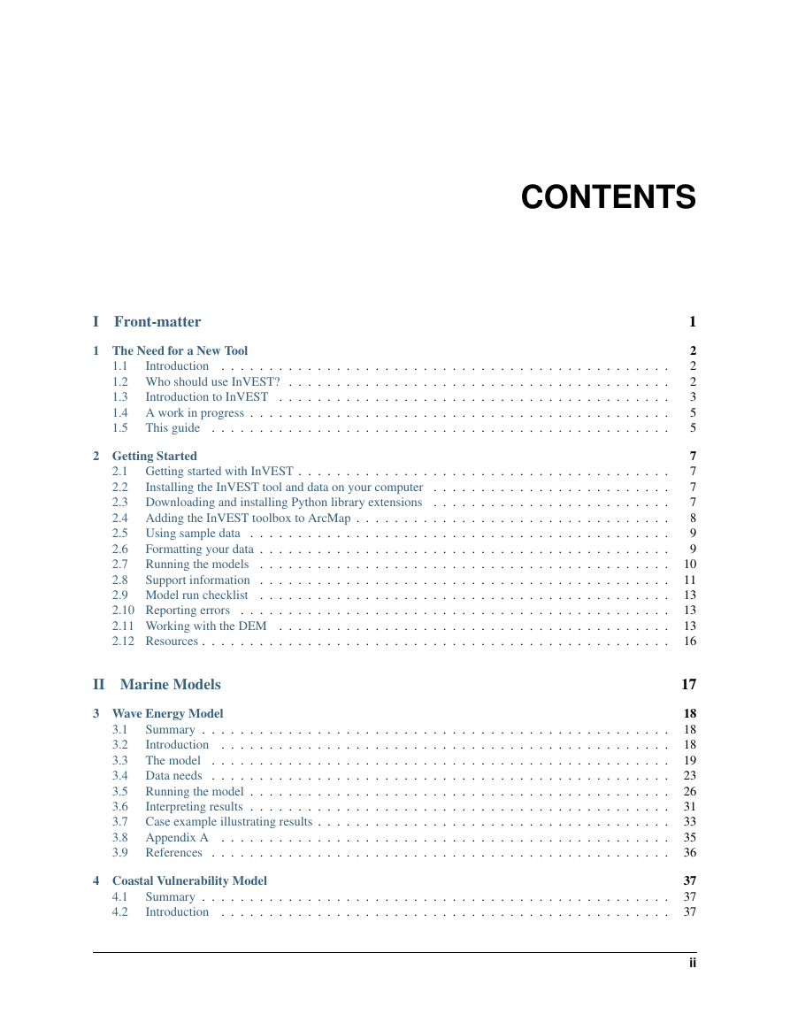
Ecosystems, if properly managed, yield a flow of services that are vital to humanity, including the production of goods
(e.g., food), life support processes (e.g., water purification), and life fulfilling conditions (e.g., beauty, recreation
opportunities), and the conservation of options (e.g., genetic diversity for future use). Despite its importance, this
natural capital is poorly understood, scarcely monitored, and—in many cases—undergoing rapid degradation and
depletion. To better align ecosystem conservation with economic forces, the Natural Capital Project is developing
models that quantify and map the values of environmental services. The modeling suite is best suited for analyses of
multiple services and multiple objectives. The current models, which require relatively little data input, can identify
areas where investment may enhance human well-being and nature. We are continuing development of the models and
will release new, updated versions as they become available.
1.2 Who should use InVEST?
InVEST is designed to inform decisions about natural resource management. Decision-makers, from governments to
non-profits to corporations, often manage lands and waters for multiple uses and inevitably must evaluate trade-offs
among these uses; InVEST’s multi-service, modular design provides an effective tool for evaluating these trade-offs.
For example, government agencies could use InVEST to help determine how to manage lands, coasts, and marine
areas to provide an optimal mix of benefits to people or to help design permitting and mitigation programs that sustain
nature’s benefits to society. Conservation organizations could use InVEST to better align their missions to protect
biodiversity with activities that improve human livelihoods. Corporations, such as timber companies, renewable energy
companies, and water utilities, could also use InVEST to decide how and where to invest in natural capital to ensure
that their supply chains are preserved.
InVEST can help answer questions like:
• Where do environmental services originate and where are they consumed?
• How does a proposed forestry management plan affect timber yields, biodiversity, water quality and recreation?
• What kinds of coastal management and fishery policies will yield the best returns for sustainable fisheries,
shoreline protection and recreation?
• Which parts of a watershed provide the greatest carbon sequestration, biodiversity, and tourism values?
• Where would reforestation achieve the greatest downstream water quality benefits while maintaining or mini-
mizing losses in water flows?
• How will climate change and population growth impact environmental services and biodiversity?
2
�
InVEST User Guide, Release 2.2.0
• What benefits does marine spatial planning provide to society in addition to food from fishing and aquaculture
and secure locations for renewable energy facilities?
1.3 Introduction to InVEST
The InVEST toolset described in this guide includes models for quantifying, mapping, and valuing the benefits pro-
vided by terrestrial, freshwater and marine systems. Specifically it includes models for:
• Wave Energy
• Coastal Vulnerability
• Coastal Protection
• Marine Fish Aquaculture
• Marine Aesthetic Quality
• Marine Overlap Analysis Model: Fisheries and Recreation
• Marine Habitat Risk Assessment
• Terrestrial Biodiversity: Habitat Quality and Rarity
• Carbon Storage and Sequestration
• Reservoir Hydropower Production
• Water Purification: Nutrient Retention
• Sediment Retention Model: Avoided Dredgin and Water Quality Regulation
• Manage Timber Production
• Crop Pollination
To date, the marine and terrestrial/freshwater models are treated separately. The current version of InVEST presents
the models for the two systems in turn. In future releases, models for the two systems will be more integrated. This
will occur in two primary ways. First, some models will have improved flexibility to be applied in either terrestrial
or marine systems (e.g. carbon storage and sequestration, biodiversity, recreation, aesthetic views). (The terrestrial
biodiversity model can be applied, as is, to nearshore marine systems. Please see the marine habitat quality model
chapter for a discussion of differences between the approaches and why there are two). Second, we are working to link
freshwater and marine models so that effects of watershed activities on coastal and marine systems can be explored.
Such linkages will be included in later releases of InVEST.
InVEST is most effectively used within a decision-making process that starts with a series of stakeholder consultations
(illustrated in Figure 1). Through discussion, questions of interest to policy makers, communities and conservation
groups are identified. These questions may concern service delivery on a landscape today and how these services may
be affected by new programs, policies, and conditions in the future. For questions regarding the future, stakeholders
develop “scenarios” to explore the consequences of expected changes on natural resources. These scenarios typically
include a map of future land use and land cover or, for the marine models, a map of future coastal and ocean uses and
coastal/marine habitats.
Following stakeholder consultations and scenario development, InVEST can estimate the amount and value of envi-
ronmental services that are provided on the current landscape or under future scenarios. InVEST models are spatially-
explicit, using maps as information sources and producing maps as outputs. InVEST returns results in either biophys-
ical terms (e.g., tons of carbon sequestered) or economic terms (e.g., net present value of that sequestered carbon).
The spatial resolution of analyses is also flexible, allowing users to address questions at the local, regional or global
scale. InVEST results can be shared with the stakeholders and decision-makers who created the scenarios to inform
upcoming decisions. Using InVEST in an iterative process, these stakeholders may choose to create new scenarios
based on the information revealed by the models until suitable solutions for management action are identified.
1.3.
Introduction to InVEST
3
�


 2023年江西萍乡中考道德与法治真题及答案.doc
 2012年重庆南川中考生物真题及答案.doc
 2013年江西师范大学地理学综合及文艺理论基础考研真题.doc
 2020年四川甘孜小升初语文真题及答案I卷.doc
 2020年注册岩土工程师专业基础考试真题及答案.doc
 2023-2024学年福建省厦门市九年级上学期数学月考试题及答案.doc
 2021-2022学年辽宁省沈阳市大东区九年级上学期语文期末试题及答案.doc
 2022-2023学年北京东城区初三第一学期物理期末试卷及答案.doc
 2018上半年江西教师资格初中地理学科知识与教学能力真题及答案.doc
 2012年河北国家公务员申论考试真题及答案-省级.doc
 2020-2021学年江苏省扬州市江都区邵樊片九年级上学期数学第一次质量检测试题及答案.doc
 2022下半年黑龙江教师资格证中学综合素质真题及答案.doc