SENTINEL-2 User Handbook
Sentinel-2 User Handbook
Page 1/64
ESA Standard Document
Date 24/07/2015 Issue 1 Rev 2
�
SENTINEL-2 User Handbook
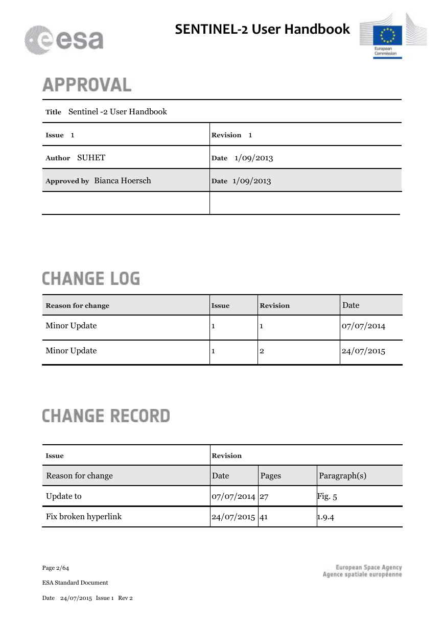
Title Sentinel -2 User Handbook
Issue 1
Revision 1
Author SUHET
Date 1/09/2013
Approved by Bianca Hoersch
Date 1/09/2013
Reason for change
Issue
Revision
Date
Minor Update
Minor Update
1
1
1
2
07/07/2014
24/07/2015
Issue
Revision
Reason for change
Date
Pages
Paragraph(s)
Update to
07/07/2014 27
Fix broken hyperlink
24/07/2015 41
Fig. 5
1.9.4
Page 2/64
ESA Standard Document
Date 24/07/2015 Issue 1 Rev 2
�
SENTINEL-2 User Handbook
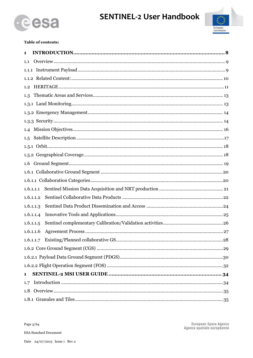
Table of contents:
1
INTRODUCTION................................................................................................... 8
1.1 Overview ....................................................................................................................................... 9
1.1.1 Instrument Payload .................................................................................................................... 9
1.1.2 Related Content: ....................................................................................................................... 10
1.2 HERITAGE .................................................................................................................................. 11
1.3 Thematic Areas and Services ...................................................................................................... 13
1.3.1 Land Monitoring....................................................................................................................... 13
1.3.2 Emergency Management .......................................................................................................... 14
1.3.3 Security ..................................................................................................................................... 14
1.4 Mission Objectives...................................................................................................................... 16
1.5 Satellite Description ....................................................................................................................17
1.5.1 Orbit .......................................................................................................................................... 18
1.5.2 Geographical Coverage ............................................................................................................. 18
1.6 Ground Segment ......................................................................................................................... 19
1.6.1 Collaborative Ground Segment ................................................................................................ 20
1.6.1.1 Collaboration Categories ........................................................................................................ 20
1.6.1.1.1 Sentinel Mission Data Acquisition and NRT production .................................................. 21
1.6.1.1.2 Sentinel Collaborative Data Products ............................................................................... 22
1.6.1.1.3 Sentinel Data Product Dissemination and Access ............................................................ 24
1.6.1.1.4 Innovative Tools and Applications .................................................................................... 25
1.6.1.1.5 Sentinel complementary Calibration/Validation activities ............................................... 26
1.6.1.1.6 Agreement Process ............................................................................................................ 27
1.6.1.1.7 Existing/Planned collaborative GS .................................................................................... 28
1.6.2 Core Ground Segment (CGS) ................................................................................................... 29
1.6.2.1 Payload Data Ground Segment (PDGS) ................................................................................. 30
1.6.2.2 Flight Operation Segment (FOS) ........................................................................................... 32
1 SENTINEL-2 MSI USER GUIDE .......................................................................... 34
1.7 Introduction ............................................................................................................................... 34
1.8 Overview ..................................................................................................................................... 35
1.8.1 Granules and Tiles .................................................................................................................... 35
Page 3/64
ESA Standard Document
Date 24/07/2015 Issue 1 Rev 2
�
SENTINEL-2 User Handbook
1.8.2 Data-Takes and Datastrips ....................................................................................................... 36
1.8.3 Geophysical Measurements ...................................................................................................... 37
1.9 Applications ................................................................................................................................ 39
1.9.1 Land Monitoring....................................................................................................................... 39
1.9.2 Emergency Management .......................................................................................................... 40
1.9.3 Security ..................................................................................................................................... 40
1.9.4 Copernicus Briefs ..................................................................................................................... 41
1.10 Product Types ............................................................................................................................. 42
1.10.1 Level-0 ...................................................................................................................................... 44
1.10.2Level-1A .................................................................................................................................... 44
1.10.3 Level-1B .................................................................................................................................... 44
1.10.4Level-1C .................................................................................................................................... 45
1.10.5 Level-2A .................................................................................................................................... 45
1.11 Processing Levels ........................................................................................................................ 46
1.11.1 Level-0 ...................................................................................................................................... 47
1.11.2 Level-1 ....................................................................................................................................... 47
1.11.2.1 Level-1B .................................................................................................................................. 47
1.11.2.2Level-1C .................................................................................................................................. 48
1.11.2.3 Level-2 .................................................................................................................................... 48
1.12 Resolutions ................................................................................................................................. 51
1.12.1 Spatial Resolution..................................................................................................................... 51
1.12.1.1 10 metre spatial resolution: ................................................................................................... 51
1.12.1.220 metre spatial resolution: ................................................................................................... 52
1.12.1.3 60 metre spatial resolution: ................................................................................................... 52
1.12.2 Radiometric Resolutions .......................................................................................................... 52
1.13 Revisit & Coverage ...................................................................................................................... 55
1.14 Product Naming Convention ...................................................................................................... 57
1.14.1 Level-1B Granule ...................................................................................................................... 58
1.14.1.1 Granule Image Data Naming Convention .............................................................................. 59
1.14.2 Level-1C Tile ............................................................................................................................. 59
1.14.2.1Level-1 Tile Image Data Naming Convention ........................................................................ 59
1.14.3 Level-2A .................................................................................................................................... 60
Page 4/64
ESA Standard Document
Date 24/07/2015 Issue 1 Rev 2
�
SENTINEL-2 User Handbook
1.14.3.1Level-2A Data Naming Convention ....................................................................................... 60
1.15 Data Formats .............................................................................................................................. 60
1.15.1 LEVEL-2A Data Format ........................................................................................................... 61
1.16 Software Tools ............................................................................................................................ 61
1.17 Definitions .................................................................................................................................. 62
1.17.1 Auxiliary Data ........................................................................................................................... 62
1.17.2 Datatake .................................................................................................................................... 62
1.17.3 Datastrip ................................................................................................................................... 62
1.17.4 Granules and Tiles .................................................................................................................... 62
1.17.5 Quality Indicator ...................................................................................................................... 62
1.17.6 Timeliness ................................................................................................................................. 63
1.17.7 True Colour Images (TCI) ........................................................................................................ 63
1.18 Document Library ...................................................................................................................... 64
1.18.1 Sentinel-2A Spectral Responses ............................................................................................... 64
1.18.2 Sentinel-2 Products Specification Document .......................................................................... 64
1.18.3 Sentinels POD Service File Format Specification .................................................................... 64
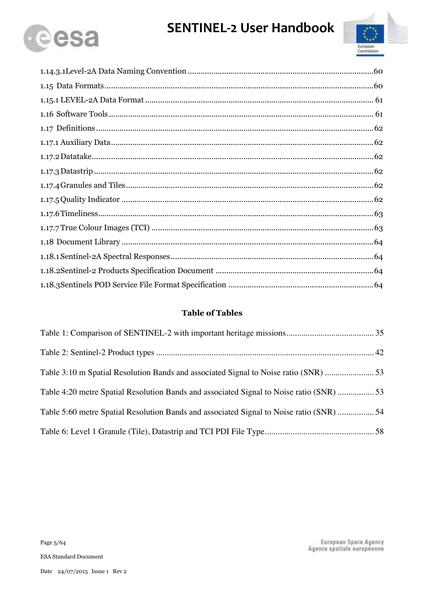
Table of Tables
Table 1: Comparison of SENTINEL-2 with important heritage missions ......................................... 35
Table 2: Sentinel-2 Product types ...................................................................................................... 42
Table 3:10 m Spatial Resolution Bands and associated Signal to Noise ratio (SNR) ....................... 53
Table 4:20 metre Spatial Resolution Bands and associated Signal to Noise ratio (SNR) ................. 53
Table 5:60 metre Spatial Resolution Bands and associated Signal to Noise ratio (SNR) ................. 54
Table 6: Level 1 Granule (Tile), Datastrip and TCI PDI File Type ................................................... 58
Page 5/64
ESA Standard Document
Date 24/07/2015 Issue 1 Rev 2
�
SENTINEL-2 User Handbook
Table of Figures
Figure 1: The Twin-Satellite SENTINEL-2 Orbital Configuration (courtesy Astrium GmbH) 9
Figure 2: Comparison of Spatial Resolution and Wavelength Characteristics of SENTINEL-2
Multispectral Instrument (MSI), the Operational Land Imager (OLI) On-Board LANDSAT-8,
and SPOT 6/7 Instruments (from ESA Special Publication 1322/2) ....................................... 11
Figure 3: Schematic View of the Deployed SENTINEL-2 Spacecraft (image credit: EADS
Astrium) ................................................................................................................................... 17
Figure 4: Copernicus Ground Segment Architecture............................................................... 19
Figure 5: Application Software ................................................................................................ 25
Figure 6: Innovative Tools and Applications........................................................................... 25
Figure 7: Sentinel complementary Calibration/Validation activities....................................... 26
Figure 8: Agreement Process ................................................................................................... 27
Figure 9: SENTINEL-2 Receiving Stations and Off-line Processing and Archiving Centres 31
Figure 10: ESA's European Space Operations Centre ............................................................. 32
Figure 11: Product Breakdown Structure (Image courtesy of ESA) ....................................... 36
Figure 12: Map of Fraction of Absorbed Photosynthetically Active Radiation (FAPAR), July
2011, as derived from MERIS Full Resolution (FR) data. The values vary from 0 (white) to 1
(red) (image courtesy of ESA and Astrium GmbH, Germany) ............................................... 38
Figure 13: Typical orbit showing layout of Level-1B product granules ................................. 43
Figure 14: Level-1C product tiling .......................................................................................... 43
Figure 15: TOA Level-1C Image Data (left) and Associated BOA Image Data (right) as
generated by the Sentinel-2 Toolbox ....................................................................................... 46
Figure 16: Processing Levels from Level-0 to Level-1C......................................................... 46
Figure 17: The figure shows from left to right: (1) A simulated Level-1C TOA input Image,
(2) the Cirrus and Atmospheric Corrected Level-2A BOA Image, (3) the Cirrus Band Nr. 10,
(4) the Scene Classification of the Level-1C Input Image ....................................................... 50
Page 6/64
ESA Standard Document
Date 24/07/2015 Issue 1 Rev 2
�
SENTINEL-2 User Handbook
Figure 18: Sentinel-2 10 m Spatial Resolution Bands: B2 (490 nm), B3 (560 nm), B4 (665 nm)
and B8 (842 nm) ...................................................................................................................... 51
Figure 19: Sentinel-2 20 m Spatial Resolution Bands: B5 (705 nm), B6 (740 nm), B7 (783 nm),
B8b (865 nm), B11 (1610 nm) and B12 (2190 nm) ................................................................ 52
Figure 20: Sentinel-2 60 m Spatial Resolution Bands: B1 (443 nm), B9 (940 nm) and B10
(1375 nm) ................................................................................................................................. 52
Figure 21: Modelled Sentinel-2 Coverage ............................................................................... 55
Figure 22: Modelled Sentinel-2 Coverage ............................................................................... 56
Figure 23: Sentinel-2 product physical format ........................................................................ 60
Page 7/64
ESA Standard Document
Date 24/07/2015 Issue 1 Rev 2
�
SENTINEL-2 User Handbook
1
INTRODUCTION
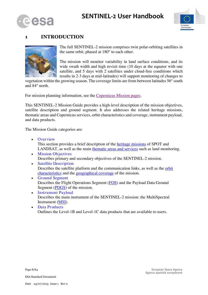
The full SENTINEL-2 mission comprises twin polar-orbiting satellites in
the same orbit, phased at 180° to each other.
The mission will monitor variability in land surface conditions, and its
wide swath width and high revisit time (10 days at the equator with one
satellite, and 5 days with 2 satellites under cloud-free conditions which
results in 2-3 days at mid-latitudes) will support monitoring of changes to
vegetation within the growing season. The coverage limits are from between latitudes 56° south
and 84° north.
For mission planning information, see the Copernicus Mission pages.
This SENTINEL-2 Mission Guide provides a high-level description of the mission objectives,
satellite description and ground segment. It also addresses the related heritage missions,
thematic areas and Copernicus services, orbit characteristics and coverage, instrument payload,
and data products.
The Mission Guide categories are:
Overview
This section provides a brief description of the heritage missions of SPOT and
LANDSAT, as well as the main thematic areas and services such as land monitoring.
Mission Objectives
Describes primary and secondary objectives of the SENTINEL-2 mission.
Satellite Description
Describes the satellite platform and the communication links, as well as the orbit
characteristics and the geographical coverage of the mission.
Ground Segment
Describes the Flight Operations Segment (FOS) and the Payload Data Ground
Segment (PDGS) of the mission.
Instrument Payload
Describes the main instrument of the SENTINEL-2 mission: the MultiSpectral
Instrument (MSI).
Data Products
Outlines the Level-1B and Level-1C data products that are available to users.
Page 8/64
ESA Standard Document
Date 24/07/2015 Issue 1 Rev 2
�



 2023年江西萍乡中考道德与法治真题及答案.doc
 2012年重庆南川中考生物真题及答案.doc
 2013年江西师范大学地理学综合及文艺理论基础考研真题.doc
 2020年四川甘孜小升初语文真题及答案I卷.doc
 2020年注册岩土工程师专业基础考试真题及答案.doc
 2023-2024学年福建省厦门市九年级上学期数学月考试题及答案.doc
 2021-2022学年辽宁省沈阳市大东区九年级上学期语文期末试题及答案.doc
 2022-2023学年北京东城区初三第一学期物理期末试卷及答案.doc
 2018上半年江西教师资格初中地理学科知识与教学能力真题及答案.doc
 2012年河北国家公务员申论考试真题及答案-省级.doc
 2020-2021学年江苏省扬州市江都区邵樊片九年级上学期数学第一次质量检测试题及答案.doc
 2022下半年黑龙江教师资格证中学综合素质真题及答案.doc