EDITOR’S SPECIAL ON SPACE DATA FOR EUROPE
ISSUE 3
2020
GNSS User Technology Report
�
More information on the European Union is available on the Internet (http://europa.eu).
Luxembourg: Publications Office of the European Union, 2020
ISBN: 978-92-9206-049-7
ISSN: 2467-3854
doi: 10.2878/565013
Copyright © European GNSS Agency, 2020. This document and the information contained in it is subject to applicable copyright and other intellectual property rights under the laws of the Czech Republic and other states. Third
parties may download, copy, print and provide the document in its entirety to other third parties provided that there is no alteration of any part of it. Information contained in the document may be excerpted, copied, printed and
provided to third parties only under the condition that the source and copyright owner is clearly stated as follows: ‘Source: GNSS User Technology Report, Issue 3, copyright © European GNSS Agency, 2020’. No part of this document,
including any part of information contained therein, in whichever format, whether digital or otherwise, may be altered, edited or changed without the European GNSS Agency’s prior express permission in writing to be requested
under http://www.gsa.europa.eu/contact-us, clearly stating the element (document and/or information) and term of use requested. Should you become aware of any breach of the above terms of use, please notify the European
GNSS Agency immediately, through the abovementioned contact site. Any breach of these terms of use may be made subject to legal proceedings, seeking monetary damages and/or an injunction to stop the unlawful use of
the document and/or any information contained therein. By downloading, forwarding, and/or copying this document or any parts thereof, in whichever format, whether digital or otherwise, the user acknowledges and accepts
the above terms of use as applicable to them.
�
GNSS User Technology Report
ISSUE 3 2020
�
4
GNSS User Technology Report | Issue 3, 2020
I N T R O D U C T I O N
HOW TO READ THIS REPORT
The GNSS User Technology Report is a continuously evolving publication that builds upon a similar structure and format used in previous issues.
This third issue of the GNSS User Technology Report is therefore structured into the following blocks:
The opening section, GNSS User Technology Overview, presents a summary of recent developments and future trends in GNSS. Updates on
Galileo, GPS, GLONASS, BeiDou and Regional Navigation Satellite Systems are described in detail as well as latest developments in the area of
GNSS augmentation. The chapter also gives a status update on multi-constellation and multi-frequency adoption in receivers. It presents different
position processing methods and the latest innovations in signal processing and antenna technologies expected to deliver more accurate, less
energy-hungry and more reliable PNT services. Specific focus is made on PNT vulnerabilities that affect GNSS and beyond. Relevant measures and
means to get protected against the growing jamming and spoofing threats to GNSS are introduced. The chapter concludes with a description of
EU GNSS downstream R&D programmes and examples of innovative technologies from members of Galileo Services organisation.
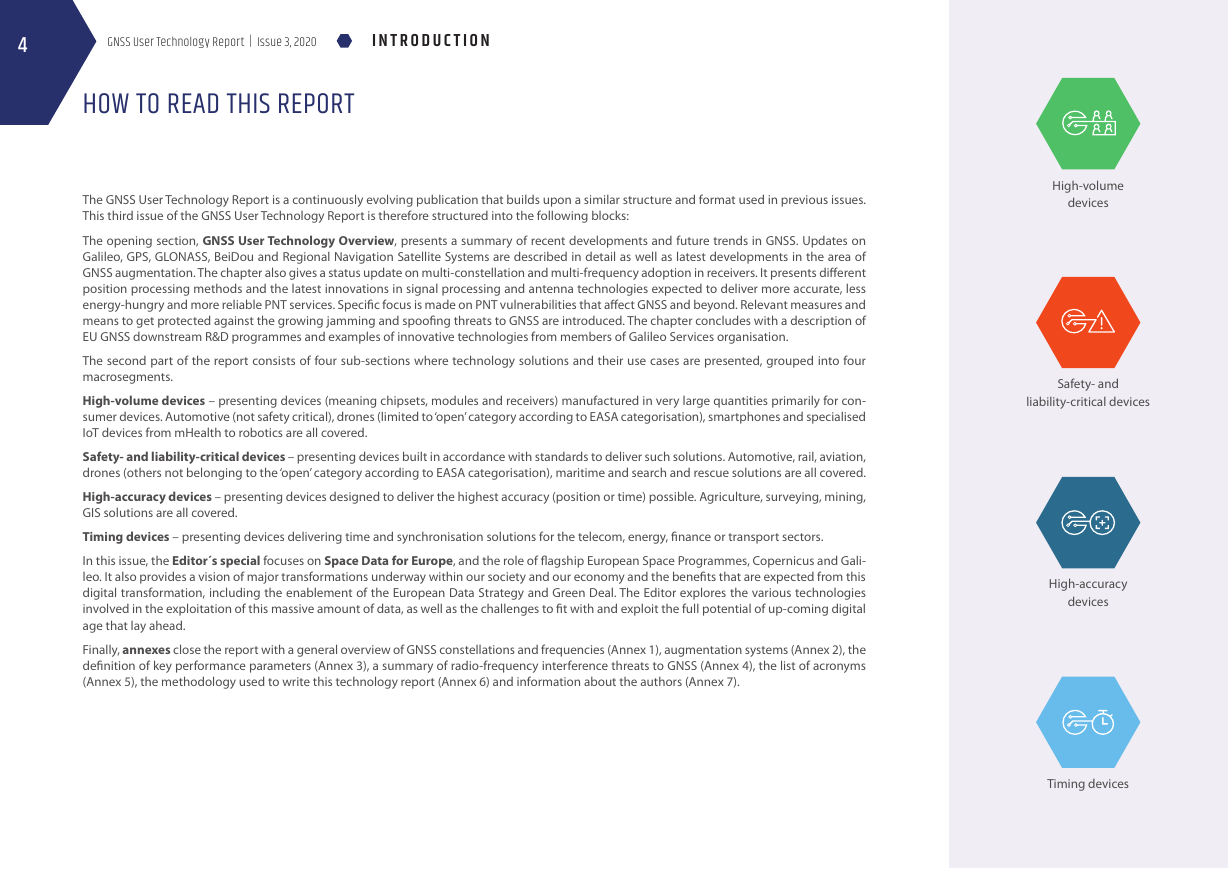
The second part of the report consists of four sub-sections where technology solutions and their use cases are presented, grouped into four
macrosegments.
High-volume devices – presenting devices (meaning chipsets, modules and receivers) manufactured in very large quantities primarily for con-
sumer devices. Automotive (not safety critical), drones (limited to ‘open’ category according to EASA categorisation), smartphones and specialised
IoT devices from mHealth to robotics are all covered.
Safety- and liability-critical devices – presenting devices built in accordance with standards to deliver such solutions. Automotive, rail, aviation,
drones (others not belonging to the ‘open’ category according to EASA categorisation), maritime and search and rescue solutions are all covered.
High-accuracy devices – presenting devices designed to deliver the highest accuracy (position or time) possible. Agriculture, surveying, mining,
GIS solutions are all covered.
Timing devices – presenting devices delivering time and synchronisation solutions for the telecom, energy, finance or transport sectors.
In this issue, the Editor´s special focuses on Space Data for Europe, and the role of flagship European Space Programmes, Copernicus and Gali-
leo. It also provides a vision of major transformations underway within our society and our economy and the benefits that are expected from this
digital transformation, including the enablement of the European Data Strategy and Green Deal. The Editor explores the various technologies
involved in the exploitation of this massive amount of data, as well as the challenges to fit with and exploit the full potential of up-coming digital
age that lay ahead.
Finally, annexes close the report with a general overview of GNSS constellations and frequencies (Annex 1), augmentation systems (Annex 2), the
definition of key performance parameters (Annex 3), a summary of radio-frequency interference threats to GNSS (Annex 4), the list of acronyms
(Annex 5), the methodology used to write this technology report (Annex 6) and information about the authors (Annex 7).
High-volume
devices
Safety- and
liability-critical devices
High-accuracy
devices
Timing devices
�
F O R E W O R D
GNSS User Technology Report | Issue 3, 2020
5
FOREWORD
Dear Reader,
I am pleased to write my first foreword to the GNSS User Technology issue 3 in the role of European GNSS Agency (GSA) Executive Director. The GSA’s GNSS User Tech-
nology Report Issue 3 takes an in-depth look at the latest state-of-the-art GNSS user and receiver technology, along with providing expert analysis on the evolutionary
trends that are set to define the global GNSS landscapes in the coming years.
A touchstone for the GNSS industry, academia and policy makers, the report is released at a time of significant changes for the Industry and the EU Space Programme.
The European GNSS Agency is currently in charge of managing operations, service provision, security, market development and user uptake for Europe’s Global
Navigation Satellite Systems (GNSS), Galileo and EGNOS. Soon, the Agency is slated to become the European Union Space Programme Agency (EUSPA). By providing
state-of-the-art, secure services, keeping close ties with the user community and contributing to the latest technology trends and innovations within its projects,
EUSPA will continue to serve and support the EU downstream industry including innovators and start-ups with its specific know-how. At the same time, EUSPA will
foster synergies at user level with other EU Space Programme components in Earth Observation and Satellite Telecommunications.
The third edition of the GNSS User Technology Report arrives at an important time for GNSS and the Galileo constellation in particular. The GNSS industry is evolving at
a rapid pace; new applications emerge, requiring customized, complex receiver technology. Production costs are dropping and an increasing number of dual-frequency
receivers become available for mass-market solutions. With numerous players coming from the fields of telecommunications, network operations and IT jumping in the
GNSS technology arena, the industry has already understood the potential of Galileo unique features. The future services will reinforce the opportunities to enhance
positioning, navigation and timing solutions for businesses and citizens.
The improvement of data technologies is changing the magnitude of data use. This is increasing the capacity to build value-added services. Therefore, in this Editor’s
special, we focus on the trends and the challenges connected to the data-driven revolution, on the specific space data contribution and on how the EU plans to shape
its digital future. Galileo, EGNOS and Copernicus capabilities have a powerful role to play within this new technological shift which will benefit the European Data
Strategy and Green Deal.
This publication became possible with contributions from leading downstream industry and SMEs players, including GNSS receiver and chipset manufacturers, and
is meant to serve as a valuable tool to support your planning and decision-making with regard to developing, purchasing and using GNSS user technology. We look
forward to receiving your feedback and working with you in continuing this exciting evolution.
Rodrigo da Costa
Executive Director
The European GNSS Agency (GSA)
Prague, October 2020
�
6
GNSS User Technology Report | Issue 3, 2020
E X E C U T I V E S U M M A R Y
EXECUTIVE SUMMARY
With the recent completion of the BeiDou constellation and forthcoming launches of Galileo
satellites, the two new GNSS are expected to reach their full operational capability shortly,
increasing the number of global operational systems to four. Meanwhile, the two historical GNSS
(GPS and GLONASS) pursue their modernisation, whilst the three regional satellite navigation
systems (NavIC, the regional component of BeiDou and QZSS) continue their development
adding new navigation satellites in their respective coverage areas. Public augmentation sys-
tems follow suit with four new Satellite-Based Augmentation Systems (SBAS) planned to be
fully operational by 2023 and upgrade their services to support multiple frequency bands and
multiple constellations in the years to come.
The first chapter of the report focus on the common technology trends for all types of GNSS devices.
The GNSS world that embraced multi-constellation yesterday is now firmly adding multi-frequency
to its major trends. As new signals become available from an ever larger number of satellites, GNSS
receivers across all domains now commonly feature multi-frequency support in order to deliver
better performances to end users, primarily greater accuracy and robustness to interference. The
increasing number of open signals in the E5 band mean that E5 is increasingly adopted in new
receiver models as the second frequency and today is present in 20% of all receiver models on the
market, while L2 adoption decreases. In 2020, the new generation of dual-frequency GNSS receivers
is already spreading in the high-volume device macrosegment, and the receivers are being actively
developed for traditionally long lifecycle regulated segments such as aviation and maritime.
One of the trends, already observed in the previous edition of the report, translates into a pleth-
ora of high-accuracy services now available on the market to all categories of users. Demanding
applications such as autonomous vehicles, mobile robots, and outdoor augmented reality benefit
from this revolution and trigger this paradigm shift. No longer the exclusive preserve of commercial
services providers, high-accuracy services are also proposed by core GNSS (e.g. the free Galileo
HAS and the QZSS CLAS) and in the plans of several SBAS service providers.
Moreover, ensuring both safety and security of the PNT solutions remains a key driver of technol-
ogy developments and innovations. Protection measures against GNSS jamming and spoofing are
implemented through different combinations of technologies on both receivers and antennas,
through the use of multiple sources of positioning information as well as the authentication of GNSS
signals. The Galileo authentication capabilities (Open Service Navigation Message Authentication
and Commercial Augmentation Service – OS-NMA and CAS, respectively) are expected to provide
good enhancements in this regard.
Lastly, sensors of all types, optical, inertial and others continue to drop in price and increase in
performance, and are now routinely integrated with GNSS receivers and their outputs fused. While
largely propelled by the emerging world of ‘autonomous things’, this trend widely benefits other
sectors. More than ever, we see GNSS at the heart of a ‘metasystem’, combining various technologies
that support ubiquitous localisation and timing, ubiquitous sensing, and ubiquitous connectivity,
where each subsystem contributes to the performance of the others and where the seamless
integration of space and ground components is paramount to achieving truly global ubiquity.
In the world of high-volume devices for the consumer market, multi-constellation support is now
standard and dual-frequency capability is not only a strategic choice for high-end products but
gains momentum in smartphone devices.
The introduction of these multi-frequency GNSS devices, the increased use of corrections services,
the deployment in some countries of thousands of additional base stations of 5G infrastructure,
actively support the democratisation of high-accuracy in the mass market. Combined with the
attractiveness of low cost solutions, these benefits are spreading throughout other sectors.
The safety- and liability-critical devices domain is traditionally constrained by regulations and
standards and therefore slower in adopting new technologies. However, noticeable changes can
be observed in the less regulated and lower end part of this sector, which increasingly uses chips
from the upper end of the mass market combined with new approaches to support safety-critical
applications. While Dual-Frequency, Multi-Constellation (DFMC) solutions have been established
in these areas, other mature safety-critical sectors lag behind, pending the finalisation of standards
and availability of the first certified receivers. However, the use of multiple frequencies and multiple
constellations, augmentation of various types, INS hybridisation, and sensor fusion all contribute
to the required ‘assured’ and safe positioning solutions.
In the professional domain, high-accuracy devices reign and steadily evolve towards exploiting
all frequencies and constellations as they become available. Modern devices consist of compact
sensor-enriched receivers, usually capable of supporting any type of augmentation service (RTK,
NRTK, PPP and new PPP-RTK services) and offer flexible customisation by the end user. The continued
digitalisation of services, the increased reliance on sensor fusion for fully-connected automated
workflow management, and advanced data exploitation techniques supported by AI also gener-
ate transformations in the sector. Finally, as high-accuracy geomatics solutions increasingly make
inroads into other mass-market sectors, mass-market devices become increasingly able to perform
low-end mapping and surveying activities. In that regard, the ‘Bring your own device’ (BYOD) trend
is emerging, whereby surveyors and mappers use their own smartphones as an alternative to
proprietary data collection devices.
Lastly, regarding timing devices that deliver time and synchronisation solutions for the telecom,
energy, finance or transport sectors, research and development efforts have been made at various
levels of the timing processing chain. In particular, multi-frequency and multi-constellation adoption
as well as innovative Time-Receiver Autonomous Integrity Monitoring (T-RAIM) and interference
monitoring algorithms aim to respond to the common demand for improved accuracy, increased
resilience and improved availability.
Many of the technical advances observed in this report relate to the exploitation of digital data
from GNSS, Earth Observation and from an increasing variety of sources. From the enhancement
of industrial processes and transportation paradigms, to the development of a new agriculture
or the monitoring of essential climate variables, digital data are already everywhere and benefit
both public and private sectors, as well as citizens. The ‘Editor’s special’ section of this report is
devoted to this ‘data-driven revolution’, which is indisputably changing the world we live in, while
meeting technological and societal challenges.
The analysis of GNSS user technology trends is supported by testimonials from key suppliers of
receiver technology: Broadcom, ICaune, FieldBee, f.u.n.k.e, Google, Hexagon, Microchip, Rokubun,
Septentrio, Sony, Trimble, Unifly presenting their latest innovations in the field.
�
T A B L E O F C O N T E N T S
GNSS User Technology Report | Issue 3, 2020
7
FOREWORD
EXECUTIVE SUMMARY
INTRODUCTION
GNSS USER TECHNOLOGY OVERVIEW
HIGH-VOLUME DEVICES
SAFETY- AND LIABILITY-CRITICAL DEVICES
HIGH-ACCURACY DEVICES
TIMING DEVICES
EDITOR’S SPECIAL: SPACE DATA FOR EUROPE
ANNEXES
ANNEX 1: GNSS CONSTELLATIONS AND FREQUENCIES
ANNEX 2: AUGMENTATION SYSTEMS
ANNEX 3: KEY GNSS PERFORMANCE PARAMETERS
ANNEX 4: RADIO-FREQUENCY INTERFERENCE THREATS TO GNSS
ANNEX 5: LIST OF ACRONYMS
ANNEX 6: METHODOLOGY
ANNEX 7: ABOUT THE AUTHORS
5
6
8
9
30
46
62
75
87
95
96
97
99
100
101
103
104
�
8
GNSS User Technology Report | Issue 3, 2020
I N T R O D U C T I O N
GALILEO PREPARES FOR THE FUTURE
The continued diverging needs of hundreds of applications drive the customisation of GNSS
receivers with wide-ranging complexities, capabilities, and resource requirements. The expectations
of users in different applications are often contradictory, but they do share some commonalities:
•
•
The need for continuous and dependable PNT services, and
The quest for ever better performance at large, e.g. in terms of accuracy, cost, or autonomy.
Thus, with every edition of this report we witness new and innovative products enabled by pro-
gress in receiver technology, as well as evolutions in the services proposed by core GNSS and RNSS
providers and by public or private augmentation providers.
Indeed, the variety of user requirements calls for a diversity of solutions, both at receiver and
system levels. Similarly, the rapid and sometimes unpredictable evolution of these requirements
demand a matching evolution of existing services, or the creation of new ones, in a timely manner.
GNSS providers face the challenge of satisfying these emerging needs, without compromising exist-
ing services. With satellite lifetimes well in excess of 10 years, the task would be almost impossible,
if the original design had not ‘planned for the unpredictable’.
This report begins with the presentation of on-going and planned infrastructure evolutions of GNSS
and SBAS, which in turn allow for the gradual introduction of new or enhanced services: GPS is
now launching its GPS III satellites, GLONASS is switching to the K2 satellites – both moves that will
enhance interoperability of the systems – and BeiDou is now focusing on regional services after an
impressive effort to rapidly deploy its final constellation. Likewise, Galileo is preparing for the future.
For Galileo 1st Generation, this translates into substantial reinforcements of the system’s built-in
redundancies and resilience and into the introduction of new services and capabilities:
•
•
•
The OS Navigation Message Authentication and the Commercial Service Authentication;
Improvements of the I/NAV message, allowing a faster TTFF;
The High Accuracy Service offering world-wide decimetre level position accuracy.
Besides these PNT services, Galileo has been pioneering MEOSAR, notably with the Return Link
Service, fully operational since January 2020.
Despite this busy agenda, Galileo already evaluates the feasibility of other services, including an
Early Warning Service and an extension of the SAR Return Link Service capabilities, and is fully
engaged in the process of developing Galileo 2nd Generation. Procurement activities for System,
Satellite and Ground Segment will commence in 2020 with the ambitious goal of reaching full
operational capability in 2030.
The design of Galileo 2nd Generation is driven by overarching principles, including backward com-
patibility and the quality of services, but also the absolute need to meet user demands in a timely
and effective manner. Acknowledging the changing nature of these user requirements, Galileo
2nd Generation is designed from the onset to evolve incrementally, and with sufficient flexibility
to provide new services or signal features, if and when required, without changing the satellites.
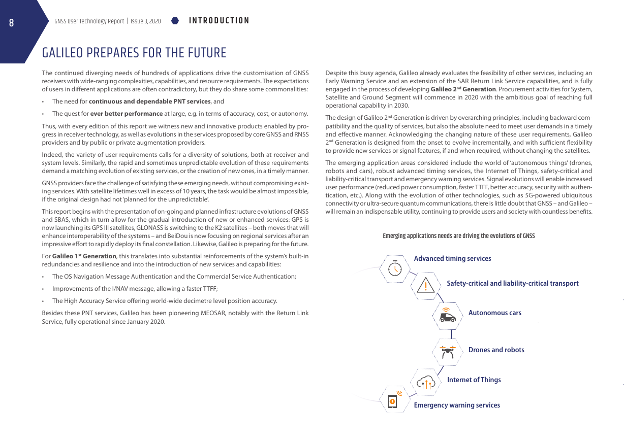
The emerging application areas considered include the world of ‘autonomous things’ (drones,
robots and cars), robust advanced timing services, the Internet of Things, safety-critical and
liability-critical transport and emergency warning services. Signal evolutions will enable increased
user performance (reduced power consumption, faster TTFF, better accuracy, security with authen-
tication, etc.). Along with the evolution of other technologies, such as 5G-powered ubiquitous
connectivity or ultra-secure quantum communications, there is little doubt that GNSS – and Galileo –
will remain an indispensable utility, continuing to provide users and society with countless benefits.
Emerging applications needs are driving the evolutions of GNSS
Advanced timing services
Safety-critical and liability-critical transport
Autonomous cars
Drones and robots
Internet of Things
Emergency warning services
�



 2023年江西萍乡中考道德与法治真题及答案.doc
 2012年重庆南川中考生物真题及答案.doc
 2013年江西师范大学地理学综合及文艺理论基础考研真题.doc
 2020年四川甘孜小升初语文真题及答案I卷.doc
 2020年注册岩土工程师专业基础考试真题及答案.doc
 2023-2024学年福建省厦门市九年级上学期数学月考试题及答案.doc
 2021-2022学年辽宁省沈阳市大东区九年级上学期语文期末试题及答案.doc
 2022-2023学年北京东城区初三第一学期物理期末试卷及答案.doc
 2018上半年江西教师资格初中地理学科知识与教学能力真题及答案.doc
 2012年河北国家公务员申论考试真题及答案-省级.doc
 2020-2021学年江苏省扬州市江都区邵樊片九年级上学期数学第一次质量检测试题及答案.doc
 2022下半年黑龙江教师资格证中学综合素质真题及答案.doc