AirMap 100
®
INSTALLATION AND
OPERATION INSTRUCTIONS
®
�
Copyright © 1996, 1997, 1998 Lowrance Electronics, Inc.
All rights reserved.
AirMap™ 100 is a trademark of Lowrance Avionics.
Lowrance® is a registered trademark of Lowrance Electronics, Inc.
Jeppesen® is a registered trademark of Jeppesen Sanderson, Inc.
WARNING!
USE THIS UNIT ONLY AS AN AID TO NAVIGATION. A CAREFUL NAVI-
GATOR NEVER RELIES ON ONLY ONE METHOD TO OBTAIN POSI-
TION INFORMATION.
Never use this product while operating a vehicle.
The background map built into this unit is not intended for navigation and
its accuracy has not been verified. This map is derived from U.S. govern-
ment sources which rely on ground and aerial surveys and satellite data.
Since there can be inaccuracies in the data used to create the maps and
in the map’s resolution, plus position inaccuracies in the navigation sys-
tem, use caution when using this product.
CAUTION
When showing navigation data to a position (waypoint), this unit will show
the shortest, most direct path to the waypoint. It provides navigation data
to the waypoint regardless of obstructions. Therefore, the prudent naviga-
tor will not only take advantage of all available navigation tools when trav-
elling to a waypoint, but will also visually check to make certain a clear,
safe path to the waypoint is always available.
The operating and storage temperature for your unit is from -4 degrees to
+167 degrees Fahrenheit (-20 to +75 degrees Celsius). Extended storage
temperatures higher or lower than specified will cause the liquid crystal
display to fail. Neither this type of failure nor its consequences are cov-
ered by the warranty. For more information, consult the factory customer
service department.
All features and specifications subject to change without notice.
Lowrance Avionics may find it necessary to change or end our policies,
regulations, and special offers at any time. We reserve the right to do so
without notice.
All screens in this manual are simulated.
�
This device complies with Part 15 of the FCC Rules. Operation is subject
to the following two conditions: (1) this device may not cause harmful
interference, and (2) this device must accept any interference received,
including interference that may cause undesired operation.
Note:
This equipment has been tested and found to comply with the limits for a
Class B digital device, pursuant to Part 15 of the FCC Rules. These limits
are designed to provide reasonable protection against harmful interfer-
ence in a residential installation. This equipment generates, uses and can
radiate radio frequency energy and, if not installed and used in accor-
dance with the instructions, may cause harmful interference to radio com-
munications. However, there is no guarantee that interference will not oc-
cur in a particular installation. If this equipment does cause harmful inter-
ference to radio or television reception, which can be determined by turn-
ing the equipment off and on, the user is encouraged to try to correct the
interference by one or more of the following measures:
• Reorient or relocate the receiving antenna.
• Increase the separation between the equipment and receiver.
• Connect the equipment into an outlet on a circuit different from that to
which the receiver is connected.
• Consult the factory customer service department for help.
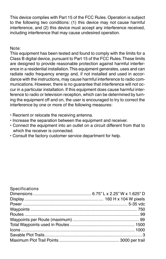
Specifications
Dimensions ................................................. 6.75” L x 2.25” W x 1.625” D
Display .................................................................. 160 H x 104 W pixels
Power ....................................................................................... 5-35 vdc
Waypoints ......................................................................................... 750
Routes ................................................................................................ 99
Waypoints per Route (maximum) ........................................................ 99
Total Waypoints used in Routes ...................................................... 1500
Icons ............................................................................................... 1000
Savable Plot Trails................................................................................. 3
Maximum Plot Trail Points .................................................. 3000 per trail
�
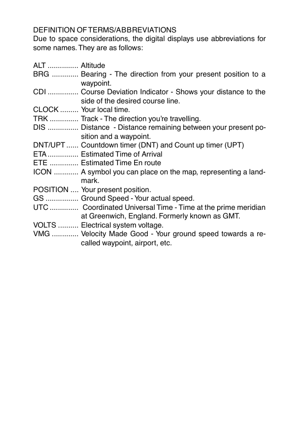
DEFINITION OF TERMS/ABBREVIATIONS
Due to space considerations, the digital displays use abbreviations for
some names. They are as follows:
ALT ............... Altitude
BRG ............. Bearing - The direction from your present position to a
waypoint.
CDI ............... Course Deviation Indicator - Shows your distance to the
side of the desired course line.
CLOCK ......... Your local time.
TRK .............. Track - The direction you’re travelling.
DIS ............... Distance - Distance remaining between your present po-
sition and a waypoint.
DNT/UPT ...... Countdown timer (DNT) and Count up timer (UPT)
ETA ............... Estimated Time of Arrival
ETE .............. Estimated Time En route
ICON ............ A symbol you can place on the map, representing a land-
mark.
POSITION .... Your present position.
GS ................ Ground Speed - Your actual speed.
UTC .............. Coordinated Universal Time - Time at the prime meridian
at Greenwich, England. Formerly known as GMT.
VOLTS .......... Electrical system voltage.
VMG ............. Velocity Made Good - Your ground speed towards a re-
called waypoint, airport, etc.
�
INTRODUCTION ............................................................................................................ 1
SA - What is it? ........................................................................................................2
Don’t Get Lost .......................................................................................................... 2
GETTING STARTED ...................................................................................................... 3
Power
.................................................................................................................3
BATTERIES ..............................................................................................................3
Battery Installation ............................................................................................. 3
NiMH Battery .....................................................................................................3
External Antenna .....................................................................................................4
Yoke Mount ..............................................................................................................5
OPERATION .................................................................................................................6
Turning Power On .................................................................................................... 6
Satellite Status Screen ............................................................................................6
Finding Your Position ................................................................................................ 8
Auto Search ....................................................................................................... 8
Manual Initialization ........................................................................................... 8
Position Acquisition ........................................................................................... 9
POSITION/NAVIGATION SCREENS ...................................................................... 9
Navigation Screens ........................................................................................... 10
Course Deviation Indicator (CDI) ................................................................ 11
Map .................................................................................................................12
Cursor ......................................................................................................... 14
Map Symbols .............................................................................................. 14
Obstructions ................................................................................................ 15
Airspace ...................................................................................................... 16
Map Setup ................................................................................................... 18
Map Options ...................................................................................................... 18
Map Orientation .......................................................................................... 18
Autozoom .................................................................................................... 20
View Destination .........................................................................................21
Range Rings/Grid Lines .............................................................................. 21
Earth Map Options ............................................................................................22
Earth Map On/Off ....................................................................................... 22
Text Labels ..................................................................................................22
Locations .....................................................................................................22
Map Detail ................................................................................................... 22
Gray Fill ....................................................................................................... 23
Map Boundaries .......................................................................................... 24
Air Map Options ................................................................................................. 24
Runway Extensions .................................................................................... 25
Plot Trail Options ...............................................................................................26
Clear Trail .................................................................................................... 26
Flash Trail .................................................................................................... 26
Update Options ........................................................................................... 26
Save Trail ................................................................................................. 26
Show Trail ................................................................................................. 27
ICONS ............................................................................................................... 27
MAP DOWNLOADING ......................................................................................29
WINDOWS ......................................................................................................... 31
Reprogram Window Groups .......................................................................36
Reprogram Boxes ....................................................................................... 37
RESET GROUPS .............................................................................................. 38
DATABASES ...................................................................................................... 38
Aviation Database ....................................................................................... 38
User Database - Waypoints ........................................................................ 42
�
WAYPOINTS ...................................................................................................... 42
Waypoint Menu ........................................................................................... 42
Saving Your Present Position as a Waypoint (Quick Save Method) ........... 42
Saving The Cursor Position as a Waypoint ................................................ 43
Saving Your Present Position as a Waypoint (Select Number Method) ..... 43
Saving a New Position ................................................................................44
Waypoint Averaging .................................................................................... 44
Project a Waypoint ......................................................................................45
Selecting a Waypoint .................................................................................. 46
Editing a Waypoint ......................................................................................46
NAVIGATION ............................................................................................................ 47
Navigating to a cursor location ..........................................................................47
Navigating to a Waypoint using the Map ........................................................... 48
OTHER WAYPOINT OPTIONS ......................................................................... 49
Move a Waypoint .........................................................................................49
Delete a Waypoint ....................................................................................... 49
Delete All Waypoints ...................................................................................49
“Nearest” Feature ........................................................................................ 50
ROUTES .................................................................................................................51
Create a Route ..................................................................................................51
Delete a Waypoint from Route ..........................................................................53
Waypoint Statistics ............................................................................................53
Following a Route .............................................................................................. 53
Waypoint Information .................................................................................. 54
Delete a Route ................................................................................................... 55
CANCEL NAVIGATION ............................................................................................55
Navigation Notes ...................................................................................................... 55
SYSTEM SETUP .....................................................................................................56
Sound ................................................................................................................ 56
Contrast ............................................................................................................. 56
Set Local Time ................................................................................................... 57
Units of Measure ...............................................................................................57
NMEA / DGPS ................................................................................................... 57
NMEA Output .................................................................................................... 58
DGPS .................................................................................................................58
Serial Communication Setup .............................................................................59
Reset Options .................................................................................................... 60
Reset Groups .................................................................................................... 61
System Info ........................................................................................................61
GPS SETUP ............................................................................................................ 61
Power Save ........................................................................................................60
Position Format ................................................................................................. 60
DATUM ............................................................................................................... 62
PCF (Position Correction Factor) ...................................................................... 63
POSITION PINNING .........................................................................................64
ALARMS .................................................................................................................65
SUNRISE/SET MOONRISE/SET CALCULATOR ................................................... 67
SIMULATOR ............................................................................................................. 67
E6B COMPUTER .....................................................................................................68
AVIATION DATA DOWNLOAD ................................................................................. 71
JEPPESEN® DATABASE UPGRADE ..................................................................... 73
DATUM LIST ............................................................................................................ 74
UPS RETURN SERVICE .........................................................................................79
WARRANTY ............................................................................................................. 81
DATABASE LICENSE AGREEMENT ...................................................................... 82
DATABASE WARRANTY .........................................................................................83
�
INTRODUCTION
Thank you for purchasing a Lowrance Avionics AirMap 100. With its large
LCD screen, easy to use menus, and outstanding performance, we think
you’ll be happy with your AirMap 100 for many years. No other handheld
GPS receiver on the market today has the AirMap’s combination of 12
channel receiver, Jeppesen® database with obstacles (U.S. only), ground
and hydrographic mapping capability, and programmable screens in a
handheld unit.
The Global Positioning System (GPS) was developed by the United States
Department of Defense as a 24-hour a day, 365 days a year global navi-
gation system for the military. Civilian availability was added (but with less
accuracy) using the same satellites. Twenty-four satellites orbit the Earth.
Three of these satellites are spares, unused until needed. The rest virtu-
ally guarantee that at least four satellites are in view of anyplace on Earth
at all times.
The system requires three satellites in order to determine a position. This
is called a 2D fix. It takes four satellites to determine both position and
elevation, (your height above sea level - also called altitude.) called a 3D
fix.
Remember, the unit must have a clear view of the satellites in order to
receiver their signals. Unlike radio or television, GPS works at very high
frequencies. The signals can be blocked easily by trees, buildings, even
your body. Fortunately, they do travel through glass and plastic, so your
receiver will work in the aircraft, if it has a clear view of the satellites
through the windshield or side windows. Let someone else drive if you
use it in a car or other vehicle.
Never use this GPS receiver while operating a vehicle!
The first time you use this unit, walk outside and turn it on in your back-
yard, an open field or park. Once it locks onto the satellites, you can ex-
periment with it around buildings and trees. This will give you some idea
of its sensitivity to blockage.
Like most GPS receivers, this unit doesn’t have a compass or any other
navigation aid built inside. It relies solely on the signals from the satellites
to calculate a position. Speed, direction of travel, and distance are all
calculated from position information. Therefore, in order for it to determine
direction of travel, you must be moving and the faster, the better. This is
not to say that it won’t work at walking speeds - it will. There will simply be
more “wandering” of the data shown on the display.
1
�
SA - What is it?
Another factor that greatly influences the receiver’s ability to determine
position is SA. The United States government intentionally degrades the
satellites signal for civilian users. They introduce small errors into the
satellite’s signals that makes the GPS receiver less accurate. These er-
rors are called selective availability, or SA. How bad is it? They guarantee
that the position reported by a GPS receiver that meets their specifica-
tions is within 100 meters horizontally and 150 meters vertically 95% of
the time. (The position can be better than that or worse than that the other
5% of the time.) In other words, the position shown on your receiver is
within 100 meters of your actual position, 95% of the time. That’s over 300
feet! Not exactly pinpoint accuracy, but then few people need positioning
accuracy greater than this. However, if you do want better performance,
(and who doesn’t?) many manufacturers (including Lowrance) sell a DGPS
receiver that attaches to your GPS receiver. The DGPS system transmits
correction signals that nullify the effects of SA. The DGPS receiver takes
signals from these land-based transmitters and gives them to the GPS
receiver which then uses them to show a more accurate position. The
ironic part is the federal government implemented SA and is also operat-
ing many DGPS transmitters. (You can use the signals from all of the
Coast Guard DGPS stations for free, by the way.) The downside to this is
it requires another piece of electronic gear (the DGPS receiver) which
usually isn’t small enough to carry with you, but will work nicely on a
vehicle. And you have to be close enough to a station to receive the DGPS
signals.
Don’t Get Lost
Generally, you find that using your GPS receiver without DGPS is both
easy and amazingly accurate. It’s easily the most accurate method of
electronic navigation available to the general public today. Remember,
however that this receiver is only a tool. Always have another method of
navigation available, such as a chart or map and a compass. It’s a good
idea to carry spare batteries with you, especially if you’re venturing into
unknown territory.
Also remember that this unit will always show navigation information in
the shortest line from your present position to a waypoint, regardless of
terrain! It only calculates position, it can’t know what’s between you and
your camp, for example. It’s up to you to safely navigate around obstacles,
no matter how you’re using this product.
2
�




 2023年江西萍乡中考道德与法治真题及答案.doc
 2012年重庆南川中考生物真题及答案.doc
 2013年江西师范大学地理学综合及文艺理论基础考研真题.doc
 2020年四川甘孜小升初语文真题及答案I卷.doc
 2020年注册岩土工程师专业基础考试真题及答案.doc
 2023-2024学年福建省厦门市九年级上学期数学月考试题及答案.doc
 2021-2022学年辽宁省沈阳市大东区九年级上学期语文期末试题及答案.doc
 2022-2023学年北京东城区初三第一学期物理期末试卷及答案.doc
 2018上半年江西教师资格初中地理学科知识与教学能力真题及答案.doc
 2012年河北国家公务员申论考试真题及答案-省级.doc
 2020-2021学年江苏省扬州市江都区邵樊片九年级上学期数学第一次质量检测试题及答案.doc
 2022下半年黑龙江教师资格证中学综合素质真题及答案.doc