User Manual
GPS Receiver with Compact Flash Interface
BC-307
�
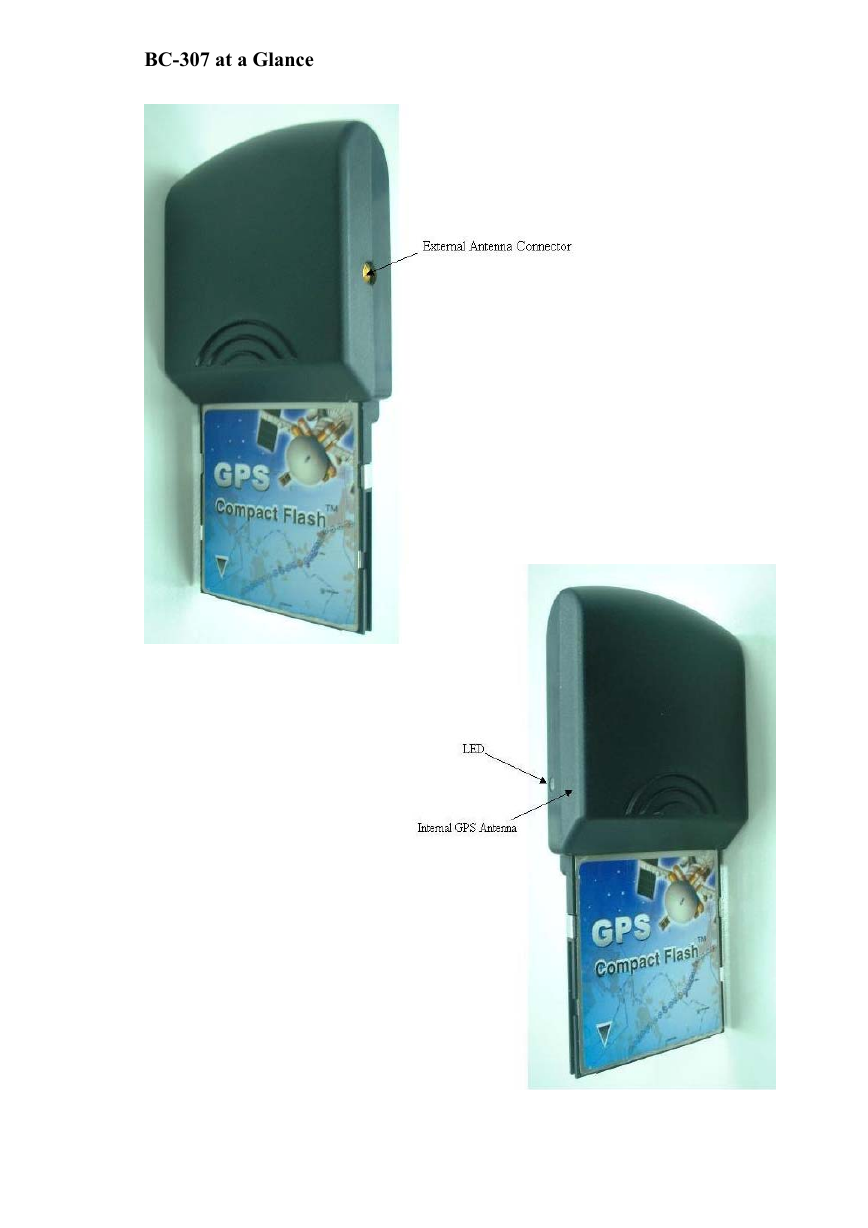
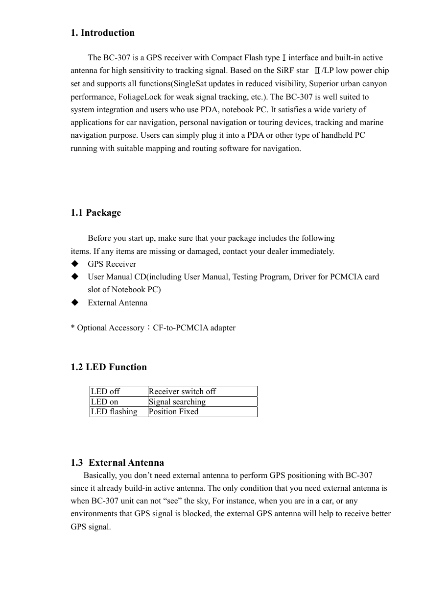
BC-307 at a Glance
�
1. Introduction
The BC-307 is a GPS receiver with Compact Flash typeⅠinterface and built-in active
antenna for high sensitivity to tracking signal. Based on the SiRF star Ⅱ/LP low power chip
set and supports all functions(SingleSat updates in reduced visibility, Superior urban canyon
performance, FoliageLock for weak signal tracking, etc.). The BC-307 is well suited to
system integration and users who use PDA, notebook PC. It satisfies a wide variety of
applications for car navigation, personal navigation or touring devices, tracking and marine
navigation purpose. Users can simply plug it into a PDA or other type of handheld PC
running with suitable mapping and routing software for navigation.
1.1 Package
Before you start up, make sure that your package includes the following
items. If any items are missing or damaged, contact your dealer immediately.
GPS Receiver
User Manual CD(including User Manual, Testing Program, Driver for PCMCIA card
slot of Notebook PC)
External Antenna
* Optional Accessory:CF-to-PCMCIA adapter
1.2 LED Function
LED off
LED on
LED flashing Position Fixed
Receiver switch off
Signal searching
1.3 External Antenna
Basically, you don’t need external antenna to perform GPS positioning with BC-307
since it already build-in active antenna. The only condition that you need external antenna is
when BC-307 unit can not “see” the sky, For instance, when you are in a car, or any
environments that GPS signal is blocked, the external GPS antenna will help to receive better
GPS signal.
�
Plug the external antenna with MMCX connector to the plug on BC-307. Place the
magnetic external antenna on the roof of the car or an outdoor open-space, and make sure
place it in correct direction. That is, the side with magnetic is the bottom side, and the upper
side must face to sky in order to receive better signal.
Notice:
Hold the antenna connector while you plug the external antenna into the BC-307 or
unplug the external antenna from the BC-307. Do not pull the cable line.
2. Installation
The BC-307 GPS supports plug and play.
For PDA:
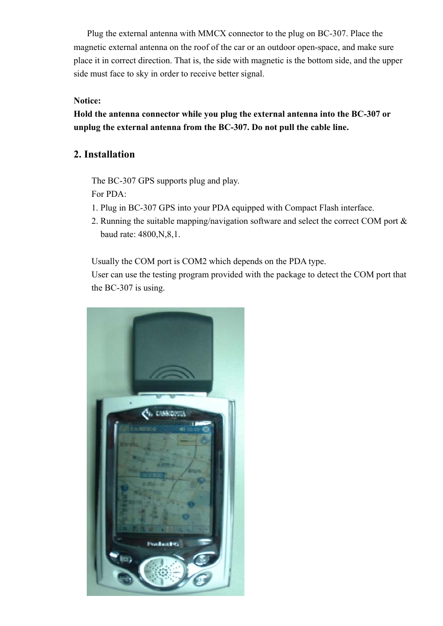
1. Plug in BC-307 GPS into your PDA equipped with Compact Flash interface.
2. Running the suitable mapping/navigation software and select the correct COM port &
baud rate: 4800,N,8,1.
Usually the COM port is COM2 which depends on the PDA type.
User can use the testing program provided with the package to detect the COM port that
the BC-307 is using.
�
For Notebook PC:
1. Plug in BC-307 into PCMCIA card slot of notebook PC through general
Compact Flash to PCMCIA adapter.
2. Install the “Compact Flash to PCMCIA” drivers for WIN98, 2000, XP
3. Running the suitable mapping/navigation software and select the correct COM port
& baud rate: 4800,N,8,1.
2.1 How to test your Compact Flash GPS for PDA?
The testing program only supports the Microsoft Windows CE & Pocket PC based PDA
platform.
1. Run the “GPSinfo.exe” to execute the installation procedure of testing program (via
PC and ActiveSync).
2. Plug BC-307 into PDA.
3. Run the “GPS Information” program from “Start → Program files” of PDA. User
can utilize such testing software to detect the COM port that the BC-307 is using and
to check the GPS output data from BC-307.
�
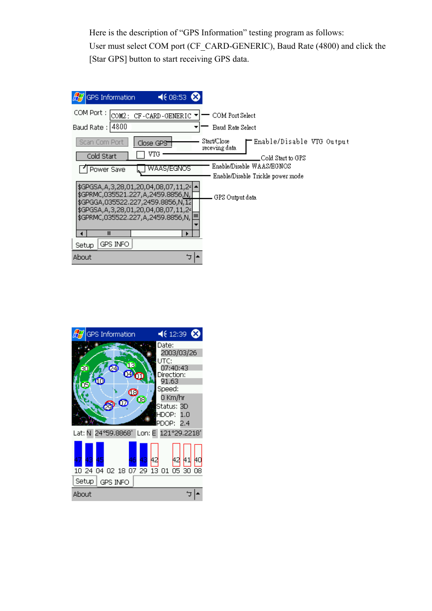
Here is the description of “GPS Information” testing program as follows:
User must select COM port (CF_CARD-GENERIC), Baud Rate (4800) and click the
[Star GPS] button to start receiving GPS data.
�
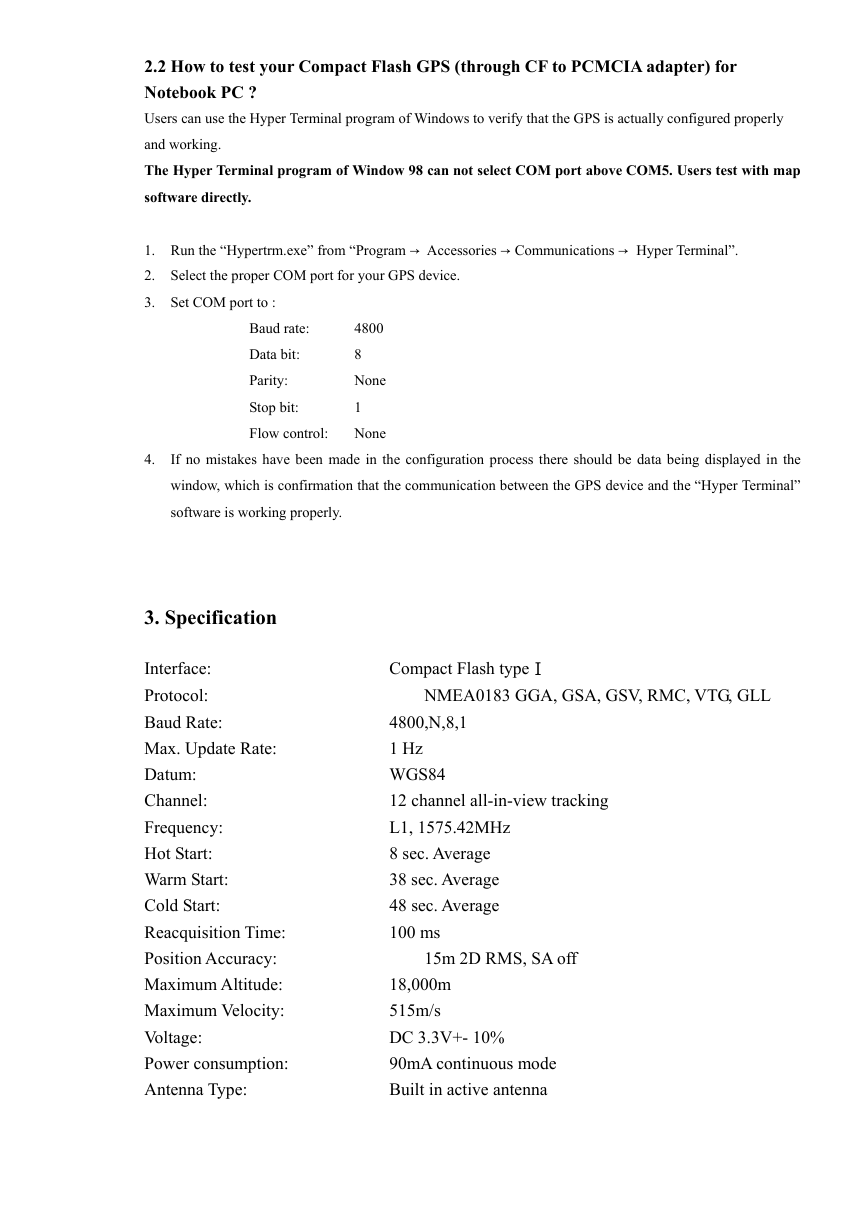
2.2 How to test your Compact Flash GPS (through CF to PCMCIA adapter) for
Notebook PC ?
Users can use the Hyper Terminal program of Windows to verify that the GPS is actually configured properly
and working.
The Hyper Terminal program of Window 98 can not select COM port above COM5. Users test with map
software directly.
1. Run the “Hypertrm.exe” from “Program → Accessories → Communications → Hyper Terminal”.
2. Select the proper COM port for your GPS device.
3. Set COM port to :
Baud rate:
Data bit:
Parity:
Stop bit:
Flow control:
4800
8
None
1
None
4.
If no mistakes have been made in the configuration process there should be data being displayed in the
window, which is confirmation that the communication between the GPS device and the “Hyper Terminal”
software is working properly.
3. Specification
NMEA0183 GGA, GSA, GSV, RMC, VTG, GLL
Interface:
Protocol:
Baud Rate:
Max. Update Rate:
Datum:
Channel:
Frequency:
Hot Start:
Warm Start:
Cold Start:
Reacquisition Time:
Position Accuracy:
Maximum Altitude:
Maximum Velocity:
Voltage:
Power consumption:
Antenna Type:
Compact Flash typeⅠ
4800,N,8,1
1 Hz
WGS84
12 channel all-in-view tracking
L1, 1575.42MHz
8 sec. Average
38 sec. Average
48 sec. Average
100 ms
18,000m
515m/s
DC 3.3V+- 10%
90mA continuous mode
Built in active antenna
15m 2D RMS, SA off
�
External Antenna Interface: MMCX (Optional)
Dimension:
LED Indicator:
Operating Temperature:
Storage Temperature:
95 (L) x 47 (W) x 17 (H) mm
GPS is fix or not fix
-10℃ to + 70℃
- 40℃ to + 85℃
95%, Non- Condensing
Operation Humidity:
�




 2023年江西萍乡中考道德与法治真题及答案.doc
 2012年重庆南川中考生物真题及答案.doc
 2013年江西师范大学地理学综合及文艺理论基础考研真题.doc
 2020年四川甘孜小升初语文真题及答案I卷.doc
 2020年注册岩土工程师专业基础考试真题及答案.doc
 2023-2024学年福建省厦门市九年级上学期数学月考试题及答案.doc
 2021-2022学年辽宁省沈阳市大东区九年级上学期语文期末试题及答案.doc
 2022-2023学年北京东城区初三第一学期物理期末试卷及答案.doc
 2018上半年江西教师资格初中地理学科知识与教学能力真题及答案.doc
 2012年河北国家公务员申论考试真题及答案-省级.doc
 2020-2021学年江苏省扬州市江都区邵樊片九年级上学期数学第一次质量检测试题及答案.doc
 2022下半年黑龙江教师资格证中学综合素质真题及答案.doc