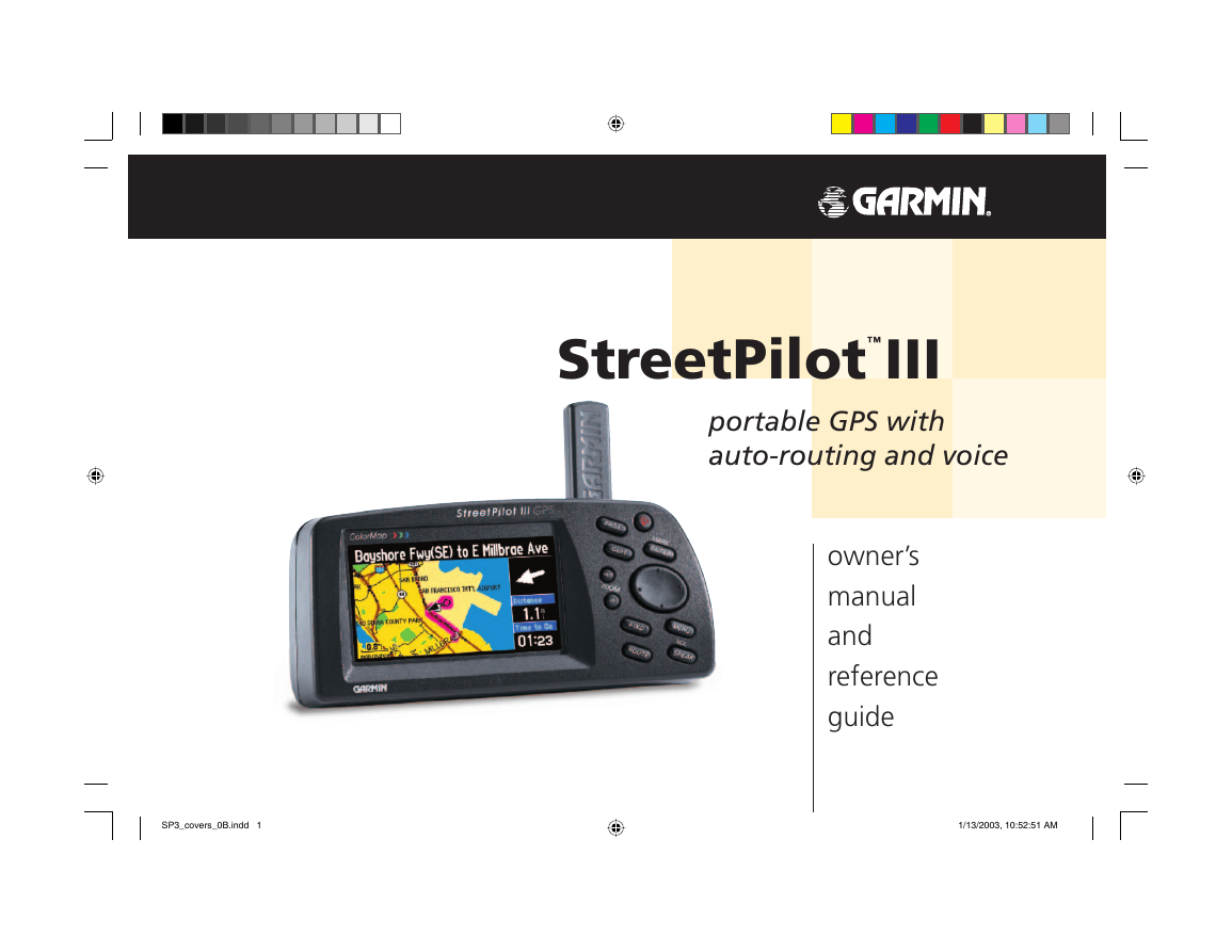
StreetPilot™III
portable GPS with
auto-routing and voice
owner’s
manual
and
reference
guide
SP3_covers_0B.indd 1
1/13/2003, 10:52:51 AM
�
© Copyright 2002-2003 Garmin Ltd. or its subsidiaries
Garmin International, Inc.
1200 E 151st Street, Olathe, Kansas 66062 U.S.A.
Tel. 913/397.8200 or 800/800.1020
Fax. 913/397.8282
Garmin (Europe) Ltd.
Unit 5, The Quadrangle, Abbey Park Industrial Estate, Romsey, SO51 9DL, U.K.
Tel. 44/1794.519944
Fax. 44/1794.519222
Garmin Corporation
No. 68, Jangshu 2nd Road, Shijr, Taipei County, Taiwan
Tel. 886/2.2642.9199
Fax. 886/2.2642.9099
All Rights Reserved. Except as expressly provided herein, no part of this manual may be reproduced, copied, transmitted, disseminated, downloaded or
stored in any storage medium, for any purpose without the express prior written consent of Garmin. Garmin hereby grants permission to download a single
copy of this manual and of any revision to this manual onto a hard drive or other electronic storage medium to be viewed and to print one copy of this
manual or of any revision hereto, provided that such electronic or printed copy of this manual or revision must contain the complete text of this copyright
notice and provided further that any unauthorized commercial distribution of this manual or any revision hereto is strictly prohibited.
Information in this document is subject to change without notice. Garmin reserves the right to change or improve its products and to make changes in the
content without obligation to notify any person or organization of such changes. Visit the Garmin web site (www.garmin.com) for current updates and
supplemental information concerning the use and operation of this and other Garmin products.
Garmin®, AutoLocate®, StreetPilot®, and TracBack® are registered trademarks and MapSource™ and MetroGuide™ are trademarks of Garmin Ltd. or its
subsidiaries and may not be used without the express permission of Garmin.
January 2003
Part Number 190-00256-10 Rev. B
Printed in Taiwan
SP3_covers_0B.indd 2
1/13/2003, 10:53:00 AM
�
Welcome
Thank you for choosing the Garmin StreetPilot III. The StreetPilot III offers true turn-by-turn
navigation with its auto-routing feature. At the touch of a button, you now have access to the shortest
and fastest routes, turn directions, and estimated time of arrival at your intended destination. Along
the way, the StreetPilot III provides automated voice prompts, alerting you to necessary turns, distance
to upcoming turns, route deviation, and distance to the fi nal destination.
The StreetPilot III is compact and portable. This dash-mounted unit can be operated by your
vehicle’s battery using the included 12-volt power adapter, or by six AA batteries. Voice commands
are clearly heard through a speaker which is built into the power adapter cable. The StreetPilot III can
easily be viewed in any lighting condition, due to its 4-inch, high resolution, 16-color display. The
unit’s built-in basemap provides detail for interstates, interstate exit data, highways, rivers and lakes,
plus commonly used streets in metropolitan areas. With the press of a button, the built-in basemap
will provide turn-by-turn guidance to a destination via interstates and highways. When a card with
MapSource City Navigator maps is in the unit, the StreetPilot III provides turn-by-turn guidance down
to residential street-level detail.
About This Manual
Make sure you take the time to read the Quick Reference Guide fi rst to get acquainted with the
basic features of the StreetPilot III. After you have read the Quick Reference Guide, you can read
through this owner’s manual in order to understand the operating features of the StreetPilot III in
detail. This manual is organized into three sections for your convenience. The Introduction Section
provides FCC and safety information and the table of contents. The Reference Section provides
details about all of the features of the StreetPilot III, organized by topic. The Appendices contain both
information on items such as accessories and specifi cations, and an index organized by subject.
Introduction
Welcome
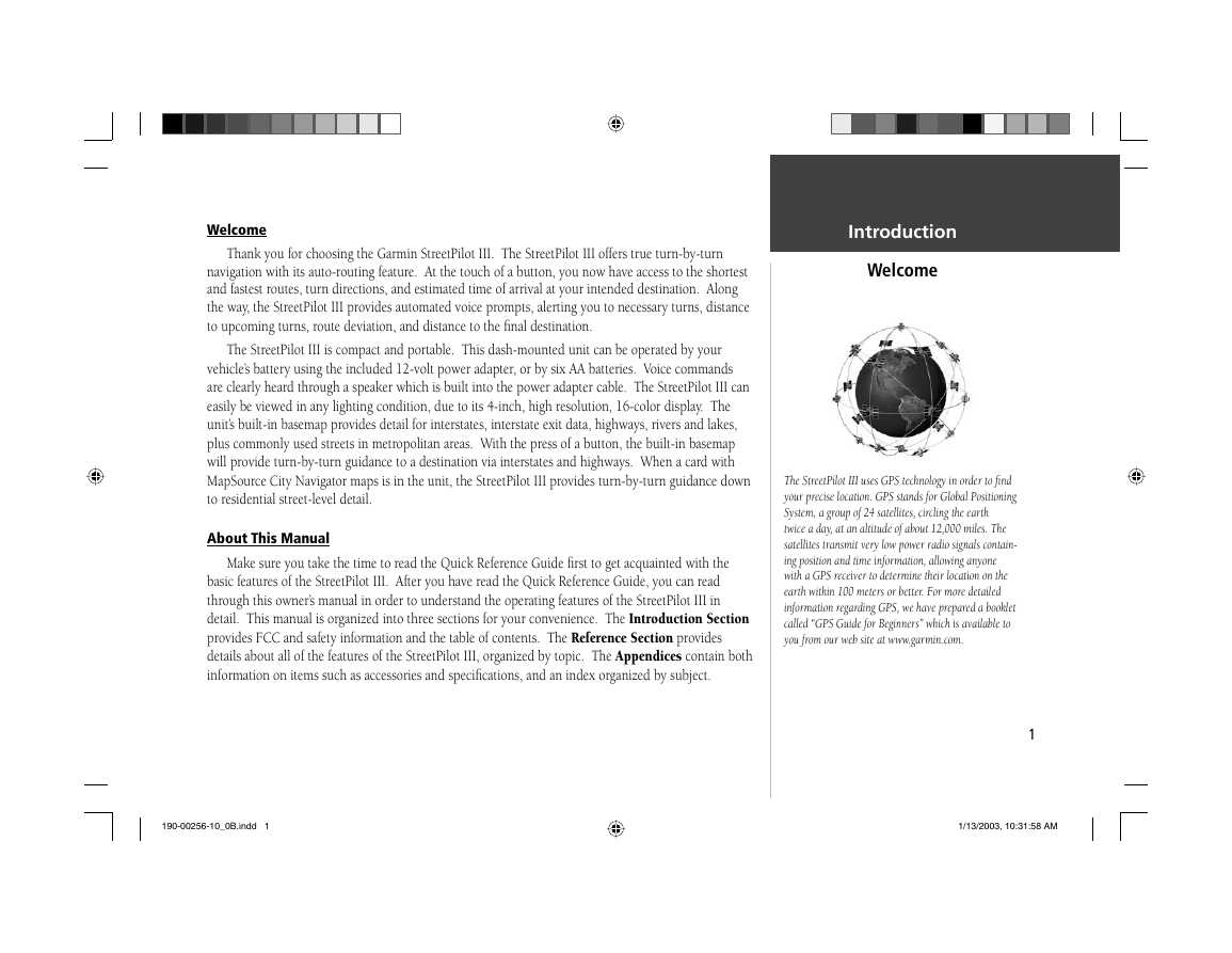
The StreetPilot III uses GPS technology in order to fi nd
your precise location. GPS stands for Global Positioning
System, a group of 24 satellites, circling the earth
twice a day, at an altitude of about 12,000 miles. The
satellites transmit very low power radio signals contain-
ing position and time information, allowing anyone
with a GPS receiver to determine their location on the
earth within 100 meters or better. For more detailed
information regarding GPS, we have prepared a booklet
called “GPS Guide for Beginners” which is available to
you from our web site at www.garmin.com.
1
190-00256-10_0B.indd 1
1/13/2003, 10:31:58 AM
�
‘Track Log’ Tab . . . . . . . . . . . . . . . . . . . 48
‘Language’ Tab . . . . . . . . . . . . . . . . . . . 48
‘Interface’ Tab . . . . . . . . . . . . . . . . . . . . 49
Appendices . . . . . . . . . . . . . . . . . . . . . . . . . 51-70
Appendix A: Vehicle Installation . . . . . . . . . . 51
Appendix B: Wiring and Interfacing . . . . . . . 55
Appendix C: Optional Accessories . . . . . . . . . 56
Appendix D: Maintenance . . . . . . . . . . . . . . . 58
Appendix E: Time Offset . . . . . . . . . . . . . . . . 59
Appendix F: Using Diacritical Marks . . . . . . . 60
Appendix G: Using MapSource
and Data Cards . . . . . . . . . . . . . 62
Appendix H: Messages . . . . . . . . . . . . . . . . . . 64
Appendix I: Specifi cations . . . . . . . . . . . . . . 67
Appendix J: Index . . . . . . . . . . . . . . . . . . . . . 69
Introduction
Table of Contents
Introduction . . . . . . . . . . . . . . . . . . . . . . . . . . 1-12
Welcome . . . . . . . . . . . . . . . . . . . . . . . . . . . . . 1
About This Manual . . . . . . . . . . . . . . . . . . . . . . 1
Table Of Contents . . . . . . . . . . . . . . . . . . . . . . 2
FCC Compliance . . . . . . . . . . . . . . . . . . . . . . . 3
Warnings and Cautions . . . . . . . . . . . . . . . . . . 4
Software License Agreement . . . . . . . . . . . . . . . 6
Limited Warranty . . . . . . . . . . . . . . . . . . . . . . . 7
Unit Description . . . . . . . . . . . . . . . . . . . . . . . . 8
Keypad Usage . . . . . . . . . . . . . . . . . . . . . . . . . . 9
Battery Installation . . . . . . . . . . . . . . . . . . . . . 10
Features/Data Entry . . . . . . . . . . . . . . . . . . . . 11
Unit Pages at a Glance . . . . . . . . . . . . . . . . . . 12
Reference Section . . . . . . . . . . . . . . . . . . . . 13-50
Map Page . . . . . . . . . . . . . . . . . . . . . . . . . . . . 13
Map Page Navigation Info . . . . . . . . . . . . . 14
Zooming, Panning and Pointing . . . . . . . . 15
Routing to a Map Feature or Location . . . . 17
Map Page Options . . . . . . . . . . . . . . . . . . 18
Next Turn Page . . . . . . . . . . . . . . . . . . . . . . . . 21
Current Route Page . . . . . . . . . . . . . . . . . . . . 22
2
Trip Information Page . . . . . . . . . . . . . . . . . . . 24
Marking your Location as a Waypoint . . . . . . 26
Using the Find Menu . . . . . . . . . . . . . . . . . . . 27
Finding Items ‘by Name’ or ‘by Nearest’ . . 27
Finding a Waypoint . . . . . . . . . . . . . . . . . 28
Finding a City . . . . . . . . . . . . . . . . . . . . . . 28
Finding an Exit . . . . . . . . . . . . . . . . . . . . 29
Finding a Point of Interest . . . . . . . . . . . . 30
Finding an Address or an Intersection . . . 31
Recently Found Places . . . . . . . . . . . . . . . 32
Using the Routes Menu . . . . . . . . . . . . . . . . . 32
Deleting and Renaming Routes . . . . . . . . . 36
Main Menu . . . . . . . . . . . . . . . . . . . . . . . . . . . 36
GPS Information Page . . . . . . . . . . . . . . . . 37
Sky View and Signal Strength Bars . . . . 37
Receiver Status . . . . . . . . . . . . . . . . . . . 38
‘Poor Satellite Reception’ Menu . . . . . . 39
Accuracy . . . . . . . . . . . . . . . . . . . . . . . 39
GPS Information Page Options . . . . . . . 40
Map Source Information Page . . . . . . . . . . 41
System Information Page . . . . . . . . . . . . . 41
System Setup Pages . . . . . . . . . . . . . . . . . . 41
‘General’ Tab . . . . . . . . . . . . . . . . . . . . . 43
‘Guidance’ Tab . . . . . . . . . . . . . . . . . . . 44
‘Routing’ Tab . . . . . . . . . . . . . . . . . . . . 44
‘Time’ Tab . . . . . . . . . . . . . . . . . . . . . . 47
‘Safety’ Tab . . . . . . . . . . . . . . . . . . . . . . 47
190-00256-10_0B.indd 2
1/13/2003, 10:33:21 AM
�
Introduction
FCC Compliance
FCC Compliance
The StreetPilot III complies with Part 15 of the FCC interference limits for Class B digital devices
FOR HOME OR OFFICE USE. These limits are designed to provide reasonable protection against
harmful interference in a residential installation, and are more stringent than “outdoor” requirements.
Operation of this device is subject to the following conditions: (1) This device may not cause
harmful interference, and (2) this device must accept any interference received, including interference
that may cause undesired operation.
This equipment generates, uses, and can radiate radio frequency (RF) energy and, if not installed
and used in accordance with the instructions, may cause harmful interference to radio communications.
However, there is no guarantee that interference will not occur in a particular installation. If this
device does cause harmful interference to radio or television reception, which can be determined by
turning the equipment off and on, the user is encouraged to try to correct the interference by one or
more of the following measures:
• Reorient or relocate the receiving antenna.
• Increase the separation between the equipment and receiver.
• Connect the equipment into an outlet on a circuit different from that to which the receiver is
connected.
• Consult the dealer or an experienced radio/TV technician for help.
The StreetPilot III does not contain any user-serviceable parts. Repairs should only be made by an
authorized Garmin service center. Unauthorized repairs or modifi cations could result in permanent
damage to the equipment, and void your warranty and your authority to operate this device under Part
15 regulations.
190-00256-10_0B.indd 3
1/13/2003, 10:33:22 AM
3
�
Introduction
Safety Warnings and Cautions—Read This First!
Warnings and Cautions
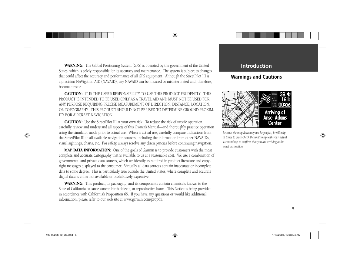
Your StreetPilot III is equipped with a ‘Safe Mode’
feature to improve driver safety. By default, this
feature is enabled, but can be turned off to allow a
passenger to operate the unit. When your vehicle is
moving, Safe Mode disables certain StreetPilot III
functions which require signifi cant operator attention
and may become a distraction to use while driving. See
page 47 for details.
For instructions on vehicle installation, see
Appendix A (pages 51-54).
4
WARNING: For use in vehicles, it is the sole responsibility of the owner/operator of the
StreetPilot III to place and secure the GPS unit so that it will not interfere with the vehicle operat-
ing controls and safety devices, obstruct the driver’s view of driving conditions, or cause damage or
personal injury in the event of an accident. Do not mount the StreetPilot III over airbag panels or in
the fi eld of airbag deployment. Airbags expand with a rapid force that can propel objects in their path
towards the vehicle driver or passengers causing possible injury. Refer to airbag safety precautions
contained in the vehicle owner’s manual. Do not mount the StreetPilot III in a place where the driver
or passengers are likely to impact it in an accident or collision. The mounting hardware provided by
Garmin is not warranted against collision damage or the consequences thereof.
WARNING: When used in vehicles, it is the sole responsibility of the driver of the vehicle to
operate the vehicle in a safe manner, maintain full surveillance of all driving conditions at all times,
and not become distracted by the StreetPilot III to the exclusion of safe driving practices. It is unsafe
to operate the controls of the StreetPilot III while you are driving. Failure by the driver of a vehicle
equipped with a StreetPilot III to pay full attention to operation of the vehicle and road conditions
while the vehicle is in motion could result in an accident or collision with property damage and
personal injury.
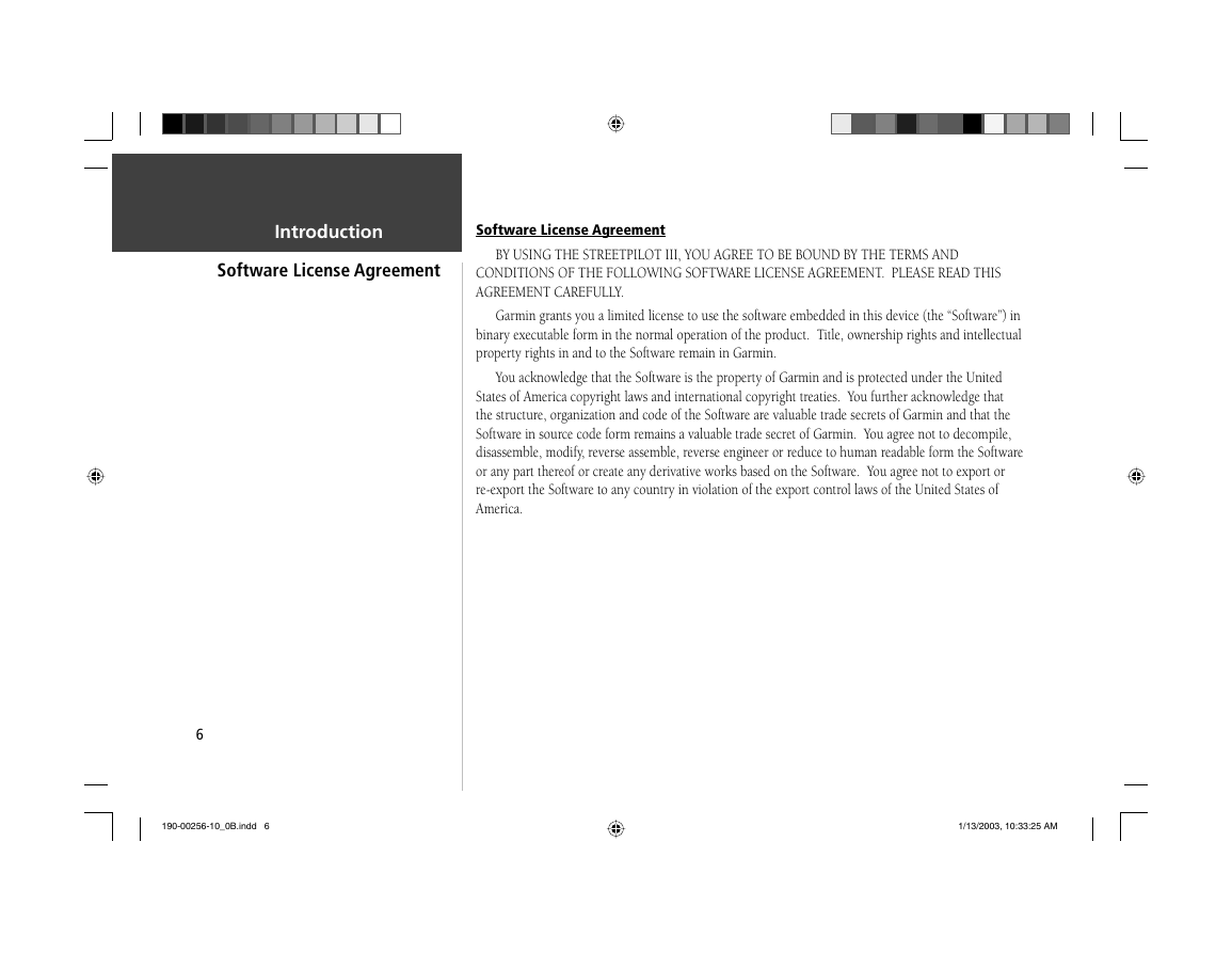
Do Not Mount Where Driver’s Field
of Vision is Blocked
Do Not Place Unsecured on the
Vehicle Dash
Do Not Mount in Front of
Airbag Panels
Do Not Mount in Front of an Airbag
Field of Deployment
190-00256-10_0B.indd 4
1/13/2003, 10:33:23 AM
�
WARNING: The Global Positioning System (GPS) is operated by the government of the United
States, which is solely responsible for its accuracy and maintenance. The system is subject to changes
that could affect the accuracy and performance of all GPS equipment. Although the StreetPilot III is
a precision NAVigation AID (NAVAID), any NAVAID can be misused or misinterpreted and, therefore,
become unsafe.
CAUTION: IT IS THE USER’S RESPONSIBILITY TO USE THIS PRODUCT PRUDENTLY. THIS
PRODUCT IS INTENDED TO BE USED ONLY AS A TRAVEL AID AND MUST NOT BE USED FOR
ANY PURPOSE REQUIRING PRECISE MEASUREMENT OF DIRECTION, DISTANCE, LOCATION,
OR TOPOGRAPHY. THIS PRODUCT SHOULD NOT BE USED TO DETERMINE GROUND PROXIM-
ITY FOR AIRCRAFT NAVIGATION.
CAUTION: Use the StreetPilot III at your own risk. To reduce the risk of unsafe operation,
carefully review and understand all aspects of this Owner’s Manual—and thoroughly practice operation
using the simulator mode prior to actual use. When is actual use, carefully compare indications from
the StreetPilot III to all available navigation sources, including the information from other NAVAIDs,
visual sightings, charts, etc. For safety, always resolve any discrepancies before continuing navigation.
MAP DATA INFORMATION: One of the goals of Garmin is to provide customers with the most
complete and accurate cartography that is available to us at a reasonable cost. We use a combination of
governmental and private data sources, which we identify as required in product literature and copy-
right messages displayed to the consumer. Virtually all data sources contain inaccurate or incomplete
data to some degree. This is particularly true outside the United States, where complete and accurate
digital data is either not available or prohibitively expensive.
WARNING: This product, its packaging, and its components contain chemicals known to the
State of California to cause cancer, birth defects, or reproductive harm. This Notice is being provided
in accordance with California’s Proposition 65. If you have any questions or would like additional
information, please refer to our web site at www.garmin.com/prop65.
Introduction
Warnings and Cautions
Because the map data may not be perfect, it will help
at times to cross-check the unit’s map with your actual
surroundings to confi rm that you are arriving at the
exact destination.
5
190-00256-10_0B.indd 5
1/13/2003, 10:33:24 AM
�
Introduction
Software License Agreement
Software License Agreement
BY USING THE STREETPILOT III, YOU AGREE TO BE BOUND BY THE TERMS AND
CONDITIONS OF THE FOLLOWING SOFTWARE LICENSE AGREEMENT. PLEASE READ THIS
AGREEMENT CAREFULLY.
Garmin grants you a limited license to use the software embedded in this device (the “Software”) in
binary executable form in the normal operation of the product. Title, ownership rights and intellectual
property rights in and to the Software remain in Garmin.
You acknowledge that the Software is the property of Garmin and is protected under the United
States of America copyright laws and international copyright treaties. You further acknowledge that
the structure, organization and code of the Software are valuable trade secrets of Garmin and that the
Software in source code form remains a valuable trade secret of Garmin. You agree not to decompile,
disassemble, modify, reverse assemble, reverse engineer or reduce to human readable form the Software
or any part thereof or create any derivative works based on the Software. You agree not to export or
re-export the Software to any country in violation of the export control laws of the United States of
America.
6
190-00256-10_0B.indd 6
1/13/2003, 10:33:25 AM
�


 2023年江西萍乡中考道德与法治真题及答案.doc
 2012年重庆南川中考生物真题及答案.doc
 2013年江西师范大学地理学综合及文艺理论基础考研真题.doc
 2020年四川甘孜小升初语文真题及答案I卷.doc
 2020年注册岩土工程师专业基础考试真题及答案.doc
 2023-2024学年福建省厦门市九年级上学期数学月考试题及答案.doc
 2021-2022学年辽宁省沈阳市大东区九年级上学期语文期末试题及答案.doc
 2022-2023学年北京东城区初三第一学期物理期末试卷及答案.doc
 2018上半年江西教师资格初中地理学科知识与教学能力真题及答案.doc
 2012年河北国家公务员申论考试真题及答案-省级.doc
 2020-2021学年江苏省扬州市江都区邵樊片九年级上学期数学第一次质量检测试题及答案.doc
 2022下半年黑龙江教师资格证中学综合素质真题及答案.doc