Autonomous Intelligent Vehicles�
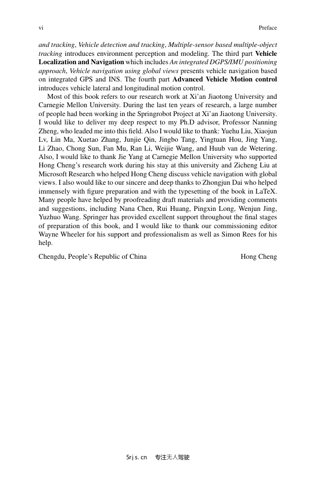
Preface�
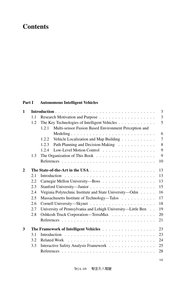
Contents�
Part I: Autonomous Intelligent Vehicles�
Chapter 1: Introduction�
1.1 Research Motivation and Purpose�
1.2 The Key Technologies of Intelligent Vehicles�
1.2.1 Multi-sensor Fusion Based Environment Perception and Modeling�
1.2.2 Vehicle Localization and Map Building�
1.2.3 Path Planning and Decision-Making�
1.2.4 Low-Level Motion Control�
1.3 The Organization of This Book�
References�
Chapter 2: The State-of-the-Art in the USA�
2.1 Introduction�
2.2 Carnegie Mellon University-Boss�
2.3 Stanford University-Junior�
2.4 Virginia Polytechnic Institute and State University-Odin�
2.5 Massachusetts Institute of Technology-Talos�
2.6 Cornell University-Skynet�
2.7 University of Pennsylvania and Lehigh University-Little Ben�
2.8 Oshkosh Truck Corporation-TerraMax�
References�
Chapter 3: The Framework of Intelligent Vehicles�
3.1 Introduction�
3.2 Related Work�
3.3 Interactive Safety Analysis Framework�
References�
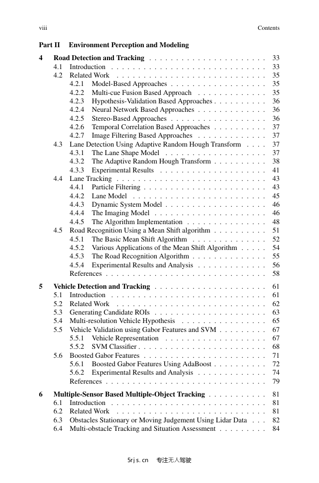
Part II: Environment Perception and Modeling�
Chapter 4: Road Detection and Tracking�
4.1 Introduction�
4.2 Related Work�
4.2.1 Model-Based Approaches�
4.2.2 Multi-cue Fusion Based Approach�
4.2.3 Hypothesis-Validation Based Approaches�
4.2.4 Neural Network Based Approaches�
4.2.5 Stereo-Based Approaches�
4.2.6 Temporal Correlation Based Approaches�
4.2.7 Image Filtering Based Approaches�
4.3 Lane Detection Using Adaptive Random Hough Transform�
4.3.1 The Lane Shape Model�
4.3.2 The Adaptive Random Hough Transform�
A. Pixel Sampling on Edges�
B. Multi-Resolution Parameter Estimating Strategy�
4.3.3 Experimental Results�
4.4 Lane Tracking�
4.4.1 Particle Filtering�
4.4.2 Lane Model�
4.4.3 Dynamic System Model�
4.4.4 The Imaging Model�
4.4.5 The Algorithm Implementation�
4.4.5.1 Factored Sampling�
4.4.5.2 The Observation and Measure Models�
4.4.5.3 The Algorithm Flow�
4.5 Road Recognition Using a Mean Shift algorithm�
4.5.1 The Basic Mean Shift Algorithm�
4.5.2 Various Applications of the Mean Shift Algorithm�
Mean Shift Clustering�
The Mean Shift Segmentation�
Mean Shift Tracking�
4.5.3 The Road Recognition Algorithm�
4.5.4 Experimental Results and Analysis�
References�
Chapter 5: Vehicle Detection and Tracking�
5.1 Introduction�
5.2 Related Work�
5.3 Generating Candidate ROIs�
5.4 Multi-resolution Vehicle Hypothesis�
5.5 Vehicle Validation using Gabor Features and SVM�
5.5.1 Vehicle Representation�
5.5.2 SVM Classi?er�
5.6 Boosted Gabor Features�
5.6.1 Boosted Gabor Features Using AdaBoost�
5.6.1.1 Gabor Feature�
5.6.1.2 Boosted Gabor Features�
5.6.2 Experimental Results and Analysis�
5.6.2.1 Vehicle Database for Detection and Tracking�
5.6.2.2 Boosted Gabor Features�
5.6.2.3 Vehicle Detection Results and Discussions�
References�
Chapter 6: Multiple-Sensor Based Multiple-Object Tracking�
6.1 Introduction�
6.2 Related Work�
6.3 Obstacles Stationary or Moving Judgement Using Lidar Data�
6.4 Multi-obstacle Tracking and Situation Assessment�
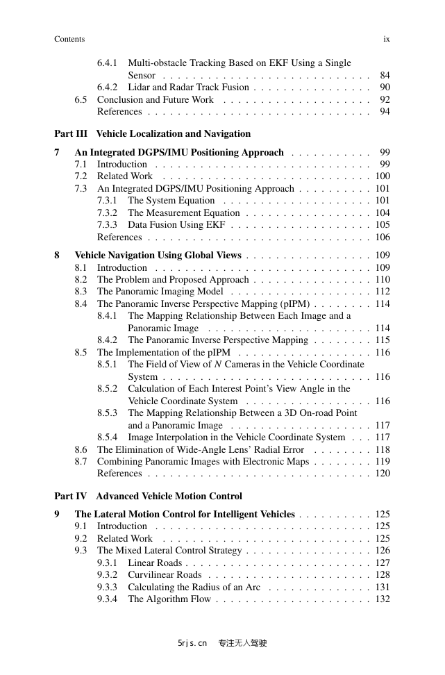
6.4.1 Multi-obstacle Tracking Based on EKF Using a Single Sensor�
6.4.1.1 Probability Framework of Tracking�
6.4.1.2 System Model�
6.4.1.3 Initial Conditions�
6.4.1.4 Data Association for a Single Sensor�
1. Observation-to-Observation Association�
2. Observation-to-Track Association�
6.4.1.5 Single Track Management�
6.4.2 Lidar and Radar Track Fusion�
6.4.2.1 Data Alignment�
6.4.2.2 Track Association�
6.4.2.3 Track Fusion Algorithm�
6.5 Conclusion and Future Work�
References�
Part III: Vehicle Localization and Navigation�
Chapter 7: An Integrated DGPS/IMU Positioning Approach�
7.1 Introduction�
7.2 Related Work�
7.3 An Integrated DGPS/IMU Positioning Approach�
7.3.1 The System Equation�
7.3.2 The Measurement Equation�
7.3.3 Data Fusion Using EKF�
References�
Chapter 8: Vehicle Navigation Using Global Views�
8.1 Introduction�
8.2 The Problem and Proposed Approach�
8.3 The Panoramic Imaging Model�
8.4 The Panoramic Inverse Perspective Mapping (pIPM)�
8.4.1 The Mapping Relationship Between Each Image and a Panoramic Image�
8.4.2 The Panoramic Inverse Perspective Mapping�
8.5 The Implementation of the pIPM�
8.5.1 The Field of View of N Cameras in the Vehicle Coordinate System�
8.5.2 Calculation of Each Interest Point's View Angle in the Vehicle Coordinate System�
8.5.3 The Mapping Relationship Between a 3D On-road Point and a Panoramic Image�
8.5.4 Image Interpolation in the Vehicle Coordinate System�
8.6 The Elimination of Wide-Angle Lens' Radial Error�
8.7 Combining Panoramic Images with Electronic Maps�
References�
Part IV: Advanced Vehicle Motion Control�
Chapter 9: The Lateral Motion Control for Intelligent Vehicles�
9.1 Introduction�
9.2 Related Work�
9.3 The Mixed Lateral Control Strategy�
9.3.1 Linear Roads�
1. Determining Look-Ahead Distance�
2. Calculating Looking-Ahead Error�
9.3.2 Curvilinear Roads�
1. Existing Shape Representation�
2. The Proposed Segmenting Approach of Contours�
9.3.3 Calculating the Radius of an Arc�
9.3.4 The Algorithm Flow�
9.4 The Relationship Between Motor Pulses and the Front Wheel Lean Angle�
References�
Chapter 10: Longitudinal Motion Control for Intelligent Vehicles�
10.1 Introduction�
10.2 System Identi?cation in Vehicle Longitudinal Control�
10.2.1 The First-Order Systems�
10.2.2 First-Order Lag Systems�
10.2.3 Identi?cation of Our Vehicle System�
1. The First-Order System Assumption�
2. Validating the First-Order Lag Assumption�
3. Validating Second-Order Assumption�
10.3 The Proposed Velocity Controller�
10.3.1 Validating the Longitudinal Control System Function�
10.3.2 Velocity Controller Design�
10.4 Experimental Results and Analysis�
References�
Index�


 2023年江西萍乡中考道德与法治真题及答案.doc
 2012年重庆南川中考生物真题及答案.doc
 2013年江西师范大学地理学综合及文艺理论基础考研真题.doc
 2020年四川甘孜小升初语文真题及答案I卷.doc
 2020年注册岩土工程师专业基础考试真题及答案.doc
 2023-2024学年福建省厦门市九年级上学期数学月考试题及答案.doc
 2021-2022学年辽宁省沈阳市大东区九年级上学期语文期末试题及答案.doc
 2022-2023学年北京东城区初三第一学期物理期末试卷及答案.doc
 2018上半年江西教师资格初中地理学科知识与教学能力真题及答案.doc
 2012年河北国家公务员申论考试真题及答案-省级.doc
 2020-2021学年江苏省扬州市江都区邵樊片九年级上学期数学第一次质量检测试题及答案.doc
 2022下半年黑龙江教师资格证中学综合素质真题及答案.doc