ProMark™3
Reference Manual
�
Copyright Notice
©2005-2006 Magellan Navigation, Inc. All rights reserved.
will be uninterrupted, error-free or virus-free. Purchaser as-
sumes the entire risk of using the software.
Trademarks
All product and brand names mentioned in this publication
are trademarks of their respective holders.
FCC Notice
This equipment has been tested and found to comply with the
limits for a class B digital device, pursuant to part 15 of the
FCC Rules. These limits are designed to provide reasonable
protection against harmful interference in a residential instal-
lation. This equipment generates, uses and can radiate radio
frequency energy and if not installed and used in accordance
with the instructions, may cause harmful interference to radio
communications. However, there is no guarantee that interfer-
ence will not occur in a particular installation. If this equip-
ment does cause harmful interference to radio or television
reception, which can be determined by turning the equipment
off and on, the user is encouraged to try to correct the inter-
ference by one or more of the following measures:
• Reorient or relocate the receiving antenna.
• Increase the separation between the equipment and
receiver.
for help.
• Connect the equipment into an outlet on a circuit differ-
ent from that to which the receiver is connected.
• Consult the dealer or an experienced radio/TV technician
Changes or modifications not expressly approved by Magellan
Navigation could void the user's authority to operate this
equipment.
CAUTION: To comply with FCC RF exposure compliance re-
quirements, a separation distance of at least 20 cm must be
maintained between the antenna of this device and all per-
sons.
In the presence of RF field, the receiver's satellite
signal strength may degrade. When removed from
the RF field, the signal strength should return to
normal.
RSS-210
This device has been found compliant with the Canadian RSS-
210 specification, issue 5, November 2001 which stipulates
that operation is subject to the following two conditions: (1)
this device may not cause interference, and (2) this device
must accept any interference, including interference that may
cause undesired operation of the device.
Magellan Professional Products - Limited Warranty (North,
Central and South America)
Magellan Navigation warrants their GPS receivers and hard-
ware accessories to be free of defects in material and work-
manship and will conform to our published specifications for
the product for a period of one year from the date of original
purchase. THIS WARRANTY APPLIES ONLY TO THE ORIGI-
NAL PURCHASER OF THIS PRODUCT.
In the event of a defect, Magellan Navigation will, at its op-
tion, repair or replace the hardware product with no charge to
the purchaser for parts or labor. The repaired or replaced prod-
uct will be warranted for 90 days from the date of return ship-
ment, or for the balance of the original warranty, whichever is
longer. Magellan Navigation warrants that software products or
software included in hardware products will be free from de-
fects in the media for a period of 30 days from the date of
shipment and will substantially conform to the then-current
user documentation provided with the software (including up-
dates thereto). Magellan Navigation's sole obligation shall be
the correction or replacement of the media or the software so
that it will substantially conform to the then- current user doc-
umentation. Magellan Navigation does not warrant the soft-
ware will meet purchaser's requirements or that its operation
PURCHASER'S EXCLUSIVE REMEDY UNDER THIS WRIT-
TEN WARRANTY OR ANY IMPLIED WARRANTY SHALL BE
LIMITED TO THE REPAIR OR REPLACEMENT, AT MAGEL-
LAN NAVIGATION'S OPTION, OF ANY DEFECTIVE PART OF
THE RECEIVER OR ACCESSORIES WHICH ARE COVERED
BY THIS WARRANTY. REPAIRS UNDER THIS WARRANTY
SHALL ONLY BE MADE AT AN AUTHORIZED MAGELLAN
NAVIGATION SERVICE CENTER. ANY REPAIRS BY A SER-
VICE CENTER NOT AUTHORIZED BY MAGELLAN NAVIGA-
TION WILL VOID THIS WARRANTY.
To obtain warranty service the purchaser must obtain a Return
Materials Authorization (RMA) number prior to shipping by
calling 1-800-229-2400 (press option #1) (U.S.) or 1-408-
615-3981 (International), or by submitting a repair request
on-line at:
http://professional.magellangps.com/en/support/rma.asp. The
purchaser must return the product postpaid with a copy of the
original sales receipt to the address provided by Magellan Nav-
igation with the RMA number. Purchaser’s return address and
the RMA number must be clearly printed on the outside of the
package.
Magellan Navigation reserves the right to refuse to provide ser-
vice free-of-charge if the sales receipt is not provided or if the
information contained in it is incomplete or illegible or if the
serial number is altered or removed. Magellan Navigation will
not be responsible for any losses or damage to the product in-
curred while the product is in transit or is being shipped for
repair. Insurance is recommended. Magellan Navigation sug-
gests using a trackable shipping method such as UPS or Fe-
dEx when returning a product for service.
EXCEPT AS SET FORTH IN THIS LIMITED WARRANTY, ALL
OTHER EXPRESSED OR IMPLIED WARRANTIES, INCLUD-
ING THOSE OF FITNESS FOR ANY PARTICULAR PURPOSE,
MERCHANTABILITY OR NON-INFRINGEMENT, ARE HERE-
BY DISCLAIMED AND IF APPLICABLE, IMPLIED WARRAN-
TIES UNDER ARTICLE 35 OF THE UNITED NATIONS
CONVENTION ON CONTRACTS FOR THE INTERNATIONAL
SALE OF GOODS. Some national, state, or local laws do not
allow limitations on implied warranty or how long an implied
warranty lasts, so the above limitation may not apply to you.
The following are excluded from the warranty coverage: (1) pe-
riodic maintenance and repair or replacement of parts due to
normal wear and tear; (2) batteries and finishes; (3) installa-
tions or defects resulting from installation; (4) any damage
caused by (i) shipping, misuse, abuse, negligence, tampering,
or improper use; (ii) disasters such as fire, flood, wind, and
lightning; (iii) unauthorized attachments or modification; (5)
service performed or attempted by anyone other than an au-
thorized Magellan Navigations Service Center; (6) any prod-
uct, components or parts not manufactured by Magellan
Navigation; (7) that the receiver will be free from any claim for
infringement of any patent, trademark, copyright or other pro-
prietary right, including trade secrets; and (8) any damage due
to accident, resulting from inaccurate satellite transmissions.
Inaccurate transmissions can occur due to changes in the po-
sition, health or geometry of a satellite or modifications to the
receiver that may be required due to any change in the GPS.
(Note: Magellan Navigation GPS receivers use GPS or
GPS+GLONASS to obtain position, velocity and time informa-
tion. GPS is operated by the U.S. Government and GLONASS
is the Global Navigation Satellite System of the Russian Fed-
eration, which are solely responsible for the accuracy and
maintenance of their systems. Certain conditions can cause
inaccuracies which could require modifications to the receiv-
er. Examples of such conditions include but are not limited to
changes in the GPS or GLONASS transmission.) Opening, dis-
mantling or repairing of this product by anyone other than an
authorized Magellan Navigation Service Center will void this
warranty.
�
MAGELLAN NAVIGATION SHALL NOT BE LIABLE TO PUR-
CHASER OR ANY OTHER PERSON FOR ANY INCIDENTAL
OR CONSEQUENTIAL DAMAGES WHATSOEVER, INCLUD-
ING BUT NOT LIMITED TO LOST PROFITS, DAMAGES RE-
SULTING FROM DELAY OR LOSS OF USE, LOSS OF OR
DAMAGES ARISING OUT OF BREACH OF THIS WARRANTY
OR ANY IMPLIED WARRANTY EVEN THOUGH CAUSED BY
NEGLIGENCE OR OTHER FAULT OFMAGELLAN NAVIGATION
OR NEGLIGENT USAGE OF THE PRODUCT. IN NO EVENT
WILL MAGELLAN NAVIGATION BE RESPONSIBLE FOR
SUCH DAMAGES, EVEN IF MAGELLAN NAVIGATION HAS
BEEN ADVISED OF THE POSSIBILITY OF SUCH DAMAGES.
This written warranty is the complete, final and exclusive
agreement between Magellan Navigation and the purchaser
with respect to the quality of performance of the goods and
any and all warranties and representations. This warranty sets
forth all of Magellan Navigation's responsibilities regarding
this product. This limited warranty is governed by the laws of
the State of California, without reference to its conflict of law
provisions or the U.N. Convention on Contracts for the Inter-
national Sale of Goods, and shall benefit Magellan Navigation,
its successors and assigns.
This warranty gives the purchaser specific rights. The purchas-
er may have other rights which vary from locality to locality (in-
cluding Directive 1999/44/EC in the EC Member States) and
certain limitations contained in this warranty, including the
exclusion or limitation of incidental or consequential damages
may not apply.
For further information concerning this limited warranty,
please call or write:
Magellan Navigation, Inc., 960 Overland Court, San Dimas,
CA 91773, Phone: +1 909-394-5000, Fax: +1 909-394-
7050 or
Magellan Navigation SA - ZAC La Fleuriaye - BP 433 - 44474
Carquefou Cedex - France Phone: +33 (0)2 28 09 38 00,
Fax: +33 (0)2 28 09 39 39.
Magellan Professional Products Limited Warranty (Europe,
Middle East, Africa)
All Magellan Navigation global positioning system (GPS) re-
ceivers are navigation aids, and are not intended to replace
other methods of navigation. Purchaser is advised to perform
careful position charting and use good judgment. READ THE
USER GUIDE CAREFULLY BEFORE USING THE PRODUCT.
1. MAGELLAN NAVIGATION WARRANTY
Magellan Navigation warrants their GPS receivers and hard-
ware accessories to be free of defects in material and work-
manship and will conform to our published specifications for
the product for a period of one year from the date of original
purchase or such longer period as required by law. THIS WAR-
RANTY APPLIES ONLY TO THE ORIGINAL PURCHASER OF
THIS PRODUCT.
In the event of a defect, Magellan Navigation will, at its op-
tion, repair or replace the hardware product with no charge to
the purchaser for parts or labor. The repaired or replaced prod-
uct will be warranted for 90 days from the date of return ship-
ment, or for the balance of the original warranty, whichever is
longer. Magellan Navigation warrants that software products or
software included in hardware products will be free from de-
fects in the media for a period of 30 days from the date of
shipment and will substantially conform to the then-current
user documentation provided with the software (including up-
dates thereto). Magellan Navigation's sole obligation shall be
the correction or replacement of the media or the software so
that it will substantially conform to the then- current user doc-
umentation. Magellan Navigation does not warrant the soft-
ware will meet purchaser's requirements or that its operation
will be uninterrupted, error-free or virus-free. Purchaser as-
sumes the entire risk of using the software.
2. PURCHASER'S REMEDY
PURCHASER'S EXCLUSIVE REMEDY UNDER THIS WRIT-
TEN WARRANTY OR ANY IMPLIED WARRANTY SHALL BE
LIMITED TO THE REPAIR OR REPLACEMENT, AT MAGEL-
LAN NAVIGATION'S OPTION, OF ANY DEFECTIVE PART OF
THE RECEIVER OR ACCESSORIES WHICH ARE COVERED
BY THIS WARRANTY. REPAIRS UNDER THIS WARRANTY
SHALL ONLY BE MADE AT AN AUTHORIZED MAGELLAN
NAVIGATION SERVICE CENTER. ANY REPAIRS BY A SER-
VICE CENTER NOT AUTHORIZED BY MAGELLAN NAVIGA-
TION WILL VOID THIS WARRANTY.
3. PURCHASER'S DUTIES
To obtain service, contact and return the product with a copy
of the original sales receipt to the dealer from whom you pur-
chased the product.
Magellan Navigation reserves the right to refuse to provide ser-
vice free-of-charge if the sales receipt is not provided or if the
information contained in it is incomplete or illegible or if the
serial number is altered or removed. Magellan Navigation will
not be responsible for any losses or damage to the product in-
curred while the product is in transit or is being shipped for
repair. Insurance is recommended. Magellan Navigation sug-
gests using a trackable shipping method such as UPS or Fe-
dEx when returning a product for service.
4. LIMITATION OF IMPLIED WARRANTIES
EXCEPT AS SET FORTH IN ITEM 1 ABOVE, ALL OTHER EX-
PRESSED OR IMPLIED WARRANTIES, INCLUDING THOSE
OF FITNESS FOR ANY PARTICULAR PURPOSE OR MER-
CHANTABILITY, ARE HEREBY DISCLAIMED AND IF APPLI-
CABLE, IMPLIED WARRANTIES UNDER ARTICLE 35 OF THE
UNITED NATIONS CONVENTION ON CONTRACTS FOR THE
INTERNATIONAL SALE OF GOODS.
Some national, state, or local laws do not allow limitations on
implied warranty or how long an implied warranty lasts, so the
above limitation may not apply to you.
5. EXCLUSIONS
The following are excluded from the warranty coverage:
(1) periodic maintenance and repair or replacement of parts
due to normal wear and tear;
(2) batteries;
(3) finishes;
(4) installations or defects resulting from installation;
(5) any damage caused by (i) shipping, misuse, abuse, negli-
gence, tampering, or improper use; (ii) disasters such as fire,
flood, wind, and lightning; (iii) unauthorized attachments or
modification;
(6) service performed or attempted by anyone other than an
authorized Magellan Navigations Service Center;
(7) any product, components or parts not manufactured by
Magellan Navigation,
(8) that the receiver will be free from any claim for infringe-
ment of any patent, trademark, copyright or other proprietary
right, including trade secrets
(9) any damage due to accident, resulting from inaccurate sat-
ellite transmissions. Inaccurate transmissions can occur due
to changes in the position, health or geometry of a satellite or
modifications to the receiver that may be required due to any
change in the GPS. (Note: Magellan Navigation GPS receivers
use GPS or GPS+GLONASS to obtain position, velocity and
time information. GPS is operated by the U.S. Government
and GLONASS is the Global Navigation Satellite System of the
�
Russian Federation, which are solely responsible for the accu-
racy and maintenance of their systems. Certain conditions can
cause inaccuracies which could require modifications to the
receiver. Examples of such conditions include but are not lim-
ited to changes in the GPS or GLONASS transmission.).
Opening, dismantling or repairing of this product by anyone
other than an authorized Magellan Navigation Service Center
will void this warranty.
6. EXCLUSION OF INCIDENTAL OR CONSEQUENTIAL DAM-
AGES
MAGELLAN NAVIGATION SHALL NOT BE LIABLE TO PUR-
CHASER OR ANY OTHER PERSON FOR ANY INDIRECT, IN-
CIDENTAL OR CONSEQUENTIAL DAMAGES WHATSOEVER,
INCLUDING BUT NOT LIMITED TO LOST PROFITS, DAMAG-
ES RESULTING FROM DELAY OR LOSS OF USE, LOSS OF
OR DAMAGES ARISING OUT OF BREACH OF THIS WARRAN-
TY OR ANY IMPLIED WARRANTY EVEN THOUGH CAUSED
BY NEGLIGENCE OR OTHER FAULT OFMAGELLAN NAVIGA-
TION OR NEGLIGENT USAGE OF THE PRODUCT. IN NO
EVENT WILL MAGELLAN NAVIGATION BE RESPONSIBLE
FOR SUCH DAMAGES, EVEN IF MAGELLAN NAVIGATION
HAS BEEN ADVISED OF THE POSSIBILITY OF SUCH DAM-
AGES.
Some national, state, or local laws do not allow the exclusion
or limitation of incidental or consequential damages, so the
above limitation or exclusion may not apply to you.
7. COMPLETE AGREEMENT
This written warranty is the complete, final and exclusive
agreement between Magellan Navigation and the purchaser
with respect to the quality of performance of the goods and
any and all warranties and representations. THIS WARRANTY
SETS FORTH ALL OF MAGELLAN NAVIGATION'S RESPONSI-
BILITIES REGARDING THIS PRODUCT.
THIS WARRANTY GIVES YOU SPECIFIC RIGHTS. YOU MAY
HAVE OTHER RIGHTS WHICH VARY FROM LOCALITY TO LO-
CALITY (including Directive 1999/44/EC in the EC Member
States) AND CERTAIN LIMITATIONS CONTAINED IN THIS
WARRANTY MAY NOT APPLY TO YOU.
8. CHOICE OF LAW.
This limited warranty is governed by the laws of France, with-
out reference to its conflict of law provisions or the U.N. Con-
vention on Contracts for the International Sale of Goods, and
shall benefit Magellan Navigation, its successors and assigns.
THIS WARRANTY DOES NOT AFFECT THE CUSTOMER'S
STATUTORY RIGHTS UNDER APPLICABLE LAWS IN FORCE
IN THEIR LOCALITY, NOR THE CUSTOMER'S RIGHTS
AGAINST THE DEALER ARISING FROM THEIR SALES/PUR-
CHASE CONTRACT (such as the guarantees in France for la-
tent defects in accordance with Article 1641 et seq of the
French Civil Code).
For further information concerning this limited warranty,
please call or write:
Magellan Navigation SA - ZAC La Fleuriaye - BP 433 - 44474
Carquefou Cedex - France.
Phone: +33 (0)2 28 09 38 00, Fax: +33 (0)2 28 09 39 39
�
Table of Contents
Introduction ..................................................................................... 1
What is the ProMark3 System? ....................................................1
Surveying..............................................................................1
Mobile Mapping ....................................................................2
Items Supplied with ProMark3.....................................................2
ProMark3 Receiver ................................................................3
I/O Module............................................................................4
USB Cable ............................................................................5
AC Adapter/Charger................................................................5
External GNSS Antenna .........................................................5
External Antenna Cable ..........................................................5
Vertical Antenna Extension .....................................................6
Field Receiver Bracket ...........................................................6
HI (Height of Instrument) Measurement Tape...........................6
Field Bag ..............................................................................6
User Documentation & MobileMapper Office Software CD..........7
Initializer Bar and Antenna Adaptor.........................................7
GNSS Solutions CD ...............................................................7
Additional Items Required but not Supplied..................................8
For Static Surveys or Base Stations .........................................8
For Kinematic Surveys ...........................................................9
Specifications ..........................................................................10
Surveying with ProMark3 ..........................................................11
Mobile Mapping with ProMark3 .................................................14
Navigating with ProMark3 .........................................................17
Time Spent in The Field............................................................18
Static .................................................................................18
Stop-and-Go........................................................................19
Kinematic ...........................................................................19
Mobile Mapping ..................................................................19
Where to Find Information.........................................................20
Preparing For First-Time Use ........................................................... 21
Charging the ProMark3 Battery Pack ..........................................21
Control Buttons........................................................................22
Turning On/Off the Receiver ......................................................25
Calibrating the Screen ..............................................................25
Automatic System Time Update.................................................26
Adjusting the Backlight.............................................................26
Initializing GPS........................................................................27
DGPS Real-Time Configuration ..................................................28
Selecting the Surveying or Mobile Mapping function....................28
Preliminary Settings .................................................................29
Storage...............................................................................29
Receiver ID .........................................................................29
Units..................................................................................30
Checking that ProMark3 is Ready For Field Operations ................30
Surveying....................................................................................... 31
Introduction to Static Surveying.................................................31
i
�
Network Design ...................................................................31
Observation Plan .................................................................34
Running a Static Survey............................................................41
Equipment Check ................................................................42
Site Selection......................................................................42
System Setup (Base and Rover) ............................................45
Static Survey Setup (Base and Rover) ....................................47
Data Collection....................................................................49
Introduction to Kinematic Surveying...........................................52
Stop-and-Go........................................................................52
Kinematic ...........................................................................53
Initialization Methods ...............................................................55
Running a “Stop & Go” Survey ..................................................56
Base Setup and Operation ....................................................56
Rover Setup ........................................................................57
Stop & Go Survey Rover Setup ..............................................57
Initialization Phase ..............................................................61
Data Collection....................................................................62
Running a Kinematic Survey......................................................66
Base Setup and Operation ....................................................66
Rover Setup ........................................................................67
Kinematic Survey Rover Setup ..............................................67
Initialization Phase ..............................................................70
Data Collection....................................................................72
Re-Initialization .......................................................................75
When is Re-Initialization Required? .......................................75
Preventive Steps to Facilitate Re-initialization ........................76
Quitting the Surveying Function.................................................78
Office Work with GNSS Solutions Software .................................79
Downloading Field Data from ProMark3 .................................79
Downloading Field Data from the Local SD Card Reader ..........82
Post-Processing Field Data ...................................................83
Uploading a Vector Background Map to ProMark3...................84
Uploading Control Points to ProMark3 ...................................86
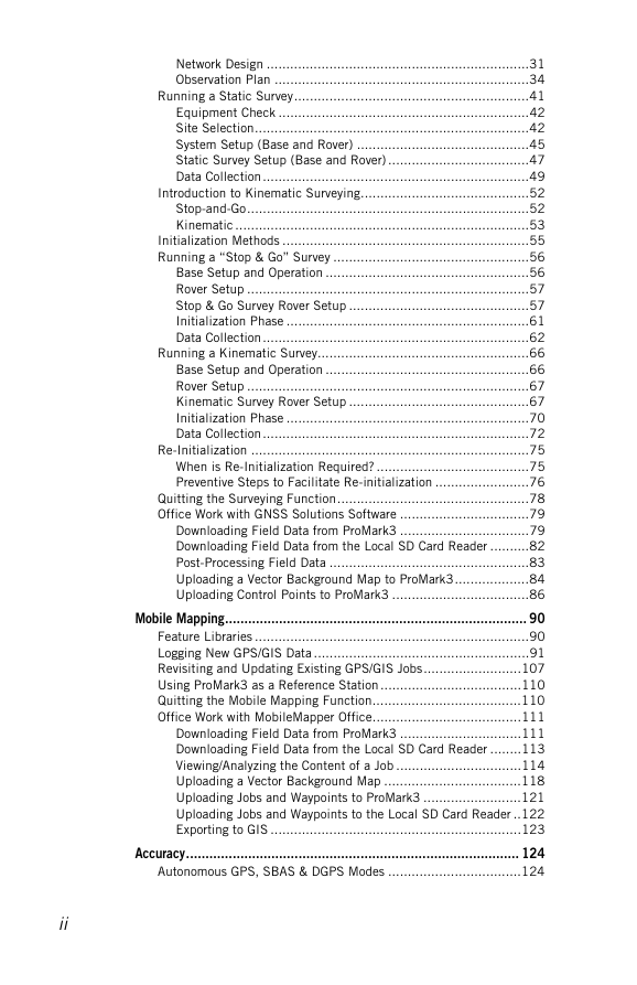
Mobile Mapping.............................................................................. 90
Feature Libraries ......................................................................90
Logging New GPS/GIS Data .......................................................91
Revisiting and Updating Existing GPS/GIS Jobs.........................107
Using ProMark3 as a Reference Station ....................................110
Quitting the Mobile Mapping Function......................................110
Office Work with MobileMapper Office......................................111
Downloading Field Data from ProMark3 ...............................111
Downloading Field Data from the Local SD Card Reader ........113
Viewing/Analyzing the Content of a Job ................................114
Uploading a Vector Background Map ...................................118
Uploading Jobs and Waypoints to ProMark3 .........................121
Uploading Jobs and Waypoints to the Local SD Card Reader ..122
Exporting to GIS ................................................................123
Accuracy...................................................................................... 124
Autonomous GPS, SBAS & DGPS Modes ..................................124
ii
�
Quality Indicators ...................................................................125
Navigation ................................................................................... 126
Navigation Screens.................................................................126
Map Screen ......................................................................127
Compass Screen ................................................................128
Large Data Screen .............................................................129
Position Screens................................................................130
Road Screen .....................................................................132
Data Screen ......................................................................133
Speedometer Screen ..........................................................134
Satellite Status Screen.......................................................135
GOTO Function ......................................................................136
Purpose ............................................................................136
Destination Point Types......................................................136
Selecting a POI as the Destination Point ..............................137
Selecting a GIS Feature as the Destination Point ..................138
Saving Your Current Position as a Waypoint..........................139
Editing/Deleting a User Waypoint ........................................139
Clearing the GOTO function ................................................140
Routes ..................................................................................141
GOTO Route......................................................................141
Multi-leg Route .................................................................141
MENU key ................................................................................... 145
File Manager..........................................................................145
Mark .....................................................................................146
GOTO....................................................................................147
Routes ..................................................................................148
Setup Menu...........................................................................149
Storage.............................................................................149
Receiver ID .......................................................................149
Select Map .......................................................................150
Map Setup ........................................................................151
Nav Screens......................................................................153
Coord System ....................................................................154
Map Datum.......................................................................156
Time Format .....................................................................156
Units................................................................................157
Alarms..............................................................................157
North Reference ................................................................159
Beeper .............................................................................159
Reset Trip.........................................................................159
Clear Memory ....................................................................160
Simulate...........................................................................161
Language..........................................................................161
Customize .............................................................................162
About....................................................................................163
Exit.......................................................................................163
Power Management....................................................................... 164
Power Saving Modes...............................................................164
Backlight Control ...................................................................165
iii
�
Checking Battery Status..........................................................166
LED Indicators .......................................................................167
Turning Off ProMark3 .............................................................167
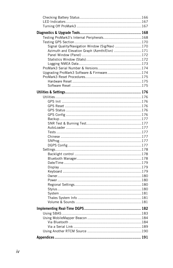
Diagnostics & Upgrade Tools.......................................................... 168
Testing ProMark3’s Internal Peripherals....................................168
Testing GPS Section ...............................................................170
Signal Quality/Navigation Window (Sig/Nav) .........................170
Azimuth and Elevation Graph (Azmth/Elvn) ..........................171
Panel Window (Panel) ........................................................172
Statistics Window (Stats)....................................................172
Logging NMEA Data...........................................................173
ProMark3 Serial Number & Versions.........................................174
Upgrading ProMark3 Software & Firmware ................................174
ProMark3 Reset Procedures.....................................................175
Hardware Reset .................................................................175
Software Reset ..................................................................175
Utilities & Settings........................................................................ 176
Utilities .................................................................................176
GPS Init ...........................................................................176
GPS Reset ........................................................................176
GPS Status .......................................................................176
GPS Config .......................................................................176
Backup.............................................................................177
SNR Test & Burning Test....................................................177
AutoLoader .......................................................................177
Tests ................................................................................177
Chinese ............................................................................177
SNProg.............................................................................177
DGPS Config .....................................................................177
Settings.................................................................................178
Backlight control ...............................................................178
Bluetooth Manager.............................................................178
Date/Time .........................................................................179
Display .............................................................................179
Keyboard ..........................................................................179
Owner...............................................................................180
Power ...............................................................................180
Regional Settings...............................................................180
Stylus...............................................................................180
System .............................................................................181
Thales System Info ............................................................181
Volume & Sounds ..............................................................181
Implementing Real-Time DGPS...................................................... 182
Using SBAS...........................................................................183
Using MobileMapper Beacon ...................................................184
Via Bluetooth ....................................................................184
Via a Serial Link ................................................................189
Using Another RTCM Source ...................................................190
Appendices .................................................................................. 191
iv
�




 2023年江西萍乡中考道德与法治真题及答案.doc
 2012年重庆南川中考生物真题及答案.doc
 2013年江西师范大学地理学综合及文艺理论基础考研真题.doc
 2020年四川甘孜小升初语文真题及答案I卷.doc
 2020年注册岩土工程师专业基础考试真题及答案.doc
 2023-2024学年福建省厦门市九年级上学期数学月考试题及答案.doc
 2021-2022学年辽宁省沈阳市大东区九年级上学期语文期末试题及答案.doc
 2022-2023学年北京东城区初三第一学期物理期末试卷及答案.doc
 2018上半年江西教师资格初中地理学科知识与教学能力真题及答案.doc
 2012年河北国家公务员申论考试真题及答案-省级.doc
 2020-2021学年江苏省扬州市江都区邵樊片九年级上学期数学第一次质量检测试题及答案.doc
 2022下半年黑龙江教师资格证中学综合素质真题及答案.doc