实验七 ENVI 软件介绍
目的:初步认识遥感数字图像处理软件 ENVI,了解 ENVI 的组成;掌握 TM、ETM+数据的
ENVI 读取;认识 ENVI 的数据文件;掌握辐射亮度和反射率的计算。
实验原理:
关于头文件的解读,传感器记录的数据,遥感的基本物理量,辐射亮度与 DN 值之间的关系。
Use Landsat TM calibration to convert Landsat TM or ETM digital numbers to radiance or
exoatmospheric reflectance (reflectance above the atmosphere) using published post-launch gains
and
and
http://edcftp.cr.usgs.gov/pub/metadata/satellite/landsat7.tar.gz).
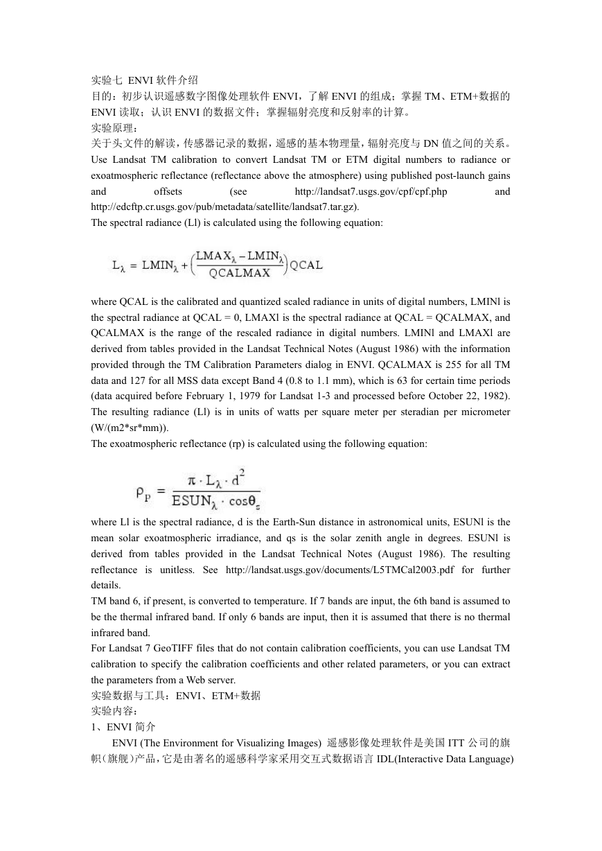
The spectral radiance (Ll) is calculated using the following equation:
http://landsat7.usgs.gov/cpf/cpf.php
offsets
(see
where QCAL is the calibrated and quantized scaled radiance in units of digital numbers, LMINl is
the spectral radiance at QCAL = 0, LMAXl is the spectral radiance at QCAL = QCALMAX, and
QCALMAX is the range of the rescaled radiance in digital numbers. LMINl and LMAXl are
derived from tables provided in the Landsat Technical Notes (August 1986) with the information
provided through the TM Calibration Parameters dialog in ENVI. QCALMAX is 255 for all TM
data and 127 for all MSS data except Band 4 (0.8 to 1.1 mm), which is 63 for certain time periods
(data acquired before February 1, 1979 for Landsat 1-3 and processed before October 22, 1982).
The resulting radiance (Ll) is in units of watts per square meter per steradian per micrometer
(W/(m2*sr*mm)).
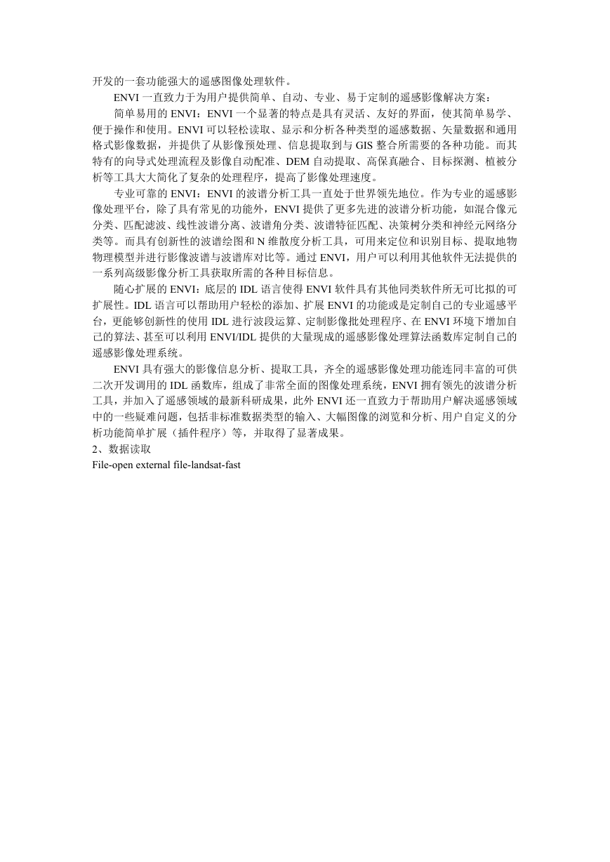
The exoatmospheric reflectance (rp) is calculated using the following equation:
where Ll is the spectral radiance, d is the Earth-Sun distance in astronomical units, ESUNl is the
mean solar exoatmospheric irradiance, and qs is the solar zenith angle in degrees. ESUNl is
derived from tables provided in the Landsat Technical Notes (August 1986). The resulting
reflectance is unitless. See http://landsat.usgs.gov/documents/L5TMCal2003.pdf
further
details.
TM band 6, if present, is converted to temperature. If 7 bands are input, the 6th band is assumed to
be the thermal infrared band. If only 6 bands are input, then it is assumed that there is no thermal
infrared band.
For Landsat 7 GeoTIFF files that do not contain calibration coefficients, you can use Landsat TM
calibration to specify the calibration coefficients and other related parameters, or you can extract
the parameters from a Web server.
实验数据与工具:ENVI、ETM+数据
实验内容:
1、ENVI 简介
for
ENVI (The Environment for Visualizing Images) 遥感影像处理软件是美国 ITT 公司的旗
帜(旗舰)产品,它是由著名的遥感科学家采用交互式数据语言 IDL(Interactive Data Language)
�
开发的一套功能强大的遥感图像处理软件。
ENVI 一直致力于为用户提供简单、自动、专业、易于定制的遥感影像解决方案:
简单易用的 ENVI:ENVI 一个显著的特点是具有灵活、友好的界面,使其简单易学、
便于操作和使用。ENVI 可以轻松读取、显示和分析各种类型的遥感数据、矢量数据和通用
格式影像数据,并提供了从影像预处理、信息提取到与 GIS 整合所需要的各种功能。而其
特有的向导式处理流程及影像自动配准、DEM 自动提取、高保真融合、目标探测、植被分
析等工具大大简化了复杂的处理程序,提高了影像处理速度。
专业可靠的 ENVI:ENVI 的波谱分析工具一直处于世界领先地位。作为专业的遥感影
像处理平台,除了具有常见的功能外,ENVI 提供了更多先进的波谱分析功能,如混合像元
分类、匹配滤波、线性波谱分离、波谱角分类、波谱特征匹配、决策树分类和神经元网络分
类等。而具有创新性的波谱绘图和 N 维散度分析工具,可用来定位和识别目标、提取地物
物理模型并进行影像波谱与波谱库对比等。通过 ENVI,用户可以利用其他软件无法提供的
一系列高级影像分析工具获取所需的各种目标信息。
随心扩展的 ENVI:底层的 IDL 语言使得 ENVI 软件具有其他同类软件所无可比拟的可
扩展性。IDL 语言可以帮助用户轻松的添加、扩展 ENVI 的功能或是定制自己的专业遥感平
台,更能够创新性的使用 IDL 进行波段运算、定制影像批处理程序、在 ENVI 环境下增加自
己的算法、甚至可以利用 ENVI/IDL 提供的大量现成的遥感影像处理算法函数库定制自己的
遥感影像处理系统。
ENVI 具有强大的影像信息分析、提取工具,齐全的遥感影像处理功能连同丰富的可供
二次开发调用的 IDL 函数库,组成了非常全面的图像处理系统,ENVI 拥有领先的波谱分析
工具,并加入了遥感领域的最新科研成果,此外 ENVI 还一直致力于帮助用户解决遥感领域
中的一些疑难问题,包括非标准数据类型的输入、大幅图像的浏览和分析、用户自定义的分
析功能简单扩展(插件程序)等,并取得了显著成果。
2、数据读取
File-open external file-landsat-fast
�
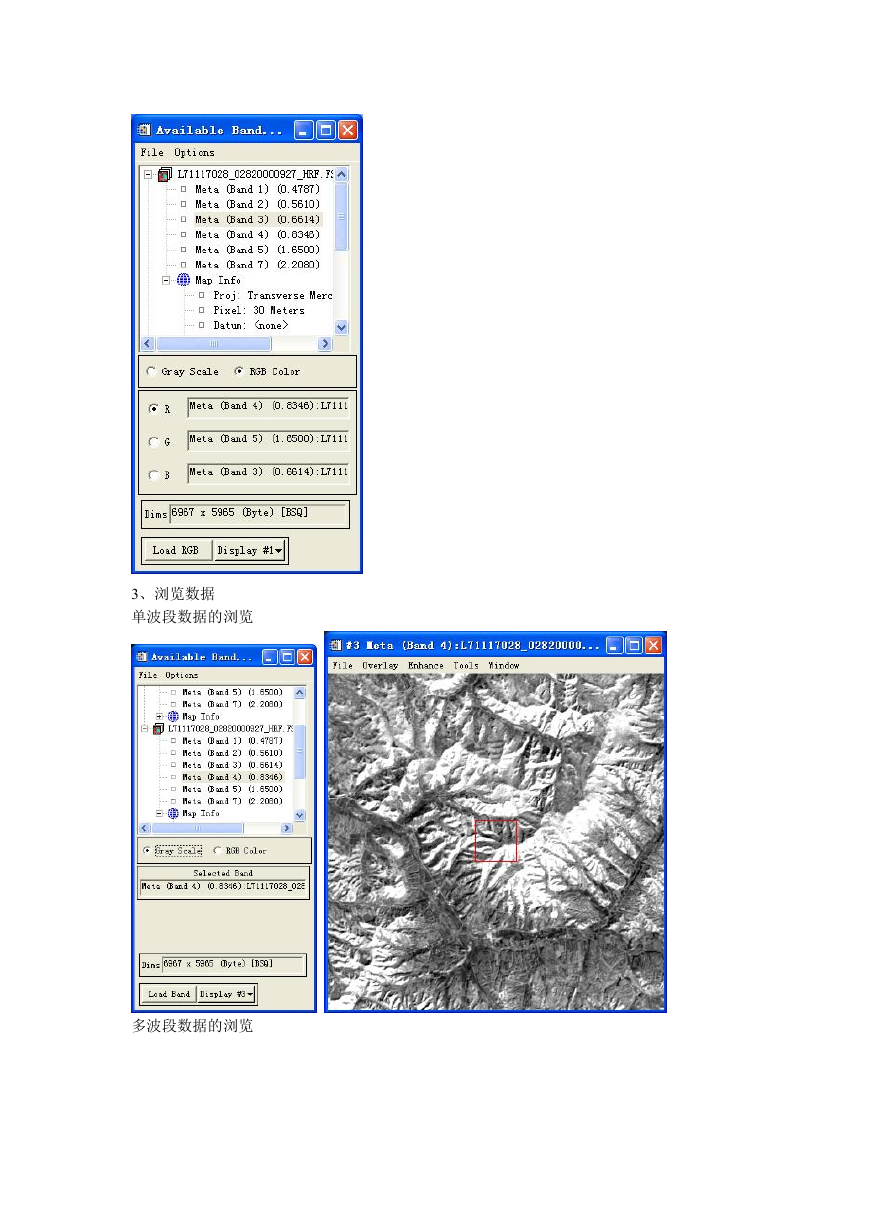
3、浏览数据
单波段数据的浏览
多波段数据的浏览
�
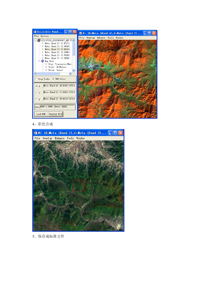
4、彩色合成
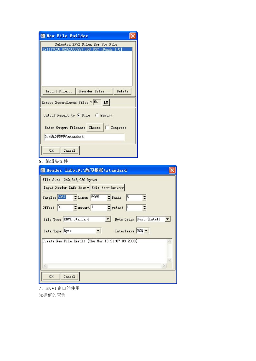
5、保存成标准文件
�
6、编辑头文件
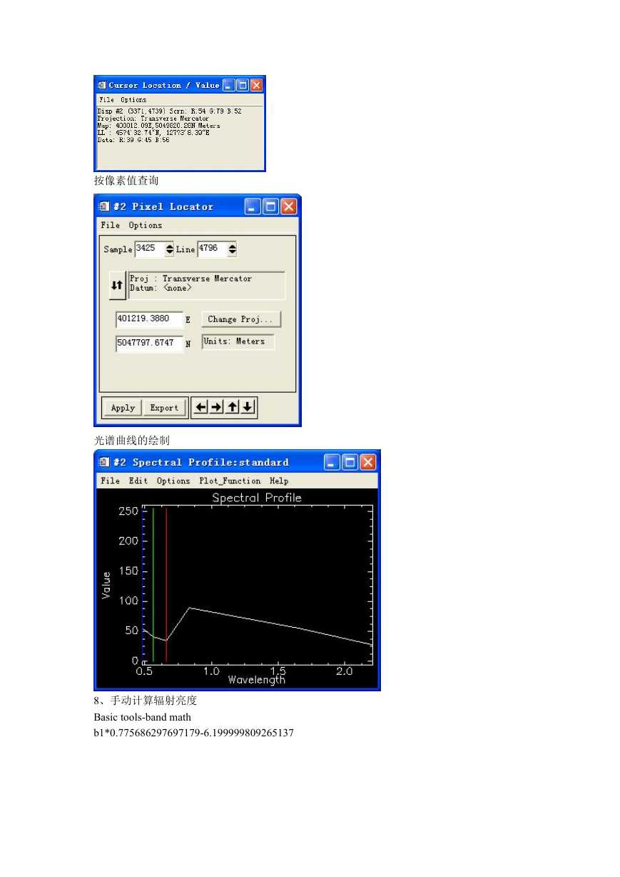
7、ENVI 窗口的使用
光标值的查询
�
按像素值查询
光谱曲线的绘制
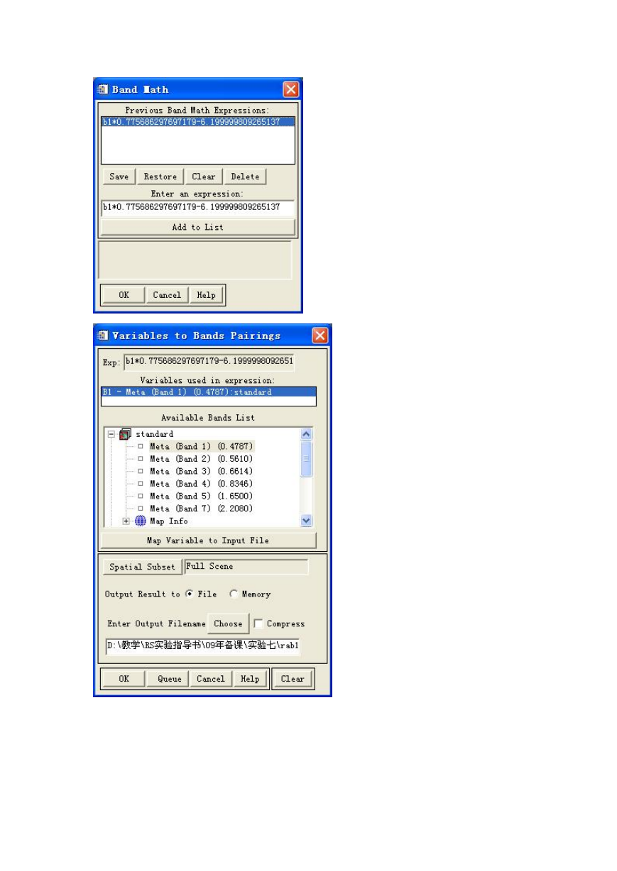
8、手动计算辐射亮度
Basic tools-band math
b1*0.775686297697179-6.199999809265137
�
�
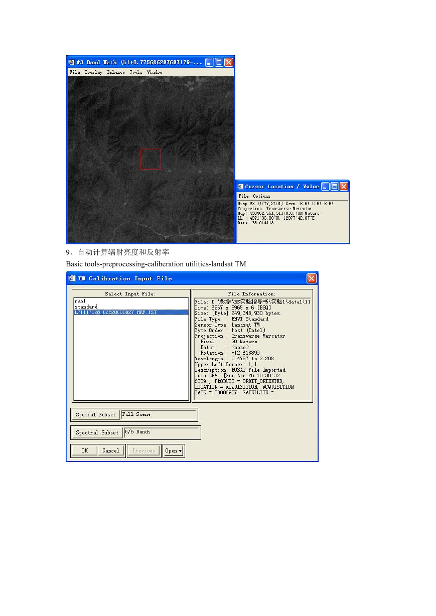
9、自动计算辐射亮度和反射率
Basic tools-preprocessing-caliberation utilities-landsat TM
�


 2023年江西萍乡中考道德与法治真题及答案.doc
 2012年重庆南川中考生物真题及答案.doc
 2013年江西师范大学地理学综合及文艺理论基础考研真题.doc
 2020年四川甘孜小升初语文真题及答案I卷.doc
 2020年注册岩土工程师专业基础考试真题及答案.doc
 2023-2024学年福建省厦门市九年级上学期数学月考试题及答案.doc
 2021-2022学年辽宁省沈阳市大东区九年级上学期语文期末试题及答案.doc
 2022-2023学年北京东城区初三第一学期物理期末试卷及答案.doc
 2018上半年江西教师资格初中地理学科知识与教学能力真题及答案.doc
 2012年河北国家公务员申论考试真题及答案-省级.doc
 2020-2021学年江苏省扬州市江都区邵樊片九年级上学期数学第一次质量检测试题及答案.doc
 2022下半年黑龙江教师资格证中学综合素质真题及答案.doc